I was going to wait before I composed this follow-up story of Withington rectors.
However, encouraged by how well the initial story about St. Paul’s Church, Withington was received I have decided to not wait.
 |
| Trinity College, Dublin |
The first of the three outstanding rectors of St. Paul’s first 100 years was Rev. William Heny Strong. Born in Dublin, Ireland in 1814, William Henry trained for his ministry at Trinity College in that city (1)
According to the “Alumni Dublinenses”of 1924 he commenced his studies there as a 17-years-old on 20th October 1831 his entry also confirms his place of birth and records that his father, George, was a “Ludimagister” (a schoolmaster). He was awarded his initial B.A. degree in the spring of 1837 later attaining an M.A.
William Henry was ordained a priest in 1839 and was given a curacy in the parish of Letterkenny, Co. Donegal, Ireland where he remained until moving to Lancashire in June 1842. (2) In Lancashire he was initially an assistant minister at St. Peter’s, Preston before being appointed to a curacy in Blackburn in December 1842. Rev. Strong married Grace (née Carr) in Blackburn Cathedral on 25th January 1844 by which time he had become the incumbent of St. George’s Church, Chorley, Lancashire.
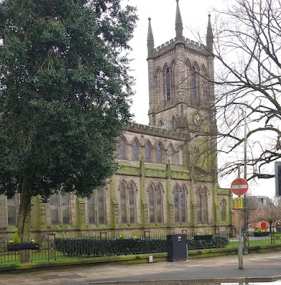 |
| St, George's Church, Chorley. |
The 1851 census reveals that Rev. Strong had moved to - 35, The Lord Mayors Walk, St. Giles, York. A letter he wrote to the local paper, “The Yorkshire Gazette” appearing on 11th December 1852 reveals that he was the vicar of St. Olave’s church in the city. William Henry and Grace had at least 3 children two sons, Charles Thomas and William Henry (3) and a daughter Frances Mary.
His daughter was born in York on 15th July 1856 by which time Rev, Strong had returned to Lancashire to the parish of Newchurch Kenyon, Nr. Leigh, Lancashire. In June 1862 he became the fourth rector of St. Paul’s, Withington in what was effectively an exchange of 'livings' with Rev. Robert William Burton M.A. He remained in Withington until 1872, when he resigned and moved to Somerton, Somerset where he was the vicar for more than 25 years. Rev Strong died at “The Lynch”, Somerton on 30th March 1899 finally having retired the previous year. His estate was valued at a modest £50 -10s -7d (= £5,474 today) which he left to his second wife, a solicitor’s widow, Eleanor Parsons (née Eastment); his first wife, Grace, previously dying on 27th December 1883 at the vicarage in Somerton.
Rev. Strong was succeeded as Rector of St. Paul’s, Withington by another Irishman, Rev. George William Grogan, a son of John Grogan and his wife Sarah (née Medlicott), who was born in Dublin during 1819. An older brother, Edward served as the M.P. for Dublin City for more than two decades and was created a baronet in 1859.
George William also attended Trinity College, entering on 4th July 1836. The Alumni Dublinenses also records that his father, John, was a “causidicus” (barrister) and that he obtained his B.A. in spring 1841 and an M.A. in 1849. The following year he was ordained in Norwich Cathedral on Sunday 10th November 1850. An incumbency of nearly a decade at St. Mathew’s, Thorpe Hamlet, Nr. Norwich, Norfolk was followed by a much shorter one in Stoke Newington, London. Then after a brief return to Norfolk, as the vicar of Clenchwarton, Nr. Kings Lynn, Rev. Grogan was appointed vicar of Somerton, Somerset in which parish he remained until December1872 when in yet another link between the incumbents of St. Paul’s Withington he “exchanged livings” with Rev. William Henry Strong.
While he was in Thorpe Hamlet, George William married a fellow clergyman’s daughter, Helen Isabel Maria Graham at St. John’s Church, Bedminster, Bristol on 15th October 1856. The couple had at least nine children, one of whom, Marian Dora, died aged just 15 in March 1878 and is buried in St. Paul’s churchyard, Withington.
Rev. Grogan was the rector of St. Paul’s for nearly twenty years. He resigned in April 1892; retiring from active ministry he moved in retirement to Nr. Cheltenham, Gloucestershire. He died at “The Priory”, Prestbury, Nr. Cheltenham on 14th February 1902.
The final one of St. Paul’s first half-dozen rectors was the very long serving Rev. William Muzzell; incumbent from 12th September 1892 until his retirement in 1938/9.
William Muzzell was born on 7th September 1848 in Kelshall, Hertfordshire. He was the second son of Peter Muzzell (4) and his first wife Mary (née Allen). Shortly after the 1851 census the family relocated to Yorkshire. William’s mother died while he was still an infant in August 1852; she was buried on 31st August in the parish of The Holy Trinity, Kingston-upon-Hull, Yorkshire (East Riding). Just 9 days after his wife's burial William’s father buried his 2-years-old daughter, Elizabeth. (5)
Soon after this double tragedy the family moved again, this time to the city of York where Peter Muzzell remarried at St. Mary’s Church, Bishophill Junior on 30th July 1855 to Rachel Mercer, a labourer’s daughter working as a maid in a clergyman’s household.
William attended the York Training College Model School (6) from May 1860. After leaving school he initially followed in his father’s footsteps and became a scripture reader; the 1871 census records him as such while lodging with a farm servant John W. Maxey and his wife Betsy at Wistow Gate, Cawood, Selby, Yorkshire (West Riding).
 |
| Muzzell family grave in St. Paul’s churchyard, Withington. |
Rev. Muzzell later trained for the priesthood at St. Aidan’s Theological College, Birkenhead, The Wirral, Cheshire and was ordained on Sunday 23rd September 1877 in Chester Cathedral by the Bishop of Chester, Rt. Rev. William Jacobson. His first appointment was a curacy in the parish of Ince-in-Makerfield, Lancashire. He moved from there to the St. Philip’s, Bradford Road, Ancoats, Manchester, being appointed as the “curate-in-charge" of a portion of that parish in need of a new church. Initially holding services in a mission hall, Rev. Muzzell was appointed as the first rector of the new church of St. Mark’s, Holland Street, Ancoats. He remained in this post until his arrival in Withington.
While he was still studying at a St. Aidan’s William married Hannah Johnson by license on 29th October 1873 at Christ Church, Ince, Wigan, Lancashire. William and Hannah had just one child, a daughter, Mary Elizabeth, born on 27thJuly 1874.
Rev. Muzzell died at his home in retirement 111, Wellington Road, Fallowfield, Manchester on 29th August 1940 and is interred in this grave in St. Paul’s Churchyard as is his wife Hannah who pre-deceased him on 27th October 1924. Their daughter, Mary Elizabeth (Lily) died on 22nd June 1947 and joined them in the churchyard.
Pictures; Trinity College, Dublin by John Brady - John Brady local guide works, CC0,
 |
| Muzzell family grave in St. Paul’s churchyard, Withington. |
https://commons.wikimedia.org/w/index.php?curid=162739159Others from the collection of Tony Goulding.
Notes: -
1) Rev. Strong was the third of four successive rectors of St. Paul’s to do so.
2) On his departure from Letterkenny, Rev. Strong received a gift and a glowing testimonial letter.
3) William Henry was born on 23rd November 1845 and after an education at Rossall School near Fleetwood, Lancashire and Wadham College, Oxford he mirrored his father and was ordained a priest at Peterborough Cathedral on Sunday 24th September 1871. He served briefly as a curate in Leicestershire parishes Ashby-de la-Zouch cum Blackfordby (from his time as a deacon) and Bringhurst cum Great Easton. However, during breakfast at the Tuebrook Lunatic Asylum, Liverpool on Tuesday 6th October, 1874, he killed himself by cutting his own throat. A charge of negligence was brought against one of the asylum’s attendants, Mr. James Dent who was subsequently cleared of any criminal behaviour.
4) Peter Muzzell ‘s occupations --- originally in 1851 census described as a “gardener” given he was living in rural Sussex this probably meant he was working in a market garden. His job as a ‘scripture reader’ may have been combined with other work as in the 1881 census he is recorded as Life Assurance Agent.
5) William’s only other full sibling, his elder brother, Jesse James, died during the March quarter of 1862 while one of his half-brothers John Mercer Muzzell also became a church of England vicar in Lancashire. He was for many years in charge of Christ Church, Bolton having previously served curacies at St. Peter’s, Ashton-under- Lyne, and Salford’s Christ Church. While at Ashton he was charged with a sexual assault, the case being dismissed.
6) “Model Schools” were established to provide opportunities for teachers in training to observe “model” classrooms and thereby acquire best practices with the aim of producing a more professional teaching body.


crop.jpeg)


.jpeg)


.jpg)


