Showing posts with label Castlefield. Show all posts

Sunday, 1 November 2026

Manchester's first railway station ........... no.1 waiting for something to happen

Now when Ron shared four pictures of the old railway station and warehouse on Liverpool Road, I was transported back nearly four decades.

The station and carriage shed
I visited it just after it had finally closed and British Rail had sold it to the museum.

It was hard at the time to see just how significant were these old run down buildings.

But these were the first passenger railway station and warehouse, having opened in 1830 when a group of Manchester businesses wanted a quick and cheaper way to get their manufactured goods to Liverpool.
Added to which they quickly saw the commercial advantage of using their railway trains to carry paying passengers.

So here in the pictures is the passenger buildings, beyond which is the carriage shed erected the following year.

And as with so much of the 19th century there was a strict division between those of property and wealth who travelled first class and the rest as seen in the provision of a first and second class booking hall and waiting room.

The 1830 warehouse, railway side
And it is worth remembering just how much the new railway company was at the cutting edge of technological change.  Their steam locomotives may have been the future but tickets were still handwritten and first class carriages were essentially stage coaches placed on a set of railway chassis.

In that respect they were looking back as well as forward.  And that was reflected in their choice of warehouse design, which was direct coy of the existing canal warehouses, complete with arches which allowed waggons to be taken into the building.

Inside the 1830 warehouse
But unlike canal boats which can turn effortless, the railway waggons had to be uncoupled placed on a turntable and then turned 90 degrees before being pushed into the warehouse.

Originally these turn tables were all over the site but the last which was beside the Byrom Warehouse was taken away some time in the 1990's.

And tomorrow there will be more on those early warehouses, of which there were three.

The first built in 1830 opposite the railway station and the second two built the following year which stood at right angles.

These were destroyed in a devastating fire.

The surviving buildings have done well to be still with us, although they were pretty much knocked about.

But have now become part  of the museum complex.

Location; Liverpool Road

Pictures; the railway station and first warehouse, built in 1830-31 as they were in the early 1980s from the collection of Ron Stubley

Wednesday, 9 September 2026

Looking down on a vanished Castlefield ....... circa 1972

Now it is easy to forget just how run down, neglected and pretty dismal was the area around the Castlefield Canal Basin just a few decades ago.

It was a place waiting for something to happen, but sadly no one knew quite what and the extent of that forlorn landscape was caught by David Easton in a series of pictures he took from a moving train.

He posted them recently on face book apologising for  “the quality of these images. 

I hope they are of some interest though. 

Those of Castlefield were taken from a moving train and have been scanned from ageing slides. This was about 1972/3 when there was still some barge traffic on the Ship Canal. 

Some barges occasionally found their way onto the Bridgewater Canal although I think the warehouses were already out of use.”

And when I saw them I was immediately transported back to a time
before the developers saw a potential for the area and when sitting beside the canal with food and a drink meant nothing more than a sandwich and a bottle of fizzy pop.

So for all those who never knew the canal basin with its empty warehouses and sunken boats here again are a selection of Castlefield in 1972.

Pictures; from the collection of David Easton, 1972

Saturday, 8 August 2026

Travelling on the railway in 1830


I wish I could  have rattled along on the Liverpool and Manchester Railway sometime in the 1830s.
But I can't so instead I will offer up the memories of one man who travelled from Manchester to Liverpool during the first decade after it had been built.

This was the remarkable; J.T.Slugg who came to Manchester as a young man and in 1881 published a description of the city of his youth.  He was there at the opening of the railway and recalled that “the morning opened most propitiously as to the weather and at about half past ten I set off with my brother and friend to witness the wonderful sight of a train being moved without a horse.”

But for me it is the comments on the daily running of what was the first passenger railway in the world which are more fascinating.

There were only seven trains a day each way and first and second class passengers had their own trains.  The last first class train left at 5 p.m. and the last second class at 5.30.p.m., but at a time  when the Manchester markets were still a significant factor in the city’s economy “on Tuesday and Saturday, which were then the two principle market days, the last train left at 6 p.m.”

Slugg also seized on the fact that while this was a first the railway still straddled both the past and the future, so the some of the carriages resembled the old stage coaches complete with luggage on the roof with the guard sitting beside it.

Just as every stage coach was designated by some name, so each first class carriage was designated in like manner.  
Amongst the names I remember were King William, Queen Adelaide, Duke of wellington, Sir Robert Peel, Earl Wilton and William Huskinson.”

And like so much of what the railway laid down as not changed over much.  

Steam locomotives more or less resembled the winning design, and carriages as these from the late 1830s testify looked very similar.

Pictures; Traveling the 1830s way, 2008, from the collection of Andrew Simpson Greater Manchester Science and Industry Museum

*Slugg, J.T., Reminiscences of Manchester, 1881 page 234

Thursday, 6 August 2026

The shock of the new ...........travelling the railway in 1830


Now I am not sure that some of the detail is completely accurate on this painting by A.B. Clayton of the “Inaugural journey of the Liverpool and Manchester Railway 1830” but what I like is the way that it captures the shock of the new.

There rattling along at an impressive speed is the future while looking on are two oldish chaps who were no doubt born in the previous century when the canal was the cutting edge of transport technology and the horse the fastest you could travel.

One of the men leans on the sign warning the curious of the dangers presented by the innocent line of railway track.  And it was at the opening of the Liverpool and Manchester Railway that William Huskinson the MP for Liverpool was killed when he was run over by Locomotive.

Now there are plenty of descriptions of the opening day and memories of people who travelled the trains from Liverpool to Manchester but my favorite is from J T Slugg’s wonderful book Reminiscences of Manchester published in 1881, and describing the city in the 1830s*.  Slugg lived here in Chorlton and knew Thomas Ellwood whose writings on the township are still required reading by anyone who wants to know what the village was like in the 19th century.

Likewise Slugg paints a detailed picture of “this system of travelling” which “it seemed impossible to jump from old practices and habits into a new order of things without passing a transition stage [so] as there had been two classes of passengers by coach – inside and outside- so there were at first only two classes of trains. The first class trains went at 7 and 10 a.m., and 2 and 5 p.m.; and the second class at 7-30 a.m., and 1 and 5-30 p.m."

And of course the accommodation varied with the cost of the fare.  For 7s you got to sit in a first class carriage holding four passengers and for a shilling less you shared with five others.  Second class cost 5s for “glass coaches and in open carriages, 3s.6d.”  Those who had not booked in advance were not permitted to travel.

But perhaps the most revealing insight into that age of transition was that “there were no wayside stations except at Newton, and [so] the train stayed anywhere on the line to suit the convience of passengers.”

Moreover the “directors announced that they were determined to prevent the practice of supplying liquor on the road, and requested that passengers not alight, [but] before this regulation as to liquor was issued I [Slugg] took a journey to Liverpool in the stand up boxes, and well recollect on the return stopping at Patricroft, opposite to an inn on the left-hand side and seeing a young woman, carrying a large tray of glasses containing liquors and cigars, which she supplied to many of the passengers.”

But that is enough for now.

Pictures; Inaugural journey of the Liverpool and Manchester Railway 1830, A.B.Clayton, in the public domain and the rest  from the collection of Andrew Simpson

*Slugg, J.T.,Reminiscences of Manchester, 1881

Wednesday, 6 May 2026

The image that defined the North

And not just the north but of working class communities across the country.

This scene is, I think Lower Byrom Street, but I could be wrong.

Location, Manchester, 1963

Picture; on the step, Manchester, 1963, Courtesy of Manchester Archives+ Town Hall Photographers' Collection, https://www.flickr.com/photos/manchesterarchiveplus/albums/72157684413651581?fbclid=IwAR35NR9v6lzJfkiSsHgHdQyL2CCuQUHuCuVr8xnd403q534MNgY5g1nAZfY

Sunday, 12 April 2026

Travels through a lost bit of railway history ........ sixty-one years ago

 I won’t be alone in having a long love affair with the former Liverpool Road Railway Station.

The 1830 Warehouse, 1965
It opened in 1830 along with a warehouse and was the first passenger railway in the world connecting Manchester to Liverpool.

Not that passenger traffic was the reason for its construction, that decision rested with the economic priorities of providing a cheap form of transport to shift goods between the two destinations.

So successful was the venture that within a few years extra warehouses were constructed, a second passenger platform was built and just 14 years after it all began, a new station was opened at Hunts Bank and our site was given over entirely to goods.

The story is one I often return to and for two decades was a place from where I ran conducted talks and walks.

The platform with former passengerwaiting room beyound, 1965
It had been abandoned by British Rail in 1975 and bits sold off to Granada TV and later still the rest became the new home of the Greater Manchester Museum of Science and Technology. 

My first encounter with the place was in 1980 during the “Steam Expo” event, when I took a series of good and not so good pictures.

But others had come with their camera before me, including Ron Stubley and as yet unknown photographer in 1965.

The unknown photographer took four colour slides which are part of a collection which cover Manchester, Stretford and out to Chorlton and Wythenshawe and are a mix of industrial scenes, some old historic buildings and more than a few of well-known city centre sites.

Former passenger platform, 1965
The collection was donated to me by the daughter of the photographer, but somewhere along the line their identity was lost, although I am still looking for the letter, email or Facebook message which alerted me to the names of the woman who donated them and the photographer.

Those for the Liverpool Road site are a window into what was still a working area and show just how far the buildings had been knocked about over the 135 years since the  complex had opened.

The 1830 warehouse still retained the loops holes through which goods would be taken in from the rail side and the arches through which wagons would have been pulled into the building.

The plaque, 1965

But at some point, one of the arches had been lost and a much larger entrance constructed.

As late as the 1990s it was still possible to find the turntables used to turn wagons 90 degrees and transfer them inside.

Likewise, bits of the old passenger railway station had survived but all were in a vey sad state.

Along with these relics there was the commemorative plaque above the doorway on Liverpool Road, recording the site’s history and set against that washed out red paint which was part of the old British Rail livery and indeed may been remanent from the former LMS colour scheme.

On that last note I await to be corrected.

Location’ Liverpool Road

Pictures; walking the old Liverpool Railway site in 1965, from the 1965 collection

Sunday, 5 April 2026

What a difference 47 years can make ........ The Rochdale Canal transformed

Forty-seven years is a pretty big chunk of any one’s life and in my case falls short of the six decades I have lived here in the city.

It is also the space between the pictures taken by a young art student and roughly the time I revisited the place with some of my own.

The canal was finished in 1804 and ran for 32 miles across the Pennines from the Duke’s Canal at Castlefield Basin to join the Calder and Hebble Navigation at Sowerby Bridge in West Yorkshire. In his description of the canal network published in 1830 Priestley was in no doubt of the canal’s importance.

"The canal is one of the main links in the chain of inland navigation between the east and west seas, being made for vessels of such size as enables them to navigate the tide way, and to pass between Liverpool and Hull without the expense of reshipping their cargoes, thus affording great advantages to the populous towns of Manchester, Rochdale, Halifax, Wakefield and other son the banks of the intermediate rivers. The Baltic produce can thus be readily conveyed into Lancashire and the manufacturers of Lancashire in return exported through the ports of Goole and Hull to Hamburg, Petersburg, Lubeck and other continental markets. The stone from Cromwell Bottom and its neighbourhood is hereby also conveyed to Rochdale and Manchester. These connections are likely to make it ultimately an undertaking of considerable profit to the proprietors.”*

So our own international highway and one that carried everything from “corn, timber, woollen cloth, coals and raw materials.” But like all our canals find it difficult to compete with the railways and finally closed in 1952, although the section through the heart of the city from Castlefield to Piccadilly proved profitable and stayed open.


Location; the Rochdale Canal


Pictures; from the collections of Eileen Blake and Andrew Simpson , map of the canal network around Manchester from Bradshaw’s map of 1830, The Inland Navigation of England and Wales, and the extract from Joseph Priestley’s Historical Account of the Navigable Rivers, Canals, and Railways, 1830 courtesy of Digital Archives http://www.digitalarchives.co.uk/ 

* Priestley, Joseph, Historical Account of the Navigable Rivers, Canals, and Railways, 1830, Page 579

Monday, 23 March 2026

A day of steam, fun and history ……………The Great Railway Exposition

I have no idea how I ended up on Liverpool Road, forty years ago.


I might have read about the event, or just followed the crowds.

Either way it was a wonderful day of steam, fun and history, and reminded me of growing up in the 1950s, and taking express trains pulled by steam powered locomotives.

Even now that mix of steam, warm oil, and clunking railway wagons is enough to transport me back to rail excursions, when electric and diesel traction was rare on our railways.

I am indebted to Paul Sherlock who sent me this cover of the souvenir booklet, which anchors the moment, because I had long forgotten just when it occurred.

It was an amazing day and left me with a portfolio of pictures.

Location; Manchester

Pictures; The Real Railway Exposure, 1980 courtesy of Paul Sherlock, and moment on the day, 1980 from the collection of Andrew Simpson

Wednesday, 18 March 2026

Living in a two roomed cottage in a Manchester court in 1851


You won’t find Span Court I know I tried.  But I do know where it was and where it had been when it was home to hundreds of families from about 1780 till sometime after 1965.

It was one of those bits of infill, the product of speculative builders trying to squeeze as many houses as possible onto a small piece of land.  In this case the plot was off Artillery Street which runs from Byrom Street to Longworth Street behind Deansgate.  Courts like these might hold half a dozen houses which faced each other across an open paved area and in some cases were locked away behind other properties, with access down narrow alleyways.

Many were back to back houses consisting of just two rooms, made from poor quality materials with party walls which were just half a brick thick and floors laid directly onto the bare earth.
My great grandmother grew up in just such a property in Whiteman’s Yard and those in Span Court were little different.  True they had cellars which still in the middle of the 19th century might be occupied by families, but otherwise they resembled the one she was born in.

In 1844 Manchester stopped the building of new houses which did not have running water and a toilet in the house or the yard which meant that no back to back houses or courts were built, although in neighbouring Bradford and Openshaw such properties continued to be constructed.  By 1900 there were only 5,000 back to backs left in the city and these had all been removed or converted  to ‘through’ houses by 1939.*

Span Court consisted of six such properties.  The eastern side of the court backed on to three identical houses fronting Swan Court while the western three were set up against industrial buildings which later became a hospital.

And in those six houses in 1851 lived a total of thirty-three people who made their living from the bottom end of economic pile.  And so while there were 6 power loom weavers and a cooper and dress maker there were also an errand boy, a hawker and one who described himself as a pauper.
Now over the next few weeks I will be delving deeper into Spam Court and trying to tell its story, looking at the people who lived there and the surrounding streets.

*Parkinson-Bailey, John P, Manchester University Press, 2000

Pictures; Span Court in 1965 J. Ryder, m00211, Courtesy of Manchester Libraries, Information and Archives, Manchester City Council, Span Court from the 1842-44 OS map of Manchester & Salford, courtesy of Digital Archives, http://www.digitalarchives.co.uk/ and Artillery Street looking up from Byrom Street with Span Court off to the right,  from the collection of Andrew Simpson

Sunday, 15 March 2026

And the band played on .......

Now I know when the picture was taken and where, but what suddenly attracted the attention of the crowd is lost in time.

We are in Castlefield, on Camp Street during the Steam Exposition at that point in time when British Rail had surrendered the old Liverpool Road site for a £1 but before the Science and Industry Museum moved in.

And on that sunny day in 1980 a collection of old steam locomotives, traction engines and a host of vintage cars and buses gathered.

So it is quite possible that while the band played on something with steam was passing by.

Of course some will remember and confirm my vague memorey that as the band struck up the first of the steam locomotives made their appearance.

No matter I was there.

Location; Manchester

Picture; The band played on, 1980 from the collection of Andrew Simpson

Wednesday, 11 February 2026

Surprises ……. St Matthews Sunday School

I have always liked the former St Matthews Sunday School that stands on Liverpool Road.


It is a simple but pleasing building which I think was paid for out of a fund created by the Government to commemorate the victory at Waterloo.

My Pevsner’s just records, “St Matthew’s Sunday School, dated 1827, converted to offices in the 1980s. Brick, two storeys, with an apsidal s end and windows with pointed arches and simple Y-tracery”.*

Given the whole sale destruction of many of the buildings along the road, it is always a surprise that it survived.

But survive it did, and this is the rear, on Rice Street.

Location; Castlefield

Picture; St Matthews Sunday School, 2022, from the collection of Andrew Simpson

*Manchester, Clare Hartwell, Pevsner Architectural Guides, Penguin Books, 2001, p269


Sunday, 1 February 2026

Deansgate remembered ................ stories from the Fox Inn on Byrom Street nu 1 .... a beginning

For many Deansgate is just a road which takes you from Knott Mill down to St Mary’s Gate.

The Fox Inn, Byrom Street, circa 1914
If you are lucky and the traffic flow is kind you can do the route in minutes.

If like me you prefer to walk it offers up a shed load of interesting buildings from the old public library between Liverpool Road and Tonman Street past the John Rylands and down to the Burlington Arcade.

And if you turn off and stroll down Liverpool Road towards the Duke’s Canal and Castlefield you will be rewarded with a rich lump of history.

Here was our Roman fort and and small town, the Manchester end of the Bridgewater Navigation, as well as the site of the first passenger railway station in the world and heaps more including one of the first recorded Cholera cases back in the 1830s.

Johhny Lee, young Charlie and Joe Gibbons
And it was a place teeming with people making it in the words of the historian Frank Heaton a “Manchester Village.”  It runs down from Deansgate towards the river, bounded on one side by a set of railway viaducts and on the other by Quay Street.

I first became fascinated by it almost four decades ago and keep getting drawn back.

And in those forty years I have researched and written about the area, walked its streets in the company of friends and conducted guided tours of its history.**

So with all of that behind me I was very pleased when Debs got in touch and supplied this picture of the pub her grandmother was born in on August 26 1908.

William Henry Forth, Doris and Florence Forth and Betty Marr
Doris Brack nee Forth grew up in the Fox Inn on Byrom Street and she recorded her memories of the pub and the area in a series of interviews with Mr Heaton who included some of them in his book.

They are a vivid picture of a vibrant working class area in the years after the Great War.

So over the next few weeks with the help of her granddaughter Debs I will be exploring those tapes and piecing together the story of a community.***

It starts with the Fox Inn and this wonderful picture. I know that standing i the doorway beside her father William Henry Forth are Doris and her sister Florence and their friend Betty Marr and Johhny Lee, her cousin Charlie and Joe Gibbons.

Now that’s a good start.

Location Byrom Street, Deansgate, Manchester

Picture; The Fox Inn, circa 1914, courtesy of Debs Brack

*The Manchester Village Deansgate Remembered, Frank Heaton, 1995, Neil Richardson

**Castlefield, https://chorltonhistory.blogspot.co.uk/search/label/Castlefield

***Deansgate, https://chorltonhistory.blogspot.co.uk/search/label/Deansgate

Sunday, 21 December 2025

The lost Manchester Collection ..... no.1 ....... August 4 1980 in Castlefield

They were a series of photographs I took during the late 1970s into the ‘80s and have sat in our cellar for over thirty years.

They were taken in the old days of film, and were developed and printed in a dark room using smelly chemicals.

That said most never got beyond the stage of being negatives, and when I finally gave up on the hobby they were a neglected piece of history made all the more redundant because the enlarger, chemicals and all the other bits of chemical photography were thrown away.

But now with a new Christmas present which scans the negatives I am back in business.

The images are not always the best quality but they are a bit of our collective past

So here are the first of the hundreds, chosen at random,  and are of the Steam Exposition at Castlefield on Saturday August 4 1980.

The old railway deport on Liverpool Road had closed and the Science and industry Museum had yet to move from Grosvenor Street and take over the site, and so on a Saturday in August lots of people came to enjoy the steam.

There was a band. lots of steam locomotives, a handful of vintage cars and buses and this old lady who had wandered into see what all the fus was about carrying her shopping bag and wearinger her slippers.

Location; Castlefield, 1980

Pictures; the Steam Exposition, 1980, from the collection of Andrew Simpson

Wednesday, 5 November 2025

In the midst of great wealth ....Span Court and St John's Street


I have been drawn back to Span Court.

It was a collection of six back to back houses in a partially enclosed court off Artillery Street which runs from Byrom Street to Longworth Street behind Deansgate.

They were one up one down with a cellar and did not rate an entry in the street directories which is not unsurprising given that those who lived here were on very modest means and some on the very margins of poverty.

In 1851 in those six houses lived a total of thirty-three people who made their living from the bottom end of the economic pile including six power loom weavers, a cooper, dress maker as well as an errand boy, a hawker and a pauper.

It is very easy to become blasé at the conditions in Span Court, after all historical empathy only goes so far, but this was living at the precarious end.  I rather think that Ann Cass aged 73 who described herself as a pauper had never had an easy life, and now she and her two daughters in their 30s were reliant on their combined wages as power loom weavers and what they got from Annie Harrison, their 38 year old lodger who was a band box maker.


Nor were they alone in taking in lodgers other families in the court were also doing the same and in most cases having to find space in what was at best two rooms and may even have been less, because the majority of  our houses were sublet.  Of the six, five had two families living in them as clearly defined and separate households.  Now these properties did have cellars and there were plenty of people living in the cellars of houses across the city according to the 1851 census.  But usually the enumerator recorded those who lived in the cellars.   But in this case no such records were made, ** which rather suggests that families and their lodgers were living in just one of the two rooms in each of the houses.

And in the case of John and Catherine Pussy it meant finding space for their five children ranging in ages from 20 down to three as well as their 19 year old lodger in what I guess was one room given that the house was shared with another family of four.

Span Court has gone but Artillery Street is still there and you have to walk it to get some idea of how narrow the street was and then try to picture the 83 people who lived mainly in the three courts off it or the 96 who lived on Longworth Street which ran from Artillery Street to St John Street.  The whole census patch amounts to ten streets and their small courts, most not much wider than Artillery Street and bounded by Deansgate and Byrom Street in which crowded a total of 497 people.

But it would be wrong to run away with the idea that this was just a collection of humble streets housing the least well off.  True the majority as the graph below shows  made their living from unskilled or factory work but there were also artisans, shop keepers small businessmen. And almost acting as an island of wealth was St John Street, then as now a place of fine late 18th and early 19th century houses whose residents included accountants, a silk manufacturer and a retired calico engraver and printer.

And it is this last “calico engraver” who I want to finish with as a contrast to Span Court.  James Holt had set up the family business sometime at the beginning of the 19th century had bought and maybe built his double fronted property on St John Street and in the fullness of time retired to Chorlton, leaving his son to run the business and retain in the family home in the heart of Manchester off Deansgate.  This was John Holt who would later in the 1850s move himself to our township.

But the family never gave up their interest in the area surrounding their town home and so by 1912 they owned seven of the fine houses on St John Street as well as shops cottages and a beer shop on the surrounding streets as well as land and the fine estate of Beech House in Chorlton.*

We have rather come to be conditioned by the rich living in gated communities set apart from the less well off and our wealthy families were no different.  Samuel Brooks had established his own estate which would be developed for the well off on the edge of Chorlton, and in the late 1830s Victoria Park Company was set up to “erect a number of dwelling houses of respectable appearance and condition, with gardens and pleasure grounds attached, with proper rules and regulations against damage an nuisances.”**

But the residents of the houses on the north side of St John’s Street backed on to Span Court while the Holt’s own fine house was not only beside a timber yard but its rear windows overlooked a coal yard and the densely packed court of Holt’s Place which consisted of ten small back to back properties.

So Span Court and the poor were never that far from the rich of St John’s Street which I suppose is an interesting take on that much quoted phrase, “the poor are always with us.”

Pictures;Span Court, J.Ryder, 1965, m00212, Courtesy of Manchester Libraries, Information and Archives, Manchester City Council, detail from 1842-44 OS map of Manchester & Salford, Digital Archives, http://www.digitalarchives.co.uk/, other pictures from the collection of Andrew Simpson


*Camp Street, Holt Place, James Place, Longworth Street, Severn Street, Byrom Street, Great John Street, Gillow Street, Lower Byrom Street, Charles Street, Peel Street and City Road

** A Short Account of the Victoria Park Manchester, Manchester Corporation, 1937

Tuesday, 4 November 2025

Walks I wish I could have taken, ...... up Liverpool Road towards Deansgate in the spring of 1849

The station and staiton master's house

We are on Liverpool Road just a little under twenty years after the opening of the Manchester terminus of the Liverpool and Manchester Railway.

The station and its warehouse had been opened in 1830 and so successful had the venture been that two new warehouses were added very quickly followed by a second platform to accommodate the increased number of trains, and just fourteen years after its grand start all passengers operations were moved to a bigger and grander station at Hunts Bank.

There had been high hopes in the last decades of the 18th century that the area could be developed into an estate of fine houses like those on St John’s Street but the proposed plans to bring a railway into Manchester had pretty much scuppered that idea.

Instead the land from the Duke’s Canal at Castlefield, north to St John’s Church and east towards Deansgate was filled with more modest houses which were the homes of craftsmen, textile workers, warehouseman and a whole range of lesser occupations. 

The station master's house
Many of which were dependant on the collection of warehouses, timber yards, and coal sites which served the network of canals and now the railways.

The Duke's Canal which had come into the city in the 1760s was but the first of more canals, while our rail terminus was soon joined by the viaducts of the Manchester South Junction and Altrincham Railway which cut through the southern edge of the city.

So in 1849 this spot at the bottom of Liverpool Road may not have offered green fields and scenic views, but it was a place that many visitors would have flocked to because here like the cotton mills was what was making Manchester a new and different type of city. As the German Johann George Kohl wrote

“I know of no town in Great Britain, except London, which makes so deep an impression upon the stranger as Manchester.  London is alone of its kind and so is Manchester.  Never since the world began, was there a town like it, its outward appearance, it’s wonderful activity its mercantile and manufacturing prosperity, and its remarkable moral and political phenomena......”*

The entrance of the first class booking hall
And had he stood at the bottom of Liverpool Road looking up towards Deansgate this frenetic industrial landscape is what he would have seen.  Almost directly behind him was a dye works and just over the river the Regent Bridge Mill while just out of site behind the viaduct was the Elm Street Paper Mill and in all directions were  those timber yards, warehouses and coal yards.

So we shall accompany our visitor up Liverpool Road past what had once been the station entrance for first and second class passengers and was now the company’s offices.  And with a bit of luck we could get a glimpse at the three warehouses of which the first held corn, groceries and butter and the remaining two are given over to cotton. 

Here there is that smell of locomotives which is a mix of steam and oil along with the distinctive clunk of railway wagons being uncoupled and manually pushed into the warehouse on turntables. 

The station and warehouse complex, 1842
Each wagon can be unloaded beside the warehouse but the company had copied the design of the canal warehouse which allowed a boat to go into the building.  

Now this presented a problem because a railway track is not a canal and so getting the wagon into the warehouse involves uncoupling each wagon and turning it at right angles and pushing it in.

But enough of such industrial detail for just beyond this spot was the Oxnoble Inn so named after a type of potato landed at Potato Wharf and a reminder of the amount of agricultural produce that came in the Duke’s Canal.

But if you didn’t fancy the Oxnoble there are three others to chose from, starting with the Queens, Arms, the Railway and Quay Tavern and finishing with the White Lion. And if that was not enough you can throw in seven beer shops which means that a quarter of the shops along our route are given over to alcohol.

That does still leave plenty of grocers, a butcher’s, a druggist, a baker and a large number of furniture shops.  Less welcome are the fish stalls at the top of the road where it joins Deansgate.  The smell is pretty intolerable and has led to the residents’ complaining to the authorities who accept there is a problem but are not prepared to clear them away and lose the revenue that come from the stalls.**

St Matthew's 1850 from the front
On a more pleasant note there is the fine looking Sunday School sandwiched between Wellington Place and Duke Street.  

The entrance is on Liverpool Road but I rather like the rear with its rounded wall.  It was built with money voted by the Government to celebrate the victory at Waterloo and is the Sunday school for St Matthews Church which a little further up the road.

It is built in the modern Gothic style of architecture and according to one guide book “when viewed from the large open space in front has a very elegant appearance.  

The height from the ground to the top spire is 132 feet [and] the west gallery contains a fine organ by Nicholson of Rochdale and the choral service is performed here on Sundays, at half past ten and half past six.”****

All of which is fine but does not hide the fact that just beyond the church in the area known as the Haymarket was what one report described “as a great nuisance [which] at certain times  bears all the appearances of a public privy rendering access to the Church yard & Vestry  from the quarter altogether impossible.   

Looking up Tonman Street with the shambles ahead
Filth seems to have a magnetic attraction hence the whole eastern boundary of the Churchyard as well as the yard itself as far as practicable is the depot of all sorts of refuse from dead rats to decayed cabbage leaves.” 

Which “in the course of years, this open space having never been paved, its level has risen to the top of the stone parapet on which the iron palisading of St. Matthew’s church yard is fixed some 18’’ or more perhaps above the original level.  

To secure access to the Churchyard and through this east gate a sufficient space has been kept clear by propping up the surrounding accumulations with wood.”

Now that I suspect is not the sort of attraction Mr Kohl would have reported with enthusiasm, and I think it a good place to stop the walk.

The church, hay market, shambles and pubs
If we did walk on past the church and the Haymarket along Tonman Street ahead of us would have been the Alport Shambles which was also known as the Butcher's Market.  

It is there just behind St Matthews and the tall chimney may well be part of it.  

I suspect our residents would have been no happier about that place. 

Not that Ebenezer Heap of the Saint Matthew's Tavern or his fellow landlord, James Crowther of the Haymarket Inn would complain over much for long hours in the shambles meant thirtsty customers in their repective pubs.  

Something which may have also been why Mary Morrell opened her beer shop next to to the Haymarket at number one Tonman Street.

So I rather think we shall retrace our steps and look again at St Matthews Sunday school, which was opened in 1827, with its fine entrance facing Liverpool Road and the elegant mock battlements running down each side.


Next; on to Camp Street and its mean secrets, St John Street with its posh houses, and the search for the home of Cholera victims

Pictures; The former station on Liverpool Road, S. Langton, 1860, m62891, St Matthews’s Church, 1850, m71038, courtesy of Manchester Libraries, Information and Archives, Manchester City Council, Liverpool Road from the OS map of Manchester and Salford, 1842-49, courtesy of Digital Archives, http://www.digitalarchives.co.uk/

*Johann George Kohl, “Journeys Through England & Wales 1844, quoted from Visitors to Manchester, complied by L.D. Bradshaw, 1987, Neil Richardson
** Manchester and Salford Sanitary Association, Deansgate District, Report of the Visiting Committee 1853, Appendix A.
***The Strangers Guide to Manchester, H.G.Duffield, 1858
****ibid Manchester and Salford Sanitary Association,

Friday, 9 May 2025

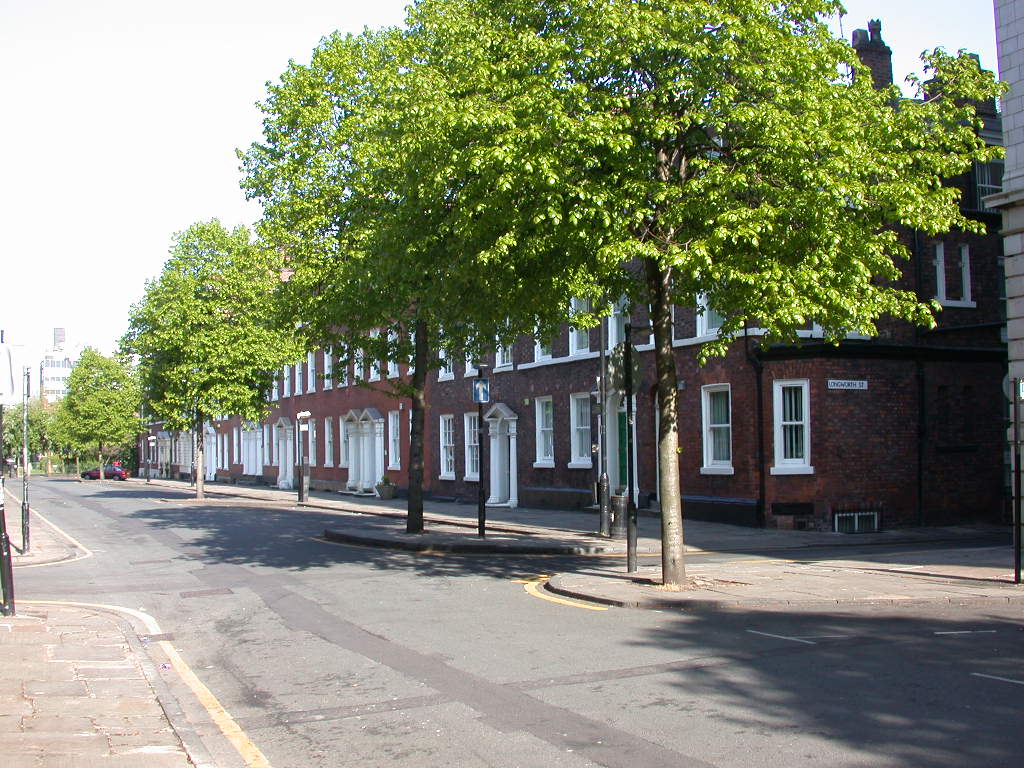
So what was Southern Street in Castlefield once like?

Southern Street in 2003
This was Southern Street, off Liverpool Road during a chunk of the 1980s  and into the next two decades it was one of the stops on an annual walk and talk I did in the Castlefield area.

During the course of those years it underwent profound changes with most of what had been late 18th century houses demolished or converted into flats and offices.

Of course part of me was saddened by the loss of these old properties but the upside is that the street is once again a place where people live and work.

Looking down Southern Street 2003
And that has to be a good thing.  By the 1980s there were few businesses left and within the next twenty years even they had gone.

I remember talking to some of the men who worked in Andrew’s Garage in the centre of Southern Street along with the owners of the printing business at one end of the street and the motor bike shop at the other.

Collectively their memories spanned back into  the 1950s and in the course of the next week or so I want to look at that lost Castlefield.

But for now I shall just reproduce something I wrote back in 2003 and leave you to reflect on just how much this little bit of Castlefield has changed.

“Southern Street in 1851 shows the same pattern of housing occupation as other working class parts of the city.  

In many of the houses there is evidence of overcrowding and cellar occupation.  

So at 3 Southern Street, 15 people are recorded there in 1851, with 5 living in the cellar, 2 in one room, 4 in another and 4 in the garret.   


Numbers 3 & 5 Southern Street, 2003
Number 5 has 11 people.  Across the street number 12 &14 are now a garage.  
In 1851, 7 people are listed as living in number 14.  

It is easy to appreciate the degree of squeeze when you measure the size of these properties.  

Put more simply when you look down Southern Street, remember that the 1851 census recorded 81 people living in this small street, which was a drop from the 200 living there a decade before.

Numbers 3 & 5 Southern Street is worth looking at in detail, as they may not be there for much longer. 

The block has been bought recently and while there is some doubt about the future plans I can’t see them staying in their present state.  

They were surveyed in 1993.  The houses consisted of three floors and a cellar.  The second floor dimensions of number 3 are 22 feet 6 inches back from the front and 16 feet 4 inches from side to side. Number 5 varies slightly at 22 feet 2 inches by 17 feet.  


Numbers 12 & 14 Southern Street, 2003
Evidence for the cellar windows can still be seen but much else has undergone changes.  

Ground and first floor windows are not original and the door to number 5 has been enlarged. 

All the evidence suggests that they were built sometime around 1794.  

Houses on Southern Street, Barton Street and Worsley Street are shown on a map of that year, when Liverpool Road was still called Priestner Street and terminated at Collier Street.  

Street Directories record people living in them from 1795.  This fits in with what we know of the surrounding streets.  

Evidence from the title deeds of the White Lion Inn and the Oxnoble Inn show that that six plots of land were sold in 1782. In 1804 the Oxnoble plot was sold again on condition that it was built upon within two years.”*

Location; Manchester

*Castlefield, Andrew Simpson, 2003

Pictures, Southern Street and Liverpool Road, 2003

Sunday, 21 July 2024

Stories from Deansgate Castlefield ….no. 1 introducing the book

Deansgate Castlefield metro stop is the place where history tumbles out in all directions

Heaps of towers, 2023
You know you are arriving at somewhere special when the views of identical new residential properties give way to something much older and more interesting.

It begins with that network of waterways which make up the Castlefield Canal Basin, interspersed with the tall lattice structures that imitate medieval castle walls and takes in some fine 18th century warehouses, along with the spire of the old Congregational Chapel and that growing number of tower blocks which seemingly reach up to scrape the sky.

On arriving, 2022
And on arriving at Castlefield Deansgate just a minute’s walk away is the bold edifice of Deansgate Railway Station which as everyone knows and some constantly reiterate is really Knott Mill Railway Station gateway to Salford and beyond.

But for those whose interests are elsewhere beside the entrance to Deansgate/Knot Mill is the Atlas Bar which has its own claim to a bit of history, having opened in 1999 boasts that it serves 570 different gins from around the world.

Nor is it alone for just across the road there is Deansgate Locks, while nestling in the canal basin can be found Dukes 92, and the even longer established Barca Bar all of which are part of the renaissance of the area which has gone from a busy but grubby work a day corner of the city to an elegant residential and leisure centre.

Atlas, 2023

And not to out change Castlefield, in 1982 it became an “Urban Heritage Park” which is an unofficial designation for an inner-city area regarded as worthy of preservation because of its architectural and historic interest.

Fort in the sun, 2022
It was here that the Romans established one of their forts as part of the “pacification” of northern Britain.

The network of military establishments connected the big legionary bases of Chester and York, and like many of these forts it attracted a settlement which grew up outside its walls.  

Here could be found metal workers, bar owners, merchants and anyone attracted to the Roman army which offered a degree of safety and a ready market for pretty much everything your average Roman soldier might want.

Alas only a fragment of the original fort still exists, but a series of archaeological digs in the 1970s uncovered finds from the civilian settlement.

In turn the presence of that fort led to a City Council project to recreate two sections of wall and a gateway.  The construction was undertaken by apprentices from the Direct Works Department and included laying out a series of ditches which were the first line of defence.

Water, unlight and bridges, 2003

All of these are there to see along with part of the civilian village running from one of the walls by Beaufort Road out towards Liverpool Road, while the remaining section at Duke Street offers up views down in to Castlefield Bowl and one of the arms of the canal basin.

A rally at the Castlefield Bowl, 2024

The Bowl is a popular venue for a live entertainment and has a capacity for 8,000 and as well as music events is used for political rallies.

Canal Basin, 2003
I could go on but that would be to reveal all the stories from our second book in the series The History of Greater Manchester by Tram.*

The idea of telling the story of Greater Manchester by using the tram network has a lot going for it. 

You can catch a tram from the city centre and go south, east, north, and west and along the way each of the 99 stops will have a story to tell, and being the tram, you can just jump off, explore this little pocket of history and move on. 

Or skip to the end destinations and discover interesting historical things about Didsbury, Ashton-Under-Lyne, Rochdale, Oldham, Salford and bits of Trafford, Altrincham and Bury.


The first in the series …. Trafford Bar to East Didsbury was published earlier in the year and the next Cornbrook to Exchange Square will be out in August.

They are available from Chorlton Bookshop, and from us at www.pubbooks.co.uk, price £4.99

Location Deansgate Castlefield

Pictures; Castlefield and Knott Mill, 2003-2024, from the collection of Andrew Simpson

*A History of Greater Manchester by Tram, https://chorltonhistory.blogspot.com/search/label/A%20new%20book%20on%20the%20History%20of%20Greater%20Manchester%20by%20Tram