Showing posts with label Little Ireland. Show all posts

Wednesday, 6 August 2025

Little Ireland …….. where once “poverty busied itself” …… and now swish bars mingle with smart apartments

Now, if you are at all interested in the social history of Manchester in the 19th century, sooner or later you will dive into the history of Little Ireland, Angel Meadow, and other bits of the twin cities where “poverty busied itself”.*

Little Ireland, 1844
In the case of Little Ireland that “abomination of desolation” nothing is left, save the street pattern and even that has all but vanished.**

It was in that dip of land, bordered by Oxford Road, and the river, and appears in the writings of Frederick Engels, Dr. Kay and other observers from the 1830s, and 40s.

The authorities tried dealing with the slum, but in the end, it was the march of the railway which swept away a chunk of it.

Until recently it was still possible to trace two of the streets which ran off Great Marlborough Street and which had been absorbed into later industrial buildings.  These were Frank Street and William Street, and like many before me I often wondered down there and tried imperfectly to reconstruct the scene.

Great Marlborough Street, 1971
Both were narrow streets, with nine one up one down back to backs on Frank Street and seven more on William Street which in turn gave off along what was no more than a yard and contained another eight back to backs.

Like other such developments across the city it didn’t even warrant a place name and instead was marked on the map as Johnson’s Buildings.

But at least it was dignified with some sort of description, because the street running parallel, and which contained four more back to backs had no name.

The received knowledge about theses things is that usually streets were named after the builder, or speculative landowner who built the properties.  In the case of our two, this was possibly Mr. William Frank who owned the four properties on William Street and four of the seven on Frank Street which were registered in the Rate Books for 1844.

Poll Book, 1836
From these properties he was deriving a weekly rent of between 2 and 3 shillings a week, which given that he owned ten properties back in 1836 qualified him for a Parliamentary vote.***

And while I know he was at Baxter Street in Hulme in 1836 he as yet doesn’t show up on the census records.  Nor can I track any of his tenants on the 1841 census.  But as always there will be a time lag between the compilation of the Rate Books and the census returns, with that strong possibility that people had moved on.

Great Marlborough Street, 2019
All of which is annoying, given that once we find one tenant, we will find the lot, offering an insight into their occupations, ages, places of birth and their families, which in tun will provide answers to the degree of overcrowding and population density.

Until then we are stuck with those well-known accounts, and a few photographs most of which were taken long after Little Ireland ceased to exist.

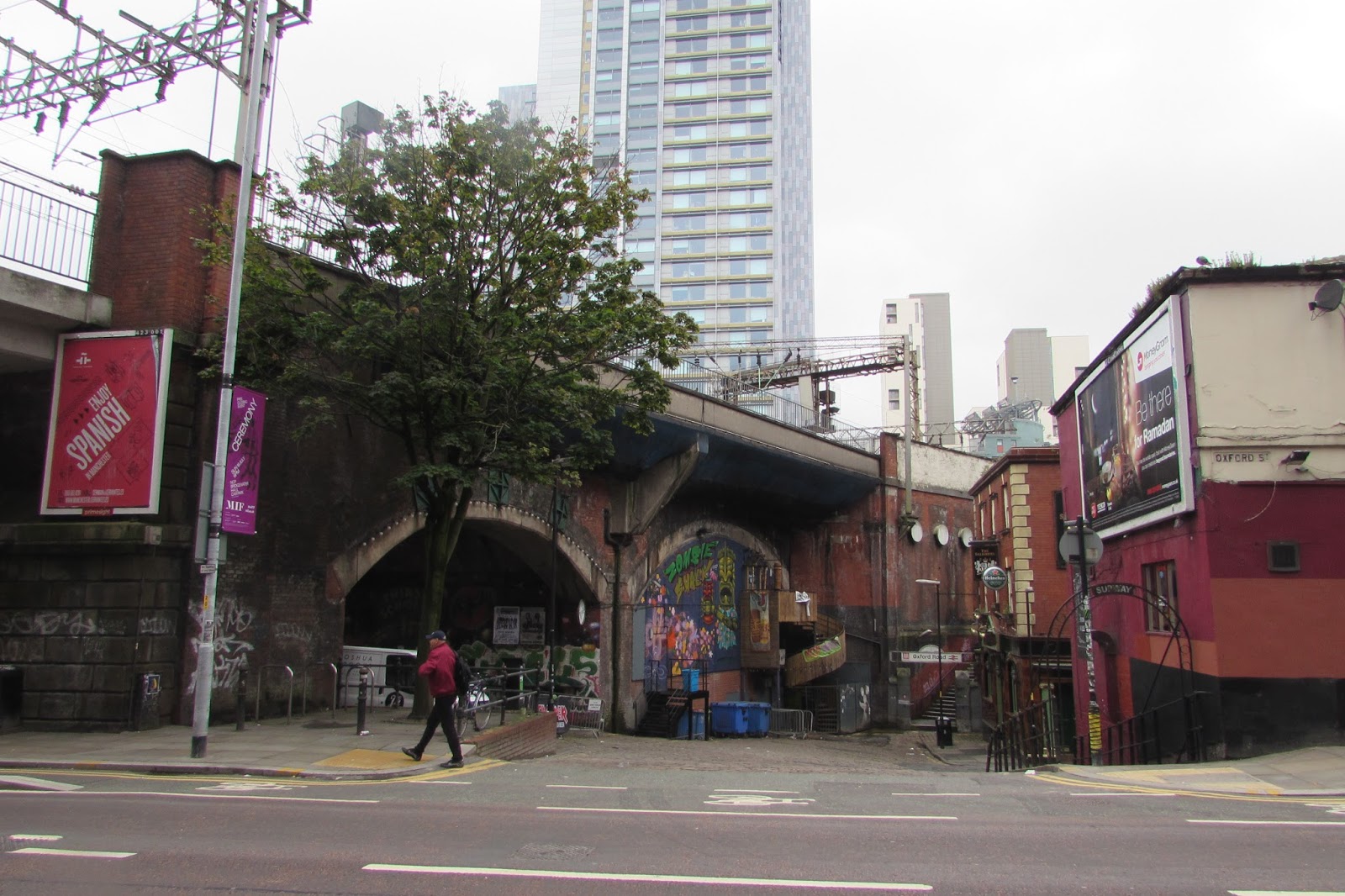
So, I will keep plugging away, not least because with every passing year the area is changing, and the Little Ireland I knew back in the 1970s has been transformed again, as Andy Robertson’s picture shows.

Location; Little Ireland

Pictures; Little Ireland, 1844, from the OS of Manchester & Salford, 1844, courtesy of Digital Archives Association, http://digitalarchives.co.uk/ extract from the Poll Book for South Lancashire, 1836, Great Marlborough Street, 1971, H. Milligan, no2174,  courtesy of Manchester Libraries, Information and Archives, Manchester City Council, http://images.manchester.gov.uk/index.php?session=pass and Great Marlborough Street, 2019, from the collection of Andy Robertson

* Roberts Robert, The Classic Slum, Salford Life in the First Quarter of the Century, 1971, Pelican edition 1973


**Little Ireland; https://chorltonhistory.blogspot.com/search/label/Little%20Ireland

***Poll Book, 1836, Rates Book, 1844

Wednesday, 2 August 2023

Looking for our memorial to Manchester’s Cholera deaths

Now I may well have missed it, but I don’t think we have a memorial to those who perished in the great Cholera outbreak of 1832.

The Cholera Monument, Sheffield, 2006
And I say that because today I came across Sheffield’s monument to its Cholera victims, which stands just a bit west of the railway station, situated in grounds that were laid out in 1850, fifteen years after the monument was completed and seventeen years after the epidemic which killed 402 people.

402 victims of the disease were buried in grounds between Park Hill and Norfolk Park adjoining Clay Wood. Money from the treasurers of the Board of Health was set aside for a monument for the site.

Cholera was regarded by many as the worst of the killer diseases that swept through our towns and cities in the 19th century.

It was often referred to as “Deadly” or “King Cholera” and is an infection caused by contaminated food and water.

The main symptoms are diarrhea and vomiting, and if untreated will continue until the patient becomes severely dehydrated. In the final stages a cholera victim will bring up what was called rice water and is almost clear liquid with fishy smell and resemble living skeletons.

Its impact was always going to be worst in the overcrowded and unsanitary parts of the city where large numbers were crowded together in back to back housing and narrow enclosed courts.

New Wakefield Street, 2004
There are vivid descriptions of these places in the 1840s by writers like Frederick Engels, Leon Faucher and Dr Kay, as well as official reports.

The Report of the General Board of Health on the Epidemic Cholera of 1848 & 1849, drew attention to the fact that in the Market Street district of Manchester half the cases of Cholera were from the inhabitants of courts and cellar dwellings, which were in close proximity to open privies where the water supply was of a “poor quality” often served several cottages and was generally only “turned on for an hour day”.

More revealing is the case notes of Dr Henry Gaulter who experienced the first outbreak of Cholera during the May to December of 1832. He kept a detailed record of the first three hundred patients he attended describing their physical condition, the onset of the disease and their living conditions but was forced to abandon the exercise as the numbers increased.

Little Ireland, 1844
 Here is the fit, not so fit and in many cases undernourished residents of streets which were overcrowded and dirty, like Martha Chorlton aged 57 of 10 John Street Ancoats, who lived in a “locality, crowding, filth, &c. Street in a very populous and poor neighbourhood.” *

Or Thomas Cavanagh aged 5 and his mother Elizabeth who lived at 5 Wakefield-street Little Ireland which “fronted an open area but an impure stream whose channel does the function of a sewer, passes by the door to adjoining field where it collects and stagnates: house and inhabitants very filthy: three children and two adults on a straw bed.”

And so, it goes on but not all the streets were dirty and not all those who would contract the disease were poor.

The rich had servants who may have had relatives in the more depressed parts of the city and might walk the disease in by the servant’s entrance.

Span Court, 1965
Nor should we forget that the wealthy often lived near run down areas. So that very posh set of late 18th century houses on St John Street off Deansgate was just next door to Span Court and surrounded by roads where there was overcrowding and Cholera.

Perhaps also we should be careful not to overstate the impact of the disease on the city.

There were just over 142,000 people in the city of which according to Gaulter 1,325 died.  But then there is the danger of falling into that callous numbers game which judges deaths in terms of statistics while for the individual just one death is a tragedy.

And the chances were that for those who contracted it death was a pretty strong outcome. So, for those who caught Cholera in Manchester over 50% would die while in Chorlton on Medlock the figure was 38% and in Salford 30%. These are not odds that I would fancy.

Nor I think should we feel that it was just the cities and towns that suffered. Rural areas were equally unsanitary and diseases like typhus and typhoid were according to the Poor Law Commissioners real threats in the countryside.

So where are Manchester’s memorials.?  I can think of the inscription on the foot of the cross in St John’s Gardens, and the plaque in St Michael’s Fields in Angel Meadow, but I am stumped as to a specific Cholera one.

That said I bet there is, and someone will tell me.

I hope so.

Picture; Cholera Monument, Sheffield, Gregory Deryckère, 2006,** New Wakefield Street, Little Ireland 2004, from the collection of Andrew Simpson,Little Ireland, 1844, from the OS of Manchester & Salford, 1844, courtesy of Digital Archives Association, http://digitalarchives.co.uk/  and Span Court, south side of Artillery Street, J. Ryder, 1965 m00211, courtesy of Manchester Libraries, Information and Archives, Manchester City Council, http://images.manchester.gov.uk/index.php?session=pass 

 *Gaulter Henry, The Origin and Progress of the Malignant Cholera, 1833, London, & Appendix A, To the Report of the General Board of Health on the Epidemic Cholera of 1848 & 1849, 1850, London

**Gregory Deryckère, permission is granted to copy, distribute and/or modify this document under the terms of the GNU Free Documentation License, Version 1.2 or any later version published by the Free Software Foundation


Monday, 10 January 2022

Two streets …… one builder ….. and the incomplete story of William Frank

Now it is odd how you can be drawn to someone from the past who less than a decade ago I wouldn’t have wasted any time on.

Mr. Frank's property empire, 1836 from the Poll Book

And so it is with William Frank, who was a small-time property developer whose empire seems to have begun with two streets in Little Ireland in the 1830s.

Frank Street and William Street, 1849

For those who don’t know, Little Ireland was that notorious slum, much written about by Dr. Kay, Frederick Engels and a heap of social observers and historians.

I first came across the two streets over 30 years ago, by which time they had been swallowed up by a factory and were relegated to access points into the building.

But once they were part of a complex of streets off Great Marlborough Street bounded on two sides by the River Medlock and dominated by Frank Street Mill, a gasometer, an iron foundry and boiler houses.

In the 1980s when I first came across these two ghost streets, I was mildly interested in how they became known as Frank Street and William Street, but never took it any further.  Much later I speculated that perhaps they were named after a builder or speculator, but again left it at that.

Great Marlborough Street, with our two streets to the left, 2019

But more recently I went looking for a Mr. Frank and Mr. William and discovered they were the same person.  Added to which his portfolio of 10 properties which he added to, conferred on him a Parliamentary vote in the newly reformed House of Commons.

At which point I still maintained he was like Mr. Gradgrind a hard-faced man of property, profiting on the backs of the workers.

Now he may well have been, but speculators and slum landlords are also worthy of research if only to give a rounded picture of the time.

So, Mr. Frank was born in Guisborough in 1788, died and was buried in 1868 in the old Manchester General Cemetery, and shares his resting place with two others who were mostly likely not related.

And that is about it.  He was married but his wife was dead by 1851, and there are only two references to where he lived.  So in 1836 I can track him to Baxter Street in Hulme, where he lived for at least four years and in 1851 to 99 Duke Street which was just around the corner.

By then he was a lodger in the home of John Hope who was a warehouseman.

Baxter Street and Duke Street, 1849

All of which is hardly a story of unparalleled wealth, because despite adding to his portfolio he appears not to have had a vast number of houses.  And calculating from the rents we know he charged I suspect his total income from all the houses was about £60 a year.

But that fits with what we know was going on in the first decades of the 19th century where small time businessmen built a few houses and rarely ended up with anymore.

Certainly, on both Frank Street and William Street, there were a number of property owners who may have built their own houses on the two streets or bought from William Frank.

The Rate Books do not record anything more on his empire, and as yet don’t even have a reference to Baxter Street.  

Nor have the other usual official documents been kind to him, so apart from his record of baptism there is nothing.  

And to add to the yawning gap, there are no photographs of Baxter Street and none of Duke Street that I can confidently date to the 1850s.  Alas anyone who goes looking for them will be disappointed, for while Leaf Street still exists, Baxter and Duke Streets vanished long ago.

All of which just leaves a certain Samuel Frank who was living on Plymouth Grove in 1861, who may have been the son of William Frank, but as yet the trial is confusing.

So all still to look for.

Location; Chorlton Upon Medlock and Hulme,

Pictures; William and Frank Street, 1849, and Baxter Street, and Duke Streetfrom the OS of Manchester & Salford, 1849, courtesy of Digital Archives Association, http://digitalarchives.co.uk/ extract from the Poll Book for South Lancashire, 1836, and Great Marlborough Street, 2019, from the collection of Andy Robertson 

*”Facts alone are wanted in life. Plant nothing else, and root out everything else. You can only form the minds of reasoning animals upon Facts: nothing else will ever be of any service to them. This is the principle on which I bring up my own children, and this is the principle on which I bring up these children". Mr. GradgrindSchool Inspector,Hard Times, Charles Dickens, 1854

Saturday, 8 January 2022

Will the real William Frank please step forward ……..

Now for a decade and more I have been hunting for Mr. William Frank who gave his name to two small streets off Great Marlborough Street in Chorlton on Medlock.

Great Marlborough Street, 2019
Once upon a time they consisted of 14 back to back houses but long ago were subsumed in to a finishing works leaving the streets as access points into the building, although at ground level it was still possible to make out the brick arches over the cellar windows and doors.

It was common practice and vanity that builders and property speculators would leave their name for ever in the names of the streets they built.

But for a long time, I couldn’t find William Frank, reposting a story about the area in which they were located.

This was the notorious Little Ireland, which Dr. Kay, Frederick Engels and a heap of other social commentators write about during the first half of the 19th century.

And in response to that story Geoff Ashworth left a comment that “Mr. William Frank, who owned these properties, lived in luxury in Plymouth Grove”, adding that “you also find how much was charged to live in these hovels, and how much they were valued at. Prior to 1860 they also had rented cellars. 1869 rents.”  

Geoff wrote that wonderful book on the rivers of Manchester which is still much sought after.*


Frank Street and William Street, 1844
So armed with this new bit of information and Geoff’s suggestion that I look at the Rate Books, I found Frank Street and William Street. 

In 1836 Mr. Frank owned ten properties, spread out across Frank Street, and William Street.  Those on Frank Street commanded rents of between 2s 5d and 3s 3d.  Now assuming the other properties brought in roughly the same sort of rents he was making well over £60 a year. 

The Rate Books indicate that there were other owners of houses on these streets, and the earliest entry appears to be 1834 which might give us a date for their construction.

As for William Frank his ten properties conferred on him the right to a vote in Parliamentary elections and his name crops up in three Poll Books, from 1836, 1837 and 1840.  

The same books give his address as Baxter Street in Hulme, but also suggest a relative who was a Thomas Frank.  He too had a vote by virtue of owning houses on the same two streets, as well as Spear Street and Oxford Road.  By 1840 Thomas disappears from the Poll Book and Frank appears yo have inherited his properties on Spear Street.

Poll Book for South Lancashire, 1836
Now in my defence a decade ago the Rate Books were not online and a trip to Central Ref to view them on microfilm was a full day’s work. 

So William Frank has come out of the shadows.

But only just.  I have yet to track down Baxter Street, and the one reference I can find lists him in 1851 living as a lodger at 99 Duke Street in Hulme.  He described himself as an “Estate Agent, and a widower who was born in Guisborough in Yorkshire.

Leaving me just to record that it may have been his son Samuel who occupied Plymouth Grove.

Pictures; Little Ireland, 1844, from the OS of Manchester & Salford, 1844, courtesy of Digital Archives Association, http://digitalarchives.co.uk/ extract from the Poll Book for South Lancashire, 1836, and Great Marlborough Street, 2019, from the collection of Andy Robertson

*Ashworth, Geoffrey, The Lost River of Manchester, Willow Publishing, 1987

Monday, 3 July 2017

Little Ireland and a bit of our history ........ soon to vanish ....... part 1 looking in

Now on the turn of a conversation starts a major new project by Andy Robertson, who commented that “Ian says as Oxford Road Station is being redeveloped much of Little Ireland will disappear, so I thought I had better get snapping.

For those who don’t know Little Ireland was one of ours slums.

Both Dr Kay and Frederick Engels wrote of the horrors to be encountered there and lots of enterprising guides and historians have made a living from describing its horrors and taking walks around the little that is left to see.


And soon they may not even be anything left.

The Corporation did their best to rid the city of the slum, and the railway did its best and now the new plans for Oxford Road Railway Station my complete the job although I rather think Derek the Developer has an eye on some of the area.

And yes, I should have gone looking for those plans, which I might still do but now I shall close by saying this is the first of the series.

Location; Little Ireland


Pictures; from the collection of Andy Robertson, 2017

Thursday, 6 October 2016

Lost and forgotten streets of Manchester ........... no 57 New Wakefield Street and the ghosts of Little Ireland

New Wakefield Street is the long twisting street which takes you away from  what was Little Ireland that byword for all that was bad about Manchester in the 1840s.

I have written about it as have shed loads of historians back to Frederick Engels and Dr Kay.

And I have to confess when I wandered down the street I was more interested in the graffiti that had been left on the wall of the railway viaduct and the impressive door way half way on your right.


In the distance is Imperial Buildings which for two and a more decades was home to Gaskell’s Baths which included a heated pool, and sauna which one journalist wrote “sweeps the filth of Manchester out of one’s pores” and were combined with treatments for obesity, rheumatism and sciatica.

They operated from the 1930s through to the 1950s and years later Mrs Gaskel could be found at the Galleon in south Manchester.

And that pretty much is that.

Location; Manchester


Picture; New Wakefield Street, 2004  from the collection of Andrew Simpson

Thursday, 4 February 2016

Down on New Wakefield Street

Now I could go into the history of New Wakefield Street.


 It is the long twisting street which takes you  down to what was Little Ireland that byword for all that was bad about Manchester in the 1840s.

But I won’t.

I have written about it as have shed loads of historians back to Frederick Engels and Dr Kay.

Instead I shall just repost this picture taken well over a decade ago which I often revisit.

Location; New Wakefield Street, Manchester

Picture New Wakefield Street, 2004 from the collection of Andrew Simpson

Friday, 28 February 2014

The Salisbury in New Wakefield Street and a new name for an old pub

© 2013 Peter Topping
Now the Salisbury on Wakefield Street is another one of those old Manchester pubs which seems to offer the past up with your pint.

It dates from at least 1841 and can be found on the OS map of Manchester and Salford for 1849 surrounded by mean houses which were packed together in between Oxford Street and the railway line.

In total there were three of these narrow streets consisting of James Leigh Street, Cayley Street and Mary Street, which took in 28 small back to back properties.

And on the corner was our pub which was then called the Tulloghgorum Tavern, a name it retained till 1895 when it became the Salisbury.

Now the origin of its name is obscure but there is a Scottish poem and Highland reel with the same name, and I am reliably informed that in Gaelic the word is variously spelled - Tullochgorm, Tulloch Gorm, Tulloch Gorum, Tulach Gorm. Tulach or tulloch and means a hill, hillock, knoll while Gorm is Gaelic for blue, green, or blue-green, so the meaning of the two words could be translated "blue-green hills."

The area in 1849 showing the pub
All of which is way beyond me, although it is worth noting that the name of the Lass O’ Gowrie just across Oxford Street also has a Scottish connection.

And given that we are on edge of the infamous slum area known as Little Ireland perhaps the Gaelic could have Irish connections.

That said the change of name is certainly linked to the Conservative leader Lord Salisbury who formed a government in 1895.

By then most of the mean little streets had gone, cleared away by the railway company, and industry.

But it is still possible to get a sense of what it might have been like a century and a half ago.

You drop down from Oxford Street into a hollow and then as now the place is dominated by the tall railway viaduct and two of those narrow streets.

And while the back to backs have long gone, and Little Ireland is just a page in a history book at least the names of the people who built the houses are still there.

James Leigh, and perhaps his wife or daughter Mary left their mark as did Mr William and Mr Frank just round the corner in the streets they built.

Map; New Wakefield Street and the surrounding area from the OS map of Manchester & Salford, courtesy of Digital Archives Association, http://www.digitalarchives.co.uk/

Painting; The Salisbury, © 2013 Peter Topping, 
Facebook; Paintings from Pictures,
Web: www.paintingsfrompictures.co.uk