Showing posts with label Chorlton rivers. Show all posts

Thursday, 18 June 2026

Of floods and weirs and peaceful places, on the edge of Turn Moss


The weir in 1915
I really don’t do enough pictures on the blog and rarely do those then and now sort of stories.  So here with the help of Nigel Anderson and Michael J Thompson of Hardy Productions UK* are some shots of the weir on the edge of Turn Moss just where the river takes one of its dramatic twists.

Now the Mersey is prone to flooding and after a particularly bad flood in 1799 the weir was built to channel storm water across the plain and into the Kickety Brook and so lessening the danger to the aqueduct which carried the Duke’s Canal.

And floods and the story of floods regularly pop up on the blog including the tale of the weir and Kickety Brook,.

Almost the same spot today © Nigel Anderson
So when Michael told me that he and Nigel had been down at the weir I just had to ask permission to use their photographs, along with two from 1915 which was the last time it served the purpose it was built for.


Their pictures show a benign spot, but it was not always so.

The river could flood with little warning and on one occasion a farmer just had time to release his horses from the cart as the water swept across the open land.

The weir from the flood plain, 1915
Another time in the July of 1828 flood water transported hay ricks from the farm behind Barlow Hall down to Stretford only later to take them back, while later floods proved to be even more destructive with one destroying the bridge across Chorlton Brook.

It was, wrote Thomas Ellwood the local historian
“no uncommon thing to see the great level of green fields completely covered with water presenting the appearance of a large lake , several miles in circuit,” and he recorded six major floods between  December 1880 and October  1881.

Looking towards Kickety Brook from the weir © Michael J Thompson


Not that it always worked.  Soon after it had been built flood water swept it away and during the nineteenth century neither the weir nor the river banks prevented the Mersey bursting out across the plain.

This happened in 1840 and in the following year it was rebuilt by the engineer William Cubitt.

After litigation the cost of repair was borne by the Bridgewater Trust who paid out £1,500, the Turnpike Commissioners £500, Thomas de Trafford £1,000 and Wilbraham Egerton £1,000.

*Hardy Productions UK https://sites.google.com/site/hardyprodsuk/

Pictures; of the weir in 1915 from the Lloyd collection and the weir today courtesy of Nigel Anderson and Michael J Thompson


Saturday, 23 August 2025

When the Brook emited "noxious odours and offensive gases which polluted the air"


I would have liked to have listened into the discussions between the seventeen Chorlton households who sometime in the summer or autumn of 1863 decided to ask the city of Manchester to build a water main.  

Up till then we had relied on wells, pumps and ponds for our drinking water.  Not that they were going to be enough, for while they might have served our needs in the past there was soon to be a pressing need for alternative sources of supply.

So while George Whitelegg had built his two fines houses on Edge Lane with a joint well in 1863 in the following January the Water Works Committee of Manchester Corporation  resolved “to  authorise the laying of a service Main in Edge Lane ........... for the supply of the houses situate in Chorlton cum Hardy”

The request had come from 17 of the principle residents and the 3 inch main extended down Edge Lane, along St Clements Road to the Horse & Jockey.

All of which was rather timely given that many of the existing sources of water were either drying up or becoming polluted. The small water course which had fed Blomeley’s fish pond on the Row had become so full of rubbish that it was flagged over and the stones then covered with ash and earth.

And a little over ten years later there were serious concerns about the quality of water in the Chorlton and Longford Brooks, which flowed through the township.  In 1875 a special conference had been convened in Manchester between the city council “and a large number of members of sanitary authorities and local boards” to discuss “what steps should be taken on the subject of the outfall of sewage and filthy matter” in the water courses across south Manchester.*

A decade later the Withington Urban District Council reported that Chorlton Brook “is  being constantly polluted with the sewage and other liquid refuse of several large manufacturing towns” and “emits most noxious odours and offensive gases which pollute the air.”  So much so that the Bridgewater Navigation Company had “discontinued using the water for some time past owing to its polluted state.”**  A state of affairs which was no better in 1907 when one newspaper reported “faecal matter” clearly visible in the water.

The very real threat to the health of the township became a a serious cause for debate in the May of 1886 but that is for tomorrow.

*Pollution of Streams about Manchester, the Manchester Guardian November 6th 1875.

**Pollution of Streams in the Withington District, the Manchester Guardian September 12 1885


Picture; Brook Road Bridge and the brook, 1909, City Engineers, Courtesy of Manchester Libraries, Information and Archives, Manchester City Council, m78027

Friday, 22 August 2025

When no trains ran from Chorlton railway station

Now I featured the story before of when flooding stopped the trains at Chorlton Railway Station.

But Andy Robertson just passed over this picture from his collection in 1954 and so here is a little of that story with this picture.

After “a day of heavy rains in the North West, the red (flooding imminent) signal was given” in the early hours of January 21st 1954* from Salford along to Didsbury “the river was rolling into the densely populated area of Meadow Road” in Salford and shortly after 2 a.m. the Mersey was said to be pouring over its banks into large parts of the Didsbury and Northenden areas.”

And here we had “one of the most serious cases of flooding in the Manchester area,” as "Chorlton Brook overflowed in the late afternoon over the railway lines.  

The flood waters were thirty inches deep below the platforms and made the station impassable ....... an official at the station said  late last night that the water had started to rise shortly after the rush hour, until it became so deep that there was a danger of it reaching the fire boxes on the trains.”

So there you have, not I suspect the last flood story but enough for now.

*When flooding stopped the trains, http://chorltonhistory.blogspot.co.uk/2013/10/when-flooding-stopped-trains.html

**Manchester Guardian January 21st 1954

Picture; Chorlton Railways Station 1954 from the collection of Andy Robertson

Thursday, 21 August 2025

When flooding stopped the trains


It might seem a last exhausted stab at stories about Chorlton and flooding but this one is interesting and set me off on one of those little historical adventures.

The picture is undated and could be anytime in the 20th century.

There are newspaper reports of flooding on the line in 1926 and 1954 and I rather think it might be the latter, given the style of the clothes of people on the platform, but I might be wrong.

But after “a day of heavy rains in the North West, the red (flooding imminent) signal was given” in the early hours of January 21st 1954* and from Salford along to Didsbury “the river was rolling into the densely populated area of Meadow Road” in Salford and shortly after 2 a.m. the Mersey was said to be pouring over its banks into large parts of the Didsbury and Northenden areas.”

And here we had “one of the most serious cases of flooding in the Manchester area,” as "Chorlton Brook overflowed in the late afternoon over the railway lines.  

The flood waters were thirty inches deep below the platforms and made the station impassable ....... an official at the station said  late last night that the water had started to rise shortly after the rush hour, until it became so deep that there was a danger of it reaching the fire boxes on the trains.”

So there you have, not I suspect the last flood story but enough for now.

Picture; from the Lloyd collection, extract from the Manchester Guardian January 21st 1954

*Manchester Guardian January 21st 1954

Wednesday, 20 August 2025

Defending Chorlton and Didsbury from the fury of the Mersey

Now there is a caption competition here but I leave that to the swift of mind who can call up a witty aside on the turn of a sixpence.

All I will say is that we are back in 1966 at that point on the Mersey where the new bridge crosses the river by the pub.

And not for the first time over the last few centuries work is underway on the river banks,

These have been raised and raised to protect us from the river which in the past could flood with little warning and cover the meadows in a lake which stretched for miles.

The last time this happened on our side of the Mersey was in 1912 and there are pictures of the flood water poring over the weir which had been built to protect the Duke’s Canal.

There are plenty of stories of those flash floods which during the 19th century were common enough to enter local folk lore and have been reproduced in the book on Chorlton-cum-Hardy.*

And that is about all I am going to say other than that the story of Jackson’s Boat and its many different names is covered in that book and in the latest on Chorlton’s pubs and bars.**

But I shall just finish with one last comment on the image which and has recently come to light through a new project.

Neil Simpson tells me that "the Town Hall Photographer's Collection Digitisation Project, which is Volunteer led and Volunteer staffed, is in the process of systematically scanning the 200,000+ negatives in the collection dating from 1956 to 2007.

The plan is to gradually make the scanned images available online - initially on Manchester Archives+ Flickr and later on other Archives+ digital platforms.***"

*Manchester City Council Archives+ Town Hall Photographer's Collection Flickr Album...

And that is all I have to say other than a thank you to Neil and the team.

Location; Chorlton

Picture; Down by the Mersey, 1966, courtesy of Manchester Libraries, Information and Archives, Manchester City Council, http://images.manchester.gov.uk/index.php?session=pass

*The Story of Chorlton-cum-Hardy, Andrew Simpson, 2012, https://chorltonhistory.blogspot.co.uk/2014/12/the-story-of-chorlton-cum-hardy.html 

**A new book on the pubs and bars of Chorlton, https://chorltonhistory.blogspot.co.uk/2017/05/chorlton-pubs-and-bars-book-has-arrived.html

***Manchester City Council Archives+ Town Hall Photographer's Collection Flickr Album...

Tuesday, 19 August 2025

The benign and fairly gentle River Mersey


The Mersey up by the meadows and down past Jackson’s Boat can seem a benign and fairly gentle stretch of water.

And this picture taken some time in the early 20th century captures just such a moment.

It was taken on the edge of the township by Red Bank Farm which was lonely outposts hard by the river, well away from the rest of community.

Another peaceful scene, May 2009
It is a peaceful scene on a warm sunny day and you can see why our commercial photographer went to the trouble to take the scene.

As it turns out he took more than one and there are a whole series shot on the same day along this part of the water.

He must have had it easier then to get the water’s edge.

Most of the river at this point is today viewed from towering banks built and added to over the centuries as the main defence against a powerful threat to the lives and livelihoods of all those who lived beside it.

And a less peaceful scene, February, 1991
Generations of farmers have laboured to construct this natural wall to repel the flood waters of the Mersey and three are plenty of moments when our benign and fairly gentle stretch of water burst even these defences, in what were sometimes flash floods and often such an immense tide of water that it created a huge lake several miles wide across the meadows.

Here below in the February of 1991 the Mersey was just lapping the top of the uppermost bank.


Location; along the Mersey

Pictures; from the Lloyd collection, circa 1900, and the collections of David Bishop, 1991 and Andrew Simpson, 2009

Friday, 25 July 2025

A photograph, a lost stream and a bit of a detective story


It’s often the way it works.

You start off with a picture and in beginning to uncover its secrets discover a whole lot more.

So there I was with this 1950 photograph from the Lloyd collection.  The caption just said “The ‘Marsh Meadow’ [Marshe Brow] from the ‘The Tip’. 1950."

It is in itself a pretty historic picture marking as it does one of the last times this stretch of land will have been worked on a regular basis.  As such it will be part of a continuity that stretches way back into our rural the past.

So as you do I set out to locate the exact spot which was easy enough to do.  It is at the point on the modern meadows where Ivy Green Road suddenly twists north to join Cartwright Road and Hawthorn Lane.

Now I never quite understood the logic of this as the rest of Ivy Green carries on only to peter out as a dead end.  But look at the old Tithe map and the OS map and the original lane turns north and then east which today is Hawthorn Lane.

And our picture was taken I think just inside the entrance to the Meadows by the gate from Ivy Green.  This was Lloyd land and back in the 1840s was farmed by John Cookson of Dark Lane whose 59 acres were mostly on land along Buckingham Road where it joins Manchester Road.  It was a mix of mainly arable with some pasture and meadow land.  But like many of our farmers he also had land away from the farm on the meadows and this was Marsh Brow which was five acres of meadow.

But in trawling across the field names I also came across Row Leech and what I have looked at on all the maps but not seen.  For here is confirmation that the Rough Leech Gutter which ran from just north of Sandy Lane across the township and under Edge Lane by the parish church finished in a big pond on Turn Moss.

“Meadow land was not only a common enough feature here in the township but important to the way we farmed.    Meadowland is grassland that is kept damp by the use of ditches called carriers worked by sluice gates fed from the Mersey.


The skill is to keep the land fed with water up to an inch in depth through from October to January, for about fifteen to twenty days at a time before allowing the water to run off into the drainage ditches.  The land must then be left to dry out for 5-6 days so that the air can get to the grass.  The early watering took advantage of the autumnal floods which brought with them a mix of nutrients and silt which enriched the land.

All this requires constant vigilance and Higginbotham the farmer on the Green would expect to visit his fields once every three or four days to see that the water was evenly distributed, and that there was no accumulation of weeds. This was not a task that could be entrusted to an unskilled manager, as the weather and time of year dictated the level of water that needed to flow from the irrigation ditches.  And as the weather got colder it would be important to watch for a hard frost which if it were severe enough could turn the meadow into ‘one sheet of ice which will draw the grass into heaps which is very injurious to meadows.’

Not that this stopped Alfred Higginbotham annually flooding one of his fields in the early 20th century to provide a skating ring for the village.

The rewards for all this care and hard work were many.  During the winter the water protected the grass roots from frost allowing the grass to grow several weeks earlier while in hot summers it kept the grass lush and provided grazing for the cattle as well as hay.*

And just as I was finishing the story I came across an interesting post on Making a Meadow on Ivy Green from the site Friends of Chorlton Meadows,

http://friendsofchorltonmeadows.blogspot.co.uk/2012/10/making-meadow-on-ivy-green.html

Pictures; from the Lloyd collection and detail of Marsh Brow and Row Leech from the OS map of Lancashire 1841, courtsey of Digital Archives, http://www.digitalarchives.co.uk/  

*The Story of Chorlton-cum-Hardy, Andrew Simpson, 2012

Monday, 7 July 2025

“that plague has entered almost every house in the village which contains children.”


The April and May of 1886 were anxious times for any in the township with children for we were in the grip of a measles epidemic.

This according to one resident “has been ranging for many weeks now” with the result that “between two hundred and three hundred of our children have been attacked and five or six have died.”*

And the issue was bound up with bigger concerns of the general lack of sanitation and the tardiness of the public health authorities to act in the face of the epidemic

There had been growing disquiet about the high level of pollution in Chorlton Brook since at least 1875 with the local board a decade later commenting that it “is being constantly polluted with the sewage and other liquid refuse of several large manufacturing towns” and “emits most noxious odours and offensive gases which pollute the air.”**

And in 1881 a government inquiry called for the closing of the parish churchyard because the place was not only full but in an effort to accommodate more bodies, the authorities had resorted to removing some and burying others within 22 inches of the surface.  Added to this there was the assertion that there “were a great number of houses here which are jerry built... and one or two spots where hollow places have been filled up with stuff which is nothing more than night soil.”

Here then was a real threat to public health made worse by the unwillingness of the authorities to close the schools during the epidemic with the result “that the plague has entered almost every house in the village which contains children.”

Of course the authorities and medical opinion sought to argue an alternative picture.  It was said by Dr Rains that the epidemic was “now passing away” and “the death rate has been very small.”

And at the heart of the rebuttal was the plain fact that “The death rate varies, as we all know, in the different townships, but the rate per 1,000 in different townships of children under five years of age in 1885 was as follows, Withington 3.3, Didsbury, 4.3, Chorlton-cum-Hardy 3.2 Burnage 5.5 showing very much in favour of Chorlton.”

But then there are statistics and dammed statistics, and when the figures are viewed over a longer period there may well have been less room for complacency.  Taking the years from 1881-4 together and comparing the death rate across the townships Chorlton recorded the highest deaths of under fives per thousand of the population.

But measles is not caused by poor sanitation.  And in the absence of hard evidence about the state of housing conditons it is difficult to draw a conclusion about the general threat to public health.

By the 1880s there were only six houses left which were wattle and daub which one Parliamentary Committee had argued were often no better than hovels.  True there were plenty of brick built cottages which were just one up one down and many that predated 1840 and there was still overcrowding in some of them.  But Dr Rains maintained that “the main drainage of the place being very good, that all dwellings are connected therewith, under the superintendence if the surveyor to the Local Board.”

Nor if he can be believed was there any evidence of Typhoid during the period which along with Cholera is a bed fellow of unsanitary conditions.

So despite the concerns over the smelly brook and the odd set of bones on the highway perhaps he was right when he asserted that people wanting to settle here could be confident that Chorlton was “more healthy than most others round Manchester whatever their elevation may be.”  And he had come “here for the good of my health in June 1868.”

Of course I might yet be proved wrong.  But then that is the fun of history. You do the research, draw the conclusions, write what you think and then something new pops up.  Well we shall see.

Location; Chorlton, Manchester

Pictures; extracts from the Manchester Guardian, 1885

*Samuel Norbury Williams, letter to the Manchester Guardian May 17th 1886.

**Pollution of streams in the Withington District, Manchester Guardian September 12 1885


Sunday, 6 July 2025

Of floods, tall embankments and dramatic happenings across Chorlton

Now anyone who walks the Meadows will have wondered at some stage about the tall embankments that run the length of the Mersey.

The Mersey, 1966
The river, which in the summer seems a gentle and benign strip of water, can in winter become a torrent, which some years threatens to over top even these tall flood walls.

And over the centuries they have done just that. 

In 1799 a particularly powerful flood, broke through the embankments along the Chorlton and Sale sides of the Mersey, while fifty years later another destroyed the weir which had been built to protect the viaduct of the Duke’s Canal.

And there are plenty of photographs from the early 20th century showing the extent of these floods including some from 1915 when the weir was last over topped and others showing vast stretches of land reduced to a great lake.

Our own historian, Thomas Elwood described a number of severe floods in the early 1880s and described in detail the dramatic events on June 14th, 1828, when the Mersey broke its banks near Barlow Hall, above Jackson’s Boat, during hay harvest time.*

The Mersey, 1828
The event occurred at about six on the Sunday evening while farmers were busy leading the hay.

The water rose so quickly that the horses had to be taken out of the carts and made to “stampede” to the nearest high ground.

The hay was carried down river lodging against the banks, where men, women and children assembled to rescue it but to no success.**

The Mersey, 1991
A George Lewis of Streford who had gone with his horse and cart to collect hay from the Ouzel meadow was caught by the flood and was trapped there till the morning while another Stretford man took refuge in a birch tree and was rescued the following day.

All which points to the importance of those embankments.  That said, it is unclear when they were built, but it is most likely they are very old and have been worked on over the centuries.

The Stretford Manor Court Records dating back to 1700 frequently mention the raising, thickening and mending the banks, while the name Wall roods for a field adjoining the river in Stretford, close to the weir is traceable as far back as 1588. ***

The Mersey, 2009
And according the historian T H Croften, in the adjoining township of Urmston, “at the Halmot, on October 5, 1614, amongst the officers appointed were both ‘Overseers of Watercourses’ and Banklookers’, whose duty was to make presentments to the Court" respecting any offences in their separate departments, respecting neglect of the water courses and ditches and the banks.

While Mr. Fletcher Moss in his book on Didsbury noted records kept by one of the parish clerks referred to the strengthening of the land between Northdenden and Gatley at nine shillings an acre in 1771 and the strengthening and repair of other parts of the banks.

Chorlton Brook, 1960
Leaving Crofton to add that “in 1840, when times were bad and work scarce, the local landowners joined together and made an assessment on their lands to raise funds, which enabled them to employ the poor all winter in raising the banks.  Probably the banks had been injured by the flood of August 1840, which had swept away the old overflow weir near the confluence of Chorlton Brook”. ****

More recently the banks along the Chorlton ees were also worked on, but sadly I can’t remember when.

Location; Chorlton

Picture; Down by the Mersey, 1966, courtesy of Manchester Libraries, Information and Archives, Manchester City Council, http://images.manchester.gov.uk/index.php?session=pass, the Mersey in 1991, courtesy of David Bishop, and in 2009, from the collecion of Andrw Simpson, 
the Junction of Gore [Chorlton] Brook and River Mersey, 1963, M80140, courtesy of Manchester Libraries, Information and Archives, Manchester City Council, http://images.manchester.gov.uk/index.php?session=pass

*T L Ellwood, Chapter 1, History of Chorlton-cum-Hardy, November 5, 1885, South Manchester Gazette,

**Dreadful Effects of the Late Storms, Manchester Guardian, July 27 1828

***Crofton, T L, A History of the Ancient Chapel at Stretford, 1899, page 31

****ibid Crofton, page 34

Saturday, 5 July 2025

In search of the Rough Leech Gutter


Every winter we get the Edge Lane Lake which depending on the amount of rain that has fallen can either be a puddle or some quite extraordinary expanse of water.

Not that I ever gave it much thought but more recently it has seemed to me that this is the Rough Leech Gutter.

It’s there on the old maps from the 1840s and runs from St Werburghs, following a line which takes in Corkland Road before cutting down close to the Four Banks and heading off towards Edge Lane and on to Turn Moss.

On its course and in its time it would have provided water for Pit Brow and Clough Farms as well as the grand house at Oak Bank before emptying into a large pond by Turn Moss Farm.  Already by 1841 a small section where it crossed High Lane and Edge Lane was culverted and it may just be that this now very old brick or stone culvert is the cause for the “lake.”

And there were lots of them.

All now have vanished underground with the exception of Chorlton Brook which appears into the light at various points around Chorlton before flowing into the Mersey.

There are some that crossed what is now Chorlton Park, another which seems to have flowed close to Acres Road and others which were probably no more than ditches for most of the year.

A few might have dried up but the others will still be there quietly and unobtrusively trickling along, hidden and forgotten.

And by and large they are just that.  I asked the Corporation for any records and they passed me on the Environmental Agency who were very helpful and very thorough but could only tell me about the Chorlton and Longford Brooks.

Not that this should surprise us for many of these water courses will have gone underground from the 1840s through to the beginning of the 20th century.

There may be records in the papers of the Egerton and Lloyd estates who owned most of the township, but I doubt there will be any other records. 

So in the absence of paperwork it’s down to looking at that maps and listening to people’s experiences, which is how I can be fairly certain that the Rough Leech Gutter follows close to the line of Wilbraham Road somewhere by Silverwood Avenue going under Brundretts Road before appearing at Edge Lane.  And it was a chance remark that I made on one of my recent walks and talks which prompted Tony who lives on Brundretts to tell me of the damp cellars at one end of the road.

And damp cellars are a possible clue.  But there are others.  Phillip Lloyd once told me that his mother could remember the sound of Longford Brook which flows further north and west of the township as it made its way underground.  But as he said to hear it you had to be up early have no surrounding noise and hope for a day of rain the evening before.

Still they are all there and I suppose the best I can say they are all in the book.

Pictures; detail of the 1841 OS for Lancashire, courtesy of Digital Archives, http://www.digitalarchives.co.uk/ and the collection of Andrew Simpson


Friday, 4 July 2025

Of lost streams, half forgotten films and a man called Duffy in Chorlton


It is one of the things which I like about doing the blog, and that is how a post elicits a response from someone who has more to tell about a story.

So after a conversation with Tony  who lives on Brundretts Road and was interested in the story of the Chorlton's water courses, he  passed me some notes about his experiences with the Rough Leech Gutter.

This was that the watercourse which ran roughly from St Werburghs along what is now Corkland Road and then crossed close to the junction of what was the Four Banks before heading off to Edge Lane and on to Turn Moss.

I first came across it on the OS map and tithe map for the 1840s, but have found no other reference to it save a sentence in a newspaper report.

It may be responsible for the Edge Lane Lake and in its time fed into Blomely’s Fish Pond on Beech Road.  Tony believed that the evidence for it course was there in his cellar and in a dip in the road.

And once started Tony is unstoppable and has begun to see links between the building records further north which might reveal more about the Longford Brook and the many small ponds in what was once known as the Isles and is the area to the south and west of Oswald Road.

In the same way I have stories of playing in the Isles, going to the local cinemas, and a dark and sinister figure called Duffy who guarded the old brick works.

David remembered “the Clay Pits” which were “situated to the immediate east of Longford Park, just the other side of the interrupted Rye Bank Road - it was a series of mounds and gulleys, the left over from previous workings of the old brick works factory with its tall chimney.  

It was a forbidden play place and it was guarded by an almost mythical man named "Duffy"! With another 9 year old boy, I recall daring ourselves to go into this derelict building one day and even crawling under the tunnel - through rubble to a place where I could look up inside the chimney and see the small hole of daylight at the top. 

On re-emerging we continued to play until - that knowledge of being watched - made its presence felt - and we looked around to see a man who I think was called Duffy staring at us, stood on a small wall about 12 yards away. Scared witless we fled the scene, and although not chased, the memory of Duffy, the clay pits, and the old building, has played a part in several nightmares since that day!”

So just keep the stories coming and continue to fill in the little gaps in the big picture.

Picture; from the Lloyd collection close to where the Rough Leech Gutter rose

Thursday, 3 July 2025

Of floods and weirs and floating hay ricks


"It was," wrote Thomas Ellwood the local historian
“no uncommon thing to see the great level of green fields completely covered with water presenting the appearance of a large lake , several miles in circuit.”

It was for this reason that the weir was built.  Just beyond the point where the Brook joins the Mersey and at a bend in the river the weir was built to divert flood water from the Mersey down channels harmlessly out to Stretford and the Kicketty Brook.

After a heavy flood in August 1799 broke the banks where Chorlton Brook joined the Mersey, there were fears that the Bridgewater Aqueduct across the flood plain could be damaged by flooding it was decided to build an overflow channel improving the course of Kicketty Brook and build the stone weir.

Not that it always worked.  Soon after it had been built flood water swept it away and during the nineteenth century neither the weir nor the heighted river banks prevented the Mersey bursting out across the plain.

In July 1828 the Mersey flood water transported hay ricks from the farm behind Barlow Hall down to Stretford only later to bring them back, while on another occasion one man was forced to take refuge in a birch tree till the following morning.

Later floods proved to be even more destructive, destroying a bridge across Chorlton Brook and making for six major floods between  December 1880 and October  1881. The last time the weir took an overflow of flood water was 1915.

On a cold bleak and rain swept morning it is possible to sense the importance of the weir.

Stretching out from the wall is a deep and placid pool of water home to ducks and broken by bunches of water plants.

But with just a little imagination how different it might have been on a stormy night when the river swollen with rain water burst over the weir.

Pictures; Higginbotham’s field in flood, J Montgomery 1963, painted from a photograph dated 1946, m800092, Courtesy of Manchester Libraries, Information and Archives, Manchester City Council, picture of weir in 1915 from the collection of Tony Walker

Thursday, 30 June 2022

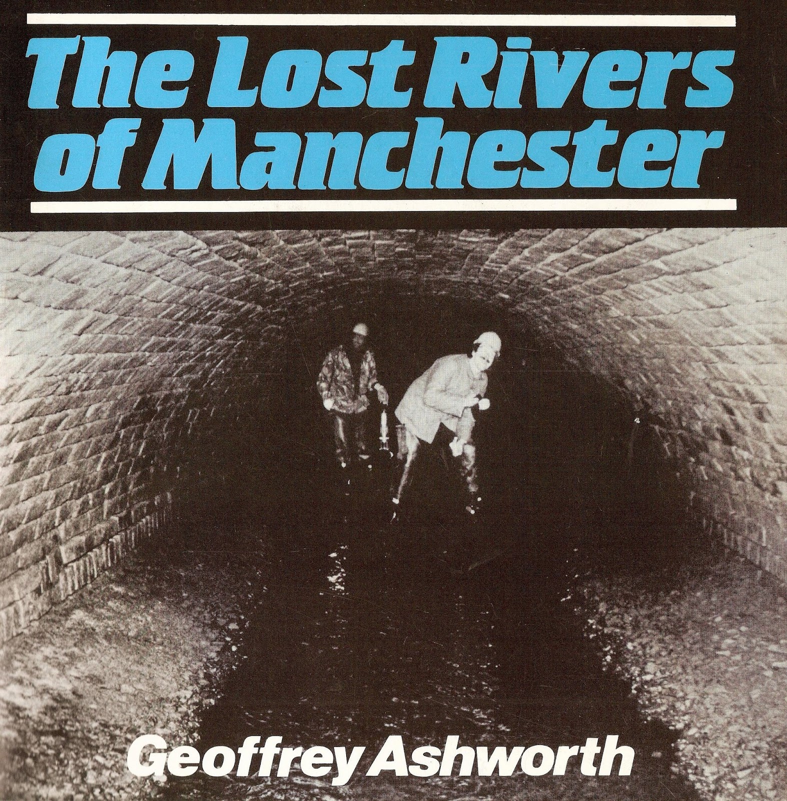
The Lost Rivers of Manchester


The lost rivers of Manchester have an abiding fascination for me not least because there are so many of them and also so little evidence of where they run.

Until fairly recently I could name just a handful all of which were in the city centre and which  appear for just brief stretches before disappearing into dark culverts.

But there are plenty more and a lot of them are here on the south side of the city.  Some have fared better than others. Our own Chorlton Brook comes out into the light of day by Hough End Hall and can be seen as it flows on through the township to join the Mersey.  Others like the Longford Brook and the Black Brook are now completely buried while others like the Rough Leech Gutter have been pretty much forgotten.

I was reminded of this recently when I came across the Platt and Ley Brooks on a walk along the Fallowfield Loop.

Both flow openly along the old railway track and are just two of a network that crisscrossed south Manchester.

Most by the late 19th century had become polluted but there would have been a time when they would have been an important resource for all the rural communities.

And in beginning to track them down I discovered The Lost River of Manchester*.  It was written by Geoffrey Ashworth in 1987 and carefully tracks the streams, brooks and water courses which by and large have bricked over and gurgle their way along unseen.

Sadly it is now out of print and copies on Amazon are going for £60, but it is available from the library and may one day be republished.

*Ashworth, Geoffrey, The Lost River of Manchester, Willow Publishing, 1987

Pictures; courtesy of Willow Publishing, http://www.willowpublishingtimperley.co.uk/

Monday, 13 September 2021

A forgotten river, an old railway track .... the Platt Brook, the Fallowfield Loop


By Withington Road Railway Bridge, 2009
Today I think we shall walk the Fallowfield Loop again

Now I first came across this disused railway line a few years ago and have been promising to take the route to Fallowfield with my botanist friend David Bishop, but in the way of these things our desire to start some serious walking has got there first.

We had been up in the Hope Valley and with the sun shining and the presence of plenty of ramblers we decided it was time to join them but more of that later.

In the meantime it is the Fallowfield Loop that has got me going on this bright sunny day at the end of April.

It is a cycle and walking track, which runs for six miles from St Werburghs in Chorlton to Debdale Park.

As you would expect there is much to see and I have already promised myself the Companion Book of Flowers, along with Trees to spot and enjoy and What was that bird?

Platt Brook and Ley Brook, 1841-53
But for me the exciting discovery of our first trip along the path was the Platt Brook which runs open along part of the track and is a constant reminder to me of the number of open water course which flowed through south Manchester.

Many now disappear in dark culverts lost to most of us but occasionally come out into the daylight.

So it is with the Platt Brook which is the Gore Brook earlier in its journey.  Like some of the other books it finally runs in to our own Chorlton Brook and on its course picks up even smaller ones like the Ley Brook which is almost hidden from view.

We missed it at first and I was only drawn to it by a small brick wall which stops the curious from falling down its banks.  But there it was running underneath the old track into the Platt Brook and visible as it snaked off southin the opposite direction  towards Fallowfield, Burnage and Withington.

Stretches of it had been put below ground by the 1840s.

Now I fight the romantic side of my character but I have to confess to a sheer bout of the emotion at finding these little water ways most of which are totally overlooked but are a powerful link to our rural past.

So a bit ironic really that it should be this old disused railway track that brings me back to south Manchester of the 1840s, where as many of you know I so often reside.

The line in 1905
The Fallowfield Loop Railway began in 1891 when the stretch between Chorlton and Fallowfield was opened, followed the next year with an extension up to Fairfield.

The line provided a new route for the Manchester, Sheffield and Lincolnshire Railway to run trains from Sheffield into Manchester, and local stopping services ran from Fairfield and Gorton on the Hope Valley line to Manchester Central via Hyde Road, Fallowfield and Chorlton-cum-Hardy before joining a section of line from Old Trafford into Manchester Central.

It had a chequered history and its demise was a slow decline marked by the closure of some of the stations in the 1930s and the rest in the 50s.   Its end as a passenger line came in 1969 with the closure of Central Station although it was still used for freight until 1988 when the line was finally closed.

The route remained an increasingly overgrown relic of our railway past until its reopening as a cycle and track way in 2001.

The Comet,  on the loop line in 1935
This brings me back to our resolve to do some serious walking and in turn leads me to a reflection on how you kit yourself out for a new hobby.

Like all new ventures we were in danger of going over the top and friends have gently smiled at the idea that we should use a compass, but it is all part of the fun.


So with that said I rather think it is time to make tracks.

Now I am always pleased to be corrected otherwise what ids the poinbt of trying to get thisngs right so Here are two corrections from Brian Roberston and Ed Allen.

Brian wrote, "I have to correct your blog on a couple of points, Andrew Simpson. Firstly, there were no station closures in the 1930s. All of the stations closed together on July 7th, 1958. Secondly, although some Hope Valley trains run through Gorton and Fairfield, these stations are very much on the Woodhead line. Incidentally, the building of this line necessitated the building of new stations at Gorton and Fairfield. The line's main claim to fame is that the blue Midland Pulman was a regular visitor as it rested at Reddish depot between turns."

And Ed Allen comented, "The first picture is not Withington Road but St.Werburghs looking South. The bridge was widened in 1929 to cater for widening the tracks...a scheme which never materialized. I grew up with the Loop at the end of the garden in Chelsfield Grove. I still live nearby, with the Metrolink now at the back of the house. Land was reserved for the widening, the long thin field behind our house, the cinema on the bridge had to be easy to demolish and the houses on the West side of Buckingham Road were built on reserved land. The Comet didn't run on the Loop but ran from Piccadilly/London Road to London Euston. It didn't run through Fallowfield and anyway, the station in the photo is somewhere else, Fallowfield' signal box was actually on the Westbound platform. The locomotive is an original Royal Scot class originally named Jenny Lind then The Rifle Brigade. Usually, steam locos running on the Loop were former Lner engines Long coal trains were run into manchester and the Manchester Central to Harwich boat train was a regular heading the other way. So many archive photos have been captioned wrongly in the past, I hop no-one minds a little correction now and then."

Pictures; on the Fallowfield Loop by Withington Bridge, August 2009, Phil Champion and  geograph.org.uk, map of the spot where the Platt Brook joins the Leigh [Ley Brook] from the OS of Lancashire 1841-53, courtesy of Digital Archives, http://www.digitalarchives.co.uk/ railway bridge close to Fallowfield Station, City Engineers, October 1905, m78399, the Comet  Manchester to London Express, pulled by Loco 6146, passing through Fallowfield at 5.30 pm 1935, m63467, courtesy of Manchester Libraries, Information and Archives, Manchester City Council

Tuesday, 19 January 2021

Following the course of the Kickety Brook, from Chorlton

It’s not the best outcome for a watercourse which once ran free across across the meadows but it is an all too familiar one.

If I have my geography correct then this is the Kickety Brook which I first came across when researching the weir which had been built in the late 18th century to protect the Duke’s Canal from a sudden surge of flood water.

Now this was all too common an occurrence before the beginning of the 20th century and there are plenty of stories of farmers being caught out by the speed and force of the Mersey in full flood.

On one occasion a farmer just had time to unhitch his horse from the wagon before being engulfed and on another hay ricks swept out of the fields near Barlow Hall Farm were deposited back a day or so later and Thomas Elwood our local historian described a vast lake of water stretching back across to the Mersey after one flood in the 1880s.

So strong was that force that the first weir was destroyed and had to be rebuilt in the 1840s.

After which it continued to do its job of breaking the flood surge and directing it out across open land towards the Kickety Brook.

Back then the brook must have been a far more attractive water course than the one that Andy Robertson photographed recently.

Of course with the passing of farming in the area water courses can seem to be a nuisance.  At best they are neglected and at worse they are full of all sorts of rubbish.

Added to which great stretches flow in concrete channels which do nothing for what was once a vital part of the countryside offering a home to wildlife and a place of mystery and fun to young children.

In some places these channels have been torn up to allow the water to flow freely once again.

One such is the river Quaggy in south east London and the result has been to create haven for all sorts of animals.

Sadly not so this bit of the Kickety Brook, but maybe the future will be different.

Pictures; the Kickety Brook, February 2015 from the collection of Andy Robertson

Friday, 5 June 2020

A bit of history …… some wildlife ….. and a walk beside Sale Water Park... not forgetting Mr. Thomas Elwood

Now, I guess most people know that Sale Water Park was created in 1979, runs through Mersey Valley between Sale and Stretford and has that 52-acre artificial lake.

A heron by the water, 2020
And if you have to have a motorway on your doorstep, turning the huge gravel pit created to provide material for that motorway into a gigantic pond is an imaginative trade off.

In places the lake is 90 feet deep, provides opportunities for a variety of water sports, and is a wonderful place to observe all sorts of wildlife.

Our neighbours, Mike and Helen, regularly walk the water and photograph the herons and swans that inhabit the area.

We had been talking recently about their walks and Mike promised to share some of his pictures including these of a heron.  “The two herons are the same bird, in the second shot it has just caught a fish and is about to fly off with a mate.”

The heron ready to fly, 2020
I can’t say I was aware of just how rich the area is in wildlife, and nor did I know the role the waterpark plays in our flood prevention schemes.

So, when the level of the Mersey becomes dangerous, excess water can be released on to the surrounding land. Similar flood prevention schemes are in place at  Chorlton Water Park and in Didsbury.

All of which is very different from when the Mersey would breach its banks and create huge lakes on both sides of the river.

The flood lake, 1963, from a photograph dated 1946
Such floods could be swift and there was often little warning, one of which was so sudden that a farmer just had time to release his horse before seeking refuge in a tree.

The Chorlton historian Thomas Elwood recorded a series of floods during the 1880s.

The first was on December 23rd, 1880, "when the bank beside Barlow Hall was washed away to a length of nearly 100 yards, followed by another on the 29th, when both streams overflowed their banks. 


The last time the weir was over topped, 1915
The next came on February 8th, 1881 when the repairs to the bank were almost completed, but so great was the volume of water coming down the river that the bank again gave way in the same place, and two streams overflowing their banks presented the appearance of one vast and extensive lake”.*

Further floods followed on March 7th and 9th which left a pile of earth from the broken bank on the meadow land to a depth varying from 11 to 3 feet, which eight months later had yet to be cleared.

And a final flood occurred on October 14th “when the brook bank gave way on the village side and the old wooden bridge across the river at Jackson’s Boat was washed away by the swollen stream”.

A more peacful scene, 2020
And so powerful was an earlier water surge, that it destroyed the newly built weir, constructed to protect the viaduct carrying the Duke’s Canal at Stretford.

All of which is in direct contrast to the scene today.

Location; Sale Water Park

Pictures; Sale Water Park, 2020, from the collection of Michael and Helen Kilduff, Higginbotham’s field in flood, J Montgomery 1963, painted from a photograph dated 1946, m800092, Courtesy of Manchester Libraries, Information and Archives, Manchester City Council, http://images.manchester.gov.uk/index.php?session=pass and the last time the weir overflowed, 1915 from the Lloyd collection

*Ellwood, Thomas, History of Chorlton-cum-Hardy, chapter 1, South Manchester Gazette, November 7th, 1885

Tuesday, 21 January 2020

The Kickety Brook, Stretford, once a vital part of our flood defences


I first walked the Kickety Brook with my old botanist friend, David Bishop.

It doesn’t look much but it was vital in its day for protecting the Duke’s Canal at Stretford.

The Canal dates from the 1760s and was cut to bring coal into the heart of the city and also was used by our farmers and market gardeners to ship their produce into the Manchester markets.

But the canal was close to the Mersey which could flood with little warning. In July 1828 flood water transported hay ricks from the farm behind Barlow Hall down to Stretford only later to take them back, while later floods proved to be even more destructive with one destroying the bridge across Chorlton Brook.

It was, wrote Thomas Ellwood the local historian
“no uncommon thing to see the great level of green fields completely covered with water presenting the appearance of a large lake , several miles in circuit,” and he recorded six major floods between  December 1880 and October  1881

By then the stone weir had been in place for nearly a century.  It had been built after a heavy flood in August 1799 had broken the banks where Chorlton Brook joined the Mersey.  This had led to fears that the Bridgewater Aqueduct across the flood plain could be damaged in a subsequent flood.

The weir was designed to divert flood water from the Mersey down channels harmlessly out to Stretford and the Kicketty Brook.  Not that it always worked.  Soon after it had been built flood water swept it away and during the nineteenth century neither the weir nor the river banks prevented the Mersey bursting out across the plain.

This happened in 1840 and in the following year it was rebuilt by the engineer William Cubitt. After litigation the cost of repair was borne by the Bridgewater Trust who paid out £1,500, the Turnpike Commissioners £500, Thomas de Trafford £1,000 and Wilbraham Egerton £1,000.

Today, standing beside the weir you get little sense of the force of the river in full flood. In the winter there can be a pool of water at its base stretching out across the plain but on many occasion in the past on warm summer’s days even this bit of land can be bone dry.

And likewise the Kickety Brook seems just an overgrown and quite forgotten bit of water. The last time the weir took an overflow of flood water was 1915 when these two pictures were taken.

Pictures; Higgibotham's field in flood, 1946, from a painting by J Montgomery, 1963, m80092, courtesy of Manchester Libraries, Information and Archives, Manchester City Council, and 1915 pictures from the Lloyd collection

Monday, 2 October 2017

Chorlton Brook, meadowland and a winters day

Chorlton Brook can seem a pleasant and benign bit of water.

Come across it on a warm summer’s day as it flows under the Brookburn Bridge and it looks pretty peaceful.

And when the children were young it was a favourite walk of ours, following its course past “secret pathways” and on to where it joins the Mersey.

Of course all the land on either side has changed dramatically and what you see now is a product of tipping and landscaping.

My friend David often rails against the policy of tree planting that has been undertaken over the years.

After all, everything you can see from the Brook to the river was until recently farmed as meadow land.*

Meadowland is grassland that is kept damp by the use of ditches called carriers worked by sluice gates fed from a river.

The skill is to keep the land fed with water up to an inch in depth through from October to January, for about fifteen to twenty days at a time before allowing the water to run off into the drainage ditches.

The land must then be left to dry out for 5-6 days so that the air can get to the grass.  The early watering took advantage of the autumnal floods which brought with them a mix of nutrients and silt which enriched the land.

In 1845 there were 680 acres of meadow and pasture compared to 490 arable acres and 10 of woodland.

But all of that has gone, and now pretty much the only reminder of what went on is the Brook and even that has changed.

So here are two of Andy Robertson’s picture taken sometime in the 1990s when the brook was in full flow.

Pictures; from the collection of Andy Robertson

*Remembering the meadows in the 1940s ..... the power of oral testimony, http://chorltonhistory.blogspot.co.uk/2013/05/remembering-meadows-in-1940s-power-of.html