Showing posts with label Stretford. Show all posts

Tuesday, 7 July 2026

There is always another on the way …… travelling by bus to Chorlton Station

I have Kevin Barker to thank for this picture.

I am looking at two employees of Manchester Corporation posing for their photograph on route number 9.

It’s a perfect example of how there is always another on the way, which might be a bus or a new picture I haven't seen before.

I think we will be on Edge Lane sometime in the early 20th century.

A quick search of The Manchester Bus by Michael Eyre and Chris Heaps reveals that this is “Daimler NA2687 at Longford Park on the service from Chorlton to the Stretford boundary at that point; it has the first of many bus bodies that would be built by the Car Works. Note the taller bonnet line of the Y type chassis”. 


They date the picture to 1914 and tell me that the bus could seat 38 but in 1923 was rebuilt to increase the number of seats to 44 by extending the upper deck over the driver’s cab.

And that is about it.

Other than to say I have no idea that there was once a bus to and from Chorlton railway station to Longford Park.

The fun will be to identify the back drop and leaving me to thank Kevin for whizzing the picture over today and to Andy Robertson for his indulgence in letting me continue to borrow his bus and tram books on an extended loan which will soon be a decade.


Location; Edge Lane?


Picture; Daimler NA2687 at Longford Park, 1914, courtesy of Kevin Barker

* The Manchester Bus by Michael Eyre and Chris Heaps, 1989


Tuesday, 23 June 2026

Discovering Turn Moss Road …… that one with a little history

Turn Moss Road is the one that runs off Edge Lane and down onto Turn Moss.

Turn Moss Road, 2023
It’s a road that you could easily miss or just give a nod to on your way from Chorlton into Stretford.

That said it has some nice-looking properties and is marked by that giant sign which welcomes you to Trafford, with a smaller one announcing that you are about to enter Stretford which regularly attracts spray can enthusiasts and the odd individual unloading a ranger of stickers.

I doubt I would ever taken the road further if Ruth hadn’t posted “Do you know anything about Turn Moss Road? 

I live in one of the black and white ones, built around 1992. I’d love to know more about what was there before. I think there was a large house and grounds on Edge Lane that was demolished”.

She was responding to a story I had written on walking into Stretford in 1847.

Turn Moss Road, 1892
And her question intrigued me, because with the sun cracking the paving stones and a possible high of 31° predicted for today, I am not going anywhere.

The road shows up on all the old maps going back into the early 19th century and for most of its existence it was just a a lane leading to Turn Moss Farm.

There are pictures of the farm, and it also appears on the OS maps for the 1840s and 1880s and in the census returns as well as various books on the history of Stretford.

John Bailey in his book Old Stretford published in 1878 wrote that “Turf moss or Turn Moss in the low lying meadows or ees, is mentioned in one of the Mosley Wills in 1612".

It was and is likely to have always been a lonely house and is yet surrounded by embankments to protect it from the floods. 

In 1771, when the estate was on sale it contained "93 Lancashire acres”,  but by the mid 20th century its size had shrunk so that when Samuel Massey in his book A History of Stretford, 1976 reported that

“Turn Moss Farm. Formerly Turfe Moss Farm. The fields, few in number, surrounded the far. The farm was approached from Edge Lane and from Hawthorn Road. The cellars of the farm house were subject to flooding. The occupiers were dependant for water on a shallow well and rainwater tank.” 

Turn Moss from the Briscat with Turn Moss in the distance, 1950
But what has really brought the old farm back is one of Allan Brown’s stories, who remembers working there as a boy in the 1940s. 

He was one of the many young people who were encouraged to help out working on farms during the Second World War.

This was the period of “Dig for Victory” with food in short supply parks gardens and even the tops of air raid shelters were used to cultivate crops.

So, Allan did his bit walking from his home near the green down the old road, now more commonly known as Hawthorn Lane to the farm and a stint of voluntary war work.

I never asked Allan if he ever used Turn Moss Road but I suppose he will have done, and back then it was just a lane with the current development dating from the 1990s.

Westonby, Edge Lane, 1914
Go back into the late 19th century and maps show that the only buildings along the Stretford side of the road was a green house and outhouse which may have the stables for the large house now long gone which stood on Edge Lane.  

That house promises to be an interesting research project and in time may match Westonby that place still remembered as the Twilight Sleep Home for painless child birth.*

It still stands to the east of our road and is somewhere I am minded to return to.

And that is about it for now..

Picture; Turn Moss Road, 2023, courtesy of Google Maps, Turn Moss Road, 1892, from the OS mapd of Lancashire, 1892-94, Turn Moss,1950 from what was known as the Briscat which was a three acre piece of pasture which back in the 1840s had been part of the land George Whitelegg rented from the Egerton’s, W. Jackson from the Lloyd collection, Westonby and Edge Lane, 1914, courtesy of Manchester Libraries, Information and Archives, Manchester City Council, m17757 courtesy of Manchester Libraries, Information and Archives, Manchester City Council, http://images.manchester.gov.uk/index.php?session=pass.

*Westonby, https://chorltonhistory.blogspot.com/search?q=westonby

Monday, 22 June 2026

Walking into Stretford along Edge Lane in 1847

Now if I wanted to walk to Stretford from the village in the late spring of 1847 I would have used the old road.

It started at Hardy Lane as a foot path twisted and turned its way following the course of the Brook at one point before skirting the church and green and going off across Turn Moss, under the Duke’s Canal and coming out at the pump opposite the Cock Inn.

It is a road I have written about before* so instead I think I will take Edge Lane which if you were at all of an inquisitive nature would be a better choice, for it offered you a chance of gazing over some fine houses.

So Edge Lane it is, starting at the green with its farmhouses and pubs and then out along the road which took you to the junction with High Lane.

Now I said it gave you a chance to gaze on some fine house but most of these are set back in their own gardens.  This is particularly true of Longford house the home of the Walker family from the early 19th century.

They too are a family who I have written about, Thomas Walker was a Manchester politician, radical and businessman who is buried in the parish church yard, and his son Charles was a noted author.  But there home like its successor Longford Hall was some distance away from the road and not therefore easily visible.

Nor so Edge House home of George and Mary Bannister who farmed 150 acres of land and employed eight men.  Their home was up a long winding lane set in an orchard.

There were of course more humble homes, along the way which were lived in by James Cain, carpenter,James Hodcroft, market gardener and William Barlow florist.

And then there was Peel House, the last before the canal.  I think it dates from after the 1830s, had its own lodge house, orchard and gardens and was the home of Norbury family who included an inspector of houses, a retired cotton merchant and a solicitor’s clerk.

I would have liked to have seen Peel House, and there are photographs but these are the property of Trafford Libraries who guard their copyright.  Had I arrived just a few years earlier in Manchester and I might have seen the building for myself, but it was demolished in 1967.

Like all such walks what you saw depended on when you walked the walk.

So a little earlier in the decade and there would a have been a few meaner cottages, while  just into the next decade and beyond Peel House the home of Thomas Massey who lived by the new railway station and was employed as a railway porter.

Fast forward just another 30 years and this end of Edge Lane would have been dominated by a series of large houses with impressive sounding names like Standish House, Fern Bank, Wansbeck House and Beech House.

But the 1880s and 90s are out of my comfort zone, I as many know prefer to walk the fields and lanes of the township in the years before 1850.

So I shall close with a place that would have been easily accessible both from the old road and Edge Lane and this was Turn Moss Farm. It is mentioned in some of the histories of Stretford, was the subject of plenty of photographs and is remembered by my old friend Alan Brown who worked for the farmer during the last war.  Bu that is a story for another time.

Location; Chorlton, Manchester

*http://chorltonhistory.blogspot.co.uk/search/label/The%20Old%20Road
**http://chorltonhistory.blogspot.co.uk/2012/01/childhood-memories-of-war-service-farm.html

Pictures; detail of Edge Lane from the OS map of Lancashire 1841-53, and Hennet’s map of Lancashire 1830 courtesy of Digital Archives, http://www.digitalarchives.co.uk/ and looking across Turn Moss circa 1950s, from the collection of David Bishop

Thursday, 18 June 2026

Of floods and weirs and peaceful places, on the edge of Turn Moss


The weir in 1915
I really don’t do enough pictures on the blog and rarely do those then and now sort of stories.  So here with the help of Nigel Anderson and Michael J Thompson of Hardy Productions UK* are some shots of the weir on the edge of Turn Moss just where the river takes one of its dramatic twists.

Now the Mersey is prone to flooding and after a particularly bad flood in 1799 the weir was built to channel storm water across the plain and into the Kickety Brook and so lessening the danger to the aqueduct which carried the Duke’s Canal.

And floods and the story of floods regularly pop up on the blog including the tale of the weir and Kickety Brook,.

Almost the same spot today © Nigel Anderson
So when Michael told me that he and Nigel had been down at the weir I just had to ask permission to use their photographs, along with two from 1915 which was the last time it served the purpose it was built for.


Their pictures show a benign spot, but it was not always so.

The river could flood with little warning and on one occasion a farmer just had time to release his horses from the cart as the water swept across the open land.

The weir from the flood plain, 1915
Another time in the July of 1828 flood water transported hay ricks from the farm behind Barlow Hall down to Stretford only later to take them back, while later floods proved to be even more destructive with one destroying the bridge across Chorlton Brook.

It was, wrote Thomas Ellwood the local historian
“no uncommon thing to see the great level of green fields completely covered with water presenting the appearance of a large lake , several miles in circuit,” and he recorded six major floods between  December 1880 and October  1881.

Looking towards Kickety Brook from the weir © Michael J Thompson


Not that it always worked.  Soon after it had been built flood water swept it away and during the nineteenth century neither the weir nor the river banks prevented the Mersey bursting out across the plain.

This happened in 1840 and in the following year it was rebuilt by the engineer William Cubitt.

After litigation the cost of repair was borne by the Bridgewater Trust who paid out £1,500, the Turnpike Commissioners £500, Thomas de Trafford £1,000 and Wilbraham Egerton £1,000.

*Hardy Productions UK https://sites.google.com/site/hardyprodsuk/

Pictures; of the weir in 1915 from the Lloyd collection and the weir today courtesy of Nigel Anderson and Michael J Thompson


Saturday, 30 May 2026

On Stretford Station with a bit of our railway past

It is 35 years since the last train ran from Stretford station which means that memories of a time before the tram will be fading

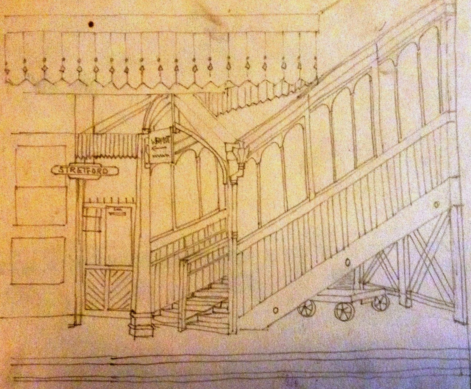
Stretford Station, April 1961
I briefly used the station back in the 1970s and had no idea of its history or the railway line.

It had been opened in 1849 by the Manchester South Junction and Altrincham Railway and was in part designed to transport food grown in Altrincham and Stretford into the heart of Manchester and in time would challenge the Duke's Canal as the main means of carrying heavy goods in to Manchester.

I have no doubt it would have created quite a stir.

The men who built the line were viewed at best with suspicion and at worst with fear.  They had a well deserved reputation for hard drinking and rough behaviour which is no surprise given the dangers of the work they undertook.

Central Station, April 1961
And there may well have been a few of  our farm a labourers who were taken on to do some of the least skilled work while some of our farmers and market gardeners would have taken advantage of the line to move their crops to the Manchester markets.

But its impact was also to start a wave of house building along Edge Lane.

The train offered the quickest way into town and allowed those who earned a living in the city to escape to what was still the countryside.

Of course by the time I used the train Edge Lane and the surrounding area had long lost any semblance of countryside, but the station still looked like an old fashioned railway, which is where my fiend Ann comes into the story.

She “found these the other day, tucked away. Stretford station in 1961, and Manchester Central, probably a similar date. I used to travel from Stretford to Oxford Road Station, spending my time on the journey drawing the other passengers.”

And so after sixty-two years a little bit of what an old railway station looked like is here to see again.

Now that is not so daft given that Stretford has become a Metro Stop with shiny yellow trams and Central having long lost its trains is now an Exhibition Centre.

Pictures; Stretford and Central Stations, April 1961 courtesy of Ann Love

Monday, 11 May 2026

Picking up the packet boat from Stretford and then post haste to Castlefield on the Duke’s Canal

Now I often write about living in the township in the mid 19th century and I reckon if I had wanted to travel into Manchester it would have been by water.

The price of a package ticket
So if I could have afforded it I would have chosen one of the twice daily package boats from Stretford along the canal which transported passengers in comfort and speed.

A ticket for the front room cost 6d [2½p] and the back room 4d [1½p].*

This was travelling in style.   These packet boats were fitted with large deck cabins surrounded by windows which allowed the passengers to sit “under cover and see the country” glide by at the rate of six miles an hour, made possible by  two or sometimes three horses which pulled the packet.  And if that was not style enough the lead horse was guided by a horseman in full company livery.**

Cornbrook south towards Stretford
It was a pleasant enough journey for most of the route was still across open farm land and it was not till Cornbrook that the landscape became more industrial.

From here on there was no mistaking that the final destination was that busy, smoky and energetic city.

The chemical and dye works of Cornbrook gave way to saw mills, a textile factory, paper mill and all manner of wharves and ware houses before the packet arrived in the heart of Castlefield.

But we all know that I wouldn’t have been in the money and so there would have been no fast packet boat for me and no walk out of the village along the old road to Stretford, instead it would have been a longer and slower tramp, north through Martledge.  But that is another story for another time.

Pictures; Packet boat charges from Pigot and Slater’s Directory of Manchester and Salford 1841, and detail of the Cornbrook stretch of the Duke’s canal from the OS map of Lancashire, 1841-53, courtesy of Digital Archives, http://www.digitalarchives.co.uk/

*This was beyond what most of our residents could afford.  A domestic servant might earn 2s 9d [13½] while that of a labourer was 13s.6d [57½p].

**Slugg, T.J., Reminiscences of Manchester, J.E.Cornish, Manchester 1881, Page 223

First posted in March 2013

Monday, 13 April 2026

On the parish, seeking benefits in the Stretford of 1807


Mary Crowther was just 18 in 1765 when she was removed from Stretford by the authorities and sent back to Chorlton.

They did this under a removal order which gave them the power to send anyone who had settled in the parish without permission back to the place of their birth.  It was a straightforward piece of economics which was designed to root out anyone who might make a claim on the parish for support in a time of need.

And Mary may well have been just such a person.  In 1765 after arriving back in Chorlton she gave birth to the first of three children all born out of wedlock.

In a period of heightened debate about benefits and the drain on the public purse the actions of St Matthew’s Parish authorities might seem all too familiar.

Now Mary’s story has been well covered already*so instead I shall concentrate on some of the other decisions made by the overseer of Stretford.

The years just before and after Waterloo** were hard times and the parish of St Matthew’s responded to requests for help.  So in the year 1810-11, James Mee the overseer regularly paid out between £40 and £90 a month in relief, with the highest sums in the winter months when little work could be done on the land.

But it was always the bastardy payments which feature prominently.

For women like Mary Crowther who had done penance and had had three illegitimate children between 1765 and 1782 there was a greater recognition of the father’s responsibility. Mary could turn to the law for help and although we have no records for Mary there are other recorded cases.    

And it is those from Stretford which throw a light on how unmarried mothers were treated. These are the Orders for Maintenance of Bastard Children, and Bastardy Bonds which identified the adult male who would support the child as well as other miscellaneous Orders Relating to Bastardy. ***for , and across the country many of these records have survived in greater quantities.


They reveal a straightforward system designed to identify the father and bring him to court.  This might begin with an examination of the mother by a magistrate or if she was already in labour by a midwife.  These Bastardy Examinations were common in the early eighteenth century.    Having achieved the information a Bastardy Warrant was issued ordering a Constable to bring the father before the Magistrate.  If the case was successfully made then a Bastardy Order was issued which identified the man and stipulated the amount he was to pay.

The documents were pre-printed with spaces for the magistrates to write the names of the mother and father and the amount that had to be paid.  Some of the Stretford ones for the years 1702-1811 reveal the estimated costs which the father was expected to pay.  

Often the sum was decided on a yearly basis which would then be paid quarterly.  This amount varied and may have been based on circumstances.

The figure of 26 shillings [£1.30p] for the year payable until the child was fourteen appears in some of the Stretford documents but others set an initial payment to cover the birth ranging from £2 down to 10s. [50p] and specify that further payments should be made weekly.

These also varied from 30d [7p] to 7d [3p].   In some cases the mother was expected to contribute and this could be 18d [7p].

Attempting to make sense of these awards is fraught, but some idea of their monetary worth can be gauged by making a comparison with wage rates and some examples of the cost of living.  Just twenty years later in 1830 Mary Bailey and Higginbotham the farmer agreed an annual salary of £7.10s [£7.50] from which she bought  in January a pair of stays which cost 10s.6d, [52p], in May a new cap worth  1s.8d [7p] and in July repaired her shoes for 2s.8d [14p].  The cost of renting on the Row for a farm labourer varied from 10d [8p] to 5s [25p] a week.    Finally the day rate for women workers in the south west was between 7-10d [3p].

Against this backdrop of wages, and spending the magistrates determined that the cost of maintaining an illegitimate child was 7d [3p] a day and this was slightly more generous than the 26 shillings {£1.30p].

So in the year 1807 which seems typical, Catherine Ashcroft received 5/- on April 28th, the widow Pinnington 2/6d and Margaret Thompson 3/-

But the system was flawed and there were many in the early nineteenth century who said so.    The moralists argued that payments to a single mother only encouraged illegitimacy and they may even be evidence to suggest they were partly right.  Both here in the township and in the Parish of Ironville in Derbyshire and no doubt many other areas,  some woman gave birth to a number of children out of wedlock. Their story is also covered in my book.

The next task will be to trawl the records and see what happened to Catherine Ashcroft, the widow Pinnington, and Margaret Thompson.

I suspect that their stories will be like many of the women from Chorlton, who went on to get married, although in the case of Mary Crowther she did not, living out her days with one of her sons in a wattle an daub cottage on the site of the Trevor arms on Beech Road.

And as ever I stand by a correction from Bill Sumner who wrote "The Stretford records you allude to were not in the Parish of St Matthew as that church was not then built, they are the records of Stretford Old Chapel and much more can be read of similar cases in The History of the Old Chapel of Stretford by Sir Bosdin Leech. Charles Walker of Barlow Hall settled later in Longford House Stretford and became Poor Law Guardian for Sretford, he ruthlessly cut down on the number of persons receiving benefit from the town excluding all who were originally from elsewhere".

Pictures, Mary Crowther's gravestone from the collection of Andrew Simpson,  map of Stretford from Greenwoods map, courtesy of Digital Archives, 1818, http://www.digitalarchives.co.uk/  Bastardy Orders, courtesy of Manchester Libraries, Information and Archives, Manchester City Council

*The Story of Chorlton-cum-Hardy, Andrew Simpson 2012, the History Press, http://chorltonhistory.blogspot.co.uk/search/label/A%20new%20book%20for%20Chorlton
**The Battle of Waterloo 1815
***  St Matthew Overseers of the Poor,  Manchester Archives L89/9/14

Thursday, 8 January 2026

Taking the tram from Swineopolis and on to ‘the Bravest Little Street in England’ with lots in between

Today I have started on the next book in the series, The History of Greater Manchester By Tram *

So far, we have published four books which cover the route from East Didsbury into Manchester, across the city and out east towards New Islington.

Stretford in 1830
And now it is the turn of the route from Old Trafford to Altrincham which passes through Stretford, Sale, Brooklands, and Timperley, and taking in places like Navigation Road.

Now without being unfair some of the stops along the way might not shake the trees of historical promise but I am ready to be surprised.

That said others like Stretford and Altrincham bubble with stories that tell us much about Greater Manchester’s past.

And so it is with Stretford which was an important stop on the Duke’s Canal which arrived in the 1760s and was to be later eclipsed by the coming of the railway in 1849.

The canal had carried agricultural produce from Altrincham and Stretford into the city and brought night soil back.  By 1849 this amounted to 873 tons of produce from Stretford, which climbed to 1,781 tons in the following year.**

Stretford in 2025
The carts left Stretford just after midnight for the markets and while one family member remained to sell the produce the rest returned with the cart loaded with manure ready to repeat the operation the following day.  

This prompted one observer to describe the place as “the garden of Lancashire.”     
It was also a major centre for the processing of pigs for the Manchester market as well the manufacture of black puddings and had gained the nicknames of Swineopolis and Porkhampton.    

During the 1830s, between 800 and 1,000 pigs were slaughtered each week and sent into the city.     

Most came from Ireland, via Liverpool and were transported into Stretford by barge.  On arrival the pigs were kept in cotes kept by the local landlords.  

The Trafford Arms charged one penny per pig a night and had cotes for 400 pigs.    Not surprisingly in 1834 there were 31 pork butchers in Stretford compared to one in Chorlton and five in Urmston.     

Stretford landscape, 2025
Edwin Muir left the Manchester train at Stretford summed up the place well when he wrote “Fruit, flowers, green market stuff, black puddings, and swine’s flesh in general – these are the pride of village.”    
He was also full of praise for both the black puddings and the local speciality known as the Stretford goose.  This was made from pork stuffed with sage and onions, which he thought “was not a bad substitute for that pleasant bird.”***    

In Stretford in 1826 there were 302 looms providing employment for 780 workers supporting 151 families,   and as late as the 1840s there were still seven.****

It was also home to John Rylands that great 19th century  industrialist who had global business interests as well as being remembered as a prime mover in the construction of the Ship Canal.  

The Essoldo, 1961
More recently there will be many with fond memories of the grand Essoldo Cinema and the Stretford Pageants with the popular Rose Queen procession.

At the other end of the tram route Altrincham can also boast heaps of history.

In Chapel Street for instance there was a row of old Georgian terraced lodging houses which were home to some 400 Irish, English, Welsh and Italian lodgers.

From this tight-knit community of just sixty houses, 161 men volunteered for the First World War.

Altrincham, undated
They fought in all the campaigns of the war, with twenty-nine men killed in action and twenty dying from injuries soon after the war; more men were lost in action from Chapel Street than any other street in England.

As a result King George V called Chapel Street "the Bravest Little Street in England”.

To this can be added its long history going back to the Middle Ages, the presence of the Linotype Company "which built 185 houses for its employees and provided two football grounds, four tennis courts, two bowling greens, a cricket ground, a playground for children and allotments”.*****

Altrincham Shaver and Repair Centre, 2015
But my favourite is the Altrincham Shaver and Repair Centre, and here amongst other things you can get your Kenwood Mixer repaired and I guess much else.

Once upon a time shops like these were common, for who would want to go out and buy a new electrical product when it was possible to get that expensive and cherished item repaired?

And the chap in his brown overalls could pretty much be guaranteed to mend anything as long as the parts were available.

The one near us as I was growing up was magic.

Every corner of the shop was piled high with electrical goods and there was that dusty, musty smell which greeted you as you went through the door.

You offered up the broken thing, Mr Anson would scrutinise it, mumble a bit and if it was do able would retreat to the back room and work a bit of that magic.

Alternatively if parts were needed it was left in that back room until it was fixed at a fraction of what it would cost to buy new.

Altrincham, 1830
And that was how it was done.  

Things were repaired when they broke and while they might not have looked as elegant at least they worked.

These are shedloads more stories will appear in our book 5.

In the meantime the first four books will take you on a journey out of south Manchester, into the city centre and on to Victoria Railway Station in one direction and east via Piccadilly Gardens, Piccadilly Railway Station to terminate at New Islington.  

The books are available at £4.99 from Chorlton Bookshop, the shop at Central Ref, St Peter's Square, or from us at www.pubbooks.co.uk

Location. Stretford, Altrincham

Pictures;  Stretford & Altrincham1830,  Hennet’s map of Lancashirecourtesy of Digital Archives, http://www.digitalarchives.co.uk/ Stretford on a March Day, 2025,  the Essoldo in 1961, m09199, courtesy of Manchester Libraries, Information and Archives, Manchester City Council, https://digitalarchives.co.uk/ https://digitalarchives.co.uk/ Altrincham, undated, Allan Brown,  Altrincham Shaver and Repair Centre, Church Street, and Linotype Works, Altrincham, 2015, from the collection of Andy Robertson 

Linotype Works, 2015
*The History of Greater Manchester By Tram,  https://chorltonhistory.blogspot.com/search/label/A%20new%20book%20on%20the%20History%20of%20Greater%20Manchester%20by%20Tram

Leech, Sir Bosdin, Old Stretford, Privately Printed 1910

**Scola, Roger,  Scola, Roger, Feeding the Victorian City, Manchester University, Manchester,  1992

***Muir, Edwin, Lancashire Sketches, Simpkin Marshall, London & Manchester, 1869 

****Leech, Sir Bosdin, Old Stretford, Privately Printed 1910

*****The Lynotype Estate, https://www.visitmanchester.com/things-to-see-and-do/the-linotype-estate-p252931  


Monday, 29 December 2025

When Stretford was sniffy about Chorlton-cum-Hardy

Now I know this will upset the residents of Stretford and no doubt bits of Chorlton too but it happened and here is the story.

Strolling by the park circa 1900
Back in 1913 the Manchester Courier reported on plans by the Stretford District Council “to establish a public museum at Longford Park”*

It was felt that “that among the residents many relics of Old Stretford, historical and literary, and probably natives who had removed further afield might have in their possession objects which would be of great interest to the present generation.”

And to this end one room of Longford Hall would be given over to the exhibits.

So far so good, but the chair of the Stretford District Council also chose to take a swipe at the residents of Chorlton commenting that the said Chorlton residents were “making a footpath across the park from the Ryecroft road entrance to that in Edge Lane.  If it still persisted he should feel it his duty to recommend to the Council to close the entrance from Chorlton-cum-Hardy.”

And that is all I shall say.

Location Stretford

Picture; on Edge Lane strolling by Longford Park in the early 1900s, courtesy of Sally Dervan

*Local Art Collection in Longford Park, Manchester Courier, July 2, 1913

Tuesday, 25 November 2025

The day I thought I was in the country …… urban tales from Chorlton-cum-Hardy

Now, the purist will immediately point out I was not in Chorlton nor the countryside.


But on a hot summer’s day sometime at the end of the 1970s I rather thought I was.

I had taken myself off across the meadows and discovered the old weir at that bend in the Mersey.

The weir had been built in the 18th century to break the force of a flood surge which might have damaged the aqueduct carrying the Duke’s Canal.

The river regularly flooded in earlier centuries and once in the 1840s the force of that surge was so strong it damaged the weir itself.

Even now the base of the weir can still be marshy and after a wet winter the water will stretch out into the surrounding land.

On the day I discovered the spot there was just a hint of water but enough for the cows who grazed on the grass.

And it was the cows, the pasture and the steeple that offered up the illusion of somewhere rural.

Although I did have to frame the picture to miss the tower block and get the chapel of Stretford Cemetery in the centre.*

And before any one sneers, .... yes the quality of the pictures was poor.  In my defence I was just beginning to develop and print images using smelly photography and the negatives have sat in our cellar for over 40 years.

Location; the meadows west of the Mersey, circa 1978, from the collection of Andrew Simpson

*Stretford Cemetery, https://www.trafford.gov.uk/residents/births-deaths-and-marriages/burials-and-cremations/cemeteries-and-crematoria-in-Trafford/stretford-cemetery.aspx


Monday, 26 May 2025

“On Edge Lane strolling by Longford Park in the early 1900s”

Now here is a picture of Edge Lane I haven’t seen before.

It dates from around 1900 and was found by my friend Sally “in an old book, that is in such a bad state, and 
pongs so badly of damp that in between scanning the pictures it has to live outside!”

She posted on that excellent facebook site Greater Manchester History, Architecture, Faces and Places which challenges that silly prejudice that social networking is trivial.*

This site and others continue to provide an exchange of pictures stories and historical investigation which would otherwise not be available and often starts an interesting debate.

Above all it reminds me that history, our history is not just the preserve of the academic and the professional historian but belongs to us all and every one of us can make a contribution to what we know about the past.

“On Edge Lane strolling by Longford Park in the early 1900s” will have been one of countless images available back then but which have long been lost.  Many were taken by commercial photographers and made their way onto picture postcards but plenty more will have been taken by amateurs and have not survived.

What I particularly like about this one is that it is a scene that hasn’t changed much in over a century and there will be many who have fond memories of taking a similar stroll on a sunny day in late spring, and early summer.

So there you have it, a little bit of Edge Lane a century and a bit ago which I guess has pretty much not seen the light of day for a long time.

And that just leaves me to hope Sally will persevere with that smelly book and share more hidden gems.

Picture; on Edge Lane strolling by Longford Park in the early 1900s, courtesy of Sally Dervan

* Greater Manchester History, Architecture, Faces and Places 

Sunday, 25 May 2025

The forgotten hospital in Longford Hall

 I know l shouldn't be surprised that Longford Hall was given over to use by the Red Cross as an Auxiliary Hospital during the Great War.


Many family homes, along with schools and other public buildings were requisitions or volunteered as hospitals for soldiers  recovering from wounds and illnesses. 

Here in Chorlton l have tracked three with the promise of another, and over the years l have written about more in Didsbury, Whalley Range, Salford and across Manchester and beyond.

I just didn't think of Longford Hall but I should. It was a fine large building, formerly the residence of the  Ryland family and from 1908 it was owned by Stretford.

So at the outbreak of war it became a centre of war activity including its role as a hospital.

After the war most of these hospitals were returned to private use or continued as hospitals. 

The equipment from beds to cooking pans and typewriters were sold off and with two generations their existence had started to fade.

So l am off to do the research, starting with one of those scrap books recording photographs and comments of the hospital.

Location; Longford Hall

Pictures; pictures, undated courtesy of Bill Sumner

Friday, 9 May 2025

On Edge Lane with the Stretford Pageant sometime in the 1960s

I am back with another of those excellent photographs from the collection of Jack Kennedy.*

And this time we are with the Stretford Pageant sometime in the 1960s on Edge Lane just before the procession made its way into Longford Park.

Now there are many in Stretford and Chorlton who will have very fond memories of this event and I featured the memories of one Rose Queen from 1928 a few years ago.**

Jack’s picture perfectly captures the moment, so much so that there isn’t anything more to add.

Picture; Stretford Pageant, circa 1960s, courtesy of Dave Kennedy

*jack kennedy black & white photography https://www.flickr.com/photos/8188211@N02/sets/72157647573263194

**Memories of a Stretford Rose Queen in 1928 by Karen J Mossman, http://chorltonhistory.blogspot.co.uk/2013/11/memories-of-stretford-rose-queen-in.html

Friday, 25 April 2025

A drunken jolly out from Manchester and stone throwing at Stretford........ petty crime in a rural community

Drunkenness violence at the Royal Oak, October 1855

Alcohol related crimes posed a real problem, from both our own and the Sunday visitors who made their way from Hulme and Manchester to drink here.

More than anything it is the sheer numbers that might surprise us.  These appear to have been organised outings and away from their own homes and filled with beer they can only be described as a mob.  

Eye witnesses on one occasion talked of a group of six men playing pitch and toss in the road, vandalising the property of locals and turning to intimidation when they were asked to stop.

Thomas Johnson who lived close by was beaten up and perhaps only saved from worst treatment by the intervention of another group.  To make matters worse the same gang reinforced by another twenty reappeared the following week and attacked property and threatened the inhabitants before fleeing when the police and a group of locals arrived.

The Royal Oak much the same 50 years after the outrage
The beer house was the Royal Oak which was the first on the route in from Hulme and Manchester.  The cottages can be traced to a collection of cottages beyond William Knight’s farm.*

The level of drunkenness in Manchester was a regularly commented on by writers in the 1840s   and there is no reason to believe the same was not true in rural communities.

There were plenty of pubs and beer shops  in the township  all of which stayed open all day and late into the night.

During 1846 and 1848 the farmer Higginbotham recorded many instances where his carters were too drunk to carry on working.  Between April 6th and April 27th George Badcock was drunk on six occasions.  On one of these he had been drinking all afternoon, and on another all day.

His replacement was Thomas Davis who fared little better, having been sent to town to collect dung he spent the day drinking and left the cart in Manchester.  A decision which with hindsight may have been a wise decision, for only a few years previously and on the same road that Davis would have used a carter was killed in a road accident caused by the drunkenness of another driver.


There were similar problems with pubs and beer house in the township. The license of the Black Horse at Lane End was finally withdrawn for breaking the drinking laws as was William Brownhill’s.  Nor should we forget the part played by alcohol in the death of Francis Deakin who had been drinking all day in a local beer shop.

Drunken gang at Stretford in the September of 1832
Finally just over the border the Trustees of the Bridgewater Canal experienced their own drink problem when a drunken group of men threw stones and potatoes at one of the packet boats passing through Stretford on a Sunday evening in the year of 1832 seriously injuring a young child.

Pictures; The Manchester Guardian, October 29, 1855, the Royal Oak circa 1900 from the collection of Tony Walker, and Manchester Times & Gazette September 29 1832

You can read more about the crime in the township in The Story of Chorlton-cum-Hardy http://chorltonhistory.blogspot.co.uk/2011/11/the-story-of-chorlton-cum-hardy.html

Next; Burglaries, robberies and poaching in Chorlton and beyond

*Manchester Guardian October 29 1855

**Engels and others described the level of drunkenness amongst sections of the working classes in Manchester

Monday, 3 March 2025

Surprising and not so surprising scenes travelling through Stretford

If you take your inspiration from that 1946 song by Bobby Troup and plan to motor west, ….. travelling the highway that's the best, you can get your kicks on Kingsway and down Urmston Lane.*

Face at the window, Eastern & Western Boutique,2025

Well I might be stretching the credulity of even the best friends of Stretford, but on a warm sunny Saturday  walking through the township there was plenty to taken in .

Car Park, 2025
On the way I bumped into my old Facebook chum Bill Sumner and his wife who let me into the secret of that old farm on Urmston Lane, clocked the sad and lonely looking Robin Hood and took pleasure in the odd Stretford scenes, from the face in a shop window and a bit of carpark, while remembering that tip to “never point your camera into the sun”.

So istorically the farm will offer up some interesting stories and there will be lots more to find out about the  the Robin Hood.

And no doubt more than a few helpful hints about how to take pictures into the sun.

Looking in from Urmston Lane, 2025

We shall see.

“Never point your camera into the sun” 2025

Location; Stretford

Pictures; Face at the window, Eastern & Western Boutique,  car park,  “never point your camera into the sun”, Kingsway, passing farm buildings Urmston Lane, 2025, from the collection of Andrew Simpson

*Route 66, Bobby Troup, 1946, version by Chuck Berry, https://www.youtube.com/watch?v=AqhQSfFtOVE

Saturday, 1 March 2025

Two chums … Enriqueta Rylands …. and a walk around Stretford’s past

It started with a talk on John and Enriqueta Rylands by the novelist Juliette Thomlinson and finished with some nice surprises.*

Closed entrances, 2025

I knew the talk by Juliette would be good and it was.  Judging by the comments from the packed audience at Stretford Library they thought so with the two infront commenting that the talk was informative and offered an insight into how a novelist works.

What I didn’t expect was to bump into my old Stretford chum Bill Sumner and his wife who is all things history.  And the chance meeting led to him showing me the remains of an old farm minutes from the Library.

Stretford shapes, 2025
Added to that as the talk finished, I bumped into Chris Roman whose photographs I much admire and who I had never met before.

All of which was interposed with a bit of Stretford’s past from the old Robin Hood pub to St Matthew’s Church.

I have a fond spot for the Robin Hood because briefly the name was adopted by one of our first beer shops in Chorlton, which changed its name to the Traveller’s Rest sometime in the 1840s.

It opened at the bottom of Chorlton Row and continued trading into the 20th century

Location; Stretford

Pictures, Stretford on a March Day, 2025, from the collection of Andrew Simpson

* A Manchester Love Story, The Squeeze Press, www.woodenbooks.com


Friday, 28 February 2025

When I lost a water trough ….. in Stretford in the summer of 1965

 I collect water troughs ….. eccentric perhaps but fun.

And had I been on Chester Road in the summer of 1965 this one would have made the collection.

But then in 1965 I was sixteen still living at home in southeast London and had yet to come across one of the passions of my life.  

Sixty years ago I might well have snapped this one, recorded its exact location, and returned decades later to check its fate.

Now I have no idea how many water troughs were made in the 19th century or for that matter how many have survived.

In London they were made and maintained by the Metropolitan Drinking Fountain and Cattle Trough Association which is not the zippiest of names but neatly does the business.

It had been founded in 1859 as the Metropolitan Drinking Fountain Association and added the rest when it began providing fresh water for horses and cattle as well as fountains for the people of London.

According to Dickens’s Dictionary of London, in 1879 there were 800 fountains and troughs which on a hot day 30,000 people took advantage of the supply while a “single trough supplied the wants of 1,800 horses in day.”*

So, I shouldn’t be surprised that in my pursuit of water troughs I should keep turning up fine examples of ones that have lasted the course.

All of which leads me back to the Chester Road trough which the caption from the 1965 slide says was erected in 1874, and here’s the rub I can’t find it.

I have wandered down Chester Road using Google maps, checked out the route from the 1896 OS map, and even trawled the collection of old photographs from Trafford Lifetimes, but to no avail.**

That said someone will know, suggest where to look and perhaps surprise me with the fact that it now resides in one of the parks.

And even before the post went live, my friend Lawrence helped me out with, "I do remember it now. That’s the floodlights of Old Trafford in the background. 

They were four steel towers at each corner. Erected around late 1957 early 1958. Now demolished. That pub is the Dog and Partridge. Used to go drinking in there when I was 16. Now demolished and the Bishop’s Blaze pub was built there.

Chester Road was widened and the island went under tarmac and the horse trough disappeared. That area has fascinating relics of the early 20th Century. I think the building behind the camera now a Halfords tyre fixing garage was a factory for motor cars.

It's the starter for ten.

Location; Stretford

Pictures; the Stretford water trough, Chester Road 1965, from the 1965 Collection 

*quoted from Metropolitan Drinking Fountain and Cattle Trough Association, https://en.wikipedia.org/wiki/Metropolitan_Drinking_Fountain_and_Cattle_Trough_Association

**Trafford Lifetimes, https://apps.trafford.gov.uk/TraffordLifetimes/

A Manchester Love Story …… John and Enriqueta Rylands .... the talk this Saturday ….

I can think of no better place for Juliette Thomlinson to talk about her debut novel featuring John and Enriqueta Rylands than Stretford Public Library.*


Afterall John Rylands established the first free lending library in Stretford in 1883 and his wife Enriqueta gifted it to the local authority a decade later, following this up in1903 by paying for the structural alterations to the building costing £1,335.

Longford Hall, 1965
Juliette’s talk with be in the present Stretford Library which dates from 1940. 

She tells me that she will be discussing how she came to write the novel, her own personal connection to both Longford Hall and the park as well as a bit about both John and Enriqueta Rylands.

And given that Juliette is an excellent speaker with an engaging manner which does not distract from her knowledge of the Ryland’s we should be in for an interesting afternoon.

Longford: A Manchester Love Story, Saturday March 1st, at 4pm for an hour in Stretford Library, Bennett Street, Stretford, M32 8AP No charge

Stretford Library, 2022

Location; Stretford

Pictures; cover of A Manchester Love Story, courtesy of the author, Longford Hall, 1965 from The 1965 Collection and Stretford Library, 2022, courtesy of Google Maps 

*A Manchester Love Story, The Squeeze Press, www.woodenbooks.com

Tickets for Longford: A Manchester Love Story, available from eventbright https://www.eventbrite.co.uk/e/longford-a-manchester-love-story-tickets-1248215398859?aff=ebdsshsms&utm_share_source=listing_android