Showing posts with label Mayfield Railway Station. Show all posts

Wednesday, 16 February 2022

Mayfield in Manchester ..... that railway station forgotten by many and mourned by a few

 Now I never knew Mayfield Railway Station.

It was the one built alongside what was London Road Railway Station, and is now Piccadilly.

For those others old enough to remember when it had trains it will be a place of trips out to Stockport, Buxton, Wilmslow and Crewe, although from the 1920s onwards these were confined to the rush hours.

It closed for passenger traffic in 1960 having just reached its 50th birthday.  It briefly had a life as a parcel depot  but this finished in 1969 and two years later the mainline tracks were lifted.

After that, there were plans for “something” for Mayfield, but the years went by with it slowly deteriorating, visited only by the curious and those wanting to post pictures from a site few people knew much about.

The railway station took its name from the area south of Piccadilly Railway Station, and east of London Road.  

It appears on the old maps as Mayfield and was developed in the early 19th century and came to be dominated by Mayfield Station.

By the end of the last century, the railway station had closed, the densely packed terraced properties along with the mills, dyeworks and foundries had gone, and the place was waiting for something to happen.

For decades it was that half-forgotten place, visited by daring adventurers keen on recording its forlorn and neglected state.

And now it is part of an exciting regeneration scheme which has crossed the pages of the blog over the last few years.  My old friend Andy Robertson who specializes in chronicling the story of buildings and areas across the twin cities and beyond, has been revisiting the Mayfield site over the last few years.  

His task as ever has been to photograph the railway station and the accompanying site as it slowly is redeveloped.*

But at the weekend he took advantage of a guided tour led by Jonathan Schofield and took a series of pictures, which for some will provoke memories of long ago excursions, and for the curious offer up images of what happens to an old railway station.

To which we can add that for the young and those who have recently settled in Manchester, Andy’s pictures are a fascinating insight into our recent past.


Location; Mayfield, Manchester

Pictures; Mayfield, 2021, from the collection of Andy Robertson

*Mayfield, https://chorltonhistory.blogspot.com/search/label/Mayfield


Saturday, 31 July 2021

Mayfield …….. the next instalment

There will still be many for whom Mayfield in Manchester means nothing.*

Abandoned

For others old enough to remember the Railway Station it will be a place of trips out to Stockport, Buxton, Wilmslow and  Crew, although from the 1920s onwards these were confined to the rush hours.

It closed for passenger traffic in 1960 having just reached its 50th birthday.  It briefly had a life as a parcel depot but this finished in 1969 and two years later the mainline tracks were lifted.

After that, there were plans for “something” for Mayfield, but the years went by with it slowly deteriorating, visited only by the curious and those wanting to post pictures from a site few people knew much about.

Transformation

The railway station took its name from the area south of Piccadilly Railway Station, and east of London Road.  It appears on the old maps as Mayfield and was developed in the early 19th century, and came to be dominated by Mayfield Station.

By the end of the last century, the railway station had closed, the densely packed terraced properties along with the mills, dyeworks and foundries had gone and the place was waiting for something to happen.

And that something is now happening, which Andy Robertson has been chronically over the last few months. 

The river

That something will be “A transformational mixed-use city centre regeneration project reviving a former industrial heartland into a modern innovation quarter.  

Mayfield is a 24-acre brownfield site packed with heritage and the River Medlock flowing through its core. The site has an industrial history of innovation spanning back to the 1700’s with previous lives as a parcel depot, relief railway station and textile mill. The site was left derelict for over 30 years before the next phase of its revival began. 

The Mayfield Partnership – comprised of U+I, Manchester City Council, Transport for Greater Manchester and LCR – formed in 2016 with a shared vision to deliver a modern neighbourhood at the heart of Manchester. Overall, the brownfield site will provide over 2.3m sq ft GIA office space facilitating 13,000 new jobs, 1,500 homes, 56,000 sq ft of retail and leisure, a new 300-bed hotel and 13-acres of public realm, including Mayfield Park – the city’s first new park in over 100 years.

The cleared land

Consent for phase one of the scheme was granted in February 2020, which will see the creation of the 6.5-acre park, office buildings, a car park and significant public realm. Construction will begin in Q4 2020, with the first buildings estimated to complete in 2022.

Since day one of the Mayfield Partnership, the site’s heritage assets have been opened up to the city through a curated programme of placemaking-led events and projects. In 2017 GRUB moved in, attracting foodies to the railway arches on Temperance Street. In 2018, Mayfield & Co established a small community of creative independent businesses. In 2019, Broadwick Live took a five-year tenancy, with a brief to deliver a series of worthwhile events.

Mayfield developments

The first major live music events began with an ambitious programme involving The Warehouse Project and some of the biggest names in electronic dance music, all taking centre stage in the historic Depot. From 2019 through to the beginning of 2020, over 300,000 music lovers visited the site, raising the profile of the area within the city and creating an initial socio-economic uplift of £10m in its first year.  

The remaining phases of Mayfield will be developed over the next decade, and are expected to generate in the region of £7bn of socio-economic gain – creating a thriving and exciting neighbourhood for all Mancunians to enjoy”.**

I could go on but by following the link you can see just what bold plans are about to come into being, leaving me just to say that this is the second of Andy’s pictures which will not be the last.

Location; Mayfield, Manchester

Pictures; Mayfield, 2021, from the collection of Andy Robertson

*Mayfield, https://chorltonhistory.blogspot.com/search/label/Mayfield

**Mayfield Manchester, https://www.uandiplc.com/our-places/mayfield  


Tuesday, 11 May 2021

In at the beginning ……. transforming Mayfield

It is not everyday that you can claim to be in at the beginning of a new urban project which will transform a tired, neglected and almost forgotten bit of the city.


But this is one of Andy Robertson’s new projects.

He is a regular contributor to the blog and many of his 663 stories are about how the twin cities and the boroughs beyond have undergone massive change over the last decade.

And always Andy is there at the beginning, photographing decaying and empty buildings, and then returning again and again as the factories, warehouses and pubs are demolished, the land cleared, and the builders get to work on something new.


This week he has been in Mayfield, that area south of Piccadilly Railway Station, and east of London Road.  It appears on the old maps as Mayfield and was developed in the early 19th century, and came to be dominated by Mayfield Station.

By the end of the last century, the railway station had closed, the densely packed terraced properties along with the mills, dyeworks and foundries had gone and the place was waiting for something to happen.

And that something is now happening, which will be “A transformational mixed-use city centre regeneration project reviving a former industrial heartland into a modern innovation quarter.  

Mayfield is a 24-acre brownfield site packed with heritage and the River Medlock flowing through its core. The site has an industrial history of innovation spanning back to the 1700’s with previous lives as a parcel depot, relief railway station and textile mill. The site was left derelict for over 30 years before the next phase of its revival began. 


The Mayfield Partnership – comprised of U+I, Manchester City Council, Transport for Greater Manchester and LCR – formed in 2016 with a shared vision to deliver a modern neighbourhood at the heart of Manchester. Overall, the brownfield site will provide over 2.3m sq ft GIA office space facilitating 13,000 new jobs, 1,500 homes, 56,000 sq ft of retail and leisure, a new 300-bed hotel and 13-acres of public realm, including Mayfield Park – the city’s first new park in over 100 years.

Consent for phase one of the scheme was granted in February 2020, which will see the creation of the 6.5-acre park, office buildings, a car park and significant public realm. Construction will begin in Q4 2020, with the first buildings estimated to complete in 2022.

Since day one of the Mayfield Partnership, the site’s heritage assets have been opened up to the city through a curated programme of placemaking-led events and projects. In 2017 GRUB moved in, attracting foodies to the railway arches on Temperance Street. In 2018, Mayfield & Co established a small community of creative independent businesses. In 2019, Broadwick Live took a five-year tenancy, with a brief to deliver a series of worthwhile events.


The first major live music events began with an ambitious programme involving The Warehouse Project and some of the biggest names in electronic dance music, all taking centre stage in the historic Depot. From 2019 through to the beginning of 2020, over 300,000 music lovers visited the site, raising the profile of the area within the city and creating an initial socio-economic uplift of £10m in its first year.  

The remaining phases of Mayfield will be developed over the next decade, and are expected to generate in the region of £7bn of socio-economic gain – creating a thriving and exciting neighbourhood for all Mancunians to enjoy”.*

I could go on but by following the link you can see just what bold plans are about to to come into being, leaving me just that Andy’s first pictures will not be the last.

Location; Mayfield

Pictures; In at the beginning …. Mayfield, 2021 from the collection of Andy Robertson

*Mayfield Manchester, https://www.uandiplc.com/our-places/mayfield  


Monday, 10 May 2021

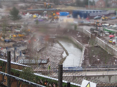
A little bit more of the River Medlock will soon come out into the daylight

Today Andy Robertson has reignited my fascination for Manchester’s rivers, especially those that have disappeared.


He sent over a series of pictures he took at the weekend, adding, “Parts of the Medlock in Mayfield are beginning to be unculverted. If you google MAYFIELD MEDLOCK on Twitter you can see a drone video. Cathy and I went there today sadly minus drone”.*

All very exciting and part of the regeneration of Mayfield area.

And as you do I did call up the video, and then went looking for just when the great slab of concrete confined the river to a stretch of darkness.

I rather think it was much earlier than suggested in the video, which offered a date of 50 years or so ago.


The slab is there in 1933, but had yet to be put in place 40 years earlier and may have been built when Mayfeid Station was built at the turn of the last century.

Either way someone will know, leaving me just to make a note to go looking at more maps, and reread that wonderful book, The Lost River of Manchester.*

Location; Mayfield

Pictures; Mayfield, 2021, from the collection of Andy Robertson

*Mayfield, https://twitter.com/MayfieldMCR

**The Lost Rivers of Manchester, https://chorltonhistory.blogspot.com/2018/03/the-lost-rivers-of-manchester.html

Ashworth, Geoffrey, The Lost River of Manchester, Willow Publishing, 1987


Wednesday, 13 January 2021

Popping back to Mayfield ....... railway stations, public baths and gardens

 Now Mayfield is back in the news.

Mayfield Railway Station, 2020

It’s the area just a little east of London Road and situated in the loop of the River Medlock.

Mayfield, 1819
It shows up in the maps of the early 19th century and disappeared under a mix of mills, foundaries, dyeworks,  and mean terraced housing.

In 1857 it got a set of Public Baths and Washhouse and in 1910 a Railway Station.

By the last decades of the last century, it had become a sorry place, having lost the Baths to enemy action during the last world war and its railway station to rationalization.

Added to which most of the industrial buildings had also gone along with the residential properties.

All of which made it ripe for development which is going on as I write, which includes a new exciting urban garden along with business and residential plans.

And not to be short changed I have posted stories about that development, the history of the railways station and most recently the rediscovery of the Public Baths.

Inside Mayfield Railway Station, 2020

So, my old friend Andy Robertson, couldn’t resist a trip to the area where he encountered the interior of the Railway Station.
Not that he is the first to have recorded the place, but as ever his will be unique as he returns, Covid restrictions permitting, to photograph how Mayfield changes.

And that is, and will be one of Andy’s major contributions to the history of the twin cities.  I doubt that there is anyone else who has consistently recorded chosen sites, from their slow decline, through to demolition and redevelopment, making his work part of how we will view the story of Manchester, Salford and Greater Manchester during the closing decades of the last century into the new one.

Location; Mayfield

Pictures; Mayfield Railway Station, 2020, from the collection of Andy Robertson, Mayfield, 1819, from Johnson’s map of Manchester, 1819, courtesy of Digital Archives Association,  http://digitalarchives.co.uk/

*Mayfield,  https://chorltonhistory.blogspot.com/search/label/Mayfield


Sunday, 16 November 2014

Down behind Piccadilly Station waiting for the Northern Hub ....... part 3 stories of of pubs and lost roads

The Star and Garter on Fairfield Street is one of those pubs that most people know even if they have never stepped inside.


The Star & Garter, 2014
Andy Robertson recorded it recently in a new set of photographs.*

It has been a listed building since June 1980 and a popular venue for music.

One source suggests that there was a Star and Garter as early as 1808 just about a hundred yards further along Fairfield Street and “moved brick by brick to its current location in 1877.”**

This earlier site was where today there is a little island on the corner of Baring Street and Travis Street.

The Star & Garter, 1844
The 1842 OS shows it as a substantial building bearing the name of the Star and Garter.

That said there are no references to it in the street directories for the 19th century and as late as 1877 there was only a beer shop close to the present pub continues run by George Clark.

And Mr Clark I found in the rate books for that year renting the property at number 14 Fairfield Street from a Mr Gibson who owned the adjoining two properties and charged an annual rent of £28.

The pub on the corner of Neild Street, 2014
Now I have been drawn into the history of the place, and will have to go off and look at the licensing records in the archives, especially as that date of 1877 is intriguing.

The following year there is no reference to either men on Fairfield Street so just possibly the beer shop closed when the Star and Garter was erected late in 1877.

Six years earlier number 14 had been home to Thomas Shawcross who gave his occupation as a shopkeeper.

Neild Street and Station Street, 1844
For now I shall have to await that research but as you do I wandered off down behind the pub along Neild Street which in its little way presents another small point of interest.

Today it runs for a short distance beside the old railway buildings before petering out in a dead end.

Back when the Star and Garter opened for business in 1877 it took a different route running directly south and is now buried underneath Mayfield Station.

That stretch that now comes to a dead end was before 1910 Station Street and it too came to an abrupt halt in front of the Boiler House and filtering ponds of the Mayfield Printing Works.

Now this may not be the most riveting of stories but it was one that took time in the making.

The site of number 14 Fairfield Street with Neild Street behind, 2014
I had just thought of showing Andy Robertson’s pictures of the pub which his son had suggested he should record as they were by Piccadilly Station.

As Andy said the area will soon be redeveloped with work on the Northern Hub and that of course led to looking up the story of the Star and Garter, and in turn exploring the directories, rate book and census returns along with maps of the area.

All of which revealed that this little bit of the city sandwiched between the two stations has undergone more change than most of us may have known.

Pictures; of the Star and Garter, 2014 from the collection of Andy Robertson and maps of the area from the 1842-44 OS for Manchester & Salford, courtesy of Digital Archives Association, http://www.digitalarchives.co.uk/

*Down behind Piccadilly Station waiting for the Northern Hub ....... part 1 pubs, warehouses and rivers, http://chorltonhistory.blogspot.co.uk/2014/11/down-behind-piccadilly-station-waiting.html

**The Star & Garter, http://en.wikipedia.org/wiki/The_Star_and_Garter

Saturday, 15 November 2014

Down behind Piccadilly Station waiting for the Northern Hub ....... part 2 tall viaducts and the spaces in between

Now I pretty much take for granted those tall railway viaducts which bring the trains into the city.

Temperance Street, 2014
Most of us will only give the road below a second’s glance as we start to collect our belongings and debate whether to get a taxi or the tram from the station.

But at street level they are massive structures snaking off into the distance and dominating the area.

Back when they were constructed they cut a swath through the houses, workshops and factories and were in their way some of the first slum clearance projects undertaken in our cities.

Temperance Street 2014
Take Temperance Street in the shadow of Piccadilly Railway Station which runs from Fairfield Street down towards Devonshire Street in Ardwick.

For most of that route it runs parallel with the viaduct from Piccadilly and earlier is sandwiched between that viaduct and the one that carried the track into Mayfield Station.

Looking at Andy Robertson’s picture of the street I am reminded of just how dismal these wastelands between railway lines can be.

But it was not always so, because before Mayfield Station was opened in 1910 to the south of Temperance Street was a series of smaller streets packed with terraced housing and all leading off to the Mayfield Dye and Print Works.

The lost streets, 1894
All of which went when Mayfield was built and what was lost included everything from Hoyle Street to Baring Street, which amounted to six streets and 96 assorted properties most of which were residential.

And so went Gray Street, Arthur Street, Mayfield Street along with Station Street and Bailey Street with three reservoirs and a school .

In fact everything west of Hoyle Street across to Baring Street.

Now in the fullness of time I think I will go looking for those old houses and some of the people who lived.

But for now I am content to look at Andy’s pictures and reflect on the changes yet to come with the plans for the Northern Hub.

Pictures; Temperance Street, 2014, from the collection of Andy Robertson, detail of Mayfield Works and surrounding streets from the 1894 OS of South Lancashire, courtesy of Digital Archives Associationhttp://www.digitalarchives.co.uk/

Wednesday, 12 September 2012

Mayfield Station, the forgotten one


It’s the forgotten Manchester Station and one that I had not thought about for over 30 years until Michael Thompson of Hardy Films reminded me of its existence.

You see it every time you are on platform 14 at Piccadilly Station, or on the rare occasion you are on Fairfield Street which runs close by it.

And for a big chunk of the 1970s Fairfield Street was where we caught the bus out to Grey Mare Lane and later to Ashton and you couldn’t avoid the site.

Even now this brick slab of a building dominates the view from the road but few who pass it have much idea of what it was or perhaps what it might become again.

It was opened in 1910 and had been designed to relieve the pressure on what today is Piccadilly Station and remained open until 1960 when it was closed to passengers. Now I am not one to lift the research of other people especially when they have told the story in detail so I will point you to http://www.disused-stations.org.uk/m/manchester_mayfield/index.shtml which has an excellent account of the station and where I not only learned of its reuse as a parcels depot, and film location but just possibly its return again to use as an overspill station for Piccadilly.

And I have fond memories of the place.

It was also where my old school colleague Norman Parry brought me sometime around 1974.

We had been talking about growing up in Manchester and Norman had been born close to Fairfield Street, had learned to swim when his father threw in him in the canal nearby and could show me the spot where a horse and cart went down Jutland Street to crash into a round pillar on the wall at the bottom on Store Street.*

Jutland Street or to use its old popular name of “stony brew” connects Ducie Street and Store Street and even today is an impressive sight.  It crosses the canal and then falls down towards the road below in what must be one of the steepest inclines of any street in Manchester.

Even now vehicles take the gradient carefully and back in the 1930s it proved too much for a tired horse hauling a heavy load.  In 1974 the round stone block was still there and with a little gruesome pride Norman pointed to the evidence of that crash on the stonework.

We had gone there also to look at the stables, ramps and storage areas which all the big stations maintained.  It is easy to forget just how much was shifted by horse and cart.

Each railway company had their own stables and in all there were 157 carriers listed in the 1911 street directory.  Look at any picture of the city from the 19th century well into the 20th and the sheer number of horses is everywhere.

I have gone back to look for them but they have long since gone, as has the wall, the stone stump and almost all of the buildings Norman knew and we visited in the summer of 1974.

*Jutland Street was originally called Junction Street and the area was teeming with timber yards, saw mills foundries and cotton factories and I rather think it was the entrance to a timber yard which was where the horse and cart crashed.


Pictures; Mayfield Station, April 1975, by T.A. Fletcher, m63159, and August 1957, by A Brownhill, m63159, Courtesy of Manchester Libraries, Information and Archives, Manchester City Council, remaining pictures courtesy of http://www.disused-stations.org.uk/