Showing posts with label Chorlton farming. Show all posts

Sunday, 31 August 2025

Snaps of Chorlton No 10, farming some where in Chorlton


An occasional series featuring private and personal photographs of Chorlton.

This is one of my favourite pictures in the collection and it is special for a number of reasons.

First it was lent to me by my friend Allan Brown who had lived here around the village green for his entire life and the seated couple are his grandmother and great grandfather which take his link with the township back into the 19th century.

But it is also because it is one of the few photographs of Chorlton which show people still working the land.

I don’t have a date or a location but we may be in the last quarter of the 19th century somewhere in Chorlton but it featured in my book The Story of Chorlton-cum-Hardy.*


Picture; from the collection of Allan Brown

*http://chorltonhistory.blogspot.co.uk/search/label/A%20new%20book%20for%20Chorlton

Sunday, 13 July 2025

The lost woods of Chorlton …… and a mystery concerning Mrs Lydia Brown and John Holland

We are looking out on John Holland’s Wood which stretched west along Chorlton Brook towards the Bowling Green Inn.

John Holland's Wood, circa 1900, looking towards Brook Farm

Today the footpath to our left is Brookburn Road which once ran east to Barlow Moor Road and west into the village and then out again to eventually cross Turn Moss to Stretford.

John Holland's Wood, formerly the Cliffs, circa 1900
I can’t be sure exactly when it became known as John Holland’s Wood, but John Holland had taken over the family farm in 1865 on the death of his father. 

The Holland family were farming 54 acres around Chorlton from at least 1841 and their holdings were dotted about the township.

These included a strip of land on Row Acre which was the large field running along Beech Road, a stretch on the northern border beyond the Longford Brook and the delightfully named Back of the World which was located where Chorlton Brook joins the Mersey to the south of the stone bridge.

The Cliffs and Brookburn Farm, 1854
Back then, according to the 1854 OS map the stretch we can see in the picture was more heavily wooded, and was known as the Cliffs, which was rented by Lydia Brown who lived at Brook Farm, and farmed across the township, on land which she owned and land she rented from the Lloyd Estate.  

Added to which she owned the smithy on what is now Beech Road, the property used by the wheelwright, Mr. Brownhill on Sandy Lane and a portfolio of cottages.

We even have a snatch of a conversation she had with the journalist Alexander Somerville who came  to Chorlton-cum-Hardy in the summer of 1847 looking for potato blight, the disease which had ravaged Ireland, and was that summer causing concern in Derbyshire.

He stopped at Brook Farm, and reported his conversation with Mrs. Brown who complained about the ash trees which grew around the fields  “which are not only objectionable as all other kinds are in and around cultivated fields but positively poisonous to other vegetation, and ran through the ground causing much waste of land, waste of fertility, and doing no good whatever.  Squire Lloyd is the landlord.  

Brookburn Farm, circa 1900

Mrs. Brown a widow, is the tenant.  She keeps the farm in excellent order so far as the landlord’s restrictions will allow.  But neither herself nor her workmen must ‘crop or lop top’ a single branch from the deleterious ash trees."

And what is exciting is that we know just which fields she was referring to.  These were Rye Field and New Hey which were plots 317 and 318, and ran beside the woods and today form part of Chorltonville.

Despite not yet finding her on the census record I can track her and her husband across the Rate Books from the 1840s through to the mid 1870s.

The woods and Rye Field, 1845

And here is the mystery, because while Lydia Brown lived at Brook Farm which was roughly on the site of Brookburn School, the Holland family are also recorded at a Brook Farm which was according to the tithe record on the bit of Manchester Road which  for a century and a bit was the Conservative Club.

All of which is compounded by the census records which in 1861 place the Holland farm house  on Brookburn Road.

I will leave it to Eric, and who else cares to attempt an explanation, suggesting only that perhaps Lydia had given up farming by 1861, and was happy to live off the rents from her properties, leaving the Holland family to move closer to the woods which took their name.

Sadly, it is no longer possible to recreate the scene and reproduce an image from roughly the same spot.

The trees have vanished under what is part of Chorltonville and a new residential development which was built on the old dairy.

Location; Chorlton

Pictures; John Holland’s Wood, and Brook farm from the Lloyd collection and the Cliffs in 1854 from the 1854 OS map of Lancashire showing a section of Chorlton-cum-Hardy, courtesy of Digital Archives Association, http://www.digitalarchives.co.uk/ and theTithe map of Chorlton-cum-Hardy, 1845

Tuesday, 29 April 2025

The Didsbury mystery …… and “a right pong”

Now I say mystery, but I suspect there will be an avalanche of answers to the simple question, what is it?

The mystery object, 2025

The blog regularly gets requests to search out people, places, and events, as well as being offered pictures and stories, and so I welcomed the message from Dominic Parker who wrote in “Hi Andrew, big fan of your work!  Wondered if you could enlighten as to what this is?

Craigmore Avenue and the Mersey, 2025
It’s in a garden I maintain on Craigmore Avenue West Didsbury.  My own theory is its some sort of ventilation for an old tip or something like that, it kicks off a right pong every now and then”.

Craigmore Avenue is off Princess Road close to where the Mersey does one of its loops and is sited on what was Redbank Farm.

I can’t be exactly sure when the avenue was cut but it will be sometime after 1936.  The OS map for that year shows the farm still there but the 1938-46 version records the presence of the avenue with its houses.

Looking at all the maps going back to 1818 there is no indication of a water course feeding into the Mersey at this spot.

But the City Council conducted widespread controlled tipping which at the time lauded as the new and scientific way was “'controlled tipping'.  Here the rubbish is dumped on low lying land and is spread carefully out and ‘sealed’ by covering with a thick layer of soil. 

Redbank Farm and the Mersey, 1894
Then another layer of waste is put on top, ‘sealed’ and so the land is built up into what becomes in a year or two solid land.  

Just as the clinker obtained from the incineration method is put to good use in road making, the controlled tipping method is usefully applied to filling up waste land, and as you will find on the Mersey Bank at Wythenshawe that a large area of waste land previously liable to floods has been built up by this method into high solid land, grass-grown and suitable for all sorts of purposes, such as playing fields and parks...”

Now just exactly where around Craigmore Avenue the City Council may have undertaken tipping is as yet unclear but with a bit more research and perhaps some anecdotal memories, we may be able to establish if this were so.

I don't think that the Corporation would build on tipped land, and there is no evidence on the maps from the 1930s that the area by Redbank Farm was tipped on, especially given that the farm had existed on that spot from the early 19th if not the late 18th century.

The Mersey and Redbank Farm to the left, 1915
Despite the Mersey’s unpredictable flood record, generations of farmers would bot choose to build and live in a farm so close to the River.

So, it is over to the experts. …. Sorry Dominic.

And just an hour after the story went live we had the suggestion that it was a "Septic tank vent" which has form, but I think all the houses will have been connected to the sewage system, but it will be interesting to hear from local residents.

Location; Close to the Mersey in West Didsbury

Pictures; the mystery object, Dominic Parker, 2025, Craigmore Avenue, 2025, courtesy of Google Maps, Redbank Farm 1894, from the OS map of South Lancashire, courtesy of Digital Archive Association, http://digitalarchives.co.uk/ The Mersey at Red Bank 1915 from the Lloyd collection

*Our City, Manchester 1838-1938, the Manchester Municipal Officer’s Guild, 1938


Wednesday, 12 March 2025

Remembering a lost Chorlton farm from over 87 years ago

Now I am looking at two pictures of Park Brow Farm which was doing the business of growing food from before the start of the 19th century.

And what makes the two pictures all the more remarkable is that I know one of the sons of the last farmer.

He is Oliver Bailey and his family ran the farm from sometime after 1911 and before that had been on Chorlton Row from the 1760s.*

Over the years Oliver has made available a whole heap of family documents from the contract his ancestor signed with the Egerton’s back in the middle of the 18th century to receipts for night soil from the 1850s, house and farm inventories and lots more.

Added to which he was able to describe in some detail the inside of Hough End Hall before it was much knocked about by a succession of developers in the late 1960s.

And his memories have also opened up the story of Park Brow Farm before it too was developed with that small group of houses to the west of the farm house and the barn conversion.

So I shall start with the farm yard and this photograph from 1938.

Oliver tells me that one of the young lads is his brother and the building behind them with the tall chimney was “used for boiling up p food bought from the UCP,” while the two elephants Mr Bailey hosted when the travelling circus arrived were watered from the wooden pump directly in front of the building.

And given that this was the farm yard, the two downstairs rooms of the building to our left were the kitchen and office, with the living room and dining room facing south onto the garden which backed on to Sandy Lane.

Now I could go on but think I will save the rest for another day, which will include more pictures of the front of the farm house, something on the certificates the farm won and a piece of garden furniture which links the farm to the old Assize Courts in town.

Those intrigued by the idea of hosting two elephants can read the story on blog which will also offer up some fine pictures of the Bailey bulls on the land where Adastral House now stands and can summon up in their imagination an image of the young Oliver driving live stock through Chorlton back to Park Brow from the railway station.

All of which just leaves me to ponder on how rural is the scene of the farm house when this picture was taken in the summer of 1940.

Location; Park Brow Farm, Chorlton-cum-Hardy

Pictures, the farm yard, 1938, m17381, and the farmhouse looking north, 1940, m17388, courtesy of Manchester Libraries, Information and Archives, Manchester City Council, http://images.manchester.gov.uk/index.php?session=pass

*Chorlton Row is now Beech Road

Wednesday, 26 February 2025

Hardy Farm ..... on the edge of the Township

 This is Hardy Farm at the end of Hardy Lane, and you will have to be of an age to remember it.

Hardy Farm, 1965
It has gone now, but it appears on Yate’s map of Lancashire for 1786 and may date back further into the 18th century.

In 1845 it was home to tenant farmer John Cook who farmed 29 acres of meadow, arable and pasture, included in which there was three quarters of an acre of woodland and an acre of orchard.

Four years earlier the census records that he lived here with his wife, five children and Thomas Hand.

The family were methodists and his standing in the community was such that he was a member of the Rate Payer’s Committee and in 1848 was one of the two elected Overseers for the Committee.

The farm stood on the edge of Chorlton and strictly was in the small hamlet of Hardy out by the River Mersey.

Hardy, Chorlton and bit more, 1830

This was a lonely spot which at one point in 1830 could boast five cottages as well as the farm.

But the cottages appear to have been progressively abandoned with the last residents leaving in the early 1850s.

Location; Hardy

Pictures; Hardy Farm, 1965 from the 1965 Collection, and Hennet’s map of Lancashire 1830

Thursday, 20 February 2025

Voices from Chorlton ……… 175 years ago

In the summer of 1847 Alexander Somerville had come looking for potato blight, that disease which had ravaged the crops of Ireland and had been reported just a little further south in Derbyshire and what he found were a group of farmers and labourers all too happy to show him we were blight free.  

Mr Higginbotham ploughing Row Acre, 1893
Here were many of the people I had come to know, including James Higginbotham, farmer on the green, Lydia Brown whose farm was just a little to the east of the Bowling Green Hotel and old Samuel Nixon, market gardener and landlord of the Greyhound just over the river.

It is a remarkable piece because Somerville reported and in places quoted what they said.  Nothing quite fits you for hearing their voices, talking of farming issues, joking about what newspapers publish and complaining about their landlords.  These are the authentic voices of 175 years ago.

Nor is that quite it.  For when Somerville and Higginbotham inspect the potato field I know where it was. 

Row Acre, Chorlton Row, and the village 1854
It is the strip of land that ran from the Row along what is now the Rec beside Cross Road, and when they stood admiring the Rose of Sharon apple trees and the Newbridge pears we are just behind the Trevor Arms on what is now Beech Road.

It doesn’t take much imagination to recreate that orchard scene with the smell of William Davis’s smithy hard by and perhaps even the noise of the children in the nearby National school on the Green.

Likewise I am pretty sure I can locate the large bank of earth with ash trees which Lydia Brown was so unhappy about and fully understand why she might contemptuously refer to George Lloyd the landlord as Squire Lloyd because of his refusal to allow her to cut the trees back.

Above all it is that calm and steady confidence of the farmer that shines through.

When Mr Somerville came to Chorlton-cum-Hardy, 1847
Along with Higginbotham’s pleasure that the weather has won out there is the certainty of a life time of experience that allows George Whitelegg to assert that he didn’t believe in blight. Whitelegg ran the Bowling Green Hotel farmed 36 acres and later would go into speculative building.

Mr Higginbotham was 'only afraid that the blight might come.  When it does come it will be time enough to raise the alarm'.

Mr Whitelegg, of Chorlton, told me that 'he was a potato grower, had heard of the blight, had looked for it, could not find it, and did not believe in it'.

Crossing the green meadows I was told at Brook Farm to go down a path under some trees and examine a field; 'for' said the workman who bad me to go, 'it is best for those who want to find the potato disease to look for it themselves and find their own disappointment.'

I told him that I did not want to find it; that I should be well satisfied to find that the blight was not there, to which he replied briefly, 'then, sir you get satisfaction.  The best grown potatoes in this part of the country are in that field, and never since the day that you and were born did the plants look better.'

Looking out towards the green from Mr Higginbotham's farmyard, circa 1880
I found them after close examination to be all that he described them. 

A large bank of earth with ash trees growing upon it – trees which are not only objectionable as all other kinds are in and around cultivated fields but positively poisonous to other vegetation, ran through the ground causing much waste of land, waste of fertility, and doing no good whatever.

Squire Lloyd is the landlord.  Mrs Brown a widow is the tenant.  She keeps the farm in excellent order so far as the landlord’s restrictions will allow.  But neither herself nor her workmen must 'crop or lop top' a single branch from the deleterious ash trees.

Again I was in the green meadows, where the rain that had newly fallen, and the fresh wind that was blowing, and the luxuriant herbage on every side, and the wild flowers prodigal of bloom, all proclaimed that the insurgents now in rebellion against bountiful Providence must soon be defeated and humiliated.

The bridge Mr Somerville crossed to visit the Greyhound, 1865
At Jackson’s Boat where I crossed the Mersey into Cheshire by the bridge which has superseded the boat, the bridge keeper, Samuel Nixon also publican of the Greyhound,  said 'I have been a farmer all my days and never saw anything that can grow out of land look better.  It is only int paper; they must have something to say in paper.'**

Now that is what I call history.

Location; Chorlton


Pictures;  Ploughing Row Acre before it became the Recreation Ground, 1896  Mr Higginbotham's farmyard, circa 1880s, from the collection of William Higginbotham, detail from the 1854 OS map for Lancashire by kind permission of Digital Archives, http://www.digitalarchives.co.uk/ and the old bridge across the Mersey, circa 1865

*Somerville, Alexander, A Pilgrimage in Search of the Potato Blight, Manchester Examiner, June 19th, 1847

**Chorlton Row, is now Beech Road

**The Greyhound is now Jackson's Boat

Tuesday, 18 February 2025

Hardy, lonely outpost on the edge of the township

Hardy is that bit of Chorlton-cum-Hardy that most people are vague about.  

It stretches east from the village and follows the river up past Hardy Lane and was a lonely outpost on the edge of the township.

Across its land were two farms a small hamlet and a little beyond the grand old house of Barlow Hall and the very large and impressive Barlow Farm.

A large part of Hardy was buried under tons of rubbish and the farm disappeared with the development of UMIST playing fields.

Back in the 1840s Charles Wood farmed 60 acres of meadow and arable land and employed three farm servants.


His home at Hardy Farm was on the edge of the flood plain and while he was safe enough the same was not so of the small collection of cottages which were situated a little further south.

In 1841 there were only two of these cottages left which were owned by Samuel Dean who farmed Barlow Farm and they were occupied by John Marsland John Burgess.

Both men were agricultural labourers and probably worked for Dean on his 300 acres.  John Marsland lived with his wife Mary and three grown up sons, Thomas, James and Charley who were also farm workers and John Burgess lived in the other cottage with his wife and son.

I doubt that they were little more than one up one down properties made of wattle and daub with a thatched roof.  A few of these survived into the late 19th century.  Our two had a garden and either relied on their own well for water or used the one up at Hardy Farm.

Sometime in the early 1850s the cottages were abandoned after the Mersey had flooded, but even before then both families had moved on and out of the township, although Charles Marsland had continued working for the Dean family and now lived at Barlow Farm.

It must have been a pleasant enough spot when the sun shone but remained a lonely remote place much favoured by those indulged in illegal prize fighting, but that as they say is another story.

Pictures; Hardy Farm and the land to the east and south from the 1841 OS map of Lancashire, courtesy of

Digital Archives, http://www.digitalarchives.co.uk/ and the meadows before the metro link from the collection of Andrew Simpson

Monday, 17 February 2025

A prize for Park Brow Farm in Chorlton

Here is a little bit of our history which often gets over looked.

In 1916 Park Brow Farm was awarded a certificate of Merit at the Manchester Show “in the Competition for supplying Milk daily from Lancashire and Cheshire to Manchester and Salford or anywhere within a mile radius of Manchester Town Hall.”

In an age when a milk float is a rarity it is easy to forget that until very recently milk on the door step before eight in the morning along with a daily paper just how it was.

Of course on very hot days that milk had to be collected quickly and I do remember on occasion how the seal had been pecked by a bird.

And if like me you were born in the first half of the last century the chances are that your milk will have been delivered by horse and cart.

I know full well Mr Bailey who ran Park Brow delivered his by horse and cart as did Mrs Lomax who lived opposite and ran her milk round from Hough End Hall.

And back then the milk arrived in churns and was decanted into a jug. Sadly the stories of being sent to collect the milk direct from the farm are fading from living memory, but my old friend Marjory was full of the tales of being sent. and there were still plenty to choose from when she was young but given that she lived on Provis Road it was just a short trip across to the frm yard opposite

And that is all I am going to say having already in the past explored the demands for municipal milk and the milk boy of Edge Lane.

Location; Park Brow Farm, Chorlton-cum-Hardy

Pictures, 1916 certificate, from the collection of Oliver Bailey

Sunday, 16 February 2025

Lydia Brown ……… Chorlton farmer and businesswoman comes out of the shadows ...... after 176 years

I wish there was more to know about Lydia Brown, because back in the middle decades of the 19th century she was a busy woman, here in Chorlton.

Brook Farm, undated
She lived at Brook Farm, and farmed 70 acres of pasture and arable land, stretching along the Brook from the Bowling Green pub almost as far as Barlow Moor Road, and south across the meadows.

She also had portfolio of properties, which included the smithy worked by William Davies on what is now Beech Road, the house and workshop of William Brownhill the wheelwright on Sandy Lane and a number cottages, one of which was occupied by John Axon who had been one of the founder members of our own brass band.

And she was a formidable woman, strong enough in her own knowledge of farming to call down her landlord who was George Lloyd who she spoke of contemptuously as “Squire Lloyd” .

Brook Farm, no. 314 and fields, 1847
This I know because in the summer of 1847 she told the journalist Alexander Somerville that Mr. Lloyd was damaging the land she farmed by his refusal to allow her to cut down a line of ash trees.

These, Alexander Somerville commented were “not only objectionable as all other kinds are in and around cultivated fields but positively poisonous to other vegetation, …… causing much waste of land, waste of fertility, and doing no good whatever.  Squire Lloyd is the landlord.  

Mrs. Brown, a widow, is the tenant.  She keeps the farm in excellent order so far as the landlord’s restrictions will allow.  

But neither herself nor her workmen must 'crop or lop top' a single branch from the deleterious ash trees”.

Now, there is something quite exciting at being able to hear the words of someone who lived in the heart of the township a full 173 years ago,

But there isn’t much else.

Despite trawling the census returns for Chorlton I can not find any reference to her, although tantalizingly there is a Mary Brown, in 1841, who despite the different name fits the profile.
Mary like Lydia was 50 in 1841, both had a son of the same name and both were married to a Johnathan.

Jonathan and Lydia Brown appear in the baptismal records for 1823, 1825, 1828 and ’31.
Jonathan described himself as a publican and according to Ellwood in his History of Chorlton-cum-Hardy, he was the tenant at the Horse & Jockey.  Jonathan is in the electoral register for 1832, 1835 and 1840 with freehold buildings at Lane End and on Chorlton Row, which fits with the properties listed as belonging to Lydia from 1844 onwards.***

The gravestone, 2011
And that is about it.  Brook Farm where she lived was on the site of the old dairy, which in turn was redeveloped into a  collection of des res properties on Brookburn Road opposite the school. I do have one picture of the house and know that it had nine rooms.

But we do have her gravestone which is still in the parish churchyard and is in itself a link to Mrs. Brown.

I just wish there was more.

Location; Chorlton-cum-Hardy

Pictures; Brook Farm, undated, from the Lloyd Collection, the tithe map showing Brook Farm and some of the land farmed by Mrs. Brown, 1847, and the gravestone of Mrs. Brown, 2011, from the collection of Andrew Simpson

*Somerville, Alexander, A Pilgrimage in Search of the Potato Blight, Manchester Examiner, June 19th, 1847

**Ellwood, T, History of Chorlton-cum-Hardy Chapter 23, Inns April 17th 1886, South Manchester Gazette

***Chorlton Row, is now Beech Road

Saturday, 15 February 2025

Walking the northern boundary of Rent Meadow in the summer of 1848 …………

Now, it is always fascinating to take a spot you know well, and try and think it back to a time before now.

Looking out towards Chorlton Brook, 2020
So here we are on that footpath that stretches from Barlow Moor Road, down to Nell Lane, with the allotments and park on one side and those roads that run off Sandy Lane on the other.

It is an ancient footpath, and is clearly visible on the OS maps of the mid and late 19th century and shows up in the 1847 tithe map.

The western end ran alongside Lime Bank which was a fine looking house and dates from at least the late 18th century.  At this point the path was more a road, but as it made its way east down to Nell Lane it pretty much petered out becoming quite narrow.

Trees, and bushes, 2020

Walk it today heading towards Barlow Moor Lane, and you get glimpses of the bank of Chorlton Brook, with its dense vegetation and it is easy to think it was always such.

But not so, because back in the 1840s, the land from the path, on either side of the brook and stretching across what we now know as Chorlton Park was fields.

Rent Meadow, [1] and Lime Bank, [3], 1847
The biggest of the two was Rent Meadow which covered 4 acres and was farmed as meadow land.

Its neighbour was Lime Bank, consisting of just 1 acre and was given over to arable farming.

Had you stood on the footpath looking south towards the brook, there would have been a clear view, down to what is now Mauldeth Road West.

But bits of that scene would have been obscures by a belt of trees and bushes which followed the line of the water course.

Beech House, 1853
Both fields belonged to James Holt, who lived in Beech House.

His grounds covered all of the land from Beech Road to High Lane, and down from Barlow Moor Road, almost to Cross Road.

Added to this he owned 17 acres of prime agricultural land in the township.

But his money and that of his family had been made in town in a factory at the bottom of Deansgate, where he made the wooden engraving blocks for calico printing.

Such was his wealth that he also owned a considerable portfolio of properties around St John Street, including the only double fronted house on that street.

As befits a man who had “made it”, he retired early, moved to Chorlton-cum-Hardy, and settled in Beech Cottage which he  redeveloped into a grand property which he renamed Beech House.

The Holt's town house, 2010
His son continued to live in the city centre in St Johns Street, managing the business, and in the fullness of time followed his father and moved into Beech House.

Now, none of this is romantic conjecture, but based on maps of the 19th century, the Rate Books, Tithe schedule and a series of legal documents belonging to the Holt’s.

Together they offer up a detailed picture of the Hot’s business along with the lie of the land by our footpath.

I would love to know who worked Rent Meadow and Lime Bank, but alas that is lost to us.

But there are the odd little glimpses of who might have laboured there.

One such clue, comes in the form of of clay pipes found on the allotments.  It is just possible that they were refuse from night soil spread over the fields which had been bought in from Manchester.

A clay pipe, 2020
But I like to think they may have been discarded by an agricultural labourer on the edge of Rent Meadow sometime in the 19th century.

And as unhistorical as it might seem I would think that the resident of the house known as Lime Bank might have taken a stroll along the footpath on a summer’s evening.  He was a Charles Morton, but more of him another day.

Location; Chorlton-cum-Hardy

Pictures; Rent Meadow, 2020, the Holt's town house, 2010, and clay pipe, 2016, from the collection of Andrew Simpson, and in 1847, from the Tithe map, Beech Cottage in 1841, detail from the OS map of Lancashire, courtesy of Digital Archives, http://www.digitalarchives.co.uk/

Friday, 14 February 2025

Looking out on one of our farms from our house on Beech Road

I have always been fascinated by the Bowling Green Farm which stood on what is now the junction of Beech Road and Beaumont Road.

The Bowling Green Farm, date unknown
Part of the reason is simply that we live opposite in the house Joe Scott built who was also responsible for demolishing the farm house sometime in the 1940s.

There is strong evidence that it was there by the 1750s and had a mixed existence.

In the 1840s it was the home of Samuel and Mary Gratrix, who were in their early 70s.  They employed a farm labourer who lived with them.

Mr Gratrix's home and land on the right of the map, 1844
Now that is a little surprising given that they only farmed an acre of land which was located to the south and east of the farm, and consisted of parts of five fields which were a mix of arable, pasture and part of an orchard.

By 1852 the farm had passed into the tenancy of Peter Langford, who a year before had farmed an acre of land by Oswald Field.  The family appear to prosper because just nine years later they have 16 acres and employed two labourers.

And the family remained on the farm until 1909.

With a bit more digging it should be possible to firm up the final date because just two years later the house was home the Mylett family and the connection with the land seems severed.  He was a coal merchant.

Chorlton Row, 1854
I know that Mr and Mrs Mylett had three young children and that their home had six rooms.

And it is that small detail about the house which as ever draws me into the property.

There will be lots more to finds out, but the romantic in me has wandered back into the 1840s, when the Gratrix family had clear views north across the fields to High Lane, south towards Chorlton Brook, and no doubt passed the time of day with whoever was walking down Chorlton Row from Barlow Moor Lane to the village green.

Plan of the farm house, circa 1930s
And there would have been plenty of them, from the itinerant traders in from Manchester with everything you might want, to those wanting to use the blacksmith down by the Wesleyan chapel and of course those wishing to call in at one of the beer shop and pubs.

Samuel Gratrix might well have supplied some of the food eaten by the Holt family who lived just east of his farm in the impressive Beech House which was set in a walled garden.

And I guess will have sold much of his crops at the Manchester markets.

All of which just leaves me to puzzle over the foot print of the house on the old maps which doesn't quite match the plan in the 1930s.

But that is for another time.

Location; Beech Road

Pictures; the Bowling Green Farm, date unknown from the collection of Tony Walker, the plan of the farm circa 1930 from the collection of Andrew Simpson and Mr Gratrix's fields, 1844, from the OS Lancashire, 1854, courtesy of Digital Archives Association, http://digitalarchives.co.uk/

Thursday, 13 February 2025

Out on the meadows sometime on a wet winter’s day with Chorltonville in the distance


We are out on the meadows sometime on a wet winter’s day with Chorltonville in the distance.  

It is another of those vanished scenes which I guess will be sometime during the second two decades of the last century.  I am fairly certain of that because the estate was completed in 1911, and later the land was being used as a tip.

So it perfectly captures what this part of the flood plain would have looked like and how it was farmed. *

What we now call the meadows was a vast stretch of land from the edge of the village on either side of the brook up to the Mersey, and some was farmed as real meadow land which involved regularly flooding it and managing the water flow to ensure that the grass grew up earlier than the surrounding pasture land.

And this may be the origin of the well known belief that old farmer Higginbotham deliberately flooded one of his field for skating.  Now this is unlikely as the expert advice was that to prevent damage to the grass the water should be drained off before the frost.  Now this warning comes from my old friend Henry Stephens whose book on farming was written in the 1840s and which helped me unlock so much about how we farmed the township in the mid 19th century.  So it is more likely that the ice had got to the field before he could drain the water.

Looking again at our picture most of what you can see was meadowland, in fact back in the 1840s when the township was surveyed two thirds of the land stretching from Hardy Farm down towards the village and south to the river was described as meadows.

*http://chorltonhistory.blogspot.co.uk/search/label/Chorlton%20farming

Picture; from the collection of Alan Brown

Wednesday, 12 February 2025

A postcard and a memory of our declining rural past


This remains one of my favourite pictures of the old church.

 It was taken sometime before September 1904 but could have been at any time after 1837 when the two side aisles were added.

 The cottage to the right was there by the beginning of the 19th century if not before while the roof of Higginbotham’s farm house behind it was at least fifty years older.

And it was a view that would soon be lost forever. Within six years the old Bowling Green Hotel just out of sight on the right would be demolished and replaced by a new pub which would obscure our view of the church entirely.

 It is still a rural scene and bits of farm equipment are littered around the picture and reminds me that here we were on the edge of the village which were cultivated as meadowland.

But for me what adds to the picture and makes it unique is the message on the back. In an age when a postcard sent in the morning could arrive in the afternoon postal messages remained the quickest and cheapest easy of communicating with friends and relatives.

In this case the offer by Mrs Wood of Manchester Road to help at the harvest festival decorations at the old Church on Saturday was “gladly” accepted. It had been sent on the Wednesday afternoon of September the 21st and would have fallen through the door of Manchester Road for teatime or certainly by the following morning.


Harvest festivals were still a real part of the life of our community at the beginning of the 20th century and ones which celebrated the end of a successful year on the land.

 There may have been fewer people who relied on farming in the township but there were still enough for a bad harvest to spell hardship and perhaps even ruin.

Mrs Wood’s husband had been born into a farming family and his father had farmed at Red Gates till his early death in 1902 aged just 52. Red Gates did not long survive his death and in the next few decades more of the farms which dated back to before the 19th century closed.
I am indebted to Carolyn Willits who lent me the post card and gave me permission to use it.

Lcation; Chorlton

Picture; the old Church, Chorlton-cum-Hardy, 1904,  from the collection of Carolyn Willits

Friday, 17 January 2025

A history of Chorlton in just 20 objects number 18, a map and what we have lost since 1907

Continuing the story of Chorlton in just a paragraph. They are in no particular order, and have been selected purely at random.

In just 40 short years much of our open land which had once been farmland and market gardens had been built over. Most of this development had happened around what was Martledge in that area stretching from the metro station west to Oswald Road and east along Barlow Moor Road. But to the south beyond Beech Road out past the Brook and onto the Mersey it was still by and large untouched, and the sight of meadowland and cows being brought back to be milked have only just   faded from living memory. Claude and Reynard Roads gave out onto fields and just a little further down Beech Road if I had a mind I could have walked the field boundaries all the way to the river.
Picture; detail from the 1907 OS map from the collection of Andrew Simpson

Wednesday, 8 January 2025

A history of Chorlton in just 20 objects number 9 ....... a legal agreement 1767


A short series featuring objects which tell a story of Chorlton in just a paragrah and a challenge for people to suggest some that are personal to their stories. 

It is one of the most revealing documents in the Bailey family collection and sets out the tenancy agreement between James Renshaw and Samuel Egerton who owned much of Chorlton.   By the contract James Renshaw was to rent “several fields, Closes or Parcels of land, ..... containing four acres,” as well “All that Messuage or Cottages and tenement.”  It laid out the timetable for paying the rent and the Egerton’s rights to any minerals found under the ground as well as all “Timber Trees Woods and Underwoods.”   It was an agreement which lasted into the 20th century with the family continuing to farm the land and live in the same farm house into the first decade of the 20th century. And at the centre of it all was the home which was only demolished in the 1970s.

Picture; from the Bailey family collection

Monday, 6 January 2025

A history of Chorlton in just 20 objects number 7 ....... a plough 1894

A short series featuring objects which tell a story of Chorlton in just a paragraph and  a challenge for people to suggest some that are personal to their stories.

This was the last time the land opposite our house went under the plough.  The year is probably 1894 and the field was Row Acre.  I can be pretty sure that the chap at the plough was Alfred Higginbotham whose family had farmed here since the 1840s.  Row Acre stretched down from Cross Road to what is now Acres Road and was divided into strips.  Along with the Higginbotham’s parts of Row Acre were farmed by the Bailey family, Thomas White and John Brundrett, and perfectly echoed the medieval idea of a community each working a strip of land.  And of course the plough reminds us that we were a farming community. The image was originally dated 1896 but that was the year the Rec was opened, so I think we can push the date back by two years

Picture; Ploughing Row Acre before it became the Recreation Ground, 1894 from the collection of William Higginbotham

Friday, 29 November 2024

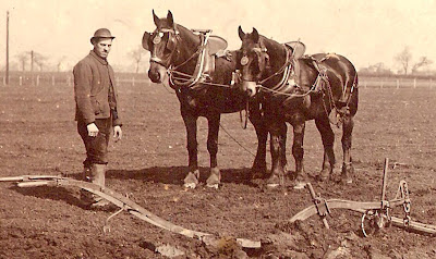
Ours was a time still dominated by working animals


Ours was a time still dominated by working animals.

For centuries the main draught animal had been the oxen and in some parts of the country their use continued well on till the end of the 19th century and the start of the twentieth.

But by the 1840s the horse had taken over in most areas.

The horse was a familiar sight here in the township.  As well as working the fields, they would have pulled the carts and wagons of the farmers and carriers as well as the coaches of the well to do.

Horses provided work for the blacksmith, and the farrier and indirectly for the wheelwright.  Then there were the men who worked with the horses.  Of these the ploughman and the carter earned more than most other farm workers.  The carter after all was assured a regular wage because horses needed to be looked after all the year round, unlike the farm labourer who could expect seasonal periods of unemployment.

But most farm workers came into some contact with horses at some point and on the smaller farms and market gardens, the job of caring and working with horses fell to the farmer or his son.

The Bailey family on the Row who farmed seven acres had just one horse which would have doubled for both ploughing and pulling the spring cart.  

This would have been the pattern here with so many of our market gardens operating with less than 10 acres of land.

On our bigger farms there were men who were employed specifically to deal with the horses.  James Higginbotham, farmer on the green employed a carter and at Dog House Farm just outside the township eight of the men who lived on this 380 acre farm were carters.

Here horses were worked in pairs and there might be two or three teams each with a carter and mate.  The most intensive period for a working horse were sowing wheat, or turnips, carting mangels and harvest time.

Many carters formed close bonds with their horses, a bond which was deepened by the long hours they spent together.  

A carter might start as early as five in the morning as the horses were prepared for work and last after the day had finished in the fields.

The horses had to be cleaned of the thick mud they had picked up and then fed, watered and groomed.

For this a carter might be paid just over £1 a week, although James Higginbotham was less generous.  During the mid 1840s he was paying his carters between 4s 6d [22p] and 6s [30p] a week.  But these wages reflected the fact that the men lived in and so received their food and lodging as part of their wages.

This supplement could make a difference of between 5s [25p] and 7s [35p] a week.   Even given this their wages seem much lower.

From THE STORY OF CHORLTON-CUM-HARDY, Andrew Simpson, http://chorltonhistory.blogspot.co.uk/2012/10/the-story-of-chorlton-cum-hardy-new.html

Pictures; from the collections of Allan Brown, Carolyn Willitts  and the Lloyd collection

Tuesday, 8 October 2024

Google Books and The Book of the Farm by Henry Stephens

One of my great delights is downloading books from google. 

 This I hasten to add is not just because they are free but because they are no longer available. Most have sat on a dusty university shelf for decades and they date from the 18th and 19th centuries.
So google book downloads have allowed me to trawl the reports of the Poor Law Commisioners from the late 1830s into the ‘40s, obscure guides on employing servants and the wonderful book The Book of the Farm by Henry Stephens.

It was written in 1844, and ran to countless editions. It was the manual for anyone wanting to be a farmer. Everything is here from what crops to plant and when to how to make a well, as well as sound advice on hiring labourers, the construction of a water meadow, and the best location for the milk house and cheese room. I learned which materials were best for building a farm house and how much I could expect to pay for materials, as well as the most up to date scientific information on planting wurzels.

It was a practical book and so “the cost of digging a well in clay, eight feet in diameter and sixteen deep and building a ring three feet in diameter with dry rubble masonry is only L5 [£5] exclusive of carriage and the cost of pumps.”

He calculated that that two brood sows could produce 40 pigs between them and that retaining six for home use the remaining 34 could easily be sold at market. So many of the smaller farmers and market gardeners in the township might well keep at least one sow and use it to supplement their income. Nor should we forget that these animals were destined for the table and so the slaughter of pigs was best done around Martinmas in early November because “the flesh in the warm months is not sufficiently firm and is then liable to be fly born before it is cured” and doing so in early November had the added advantage that cured hams would be ready for Christmas.

To read Stephens is to step back into the world that was Chorlton in the 1850s and for that alone it is worth making the effort to get a copy.
This review was first posted in full on Friends of Chorlton Meadows http://friendsofchorltonmeadows.blogspot.com/
Picture; cows on Chorlton meadows from the collection of David Dishop

Monday, 7 October 2024

A day out on the meadows ..... circa 1910


The caption reads, “the footbridge over the stream at Brook Road entrance to the meadows. 

 From this bridge there was a diagonal path across Boat Meadow to Jackson’s footbridge which was part of the normal path from the green to the pub by the Mersey.” 

It is dated 1910.

The picture is a perfect reminder that the area was farmed as meadow land which involved regularly flooding the land from a series of irrigation ditches.

Picture; from the Lloyd collection

Sunday, 6 October 2024

With farmer Higginbotham on the meadows collecting in the hay around 1890


This remains one of my favourite pictures of that time when we were still a rural community.

We are on the meadows in a field farmed by the Higginbotham family sometime around 1890.

Now I can be fairly confident of that because the picture comes from the Higginbotham collection and the boy on the horse might well be the last of the family to have farmed this land and live in the farmhouse on the green.

Much of their land was concentrated out to the west of the village hard by the river and was meadowland and we are out there with them as the cut grass is being collected.

After it was cut, stacked and left to dry it was loaded onto the wagon with rakes and pitchforks which required a large amount of skill and hard work.

Each person had a specific job.  Some were employed to lift the hay up to the men on the wagons.

On top of the wagons these men would take the hay and build it into a square load.

To get some sense of the sheer hard work and skill that was involved, we only have look at the photograph of hay making around 1890.

To lift the hay from the ground to the height of the stacked wagon did indeed require strength and stamina.

And great care had to be taken in building the hay load. There was no rail on the wagon and if the load were not evenly distributed the hay might fall off once the horses began to pull the load.

Even the best stacked hay load might have an accident.

And just such an accident happened to the farmer John Joseph Briggs during the “harvest home”  which was the old custom where the last wagon loaded with the harvest would be decorated and escorted back accompanied by wives workers and children some of whom sat on top.*

But when the load overturned he abandoned the practice.

Hay making was an intensive period and there was often extra work for the casual labourers and it also attracted village children.  Some may have come to watch while others will have tarried after bring food from home for their fathers.

They are there in many pictures of hay making and harvest time and this day on the meadows is no exception.  They are sitting close to the wagon amongst the hay.

But I rather think given the date and the clothes of some of the children in the picture old Higginbotham has caught the interest of a group of the newcomers whose parents had been settling down in the properties around Martledge and the station in the last decades of the 19th century.

Unlike our village children the daily routines of the agricultural world was both different and exciting.

And so being allowed to hold that broad wooden rake and stand beside the hay maker was something to talk about that evening.

But despite the idyllic scene this was hard work and wages reflected that fact.

In the middle years of that century wages at harvest time ranged from 15s a week to 18s, 21s and even 24s, which compared well with task work which might pay between 14s and 21s and special work like drainage bringing in 5s for men and 7s 6d for boys.

So there we have it, hay making on the meadows sometime in the 19th century.


Picture; collecting hay from the Higginbotham collection

* Briggs, John Joseph, Melbourne 1820-1875, edited by Philip Heath Melbourne Historical Society 2005.  John Joseph Briggs farmed Elms Farm just south of Derby and kept a diary