Showing posts with label Beech Road. Show all posts

Thursday, 6 August 2026

When we had a piano shop on Beech Road


Sometimes a picture captures a moment which with hindsight allows you to see that things were just about to change.

 Here is another of those photographs taken by Tom McGrath in the middle 1980s.

I don’t suppose any of us could have realized that as we walked past the old closed up off license that within a couple of years two out of these three shops would be part of the transformation of Beech Road.

For as long as I can remember Muriel and Richard had run the green grocers in the centre of the parade.  On one side had been the off license which had sold bottled beer since the early years of the 20th century, while on the other the shop had been many things, including in the 50s a grocery store and by the time I washed up here was selling pianos.

But all of that was about to change and Tom’s pictures captures that point of change.

The off license which had struggled on into the 1980s became the Italian deli while the piano shop became a cafe before becoming a series of wine bars and growing its extension.

Only Richard and Muriel’s stayed the course, but were about to have a new and very impressive sign put above the door announcing that they were the Purveyors of fine fruit and vegetables, which they were.

But back in the mid 80s such things just didn’t seem to be done in the same way.  If you wanted fruit and veg, then that is where on Beech Road you went.  Just like if you needed paraffin or the odd nail or screw you went to the ironmongers next to Wilkinson’s the butchers.  Everyone knew them and knew what they sold.

Of course within a few years the old council offices had become the Lead Station, the grocers' beside the barbers' had become Primavera and the Wool Shop was to become Truth.

All of which makes Tom’s picture such a wonderful record of the old Beech Road some of us still remember.  And as if on cue as I was standing outside one of the new shops a couple went past telling their friend about “trendy Beech Road.”

What a lot has changed.

Picture, from the collection of Tom McGrath

Thursday, 30 July 2026

Looking out on one of our farms from our house on Beech Road

I have always been fascinated by the Bowling Green Farm which stood on what is now the junction of Beech Road and Beaumont Road.

The Bowling Green Farm, date unknown
Part of the reason is simply that we live opposite in the house Joe Scott built who was also responsible for demolishing the farm house sometime in the 1940s.

There is strong evidence that it was there by the 1750s and had a mixed existence.

In the 1840s it was the home of Samuel and Mary Gratrix, who were in their early 70s.  They employed a farm labourer who lived with them.

Mr Gratrix's home and land on the right of the map, 1844
Now that is a little surprising given that they only farmed an acre of land which was located to the south and east of the farm, and consisted of parts of five fields which were a mix of arable, pasture and part of an orchard.

By 1852 the farm had passed into the tenancy of Peter Langford, who a year before had farmed an acre of land by Oswald Field.  The family appear to prosper because just nine years later they have 16 acres and employed two labourers.

And the family remained on the farm until 1909.

With a bit more digging it should be possible to firm up the final date because just two years later the house was home the Mylett family and the connection with the land seems severed.  He was a coal merchant.

Chorlton Row, 1854
I know that Mr and Mrs Mylett had three young children and that their home had six rooms.

And it is that small detail about the house which as ever draws me into the property.

There will be lots more to finds out, but the romantic in me has wandered back into the 1840s, when the Gratrix family had clear views north across the fields to High Lane, south towards Chorlton Brook, and no doubt passed the time of day with whoever was walking down Chorlton Row from Barlow Moor Lane to the village green.

Plan of the farm house, circa 1930s
And there would have been plenty of them, from the itinerant traders in from Manchester with everything you might want, to those wanting to use the blacksmith down by the Wesleyan chapel and of course those wishing to call in at one of the beer shop and pubs.

Samuel Gratrix might well have supplied some of the food eaten by the Holt family who lived just east of his farm in the impressive Beech House which was set in a walled garden.

And I guess will have sold much of his crops at the Manchester markets.

All of which just leaves me to puzzle over the foot print of the house on the old maps which doesn't quite match the plan in the 1930s.

But that is for another time.

Location; Beech Road

Pictures; the Bowling Green Farm, date unknown from the collection of Tony Walker, the plan of the farm circa 1930 from the collection of Andrew Simpson and Mr Gratrix's fields, 1844, from the OS Lancashire, 1854, courtesy of Digital Archives Association, http://digitalarchives.co.uk/

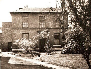
Tuesday, 21 July 2026

Will those responsible ……… return the drinking fountain to the Rec on Beech Road

It is one of those silly stories which started with a couple of pictures of the Rec in the early morning.

Early morning on the Rec, 2021

And progressed through to a newspaper report from September 1897 of an ordinary meeting of the Withington Urban District Council at which Mr. Burgess “intimated that a gentleman in Manchester, whose name he would not at present mention, had offered to give a drinking fountain to be placed in Chorlton-cum-Hardy”.*

I had been looking for information about the early years of the Recreation Ground on Beech Road.**

It had been opened in the May of 1896, and was gift form Lord Egerton of a strip of land which had for centuries been known as Row Acre.***

And here I went very  wrong, because so engrossed was I in the research that the fountain and the Rec came together and for a brief while I went searching for just where the drinking fountain might have been located on what is now called Beech Road Park.

Waiting for something to happen, 2021
All of which will allow Mr. Pedantic of Provis Road to mumble that the story is a nonsense, and artificially connects pictures of the Rec on a Tuesday morning with the real drinking fountain which was on Chorlton Green.

And he would be right, leaving me to reflect on that earlier bit of public open space which is surrounded by two pubs, the old parish burial ground, the village school along with two former farm houses.

Today most of us think of Chorlton green as an open space of grass ringed by trees but this was not how it has always been.

Before the turn of the 19th century it may have been much bigger and indeed for most of that century was not even open to the people of the village, having been enclosed by Samuel Wilton and not returned to public use until the 1890s.

And then for a great stretch of time remained without grass but did have a pretty neat water fountain.

The Green, circa 1900
The picture dates from 1906 when the Horse and Jockey was still just a set of beer rooms on either side of the main door, Miss Wilton’s outhouse still jutted out from the building and the space between the main entrance and the sweet shop was still a private residence.

I have always liked the lamp which stands on the green, with its hint of Narnia.

And back in the May of 1986 I can remember walking past it in the early evening and coming across a string quartet playing around its base.  Today people would just take it in their stride mutter something about it being typically Chorlton, but back then it struck me as the promise of things to come.

Which later that night with the defeat of the Conservative candidate and the election of the first Labour Councillor it  indeed seem to herald something new.

But being a historian I have to own up to the fact that the following year the Conservatives were back but they were on borrowed time, and 1987 marked the final year that a Conservative would be elected from Chorlton to the Town Hall.

The year before may have been the first string quartet on the green but it has not been the last.

The drinking fountain, circa 190o
I have to say I prefer the grass but lament the loss of the fountain.  

First it lost its cups and then vanished sometime in the 1920s or 30s.  To my mind that was a loss.  Public fountains are wonderful places to meet people, spend time chatting and just having a drink on a hot day.

Once it would have been the village pump which offered all three and which on hot summer days had the added bonus of a place the kids could play.

Now there is a lot more history to explore in the photograph of the fountain but I rather think I will leave that for another time.

To which Michael Wood has added, "My recollection is that the fountain on the rec was located centrally outside the shelter, as on the attached snip from the georeferenced maps website showing OS 25” 1892-1914 series.  

It was the same design as was used in Chorlton Park near the tennis courts, a perfunctory iron structure with domed hoods over the outlets, operated by a button on top -  nothing like the elaborate ornamental feature on the Green.  Can’t find an image at the moment, but I could draw one!  

The Rec, 1914
They must have been a common municipal feature in their time, but by the mid-sixties they were semi-functioning or defunct. "

And I hope he does, as it is I never knew about the bandstand.

Location; Chorlton

Pictures; the Rec very early on a Tuesday morning from the collection of Andrew Simpson and the drinking fountain on the green, circa 1900, from the Lloyd Collection

*District Councils, Manchester Guardian, September 10th, 1897

**Public Recreation Grounds at Withington, Manchester Guardian, May 18th, 1896

***Breaking News ……….. the Rec on Beech Road is officially opened, https://chorltonhistory.blogspot.com/2020/04/breaking-news-rec-on-beech-road-is.html


Monday, 13 July 2026

One old picture ….. a mystery location ….. and the Chorlton debate

Now I have Lee Hutchings to thank for this image.


He posted it today on a Chorlton Facebook site and it invites intriguing questions of just where we are, and the identity of the three individuals.

I doubt we will ever know their names but with a location we might be able to check on the occupants of the house and make a guess using the historical records.

Which of course just leaves the hunt for that location.  We are looking out on a well-established front garden with a lane and fields beyond, with just a suggestion of open water in the distance and a date of 1898.  There is furthermore a reflection of another house in the windows of the front door, which must have been opposite ours.

The lamp would perhaps indicate that the lane was well used or important enough to have public lighting at a time when this was not common in Chorlton.  

The first four street gas lights date from 1875 and a trawl of the records of the Withington Local Health Board and its successor the Withington Urban District Council might reveal the onward march of lighting provision and in turn reveal possible locations which match our picture and the date.

And I rather think our house might be one of a pair, which could narrow the hunt slightly.

So, with an address we could hit lucky and find occupants who resemble the people in the photograph.

The three look as if they are posing with that uncomfortable attempt to “look natural” which is rather negated by the artificial pose of the dog on the chap’s shoulder.

Already and rightly so there has been some speculation on where we are. The consensus so far is Beech Road with the Rec directly opposite.

It is plausible.  The Recreation Ground was opened in 1896, and our picture is dated two years later, but I think not.

This stretch of Beech Road facing what is now Beech Road Park down to Ivy Farm was undeveloped and remained so until Joe Scott built the row of terraced houses in 1915.

Wilton Road could be an alternative but there were no houses matching that reflected building nearby.

All of which leaves Cross Road, its houses are all in situ by the late 1880s and just maybe that reflected building has a mirror in the tall mid 1870s buildings on the corner of Cross Road and Beech Road.

But I am unconvinced, leaving me to think we still have a mystery.

And of mysteries I am fascinated by the thumb print on the picture. It is fruitless to wonder how we could identify it but it is one of those exciting but intangible bits of history which march alongside speculation on the identity of the last person to handle the grave goods of Tutankhamun or the strand of hair placed in a locket beside the ancient burial of a young bride.

But enough of such romantic tosh ….. bring on the debate on the location of our house.

But answers will only be judged worthy of consideration if like John Anthony Hewitt you make out a compelling case.


It maybe just be that we should be looking elsewhere and that open land in the distance is not the Rec but open fields yet to be built on.

We shall see.

Location; as yet unknown

Picture; the mystery house the unidentified people and a street gas lamp, courtesy of Lee Hutchings, 1896, restored and colourised 2026

Sunday, 12 July 2026

A history of Chorlton in just 20 objects number 7 ....... a plough 1894

A short series featuring objects which tell a story of Chorlton in just a paragraph and  a challenge for people to suggest some that are personal to their stories.

This was the last time the land opposite our house went under the plough.  The year is probably 1894 and the field was Row Acre.  I can be pretty sure that the chap at the plough was Alfred Higginbotham whose family had farmed here since the 1840s.  Row Acre stretched down from Cross Road to what is now Acres Road and was divided into strips.  Along with the Higginbotham’s parts of Row Acre were farmed by the Bailey family, Thomas White and John Brundrett, and perfectly echoed the medieval idea of a community each working a strip of land.  And of course the plough reminds us that we were a farming community. The image was originally dated 1896 but that was the year the Rec was opened, so I think we can push the date back by two years

Picture; Ploughing Row Acre before it became the Recreation Ground, 1894 from the collection of William Higginbotham

Wednesday, 8 July 2026

A history of Chorlton in just 20 objects number 3........ the tithe map 1845


A short series featuring objects which tell a story of Chorlton in just a paragraph and  a challenge for people to suggest some that are personal to their stories.

The tithe map perfectly captures a moment in our history.  Here were recorded the fields, buildings and roads in 1845.  But there is much more because the map and its accompanying schedule lists who owned the land, who they rented it to, the size of each field, its value and above all its use. It will also tell you who lived in the houses.

Now  we live facing the Recreation Ground and beside us was the Bowling Green Field, farmed by Samuel Gratrix, and owned by the Egerton’s.  It was an acre of arable farm land and its value was 3s 10d and directly opposite us was Row Acre which is now the Rec

Picture; by courtesy of Philip Lloyd


Friday, 26 June 2026

A book called Alice …. a thunderstorm ….and the lazy buzz of visiting bees … the non-history story

August into September used to be known as the silly season when with Parliament in recess along with the law courts nothing much stirred leaving the media to fall back on trivia to sell newspapers and generate income from advertising.

Driven from the Rec ... hot days, 2026
It would be the time of “man bites dog”, “looking for the sea at Southport” and “spotting the first onion sellers from France”.

And despite that it is only June, and recent stories of earthquakes in Venezuela, wars in the Middle East and that unfolding speculation on who will be Britain’s next Prime Minister, here in Chorlton it all seems to be what the Americans would call a “slow news week”.

All of which I guess is down to the heat wave which has driven me into the coolest part of the house.  Shutters and curtain drawn, windows closed and the admission that the last time I went out was Monday.

It has however given me more time to reflect on smaller bits of history and to explore phrases like “Piffy on a rock bun”, “Black as New gate’s knocker”, and “looking like Reggie Page”. Some are very personal and arise from our own family while others have a wider context and some are rooted in historic events. *

And there are those which like me and my friends have used for decades and no doubt were picked up from our youth.  One such was when my friend Lois responding to the present heatwave describing the moment as “boiling” while many of us have and do say I am “starving”. 

Now neither can logically be true but they perfectly describe a moment.

Alice trying to play croquet with a flamingo, 1865
And that brings me back to one of my favourite bits from Through the Looking Glass where Humpty Dumpty remarks, “When I use a word,’ Humpty Dumpty said in rather a scornful tone, ‘it means just what I choose it to mean — neither more nor less’”.

An absurd comment but one which chimes in perfectly with the utterances of some politicians and much of what is peddled on social media and is just “fake news”, although even the word fake news has been hijacked to rubbish what has been verified as accurate.

All that said there is nothing fake about the heat wave.

Inside our house it is currently 29° while outside its 32° but which pales when set against the 34° being suffered by one of my sisters in southeast London.

Alas the promised thunderstorms passed off with just three claps of thunder and the accompanying streaks of lightening at 5 this morning.

It was enough to get me up, water the garden and enjoy the lazy buzz of some friendly bees who were more active than I have been all day.

All of which is very unhistorical so I shall close with a review of the summers from the mid-1840s.

Back then we were still a rural community with most of our population deriving a living from the land or in associated trades. So, the weather was more than just a hot day to endure.  

Hot days looking for bees, 2026
My copy of “Agricultural Records” reports that 1842 and 1843 were “fine dry summers with a good harvest” while 1844 was “a year of drought with disastrous harvest", followed by a year when the summer was “cold with a fairly poor harvest”.***

Happily, 1847 and 1848 offered up mixed weather but the harvests were plentiful although the quality was low.

And anyone who has studied social unrest will know that a succession of poor harvests brings hardships to the poor and anxiety for the people of plenty, who well remembered that the bumper French harvest of 1787 gave way to two bad years and a revolution.

Location; where ever  it is hot

Pictures; Driven from The Rec, Beech Road, empty at midday, 2026, and hot days looking for bees, Royal Horticultural Gardens, Bridgewater from the collection of Andrew Simpson, Alice trying to play croquet with a flamingo, John Teninel, 1865, Alice's Adventures in Wonderland, Lewis Carrol, 1865

*"'When I use a word,’ Humpty Dumpty said in rather a scornful tone, ‘it means just what I choose it to mean — neither more nor less.

'The question is,’ said Alice, ‘whether you can make words mean so many different things.’

'The question is,’ said Humpty Dumpty, ‘which is to be master — that’s all’”.

Through the Looking Glass, Lewis Carroll, 1871

**Piffy on a rock bun …………… and other travels with my past, https://chorltonhistory.blogspot.com/2020/06/piffy-on-rock-bun-and-other-travels.html

***Agricultural Records, AD 220-1977, J.M. Stratton and Jack Houghton Brown, 1978

Mr Gratrix's clay pipe lost in our garden in 1845

The pipe found in the garden, 2014
It is not much of a piece of history but I found it in our front garden which makes it special and takes me back to sometime in the 19th century.

It is a bit of clay pipe and was probably thrown away by some one working this bit of land, or by someone passing along what was then called the Row.*

It is even just possible it came from night soil brought in from Manchester to spread on the fields of Chorlton.

'Like any time in history some of the most revealing clues to how people lived are contained in the rubbish they threw away.  Across the township one of the most common items to resurface is the humble clay pipe.

Found in the parish churchyard, 1980
Usually they are broken and often turn up on their own, although sometimes a whole batch has been unearthed over a period of time all quite close together.

They were the pipe of the working man, and some working women.  

Inexpensive, easy to make and made in huge quantities, they are a true example of a throw away product.  

They were smoked in the home, in the pub and at the work place.  

The evidence from sites in some of the poorer parts of London show that the owners smoked heavily.**

Clay pipes come in many different sizes, some with long stems and decorated bowls and date from anytime from the 17th through to the 20th century.  The last clay pipe manufacturer in Manchester only ceased trading in 1990.

The most interesting pipe to come back out of the earth was found in the archaeological dig of the church in the 1980s.  It can be dated to between 1830 and 1832, and may have been bought to commemorate the coronation of William IV.  


The William IV pipe, 1830-32
It bears the inscription “William IV and Church” around the rim and is highly decorated with the royal coat of arms flanked by a lion on one side and a unicorn on the other.  

It is also unusual because it was found in one of the graves inside the church.  

The final burial in the grave was that of Thomas Watson aged 54 in 1832.  

There are those who might well imagine the pipe being placed alongside the coffin of Thomas Watson in imitation of the ancient practice of placing grave goods alongside the departed.  

The less romantic will counter with the obvious observation that it was the casual act of one of the grave diggers.  

Either way it is unusual for the bowl to survive.   More commonly it is the stem which is turned up and even these are found as fragments.


Detail of the pipe
Clay pipes were never expected to last.  At best they might survive for a few weeks and in many cases just days.  But then they were cheap.  

Very little has been published on the price of pipes but adverts dating from 1799 have unglazed ones selling at 2s 6d [12½p] a gross.  Just over 130 years later the 1930 Pollock catalogue was selling them at 4s [20p] a gross.  Longer pipes did cost a little more but these were not the choice of the working man in the fields.  

Shorter pipes could be smoked while working and it is these that turn up in the fields around the township.'***

So I wonder about my bit of pipe.

I would like to think it belonged to Samuel Gratrix who was farming this bit of Egerton land in the 1840s, but chances are it was discarded by someone passing along the Row, or worse still dropped into a privy somewhere in Manchester, only to make its way with a cart load of night soil along the Duke's canal to Chorlton.

But that along with Mr Gratrix and his field belong to another story.

Pictures; clay pipe, 2014  from the collection of Andrew Simpson, and other pipes from the report on the Archaeological dig conducted by Dr Angus Bateman during 1980-81


*The Row or Chorlton Row is now Beech Road

** Pearce, Jacqui, Living in Victorian London: The Clay Pipe Evidence, 2007, Geography Department at Queen Mary, University of London

***from the Story of Chorlton-cum-Hardy,   http://chorltonhistory.blogspot.co.uk/2011/11/the-story-of-chorlton-cum-hardy.html

Friday, 19 June 2026

Gaze upon this tarry thing ... all you in Chorlton who want to be nostalgic

Now I am never one to stop a good story, and remain fully aware that out there, some remain nostalgic about stone setts which were once a common form of road surface.

The Beech Road sett, late 19th century
So here is one of mine. I cannot now reveal how I came to acquire it, suffice to say that once a very long time ago when Beech Road was going through an earlier tar experience, this one was about to be thrown away.

I asked if I could have it as a relic of that old Chorlton and I was given two.

It will date from I suppose the late 19th century but maybe from the 1900s.

I just don’t know.

Of course some will know and there will a minute either in the records of the old Withington UDC or Manchester Corporation, but I am not going to look.

It sits in a special place beside two handmade bricks, one dating from the late 18th century which was part of a one up one down back to back house on Miller Street and the other from that grand property which once stood on Beech Road beside Acres Road which some will still call Acres Crack.

Longford Road, circa 1900
I have to admit that the old tin potty also from Miller Street was refused entry by the family, which I suspect was for the best.

Location; Chorlton

Pictures; a Chorlton stone sett from the collection of Andrew Simpson and Longford Road circa 1900 from the Lloyd Collection

Wednesday, 17 June 2026

Walking the northern boundary of Rent Meadow in the summer of 1848 …………

Now, it is always fascinating to take a spot you know well, and try and think it back to a time before now.

Looking out towards Chorlton Brook, 2020
So here we are on that footpath that stretches from Barlow Moor Road, down to Nell Lane, with the allotments and park on one side and those roads that run off Sandy Lane on the other.

It is an ancient footpath, and is clearly visible on the OS maps of the mid and late 19th century and shows up in the 1847 tithe map.

The western end ran alongside Lime Bank which was a fine looking house and dates from at least the late 18th century.  At this point the path was more a road, but as it made its way east down to Nell Lane it pretty much petered out becoming quite narrow.

Trees, and bushes, 2020

Walk it today heading towards Barlow Moor Lane, and you get glimpses of the bank of Chorlton Brook, with its dense vegetation and it is easy to think it was always such.

But not so, because back in the 1840s, the land from the path, on either side of the brook and stretching across what we now know as Chorlton Park was fields.

Rent Meadow, [1] and Lime Bank, [3], 1847
The biggest of the two was Rent Meadow which covered 4 acres and was farmed as meadow land.

Its neighbour was Lime Bank, consisting of just 1 acre and was given over to arable farming.

Had you stood on the footpath looking south towards the brook, there would have been a clear view, down to what is now Mauldeth Road West.

But bits of that scene would have been obscures by a belt of trees and bushes which followed the line of the water course.

Beech House, 1853
Both fields belonged to James Holt, who lived in Beech House.

His grounds covered all of the land from Beech Road to High Lane, and down from Barlow Moor Road, almost to Cross Road.

Added to this he owned 17 acres of prime agricultural land in the township.

But his money and that of his family had been made in town in a factory at the bottom of Deansgate, where he made the wooden engraving blocks for calico printing.

Such was his wealth that he also owned a considerable portfolio of properties around St John Street, including the only double fronted house on that street.

As befits a man who had “made it”, he retired early, moved to Chorlton-cum-Hardy, and settled in Beech Cottage which he  redeveloped into a grand property which he renamed Beech House.

The Holt's town house, 2010
His son continued to live in the city centre in St Johns Street, managing the business, and in the fullness of time followed his father and moved into Beech House.

Now, none of this is romantic conjecture, but based on maps of the 19th century, the Rate Books, Tithe schedule and a series of legal documents belonging to the Holt’s.

Together they offer up a detailed picture of the Hot’s business along with the lie of the land by our footpath.

I would love to know who worked Rent Meadow and Lime Bank, but alas that is lost to us.

But there are the odd little glimpses of who might have laboured there.

One such clue, comes in the form of of clay pipes found on the allotments.  It is just possible that they were refuse from night soil spread over the fields which had been bought in from Manchester.

A clay pipe, 2020
But I like to think they may have been discarded by an agricultural labourer on the edge of Rent Meadow sometime in the 19th century.

And as unhistorical as it might seem I would think that the resident of the house known as Lime Bank might have taken a stroll along the footpath on a summer’s evening.  He was a Charles Morton, but more of him another day.

Location; Chorlton-cum-Hardy

Pictures; Rent Meadow, 2020, the Holt's town house, 2010, and clay pipe, 2016, from the collection of Andrew Simpson, and in 1847, from the Tithe map, Beech Cottage in 1841, detail from the OS map of Lancashire, courtesy of Digital Archives, http://www.digitalarchives.co.uk/

Saturday, 6 June 2026

Claude Road and a clue to the vanished Beech House


The date on this postcard of Claude Road is 1915 but the scene must be earlier.

On the surface it seems an unremarkable image.

It would look to be a morning perhaps in the holidays and the peace is disturbed only by the children playing close to Beech Road and the appearance of the delivery man who has attracted the woman on the right who I guess has come out of her house to catch him.

It is not unlike the same scene today with of course the absence of parked cars and passing traffic. But what does make it remarkable and dates the photograph to sometime in the first decade of the 20th century is the wall and gateway at the bottom of Claude Road where it joins Beech Road.


They are part of Beech House which had stood in its own extensive grounds since at least the 1830s.

Three generations of the Holt family had lived there but the last had died in 1906, and by 1908 the house was empty and the estate was awaiting sale. By sheer chance a postcard showing the lodge has survived. 

The message records a pleasant afternoon spent in the grounds and the speculation that it was soon to disappear. “Edith and I had tea on the lawn of the big house which you see the lodge in the picture. It will soon be sold and then will probably be divided into small plots.”

By the following year part of the garden which ran the length of Barlow Moor Road as far as High Lane had been bought by Manchester Corporation who felled the trees demolished the wall and built the tram terminus on the land. 

The remaining land was developed with the cinema and a row of shops and the garage of Mr Shaw.

But we can be even more precise about the date of our photograph. Claude Road and its neighbouring Reynard had been built by 1907 and the estate wall demolished in 1909.

So that little detail of wall anchors our photograph and provides a view of Beech Road that has gone forever.

Location; Chorlton-cum-Hardy, Manchester

Picture, from the Lloyd collection circa 1907-09

Wednesday, 27 May 2026

When the tower of tyres ....... left our Rec

So farewell that tower of tyres,

You were a constant feature of the Rec. 

And while some may have castigated your presence

As a blot on the beauty of Lord Egertos’s gift,

You were many things to many people.

You served as a climbing frame, 

A game of rolling tyres

And even a place to hide.

But now you have gone,

Taken on a Wednesday morning

By men of the Council.


No more will Declan in his early tasks

Of clearing the rubbish from last night’s revellers

Collect you up 

For fresh adventures by children of all ages.

Why you went is a mystery

But in your going

A little bit of the Rec has been lost.

I don’t suppose the curfew bell

Will toll the knell of your parting pleasures.

Nor the weary commuter homeward bound

Mourn your passing 


But I will 

Location; the Rec

Pictures; those lost towers of tyyres, 2025 from the collection of Andrew Simpson


Sunday, 24 May 2026

At the chippy on the green with Mrs Jones and "Chippy Madge"

Now I am always fascinated by those pictures which call up a rich seam of memories that cross the generations.

And this one pretty much does just that.  We are inside Chorlton Green Supper Bar sometime in the late 1960s courtesy of Bob Jones.

Just a few years later it would be one of my regular haunts and later still the chosen chippy of my lads.

And I will not be alone in remembering that tiny room with the tiled counter and steamed up windows with the bright lights and promise of something good to eat.

Even now nothing is quite like going into a chip shop on a cold winter’s evening.

It starts with that wall of heat and then the distinctive smell, along with the noise of the chips in the deep fryer and the rustle of paper.

And there is also the conversations which are a mix of the humorous, the mundane and usually a little of the village gossip.

Of course most of what is said might well be repeated over the counter of the newsagents and in the pub but waiting in line for your supper offers up plenty of time to listen to what is being said and an opportunity to add your own contribution.

Now I am old enough to remember getting your chips in newspaper and then walking home on dark nights with that double pleasure which came not only from eating the chips but from holding the bag which kept your hands warm.

So Bob’s picture is just that bit special, more so because on the right is his mum and on the left “Chippy Madge.”

All too often photographs like this one get lost over time and with it go a tiny but important record of how things were.

And it is the little often trivial things, like the name “Chippy Madge” and “Blind Bob the Barber”, which say something about the time and the place.

The nicknames were rarely meant to be cruel and were just one of those things that you said.

Madge worked in the chip shop and her name was Madge so “Chippy Madge” it was, and more often than not there would be a raft of such names for everyone from the milkman to the chap who came round to sharpen your knives.

I may not get out as often these days or visit as many places but I rather think such names are no longer as common and that is a shame.

Picture; Mrs Jones and “Chippy Madge” circa 1960s courtesy of Bob Jones, and the Chorlton Green Supper Bar 1978 from the collection of Tony Walker.

Thursday, 14 May 2026

A little bit of our unremarkable past ...... that hut in the Rec

Now here is a little piece of our past which makes me very happy.

The picture was taken in 1980 and confirms that I wasn’t imagining that once the Rec which new comers call Beech Road Park did indeed have its own hut.

I have no idea when it was built.

I know that it doesn’t appear on photographs from the 1900s but is there by the 1940s, because it shows up in a picture of our own barrage balloon.

Nor am I quite sure when it vanished.

All of which I suppose is indicative of the state of my memory.

But there it is, and for those now in the 40s who sat on its bench on long winter’s nights passing the time till they were old enough to visit a pub, here is a memory.

And soon after the story was posted, Bruce Wemyss commented, 
"Andrew Simpson I remember it well in the sixties and would guess it was removed in the early 70s 

It was turned on by the Park Keeper each spring and back off again in the Autumn Chorlton Park and Longford park each had a couple 

They where double sided and operated by pressing a Brass button on the top of the font 

They we’re all the same design I suspect Manchester Corporation will have some pictures hidden away somewhere 

As a footnote In the sixties and early seventies we local lads played football in the Rec most weekends and summer evenings sometimes with games going on all day and well into the evening breaking off to go home for lunch and tea it was not unusual for there to be 12 to 15 on each team Great times I feel very lucky to have grown up in Chorlton back in the day"

All of which was repeated by my own kids, who did the same Bruce, and had to be called in at night
  
We even had a special box full of their friends football boots for the games, and my lads would exhaust shed loads of their friends which came and went.

Location; Chorlton.

Picture; the hut on the Rec and football games, 1980, from the collection of Andrew Simpson

Saturday, 9 May 2026

When the bulldozer came to Beech Road ………… well almost

I just missed the battle which if lost would have seen a swathe of properties from Crossland Road north across Beech Road and encompassing Acres Road demolished because they were judged “unfit for human habitation”.

Summer Cottages, 1958
I knew that there had been plans, and at one stage a small row of cottages off Beech Road were demolished in the early 1970s.

These were Summer Cottages, and were probably the last one up one down cottages and occupied part of what is now The Forge.*

And I always thought that Summer Cottages were the properties that Richard and Muriel often referred to as part of a clearance scheme. 

Richard and Muriel ran the greengrocers on Beech Road and Richard in particular was still quite cross about the plan a decade later.

The City Council had already demolished some cottages at the top of Sandy Lane in the 1950s or 60s and went on to clear Brownhills Cottages also on Sandy Lane and another row on High Lane.

Crossland Road, 1972
But I was unaware of the extent of the planned clearance around Beech Road.

It would have included the demolition of some of the houses on Crossland, Road, all of Redbridge and Stanely Grove, some of the shops on Beech Road  as well as Acres Road and possibly a section of Whitelow and even Chequers Road.

The Guardian in the March of 1974 reported on a City Council scheme to demolish 750 properties in the Slade Lane, Chorlton, and Didsbury areas.

Here the residents of the proposed area reacted with a mix of dismay, anger that there homes should be labelled “slum dwellings” and resolved to organise to oppose the plans.

Stanley Grove, 1972
A resident’s association was formed which linked up with similar groups across the city and worked with experts from Manchester University, Town and Country Planning specialists and commercial companies along with “The People of Chorlton”.

Their report dated March 1974 arrived in our house yesterday and it makes for fascinating reading.  

It consists of three parts, which are the Residents’ Case, the Social and Planning Context, and Technical Report.  The third part is supported with costings, suggested alterations to named properties, and a time scale.***

By October the City Council had revised its plans and chose to renovate the properties, a wise decision which has left us with so many fine 19th century houses and retained something of the character of old Chorlton.

Redbridge Grove, 1972
There is much still to so.  I would like to clearly define the area which would have been redeveloped, and solicit the memories of those who took part or just remember the campaign.

Some of those are listed in the report.

Added to this there will be the minutes of the various City Council committees and the story as reported by the local newspapers.

So much still to do.

Location; Chorlton

Pictures; Summer Cottages, R E Stanley November 1958 m17666,  Crossland Road, H Milligan, m18209, m18209, and m17732,  Stanley Grove, 1972, A Dawson m18210 courtesy of Manchester Libraries, Information and Archives, Manchester City Council, http://images.manchester.gov.uk/index.php?session=pass Acres Road, 2023, courtesy of Google Maps

Acres Road, 2023
*Summer Cottages, the hidden homes behind Beech Road, https://chorltonhistory.blogspot.com/2012/04/summer-cottages-hidden-homes-behind.html

**Taken for Granted? Gillian Linscott, Guardian March 23, 1974

***Chorlton Village, the residents association’s case for improvement March 1974

****Council’s about turn on Housing, Michael Morris, Guardian October 3rd, 1973