Showing posts with label Manchester rivers. Show all posts

Wednesday, 20 August 2025

Defending Chorlton and Didsbury from the fury of the Mersey

Now there is a caption competition here but I leave that to the swift of mind who can call up a witty aside on the turn of a sixpence.

All I will say is that we are back in 1966 at that point on the Mersey where the new bridge crosses the river by the pub.

And not for the first time over the last few centuries work is underway on the river banks,

These have been raised and raised to protect us from the river which in the past could flood with little warning and cover the meadows in a lake which stretched for miles.

The last time this happened on our side of the Mersey was in 1912 and there are pictures of the flood water poring over the weir which had been built to protect the Duke’s Canal.

There are plenty of stories of those flash floods which during the 19th century were common enough to enter local folk lore and have been reproduced in the book on Chorlton-cum-Hardy.*

And that is about all I am going to say other than that the story of Jackson’s Boat and its many different names is covered in that book and in the latest on Chorlton’s pubs and bars.**

But I shall just finish with one last comment on the image which and has recently come to light through a new project.

Neil Simpson tells me that "the Town Hall Photographer's Collection Digitisation Project, which is Volunteer led and Volunteer staffed, is in the process of systematically scanning the 200,000+ negatives in the collection dating from 1956 to 2007.

The plan is to gradually make the scanned images available online - initially on Manchester Archives+ Flickr and later on other Archives+ digital platforms.***"

*Manchester City Council Archives+ Town Hall Photographer's Collection Flickr Album...

And that is all I have to say other than a thank you to Neil and the team.

Location; Chorlton

Picture; Down by the Mersey, 1966, courtesy of Manchester Libraries, Information and Archives, Manchester City Council, http://images.manchester.gov.uk/index.php?session=pass

*The Story of Chorlton-cum-Hardy, Andrew Simpson, 2012, https://chorltonhistory.blogspot.co.uk/2014/12/the-story-of-chorlton-cum-hardy.html 

**A new book on the pubs and bars of Chorlton, https://chorltonhistory.blogspot.co.uk/2017/05/chorlton-pubs-and-bars-book-has-arrived.html

***Manchester City Council Archives+ Town Hall Photographer's Collection Flickr Album...

Thursday, 26 October 2023

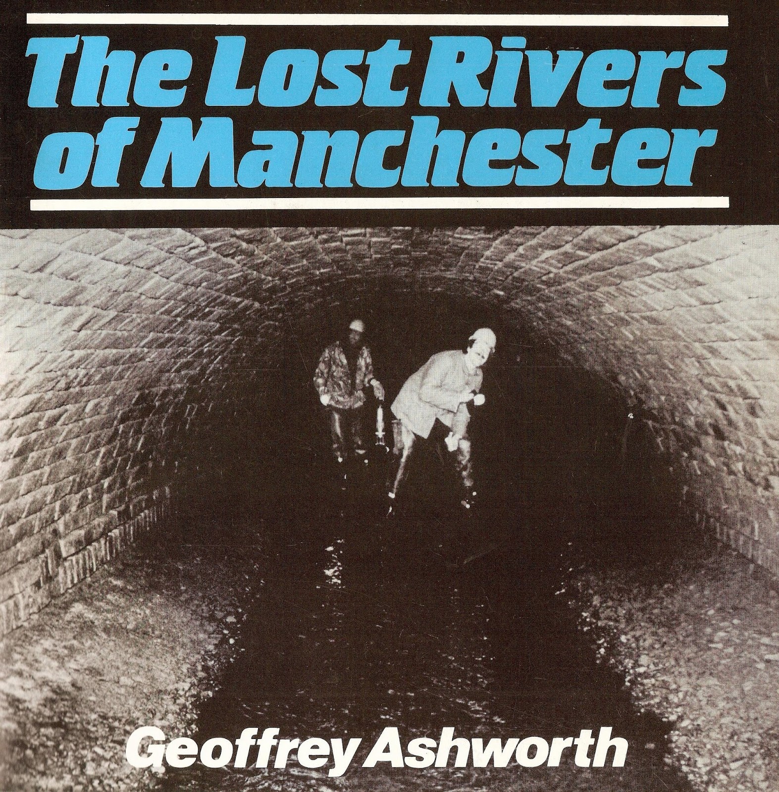
Welcome back ….. the Lost Rivers of Manchester

 It will be nearly thirty-six years ago that I fell across Geoffrey Ashworth’s ground breaking book on The Lost Rivers of Manchester.

And a good five years since I made contact with him and discovered that a new edition of the book was being planned.

Last week he told me it was to be published in November, and yesterday Keith Warrender of Willow Publishing emailed me over the details.

The book is an updated version, with  an additional chapter which makes it certain I will order it up for November 18th to sit beside the first edition.

At which point I could write reams on the book and the excitement that so many of us will have at greeting the new edition.

Instead, I will cheat and repost the media release which gives all you need.

"It was the idea of science student Geoffrey Ashworth who was studying for a doctorate degree at Manchester University. One day he watched as workman uncovered a large hole in the centre of the city to reveal a flowing watercourse.

The Corn Brook culvert under Denmark Road, Moss Side, undated
His fellow students and staff speculated whether it was a sewer, the river Medlock, Shooters brook or perhaps the river Tib.

Geoffrey was motivated to find out more about this mysterious watercourse and thirteen years later after painstaking research he brought out his book.

It tells the fascinating story of the city’s long forgotten rivers and brooks which have been gradually hidden away in culverts as Manchester expanded and sites were built over.

As well as meticulously tracing the route of the watercourses, the author also interweaves the history of the neighbourhoods they pass through. 

We learn the stories of many past landmarks such as the Pomona Gardens and Belle Vue and also the often surprising successes and failures of the well to do families of the big halls and estates which lined the routes as well as other local characters.

Today, most of these underground waterways are only remembered in street names and wall plaques, but Geoffrey Ashworth, who has lived in USA since 1982, hopes that readers will take the time to get out and walk the streets which are associated with the rivers, as well as get to know more about the wonderful history of our great city.

Published  November 8th 2023 and available from booksellers or direct from the publishers. Fully illustrated, 100 pages £17.95.”*

Pictures; from The Lost Rivers of Manchester, courtesy of Willow Publishing

*Willow Publishing, Geoffrey Ashworth, geoffreyashworth49@gmail.com or between 4-10pm 01 603-989-3184 or Willow Publishing, 0161 980 2633

Thursday, 30 June 2022

The Lost Rivers of Manchester


The lost rivers of Manchester have an abiding fascination for me not least because there are so many of them and also so little evidence of where they run.

Until fairly recently I could name just a handful all of which were in the city centre and which  appear for just brief stretches before disappearing into dark culverts.

But there are plenty more and a lot of them are here on the south side of the city.  Some have fared better than others. Our own Chorlton Brook comes out into the light of day by Hough End Hall and can be seen as it flows on through the township to join the Mersey.  Others like the Longford Brook and the Black Brook are now completely buried while others like the Rough Leech Gutter have been pretty much forgotten.

I was reminded of this recently when I came across the Platt and Ley Brooks on a walk along the Fallowfield Loop.

Both flow openly along the old railway track and are just two of a network that crisscrossed south Manchester.

Most by the late 19th century had become polluted but there would have been a time when they would have been an important resource for all the rural communities.

And in beginning to track them down I discovered The Lost River of Manchester*.  It was written by Geoffrey Ashworth in 1987 and carefully tracks the streams, brooks and water courses which by and large have bricked over and gurgle their way along unseen.

Sadly it is now out of print and copies on Amazon are going for £60, but it is available from the library and may one day be republished.

*Ashworth, Geoffrey, The Lost River of Manchester, Willow Publishing, 1987

Pictures; courtesy of Willow Publishing, http://www.willowpublishingtimperley.co.uk/

Monday, 19 July 2021

Quietly going about its business …. the Baguley Brook

Today, tiny water courses like the Baguley Brook, are pretty much forgotten, except for kids, and the Water Agency.


To which you might add nearby residents during one of those increasingly more frequent times when sudden changes in the weather turn such small streams into surging flows of water threatening a flash flood.

But once for many rural communities they were an essential part of life, when surface water, and wells provided water for drinking, cooking, and washing as well as irrigating the crops.

I have long been fascinated by them, more so because  many have vanished underground, long ago confined to brick culverts and all but forgotten, while others have apparently dried up.


Here in Chorlton there are still a handful which flow through the township, although some are now buried.  

There are others which while they appear to have dried up will be there waiting for a particularly wet winter to bubble to the surface.

Some once flowed across Chorlton Park, and after Corporation acquired the site which is now Southern Cemetery, much work had to be done to drain the area, involving a severs of culverts running down Barlow Moor Road, and under Hardy Lane, and out to the river.


Andy was out to the west of Wythenshawe Hall last week and took these of the Baguley Brook.

I went looking for information on this particular water course, but unless I missed an entry, it is slim pickings. 

That said I am convinced someone will know something and pass on the information.

We shall see.

Location; Wythenshawe

Pictures, Baguley Brook, 2021, from the collection of Andy Robertson


Saturday, 15 May 2021

Following the Medlock ……….. from Gaythorn into Knott Mill

This will be the last of the short series exploring the changing landscape on either side of the Medlock as it flows from Gaythorn,  through to Knott Mill and beyond.

Old and new along the Medlock, 2021

It is one of those places rich in industrial history with more than its share of iffy housing, which consisted of numerous back to back properties and closed courts.

As late as 1794 it still flowed through open fields, but already there were was the evidence of what was to come, in the shape of a printing press, several dye works and an iron foundry.

Half a century later and these had been joined by a heap more.  

So, as the river ran through Gaythorn, it encountered the Gaythorn Chemical Works, the gasworks, a cotton mill and the Medlock Street Dye Works, before navigating the Medlock Street Iron Works, the Hulme Brewery, the Knot Mill Iron Works and finally as it passed under the Knott Mill Bridge washing up against the Brazil Cotton Workes owned by Lea Birch & Co.

Knott Mill, 1794

Some  of this industrial history was still there to see until relatively recently, although the few bits still standing had almost all been converted into other uses.

Knott Mill, 1849

And back in the 1980s the evidence of those back to backs was still visible in one cark park on Jordan Street Street.* 

The houses bordering Fogg’s Place, Alpha Street and Omega Street have long gone, but the outline of the lower bricks were still there in thirty years ago. 

Since then the cark park has been properly surfaced, the surrounding 19th century buildings transformed, and joined by bright shiny new build, some of which house offices, others housing people and some doing both.

There will be a few who moan at the new developments, but will rarely acknowledge that some of these 19th century conversions, were themselves responsible for sweeping away earlier properties or worse still building over those open fields.

Along the Medlock, 2021

And while some of the new build might not win an architectural prize, at least it might be argued they have  filled what were empty derelict spaces which in turn were bordered by decaying and sad mills and warehouses which no one wanted or could think had a useful life.

In time I will return to some of those back to backs off Jordan Street and research who lived there in the middle decades of the 19th century, but for now I will just follow Andy’s series of pictures which followed the Medlock as it flowed through Knott Mill and under Chester Road.

Location; Knott Mill

Old and new, 2021


Pictures; following the Medlock at Knott Mill, 2021 from the collection of Andy Robertson, and the area in 1794 from Green’s map of Manchester,  and in 1849 from the OS map of Manchester and Salford, 1849, courtesy of Digital Archives Association, https://digitalarchives.co.uk/

*Knott Mill, https://chorltonhistory.blogspot.com/search?q=omega+place

Monday, 10 May 2021

A little bit more of the River Medlock will soon come out into the daylight

Today Andy Robertson has reignited my fascination for Manchester’s rivers, especially those that have disappeared.


He sent over a series of pictures he took at the weekend, adding, “Parts of the Medlock in Mayfield are beginning to be unculverted. If you google MAYFIELD MEDLOCK on Twitter you can see a drone video. Cathy and I went there today sadly minus drone”.*

All very exciting and part of the regeneration of Mayfield area.

And as you do I did call up the video, and then went looking for just when the great slab of concrete confined the river to a stretch of darkness.

I rather think it was much earlier than suggested in the video, which offered a date of 50 years or so ago.


The slab is there in 1933, but had yet to be put in place 40 years earlier and may have been built when Mayfeid Station was built at the turn of the last century.

Either way someone will know, leaving me just to make a note to go looking at more maps, and reread that wonderful book, The Lost River of Manchester.*

Location; Mayfield

Pictures; Mayfield, 2021, from the collection of Andy Robertson

*Mayfield, https://twitter.com/MayfieldMCR

**The Lost Rivers of Manchester, https://chorltonhistory.blogspot.com/2018/03/the-lost-rivers-of-manchester.html

Ashworth, Geoffrey, The Lost River of Manchester, Willow Publishing, 1987


Tuesday, 6 April 2021

It’s 1959 ……… and I have no idea where I am

Strictly speaking it’s a silly title, since back in 1959, I was just coming up for my tenth birthday and living in Peckham.

But that said if I had been at this spot sixty-one years ago, it’s not somewhere in Manchester I recognise.

I would guess we are on the east or the north of the city, and this is either the River Irk or the Medlock. 

The clues have to be the higher ground to the right of the picture, with what might be a school, and the railway line which crosses over the river.

I thought we might be on Dantzic Street, or Scotland Street, following the line of the Irk, but I think not, which leaves me none the wiser, and hoping someone out there will be able to cast their memories back a full half century and more and place the location, or use the clues, with maps and modern pictures to solve the puzzle.

Location; somewhere in the city


Pictures; by the water, following the river,  1959, Courtesy of Manchester Archives+ Town Hall Photographers' Collection,
https://www.flickr.com/photos/manchesterarchiveplus/albums/72157684413651581?fbclid=IwAR35NR9v6lzJfkiSsHgHdQyL2CCuQUHuCuVr8xnd403q534MNgY5g1nAZfY  

Wednesday, 17 March 2021

A printing press ..... a river and the future …… Cambridge Street

The story of the Hotspur Press on Cambridge Street is well documented.


And there will be many people who have watched the surrounding streets slowly transform from run down reminders of our industrial past to bright tall office and residential properties.

So, this week Andy was back walking the familiar route, following the bend in the River Medlock, and clocking the changes.

The two images I have chosen perfectly capture this spot.

The first mixes Hotspur House with the tall buildings behind it and point to that simple observation that the city continues to change.


I am not always a keen fan of the tall blocks that are rising everywhere, particularly those that seem to defy gravity and make the human figure look miniscule.

But then I doubt I would signed up to that burst of new build which spread across Manchester in the early 19th century.

And no doubt I would have railed against the enclosing of the “sweet flowing rivers” by tall factories and warehouses, and worse by hiding them in brick built tunnels.

The end of the city’s first Industrial Revolution has begun to open up those rivers again, but there is still plenty of evidence of that past.

Location; Cambridge Street

Pictures; Hotspur House and the river, 2021, from the collection of Andy Robertson

Thursday, 15 October 2020

On Fairfield Street …..…. with a pub, a river, and some mysteries

There is something quite magical about rivers, streams, and canals, and more so when they run through our towns and cities.


Often access to them is made difficult by the surrounding buildings and at some point many disappear into a tunnel and are lost, while a lot of those once busy canals have long ago been drained and their route only indicated by the odd bridge or modern foot path.

 But the deindustrialization of places like Manchester, now offer up the opportunity to get close to our rivers in a way not possible since the Industrial Revolution consigned them to sources of water for steam engines, handy sewers, or in a few cases navigable routes for transporting goods.


 And so, it is with the River Medlock which Andy came across while looking for old pubs on Fairfield Street.

 So, having found what was once the Bridge Inn, he took to looking over the stone parapet at the slow-moving water below.

 In the distance you can just make out the tunnel that takes the river under what is now North Western Street.

 Now, I will take some time out to track the story of the Bridge Inn.  It was serving beer and good cheer under its landlord, a Mr. William Walker in 1840, and eight years later turns up on the OS map,  complete with a brewery situated directly behind it.


The map also reveals a row of properties running along the bank of the Medlock.  In all there were 24 of them, and fourteen were back to back houses, of which seven faced onto the river and the remaining seven onto Coronation Square.

 And while Victoria Terrace consisted of 4 rooms the remaining properties were two and three roomed.

You can still walk  Coronation Square, one side of which runs along the side of the former pub and the other beside a tall brick wall beyond which is a small lorry park.

 But of Mr. William Walker I can as yet find no more.  He is there in the rate books for 1840, and is shown as the owner and occupier of the Bridge Inn which commanded a ratable value of £58, but try as I might I can’t find him on the 1841 census.


All of which will require a lot more detective work, as will locating those 12 back to back houses off Coronation Square.  

Needless to say, given their location beside the river they are too modest to appear on directories of the period, leaving me just to  contemplate the slow tedious job of working my way through the census returns for this bit of Manchester.

 The short cut is usually to pick other people from the rate books, look for them on the census and by degree wander across the pages to Coronation Square, but alas so far I gave drawn a blank with all of them.


But by a happy coincidence, a few days earlier my friend Linda Rigby gave me a slim book by the Greater Manchester Planning Department on “Giving the river valleys a breath of fresh air”.

 It is chatty little document covering five of the river valleys in Greater Manchester, describing each and looking to the future of each.*

 It is an optimistic piece but sadly there is no date, which leaves me falling back on a guess for its publication, sometime between 1974 when the Greater Manchester Council was established and 1986 when it was abolished.


 It is a planning document I shall return to, if for no other reason than to compare the descriptions and forecasts for the future with the way things have turned out.

 But it doesn’t include our bit of the River Medlock as it twists and turns through the area behind Piccadilly Railway Station, so I shall leave it on the table, along with a story of the Bridge Inn in the 20th century, for tomorrow.

 So that is it.

 Location; Manchester

Pictures; Fairfield Street and the Bridge Inn, 2020 from the collection of Andy Robertson, Fairfield Street in 1848, from the OS map of Manchester and Salford, 1848-49, courtesy of Digital Archives Association http://www.digitalarchives.co.uk/ and pages from “Giving the river valleys a breath of fresh air” GMC Planning Department, date unknown, courtesy of Linda Rigby

 *Croad/Irwell valley, Tame valley, Mersey valley, Etherow/Goyt valley, and the Medlock valley, Giving the river valleys a breath of fresh air” GMC Planning Department, date unknown

Tuesday, 24 April 2018

Exploring the River Irk .........and travelling to Scotland via Victoria Railway Station

Now, there is something quite awesome about the spot where the Irk goes over the weir by Cheetham Hill Road.

It is I suppose the contrast between the slow mowing water as it reaches that stone wall and then the cascading bubbling swirl of water that disappears off under the bridge.

I first encountered it way back in the 1990s, when you could access the view from a stair way down from the main road.

Back then it was not the most edifying of places, and you had to pick your way past accumulated rubbish including discarded sleeping bags, empty bottles and much worse.

But you got a fine view of the river and across to that oddly named street Scotland.

Back then the area behind Scotland was open ground but like so much of what was once the run down bits of the city has become tall blocks of apartments and hotels.

But amongst all these examples of modern city living there is still the bits that take you back to our industrial past and the squalid housing that was crammed in the dismal and dark streets.

And over the next few weeks I will be revisiting that grim side of Manchester and renew an interest in a tiny stretch of streets that made up John Street, and Back Irk Street while also posting more of Andy Robertson’s pictures of the area.

He was down there yesterday and playfully introduced the collection with the title, "had a couple of hours spare, so decided to go to Scotland via Victoria" and not content with that added “this is Scotland where the Irk makes its final disappearance before meeting the Irwell.  Didn't spot any kilts though”.

Location; Manchester

Pictures; the Irk, 2018, from the collection of Andy Robertson

Wednesday, 18 April 2018

In the dark chambers and tunnels...... the Irk flows on.

Now yesterday I featured one of Andy’s photographs taken this week of the river Irk.

And to continue that series here are two more which will be familiar to most.

But yesterday I got asked where Andy’s picture of the Irk was, and so today rather than bumble on with lots of words and directions, here are two shots which will perfectly locate the spot.

The romantic in me would love to see this spot as it might have looked during the early 18th century when the area was open fields, while the inquisitive side hankers to wander into that dark tunnel.

Of course such ventures are not to be promoted and will be dangerous, and certainly not what I would undertake.

I did instead think about launching into a history of the 19th century engineering and the construction of the railway station and surrounding buildings, but that has been done,so I will leave it at that.


Location; where the Irk meets the Irwell

Picture; where the Irk meets the Irwell, 2018, from the collection of Andy Robertson

Tuesday, 17 April 2018

Looking for the more unfashionable bits of the City ........ down by the Irk

Now Andy Robertson delights in searching out the grimy bits of the Twin Cities.

He seems at home with derelict buildings, run down streets and the bits that people have forgotten.

But there is always a purpose and Andy often photographs places which are waiting for something to happen.

And on the way captures some fine images of our industrial past.

This is one he sent over this afternoon and which I like.

Location; where the Irk flows into the Irwell


Picture; where the Irk flows into the Irwell, 2018, from the collection of Andy Robertson

Friday, 9 March 2018

The undefeated River Irk ........

Now no matter what three centuries of industrialists and city planners have done, our urban rivers continue to flow and even offer up surprises.

And no more so than the River Irk.

It has been diverted, made to flow in deep and dark channels and harnessed to power all manner of
machinery.

Stretches of it pass out of the human eye but it is still there, and so I am pleased that Andy on his journey through the city and up into Collyhurst last week, stopped to capture this bit of the Irk by Danzic Street.

The buildings that once lined its course have gone but the river remains.

Now that has to be a happy story.

Location; Manchester

Picture; the river Irk, 2018, from the collection of Andy Robertson