Showing posts with label Manchester in the 1840s. Show all posts

Tuesday, 26 August 2025

" a narrative of the life of a poor man like myself" ................ Richard Buxton

Richard Buxton was born in 1786 and died in 1865. He was one of those remarkable working men who were self taught.*

Mr. Buxton's grave, Prestwich, 2012
He became an expert on botany, wrote books and struggled against poverty before dying obscurely. “I am well aware” he wrote “that a narrative of the life of a poor man like myself .... is anything but interesting.” and yet it has proved to be so. **

Buxton was a remarkable man living at a time when Manchester was fast becoming the “shock city of the industrial revolution.”***

During his lifetime the city became the centre of cotton manufacture and a huge sprawling place of overcrowded, mean and shoddy housing.
Ancoats, 1794
He witnessed some of the great political events of the nineteenth century as the working class attempted to assert their share of the wealth that their labours had created and yet it appears he remained aloof from it.

He was of a “quiet and retiring disposition” with a “humble opinion of his own great powers.”****

He was born at Sedgley Farm in Prestwich.

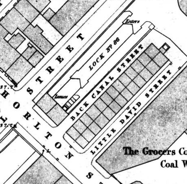
 In 1788 his father “became much reduced in circumstances and had to leave his farm”, moving the family to Ancoats .

The Buxton’s were not alone. During the late eighteenth century and through the nineteenth century thousands left the countryside for the cities, exchanging open fields for narrow streets.

Buxton did not expand on the reasons for the family move. It may be that they overstretched themselves or were just unlucky. But rural life could be hard and unpredictable. The standard of living was if anything worse than conditions in the fast expanding industrial towns.

They settled in one of those mean narrow streets off Great Ancoats Street, and later he lived on Gun Street.

St Clements's circa 1870-80
At week ends he was off "botanizing", and on one memorable day walked from Manchester to Chorlton, and on across the Mersey, recording what he saw, and will no doubt have passed on the old parish church of St Clements on the green before crossing the meadows.

I was introduced to Buxton by David Bishop who is a passionate botanist and has patiently explained nature to me over the years and it was David who lent me the book Buxton wrote in 1849.

For a self taught man, his 'Botanical Guide to the Flowering Plants, Ferns Moses and Algae found Indigenous within Sixteen Miles of Manchester' is both a wonderful record of what there was to see, but also a testament to his interest and tenacity.

In a world where reading and writing are taken for granted, it is easy to gloss over the fact that at the age of sixteen he was illiterate, and had to set himself the task of learning to read.

Out on the Meadows, 2008
What is all the more remarkable is that having mastered the spelling book and the narrative of the New Testament he realised he needed to know not only how to pronounce the words but their exact meaning.
And so “by this means I was enabled not only to read, but also to understand the meaning of what I read, and to speak it correctly.” 

All the more remarkable given that his working day lasted from six in the morning till eight or nine at night.

The result is a book that has stood the test of time and one that botanists still use as a hand book and sits with those other books of poetry and local history and politics which were written by many who lived on the margins of poverty, and balanced these books against the demands of the day job.

Picture; gravestone of Richard Buxton photograph taken in 1916 by T Badderley, m72545, courtesy of Manchester Libraries, Information and Archives, Manchester City Council, http://images.manchester.gov.uk/index.php?session=pass St Clements Church circa 1860 from the collection of Tony Walker and the meadows as Buxton would not have known it, December 2008. Courtesy of David Bishop, detail from Green's map of Manchester 1794, courtesy of Digital Archives, http://www.digitalarchives.co.uk/

Location, Manchester, Chorlton, Prestwich

*Richard Buxton, https://chorltonhistory.blogspot.com/search?q=richard+Buxton

**Buxton R A, Botanical Guide to the Flowering Plants, Ferns Moses and Algae found Indigenous within Sixteen Miles of Manchester second edition of 1849 page iii

***Briggs Asa Victoria Cities Penguin Books 1963

****‘Death of Mr. Richard Buxton, the botanist’, Manchester Guardian January 5th 1865


Tuesday, 12 August 2025

Who stole Henry ‘Orator’ Hunt? ……..

Now for those who don’t know Henry ‘Orator’ Hunt was one of the outstanding Radicals of the early 19th century.

Henry 'Orator' Hunt, circa 1820
He had campaigned for the reform of Parliament, called for universal suffrage, and demanded an end to child labour, and was imprisoned for two years for being at Peterloo.

Added to which in 1830 he was elected as the MP for Preston on a radical platform and went on to oppose the Reform Act because it didn’t go far enough.

And given such an illustrious commitment to reform and to Manchester, in 1842 he was commemorated by a monument, which four decades later was stolen.

The statue was not in one of the principle public places in the city but out on the edge, sandwiched between rows of working-class dwellings and in the shadow of a textile mill, and surrounded by an iron works, a chemical plant, and umpteen coal wharfs.

All of which I suppose was an appropriate spot for someone who had spent his adult life promoting equality and demanding a better deal for working people.

The Round Chapel and burial ground, Every Street, 1844
The monument was by all accounts an impressive thing.

The base was nearly six feet square and the plinth on which the monument rested was ten feet square.

There were spacious vaults underneath which were intended for “the remains of those who shall distinguish themselves in promoting the principles advocated by the late Henry Hunt”. *

And beneath the foundation stone were placed, the “memoirs of Henry Hunt, the history of the Peterloo massacre and his letters from Lancaster goal to the Reformers [along with] the placard announcing the ceremony, a copper plate likeness of Mr. Fergus O’Connor, and a copy of the address which was subsequently read to the meeting by Mr. Scholefield”.

Fergus O’Connor was one of the leaders of the Chartist movement and Mr. Scholefield, was the Rev. James Scholefield of the Every Street Chapel, and the monument was erected in the burial ground of the chapel.

Media coverage reported that “no less than 15,000 probably one half of whom were Chartists” [congregated] in Every Street and its neighbourhood”.

The Round Chapel, burial ground and Mr. Hunt's monument, 1851
The address referred to the events at Peterloo and the decision “to perpetuate the memory of Henry Hunt, Esq, and of those who fell in that action, by erecting a public monument and thus show to future generations how the people of these times estimated sterling worth, and how they appreciate genuine patriotism”.  

And that pretty much seems to be what happened over the next decade with leading members of the movement buried beside the monument.

In all five were interred in the grave which was “covered by a flat stone bearing the inscription “Names of the members of the Committee interred beneath.  Peter Rothwell died 6th of September 1847, aged 78 years; George Hadfield, died 12th of January 1848, aged 59 years; George Exley, died 24th of January 1848, aged 79 years; Henry Parry Bennet, died 10th of November 1851, aged 65 years; James Wheeler, died 13th of September 1854, aged 63 years”. **

Peterloo, 1819
Sadly, the passage of time had not been kind to Mr. Hunt’s memorial and when the foundation stone was moved in 1888, the printed material had all but disintegrated and was in the words of an observer “rendered almost to pulp”, but there was a “medal of white metal” which was not mentioned in earlier accounts.

It had the figure of justice on one face and on the other a crown and a scroll bearing the words ‘Maga Charta, Liberty, Unity, Justice” and an inscription in the rim ‘Manchester Political Union, established August 16th, 1838’ ‘Universal suffrage, vote by ballot, annual Parliaments’”. **

And that leads me to the destruction of the monument, which was undertaken on the pretext that it was unsafe, although one visitor to the site at the time was less convinced that this was so.

Peterloo, 1819
Nevertheless, the contractor employed to make good the burial ground which had become neglected, broke the monument up and sold the stone for £3, which was then sold on again to “a man at Irlam-o’-the Height” who subsequently could not be traced.

This act of vandalism was condemned at the time and within days of its destruction an appeal was launched to raise money for a new monument.

There was some disagreement about what form the new memorial should take, with some arguing that the old site was unsuitable give the high wall that surrounded the old burial ground and its position on Every Street, “it had long been practically inaccessible for Manchester people” and a better alternative might be “a small marble tablet near the scene of Peterloo”.***

The Round Chapel, 1959
Today, little is left of the burial ground which is now an open piece of land surrounded by social housing and new build, but the outline of chapel has been preserved.

It was demolished in 1986 and a few of the original grave stones have been preserved.

Alas Mr. Hunt’s memorial is lost forever, although not as I first thought because of a vengeful act of conspiracy on the part anti-democratic forces but out of wanton greed compounded by neglect on the part of the family of the late Rev. Scholefield who had died in 1855.

Still I do have the names of the five interred beside the monument and they may yet bring forth fresh insights into Peterloo and that monument, in the centenary year of that massacre in St Peter’s Fields.

Location; Manchester

Pictures; Henry Hunt, circa. 1810, watercolour, by Adam Buck, 1759–1833, Peterloo, 1819 by Richard Carlile, m01563, Peterloo, 1819, m07589, the Round Chapel, 1959, m6868 , Courtesy of Manchester Libraries, Information and Archives, Manchester City Council, http://images.manchester.gov.uk/index.php?session=pass, the Round Chapel and burial ground, 1844, from the OS map of Manchester and Salford, 1842-44, and the Every Street burial ground, showing Mr. Hunt’s memorial, 1851, from Adshead map of Manchester, 1851, courtesy of Digital Archives Association, http://www.digitalarchives.co.uk/

*Monument to the late Henry Hunt, Manchester Guardian, March 27, 1842

**Henry Hunt’s Monument, Manchester Guardian October 6, 1888

***The Henry Hunt Memorial, The Manchester Guardian October 18, 1888

Monday, 11 August 2025

The lost stories of Hatter’s Court ……..

You won’t find Hatter’s Court.

Hatter's Court, 1850
It went a long time ago and with it the stories of the people who called it home for a chunk of the middle decades of the 19th century.

It consisted of eleven houses facing into a court which was enclosed on three sides, with just an entrance on Addington Street and a dark and narrow passage which led out onto Marshall Street.

It was there by 1819 but just when an enterprising speculative builder chose to build some, or all of the houses is lost.

Five of the eleven were back-to-back and a search of the Directories has revealed the place didn’t warrant a listing.

Not that I am surprised, because Hatter’s Court and countless others were homes to the poor and as such didn’t get a mention.

Eight of the occupants are listed in the rate books for 1851, but despite having those eight names none have so far turned up on the census records for that year.

And it maybe they belong to those census records which were damaged and are now unreadable.

So, while I have the names of John Weston and Patrick Dowling both of whom were shoemakers it has been impossible find out anymore about either man or the families.

Growing old in Hatter's Court, 1841
But there are ways of delving deeper, and by a laborious process of working through the 1841 census applying a bit of imaginative searching and a heap of patience our court turned up.

There were 42 people recorded as living in ten of the properties, with some examples of overcrowding.  

Most of the households consisted of three or four people, but in one there were seven and in another eight occupants.  Added to which there is evidence of some subletting. In houses which at best consisted of 4 rooms and in the case of the back to backs just two rooms.

That said the 1841 census lacks the detail which comes on later census records.  

So, it is impossible from these entries to determine the relationship of the head of the household and the other residents. And while in some cases it is possible to infer a couple are married with young children, in other cases the names are not ranked by age making it difficult to know who was who.

Added to which the census is silent on exactly where people were born, preferring to list them as either from or not from Lancashire and providing a supplementary column to be ticked if they were born in “Scotland, Ireland or Foreign Parts”.

Of these “supplementaries” there were 15, which when combined with nine who were not from Lancashire means that in the June of 1841 our court rang out with accents which were not Mancunian and were the majority of the residents.

The census also offers up a snapshot of the jobs they did.

Working for a living, Hatter's Court, 1841
There were two weavers, five hat makers, a butcher, bookkeeper, two servants, three hawkers, along with a joiner, a porter and one seamstress.  

Of the remaining adult women, only one described herself as a “housekeeper”, although it is possible to infer that another seven might have been engaged in similar responsibilities.

What is certain is that almost half of the 42 were under the age of twenty and the eldest were  Patrick and Margaret Lannigan who were both 60.

In time I will go looking for all of our 42, tracking them as best we can back from 1841, and forward through the 19th century.

All that's left the line of the entry into the court, 2023

I doubt their stay in our court lasted long, looking at the tenure of stay in other courts I can be confident most moved on within a few years.

Nor did Hatter’s Court survive long after the 1890s, because while it is still there on the 1894 OS it looks to have disappeared sometime in the early 20th century, although even that bold statement may yet be qualified.

Location; Addington and Marshall Street, Manchester

Pictures; Pictures; the street with no name and little history, 2023, from the collection of Andrew Simpson, and in 1850 from Adshead’s map of Manchester, courtesy of Digital Archives Association, http://www.digitalarchives.co.uk/ 

Sunday, 10 August 2025

Lost and forgotten streets of Manchester ..... nu 65 the vanished 22 houses and 81 people

I can’t think anyone would mourn the disappearance of Back Canal Street and Little David Street.

In the space where two streets existed, Chorlton Street, 2016
In 1841 81 people lived in 22 of the 28 back to back properties which had been built as one up one downs at the beginning of the 19th century.

Here lived a mix of families who earned their living as labourers, textile workers with the odd craftsmen.

So few back to backs have survived that it is difficult sometimes to realize how small these properties were and how overcrowded they must have been.

Suffice to say that the width of this stone fronted building on Chorlton Street took in the combined width of Little Canal Street and the back to back houses.

The two streets in 1849
And I think we can be even more precise and calculate that the width of the street would be the distance from the edge of the brick building to right side of the doorway and what was left would be the width of the houses.

Looking at the census records for the June of 1841 reveals that some of the houses were occupied by just one person while others contained four to five people and one had nine individuals crammed in to its two rooms.*

But those with single occupants were in the minority and the general picture is one of overcrowding made worse by what appears to be the provision of only one lavatory.

The sound of young voices in Little David Street, 1841
The largest single age group were the young with 18 out of 52 in Back Camp Street under the age of 10, and 11 out of 29 in Little David Street.

All of which must have been a constant worry for parents with the canal and an arm of the canal surrounding the properties on two sides.

And it may well have been the canal which did for our 28 houses.  Maps from the 1890s show they no longer existed and the 1863 directory lists a warehouse on the site which may even have been there by the 1850s.

So a short life for those two streets.

Location; Manchester

*Census, Little David and Back Camp Streets, Enu 10, 7-8, London Road, Manchester, 1841

Pictures; the site of Little Canal and Little David Streets, 2016, from the collection of Andrew Simpson and streets in 1849, from the OS map of Manchester & Salford 1844-49 courtesy of Digital Archives Association,  http://digitalarchives.co.uk/

Saturday, 9 August 2025

Walking the city of Manchester in 1841 .......... courtesy of Mr B Love

Now I bet the Handbook of Manchester would have caused a stir amongst the elegant tea rooms and learned libraries of London back in 1842 when it was published.* 

After all our city was as Asa Briggs said “the shock city of the Industrial Revolution" and as such was on the itinerary of both British and foreign commentators keen to know what was going in the North.

And it is worth giving the full title of the book because it lays out just what it is about  The Handbook of Manchester, containing statistical general information on the trade, social condition, and institutions of the Metropolis of Manufactures: was published in 1842.

It was according the Preface a “new and it is presumed, a greatly improved edition of ‘Manchester As It Is,’ – published in 1839.  

Considerable pains have been taken to render this volume one of the most complete of its kind.”

And here are chapters on all the major manufacturing industries, descriptions of the population of the city and surrounding towns and townships and much on the conditions of those who lived here.

It is in short a wonderful bit of history and sits alongside those others by Dr Kay, Mr Engels and many more.

It praises the beauty of many of the new buildings and the industrious nature of its residents but has a keen social eye, commenting that the river Medlock and the river Irk “are made extensively available for manufacturing purposes; hence their waters are thick, black and filthy.”

And for me it will be when Mr Love explores the lives of the cotton workers, along with chapters on the charities, the social scene and crime when the book becomes fascinating.

So there you have it and I am thinking there will be plenty more to come.  The Female Penitentiary and the information on aspects of the city's population were drawn from random and just caught my eye.

Location; Manchester 1841

Picture; Female Penitentiary Emdben–place, Greenheys, 1841, and data from the 1841 Census represented in The Manchester, Handbook, 1842 

*The Handbook of Manchester containing statistical general information on the trade, social condition, and institutions of the Metropolis of Manufactures: being a second edition of Manchester as it is, by B. Love, member of the Literary and Philosophical Society of Manchester, 1842   And is available as a download from Goggle Books

*Victorian Cities, Asa Briggs, 1963

Friday, 8 August 2025

Rescuing five Manchester Radicals ……………"from the enormous condescension of posterity”

How easy it is to lose our history, and once lost how much more difficult to retrieve.

Alexander Somerville, 1848
This I know is not an original idea but is one that I have been wrestling with today, as I seek to uncover the lives of five radical working men all of whom were born in the 18th century and died long before Parliament extended the vote to include a section of the male working class.

They were, Peter Rothwell, George Hadfield, George Exley, Henry Parry Bennet, and James Wheeler.

I doubt I would ever have come across any of them, were it not that all five were buried beside the monument to Henry “Orator” Hunt, which stood in the burial ground of the Round Chapel on Every Street.

They were part of the committee responsible for that monument, and I suspect had been at Peterloo along with Mr. Hunt.

As yet, I don’t know what they looked like, the position they took on the reform of Parliament and where they stood on the broad spectrum of opinion within the Chartist movement.

To be honest I don’t even know if they were all Chartists, but I suspect they were.

Off Oldham Road, home to some of the "five", 1851
They may appear in the autobiographies of other radicals like Samuel Bamford and Mr. Hunt, and if I am very lucky, I might turn up a reference to the memorial committee.

I have trawled the database of the Working-Class Museum in Salford and gone looking for any reference in the newspapers to the five, but so far have only found them in the census returns, directories and registers of births deaths and marriages.

But I am confident that I have found all five in the official records, which list their occupations as cotton weaver, tailor, and baker, in fact three of the five were bakers.

Back Prussia Street, 1851
All lived in the northern part of the city in an area which was densely packed with rows of terraced houses which in turn were surrounded by textile mills, iron works and timber yards, bounded by the Ashton and the Rochdale Canals.

In the absence of anything on their politics, and their activities I am forced back on exploring just where they lived.

Henry Parry Bennet who was one of the three bakers lived with his wife on Bradford Street, throughout the 1840s and into the next decade, and died there in 1851.  And as you do, I wondered on the fate of his wife, who was 62.  But like so many working people of the period, she is lost from the records with nothing listed as yet after the date of her husband’s death.

Conversely in the case of Peter Rothwell there is bewildering choice of candidates, one of whom lived in a property which commanded an annual rent of £20 and would have entitled him to a vote in the reformed Parliament and another Mr. Rothwell, who in 1841 described himself as a cotton weaver and lived with his family and assorted others in Back Prussia Street.

Prussia Street, 1904
In all there were ten people sharing the house, four of whom along with Mr. Rothwell and his wife Ann were well past retirement age, but I suspect were still hard at it working in the nearby cotton mills.

Back Prussia Street was, as its name suggests directly behind Prussia Street, which ran from Oldham Road down to Jersey Street, and like the rest of this part of town was a mix of cotton mills, foundries, timber yards with the odd glass making works thrown in.

And to further complicate the picture, a Peter Rothwell in 1844 was listed in the rate books as living in the cellar of a property on Bradford Street which was close to where the Bennet’s lived.

It is all tantalizing and is a bit like looking through a dirty window, which reveals some detail but not much.

I suspect our cellar dwelling Mr. Rothwell will be the same as he that lived on Back Prussia Street and is a reminder that people moved around the city in a way that most of us don’t today.

I continue to trawl the records and might yet turn up the minutes of the committee which erected the monument to Mr. Hunt, and remain confident that there will be some reference to them, but in the meantime, they are just names.

Prussia Street, 1907
But not quite, because we know that the organization that went into the erection of the monument and the subsequent preparations for the day of its unveiling are impressive.

The committee had decided on charging a penny for admission to the event and set up platforms from which spectators could observe the speeches, for which they wee asked to pay an extra 6 pence.

And on the day the committee had to cope with an estimated crowd of 15,000 people, which would have taxed any group of marshals charged with making for a peaceful and dignified day.

So that is it, ………. Not much perhaps, but a step in uncovering the lives of five Manchester radicals who have been pretty much forgotten.

Does it matter?  Yes, I think it does.  In his ground-breaking book, The Making of the English Working Class, E.P. Thompson, wrote "I am seeking to rescue the poor stockinger, the Luddite cropper, the ‘obsolete’ hand-loom weaver, the ‘utopian’ artisan, and even the deluded follower of Joanna Southcott, from the enormous condescension of posterity."*

And if it was good enough for him, who am I to stop digging for my five?

Pictures; cover page of Alexander Somerville's Somerville's autobiography, 1848, Back Russia Street, 1851, from Adshead’s map of Manchester, 1851, courtesy of Digital Archives Association, http://digitalarchives.co.uk/ Harriet Street stables adjoining No.1 Prussia St, near Oldham Road, Bradburn ,A,  1904, m10109 and Portugal Street & No. 3 Prussia Street, near Oldham Road, Jackson, J, 1907, m10411, courtesy of Manchester Libraries, Information and Archives, Manchester City Council, http://images.manchester.gov.uk/index.php?session=pass


*Thompson, E.P. The Making of the English Working Class, 1963, 1968, 1980, page 12 from the 1980 revised edition.  My 1968 Pelican edition is all but falling apart and I suspect it is time for a new copy.

Thursday, 7 August 2025

Henry Hunt ………. “and the Manchester Monument to Perpetuate His Memory”

I am back with Henry “Orator” Hunt who the Chartist newspaper described as the “one of the most bold, most strenuous , most disinterested and most able advocates of LABOUR’S CAUSE, that the cause ever had to boast of”.*

He was scheduled to speak at the “Manchester Reform Meeting” in St Peter’s Fields in the August of 1819, which was broken up by the authorities, with much loss of life, hundreds of casualties and which was for ever afterwards known as Peterloo.

What I hadn’t known was that years later a monument was erected in the grounds of Every Street Chapel in Ancoats.

It is a story  I have written about already, but until today had never come across an image of the actual monument which was demolished in 1888, and so I was more than pleased when Jon Silver, reproduced this one, which according to the Northern Star, “represents a monument, now in the course of erection Manchester, in the burial ground of the Chapel, belonging to the Rev. Mr. Schofield, in Every Street …..raised by means  of a subscription amongst the working people of England, to perpetuate the name and fame” of Mr. Henry Hunt.**

Jon found the image on another blog site, which referenced the Northern Star, and so as you do I went back to the collection of Northern Star editions, and came across the one for August 20th 1842, which not only carried the story of the monument but a detailed report on the events of Peterloo, including the names of the Manchester Yeomanry who brutally attacked the peaceful demonstrators.

Some of the Yeomanry, 1819
The list complements that of those who are recorded as casualties on the day long with those who were charged into the crowd.***

Most are from Manchester and Salford, with a few drawn from Stretford, Pendleton and Eccles with two are listed as “Foreigners”.

And while there are a smattering of the “gentry” and the professions, most were shop keepers, small businessmen and labourers, including Savage who is described as a quack doctor”.

All of which points to that simple truth that those who cut and sabered were little different in their class origins and occupations than the majority of the demonstrators who were their victim.

Now I am well aware that all the published names will have been trawled over by the eminent and the interested long before I got to see them, but that won’t stop me spending hours doing the same.

Leaving me just to highlight the link to online collection of the Northern Star, which makes fascinating reading.****

Such is research and the fun of history.

Location; Manchester, 1819, and 1842

Pictures; the engraving of the Henry Hunt memorial, the Yeomanry list and the front page of the Northern Star, from the edition of the Northern Star, August 20th, 1842

*Henry Hunt and the Manchester Monument to Perpetuate His Memory
Henry Hunt, The Northern Star, August 20th, 1842

**Henry Hunt, https://chorltonhistory.blogspot.com/search?q=henry+Hunt


***What did you do at Peterloo? https://chorltonhistory.blogspot.com/2019/08/what-did-you-do-at-peterloo.html

****The Northern Star, https://ncse.ac.uk/index.html

Wednesday, 6 August 2025

Little Ireland …….. where once “poverty busied itself” …… and now swish bars mingle with smart apartments

Now, if you are at all interested in the social history of Manchester in the 19th century, sooner or later you will dive into the history of Little Ireland, Angel Meadow, and other bits of the twin cities where “poverty busied itself”.*

Little Ireland, 1844
In the case of Little Ireland that “abomination of desolation” nothing is left, save the street pattern and even that has all but vanished.**

It was in that dip of land, bordered by Oxford Road, and the river, and appears in the writings of Frederick Engels, Dr. Kay and other observers from the 1830s, and 40s.

The authorities tried dealing with the slum, but in the end, it was the march of the railway which swept away a chunk of it.

Until recently it was still possible to trace two of the streets which ran off Great Marlborough Street and which had been absorbed into later industrial buildings.  These were Frank Street and William Street, and like many before me I often wondered down there and tried imperfectly to reconstruct the scene.

Great Marlborough Street, 1971
Both were narrow streets, with nine one up one down back to backs on Frank Street and seven more on William Street which in turn gave off along what was no more than a yard and contained another eight back to backs.

Like other such developments across the city it didn’t even warrant a place name and instead was marked on the map as Johnson’s Buildings.

But at least it was dignified with some sort of description, because the street running parallel, and which contained four more back to backs had no name.

The received knowledge about theses things is that usually streets were named after the builder, or speculative landowner who built the properties.  In the case of our two, this was possibly Mr. William Frank who owned the four properties on William Street and four of the seven on Frank Street which were registered in the Rate Books for 1844.

Poll Book, 1836
From these properties he was deriving a weekly rent of between 2 and 3 shillings a week, which given that he owned ten properties back in 1836 qualified him for a Parliamentary vote.***

And while I know he was at Baxter Street in Hulme in 1836 he as yet doesn’t show up on the census records.  Nor can I track any of his tenants on the 1841 census.  But as always there will be a time lag between the compilation of the Rate Books and the census returns, with that strong possibility that people had moved on.

Great Marlborough Street, 2019
All of which is annoying, given that once we find one tenant, we will find the lot, offering an insight into their occupations, ages, places of birth and their families, which in tun will provide answers to the degree of overcrowding and population density.

Until then we are stuck with those well-known accounts, and a few photographs most of which were taken long after Little Ireland ceased to exist.

So, I will keep plugging away, not least because with every passing year the area is changing, and the Little Ireland I knew back in the 1970s has been transformed again, as Andy Robertson’s picture shows.

Location; Little Ireland

Pictures; Little Ireland, 1844, from the OS of Manchester & Salford, 1844, courtesy of Digital Archives Association, http://digitalarchives.co.uk/ extract from the Poll Book for South Lancashire, 1836, Great Marlborough Street, 1971, H. Milligan, no2174,  courtesy of Manchester Libraries, Information and Archives, Manchester City Council, http://images.manchester.gov.uk/index.php?session=pass and Great Marlborough Street, 2019, from the collection of Andy Robertson

* Roberts Robert, The Classic Slum, Salford Life in the First Quarter of the Century, 1971, Pelican edition 1973


**Little Ireland; https://chorltonhistory.blogspot.com/search/label/Little%20Ireland

***Poll Book, 1836, Rates Book, 1844

Tuesday, 5 August 2025

King Cholera ......... stories of Public Health

I have been reflecting on those awful diseases that stalked our cities, towns and villages just over 170 years ago.

Of these Cholera was regarded by many as the worst and was often referred to as “Deadly” or “King Cholera” It is an infection caused by contaminated food and water. The main symptoms are diarrhoea and vomiting, and if untreated will continue until the patient becomes severely dehydrated. In the final stages a cholera victim will bring up what was called rice water and is almost clear liquid with fishy smell and resemble living skeletons.

Its impact was always going to be worst in the overcrowded and unsanitary parts of the city where large numbers were crowded together in back to back housing and narrow enclosed courts.

Span Court off Artillery Street is a fine example of a court and survived into the 1960s.

There are vivid descriptions of these places in the 1840s by writers like Frederick Engels, Leon Faucher and Dr Kay, as well as official reports.

The Report of the General Board of Health on the Epidemic Cholera of 1848 & 1849, drew attention to the fact that in the Market Street district of Manchester half the cases of Cholera were from the inhabitants of courts and cellar dwellings, which were in close proximity to open privies where the water supply was of a “poor quality” often served several cottages and was generally only “turned on for an hour day”

More revealing are the case notes of Dr Henry Gaulter who experienced the first outbreak of Cholera during the May to December of 1832. He kept a detailed record of the first three hundred patients he attended describing their physical condition, the onset of the disease and their living conditions but was forced to abandon the exercise as the numbers increased.

 Here are the fit, not so fit and in many cases undernourished residents of streets which were overcrowded and dirty, like Martha Chorlton aged 57 of 10 John Street Ancoats, who lived in a “locality, crowding, filth, &c. Street in a very populous and poor neighbourhood.”*

Or Thomas Cavanagh aged 5 and his mother Elizabeth who lived at 5 Wakefield-street Little Ireland which “fronted an open area but an impure stream whose channel does the function of a sewer, passes by the door to adjoining field where it collects and stagnates: house and inhabitants very filthy: three children and two adults on a straw bed.” 

And so it goes on but not all the streets were dirty and not all those who would contract the disease were poor. The rich had servants who may have had relatives in the more depressed parts of the city and might walk the disease in by the servant’s entrance.

Nor should we forget that the wealthy often lived in close proximity to run down areas. So that very posh set of late 18th century houses on St John Street off Deansgate was just  next door to Spam Court and surrounded by roads where there was overcrowding and Cholera.

Perhaps also we should be careful not to over state the impact of the disease on the city. There were just over 142,000 people in the city of which according to Gaulter 1,325 died.  But then there is the danger of falling into that callous numbers game which judges deaths in terms of statistics while for the individual just one death is a tragedy.

And the chances were that for those who contracted it death was a pretty strong out come. So for those who caught Cholera in Manchester over 50% would die while in Chorlton on Medlock the figure was 38% and in Salford 30%. These are not odds that I would fancy.

Nor I think should we feel that it was just the cities and towns that suffered. Rural areas were equally unsanitary and diseases like typhus and typhoid were according to the Poor Law Commissioners real threats in the countryside.

Which of course brings us to Chorlton, and in the next few weeks I shall be reporting on child mortality, sickness and public health in our own township but in the meantime I am happy to say that the worst is over here on Beech Road.

Picture; Span Court, south side of Artillery Street, J.Ryder, 1965 m00211, courtesy of Manchester Libraries, Information and Archives, Manchester City Council, http://images.manchester.gov.uk/index.php?session=pass & New Wakefield Street, Little Ireland today from the collection of Andrew Simpson

 Sources, Gaulter Henry, The Origin and Progress of the Malignant Cholera, 1833, London, & Appendix A, To the Report of the General Board of Health on the Epidemic Cholera of 1848 & 1849, 1850, London

* Gaulter

Friday, 21 February 2025

Lost and forgotten streets of Manchester ...... nu 66 Back Canal Street and Mr Thomas Griffiths

Now there are no photographs of Mr Griffiths and there is nothing surprising about that.

Home of Mr Griffiths marked in red on Little Canal Street, 1849
He was born in 1806 worked as a labourer and lived in Back Canal Street, which was a row of one up one down back to back houses facing on to the Rochdale Canal.

So unremarkable or perhaps so dire were the houses that they were swept away sometime in the 1860s to make way for a warehouse.

That said the warehouse still exists and is on Chorlton Street as is Little David Street which ran parallel to Back Canal Street.

History has been no kinder to Little David Street which is now gated off but given that it was the same width as its neighbour it will offer up an idea of what Little Canal Street was like.

Sadly so far the historical record has revealed little more about Mr Griffiths who was living at number 17 Back Canal Street with his five children who ranged in age from fifteen down too four.*

He was a widow and while I can’t yet find a reference to his marriage or the death of his wife, I am guessing that he may have been married sometime around 1826 and she might have died in childbirth giving us a date of 1837.

It’s all very vague and making a second guess of basing her name on that of either of her two daughters has proved a dead end.

Still I know that in 1841 when the Griffiths family were in Back Canal Street they were paying 9d in rent and that they were still there in 1842.  Now trying to make anything of wage rates and the cost of living is fraught with difficulties. But a labourer might be on a £1, a textile worker on a little more and rural workers on a lot less.**

Little Back Canal Street occupied half the same of the warehouse
But after that we lose them and the hunt is made more difficult by the large number of men with the name Thomas Griffiths.

That said there is a Thomas Griffiths who was living nearby in Silver Street in 1839 and another in Major Street a year later and both of these are very close to Back Canal Street.

Added to which the rents are pretty much the same so I think it would be sensible to say this is our man.

So far I can’t find him after 1842 but the census of 1851 reveals a Richard Griffiths who might have been his son.  He was the right age, used the same names for his children as Thomas's dad done and shared the family house with two of his siblings.***

Both siblings carried the same names as children at 17 Little Canal Street and were born at the same time as Thoma's children.

It might all be a little too far fetched but if historical research has taught me anything it is that such clues usually lead to the right conclusion.

Well we shall see.

Location; Manchester

*Census, Enu 10 8, London Road, Manchester 1841

**The History of Chorlton-cum-Hardy, Andrew Simpson, 2012

**Census Enu 1k, 46, Ancoats, Manchester 1851

Pictures; the site of Little Canal and Little David Streets, 2016, from the collection of Andrew Simpson and streets in 1849, from the OS map of Manchester & Salford 1844-49 courtesy of Digital Archives Association,  http://digitalarchives.co.uk/

Monday, 6 January 2025

What was lost is found .... the continuing story of Little Ancoats Street

 History hasn’t been kind to Little Ancoats Street.

Little Ancoats Street from Newton Street, 2019
It is one of those very narrow streets, which has never warranted much in the way of official recognition.

It once stretched from Dean Street, across Newton Street, and almost but not quite running out on to Lever Street.

Today the bit from Dean Street to Newton Street has vanished under a block of new build which was constructed in the last few years, and which wiped out the Lord Nelson pub, which was doing the business of serving beer and good cheer from at least 1841.

In that year the landlord was a Robert Walker, and a decade later it was run by a Mary Ann Belshaw and judging by the occupants listed in the Rate Books it appears to have changed hands frequently.

Little Ancoats Street from Little Lever Street, 2019
As for Little Ancoats Street, it  remains a bit of an enigma.  It shows up on maps of the early 1790s, but as yet there are no listings for who resided there in the directories, nor as yet can I find any entry in the census returns.

And that is slightly odd given that the southern side of the street consisted of residential properties during the middle of the 19th century.

Their absence from the street directories may just be because they were not worthy of inclusion, but they should appear in the census records, especially given that the surrounding streets are all included.

The stretch of Great Ancoats Street, and Ancoats Street which were either side of our street are there in the official records but not ours.

That said some of the buildings along the part of Little Ancoats Street from Little Lever Street may be the original residential properties shown on the maps of the 1840s and 50s, which may be as close as we get to their inhabitants.

But in time and widening the search I am sure the mystery of who lived in them will be revealed.

All of which leaves me with the Lord Nelson, which was demolished in 2010.  That building only dated from 1895, and while there is a suggestion that the original dates from 1830, the first reference I have is 1841.

Little Ancoats Street, 1851
Nor have the records revealed any details of either Mr. Walker  or Ms Belshaw, but I shall keep looking.

But as history often shows .... something always turns up.

And so today Derek Jackson emailed me with an extract from the 1841 census along witha death certificate for a Mr. James Owen who lived on Little Ancoat's Street.

They are a fascinating find, because with a name comes another opportuinity to search the records for the cenus returns and the stories of others who lived on this litte street.

I may even with Derek's permission explore the life of Mr Owen who was born in 1768, died in 1848 and who had been a "weaver", but on his death was described as a "labourer".

Now I have no idea if he was a handloom weaver that skilled occupation which was eclipsed by the coming of the power loom and the absorption of the trade trade into the factory system.

But if so his eventual job as a labourer might be seen as another casuality of industrilization. 

And as you do the census return showed him living with his wife. and a an Ann Jones aged 20 and her daughter of six months.

So a thank you to Derek.

Location; Little Ancoats Street,

Pictures; Little Ancoats Street, 2019, from the collection of Richard Hector Jones, and in 1851,  from Adshead’s map of Manchester 1851 courtesy of Digital Archives Association, http://digitalarchives.co.uk/


*Lost  Manchester Streets, https://chorltonhistory.blogspot.com/search?q=Lost+Manchester+Streets

Sunday, 4 February 2024

Robert Rose ... The Bard of Colour .... Manchester 1849

By chance I tuned into Testament to Rose on Radio 4 today.

Liverpool Road close to Byrom Street, 1860
And it has set me off on a search for Robert Rose who described himself as the Bard of Colour.

I know that after living in Liverpool he moved to Manchester where he wrote some fine poetry.

So far all I have is his burial plot number in Manchester General Cemetery and an entry for a Robert Rose "author" living off Byrom Street in Castlefield in 1841.

So I shall keep looking for him and in the meantime listen again to Testament to Rose, which the sleeve notes introduce Mr. Rose,

"When beatboxer and poet Testament discovers a mixed-race poet once lived and prospered 200 years ago in his hometown of Manchester, he’s captivated.

He sets off to talk to historians, a librarian and even a descendant of one of Robert Rose’s friends to find out what he can about The Bard of Colour – Rose’s self-given title. In Britain’s oldest public library, Chetham’s Library, Testament handles one of Rose’s notebooks, marvelling at his beautiful handwriting.

Tonman Street, near Byrom Street, 1850
What was the half-Guyanese Robert Rose doing here, in Victorian Manchester, on a generous private income, wining and dining with people of influence? 

Educated at public school, who were his patrons? Who were his parents? 

Why is he obscured from history? And is his poetry any good? A resounding "Yes!" from poet, novelist and fellow Guyanese David Dabydean who, like Testament, is excited to discover the work of Robert Rose.

A radical unafraid to speak up against slavery, a man with a vivid social life and many good friends, Rose was nevertheless far from home. 

Paterson Joseph brings Rose’s lyrical verse to life, some of it full of longing: "A wanderer here, O! Who for me would mourn/If the vast sea of life should o'er me close?"

Presented by Testament

Contributors: David Dabydeen, Lucy Evans, David Altson, Fergus Wilde, Michael Kelly, Jeanne Carmont, Voice of Robert Rose: Paterson Joseph, Research by Glynis Greenman, Additional recording: Ed Heaton, Produced by Nija Dalal-Small, Executive Producer: Mel Harris, Sound Design by Eloise Whitmore, A Sparklab production for BBC Radio 4"

Pictures; The former station on Liverpool Road, S. Langton, 1860, m62891, St Matthews’s Church, 1850, m71038, courtesy of Manchester Libraries, Information and Archives, Manchester City Council, http://images.manchester.gov.uk/index.php?session=pass

*Testament to Rose, BBC, Radio 4, https://www.bbc.co.uk/programmes/m001w0v2

Monday, 30 October 2023

The confusing story of New Wakefield Street

It was the railway wot did for New Wakefield Street.

New Wakefield Street, 2002
It’s that twisty thoroughfare that runs from Oxford Road alongside the railway viaduct and ends at Great Marlborough Street.

It might have been something more than it is, but that viaduct determined that only the south side would be developed, and the development would be a collection of mucky businesses.  

So, in 1911 these included a printers, a shirt maker, as well as an engineering works, a rubber tyre maker, a packing case firm and an art metal workshop alongside a company specializing in refining oil and a drysalters’ store.

All of which meant that it was a place you went for work, or to deliver or collect stuff, or as a cut through to Great Marlborough Street. 

But I don’t want to give the impression that it was ever destined for great things because even before the viaduct arrived the area was a collection of mean houses and smelly, noisy factories some of which occupied the appalling slum known as Little Ireland, which Dr. Kay and Frederick Engels described in detail.

And the maps can’t quite agree on our dismal thoroughfare.

Wakefield Street and Railway Street, 1851
The 1841 OS map shows it as a continuous street running west to east, crossing Great Marlborough Street before ending in what was then Oxford Street.  

The western half up to Great Marlborough Street was dominated on the south side by 17 terraced houses of which 15 were back-to-back properties, facing a Whipstring Manufacturer, beyond which there were what might have been more houses on the northern side.

It was these “northern” properties which the viaduct did for, cutting a swathe from London Road Railway Station out across Chorlton-on-Medlock and on towards Cornbrook and open country. 

And oddly it would appear this stretch is not recorded on the OS Map for 1849 which shows an engineering works straddling what should have been the bit of Wakefield Street which joined Oxford Street.

New Wakefield Street, 2017, looking west
All of which becomes even more confusing just two years later when Adshead’s map of Manchester shows the road reinstated but going under the name of Railway Street, a name it has lost by 1863 when it shows up in the directories as New Wakefield Street.

In the fullness of time, I will set about trawling the Rate Books in a laborious search for just when the name changes occurred.

Leaving me just to reflect that the workshop in my picture and the open space that was opposite have undergone their own changes, but that is another story or perhaps for a walk.

Location; Manchester

Picture; New Wakefield Street, 2002, from the collection of Andrew Simpson, in 1851, from Adshead map of Manchester 1851, courtesy of Digital Archives Association, http://digitalarchives.co.uk/ and in 2017 courtesy of Andy Robertson


Sunday, 29 October 2023

Lost and forgotten streets of Manchester .......... nu 94 Cotswold Street ...

It is easy to miss Cotswold Street, which is off Fairfield Street, runs under the old Altrincham and South Junction Railway and goes nowhere.

Cotswold Street, 2021

You can’t even use it to park up while waiting to meet someone off the train, anymore since it was closed off sometime around 2009.

Nor and this is the real irritant it does not show up on any street directories back into the 19th century, because long before it started its journey into obscurity its name was changed, not once but twice.

In 1894 it is listed on the OS map as Croft Street and a half century before that as Holbrook Street, neither of which place name was deemed worthy to be included  in any of the street directories.

Holbrook Street, 1849

The maps of the 1840s and 50s show Holbrook Street as a narrow road in which there 4 commercial businesses and eighteen residential properties, eight of which were back to backs, and some leading off into closed courts.

In time I will going looking for the inhabitants of those eighteen houses and might struck lucky in tracking down the people who lived in the closed courts on either side of Holbrook Street.

Cotswold Street, 2021

I suspect we will be looking at men, women and children who were drawn from a mix of skilled, and unskilled occupations, and were employed at the London Road Railway Station and the textile, dye and printing works which dominated the area.

And the key will be a name of a resident, because with that we can follow them up on the Rate Books, and census returns.

But for now, that is it.  

By 1950 what had been  Holbrook Street and was now Croft Street contained just eight buildings, seven of which backed on to an Engineering Works, while the opposite side contained just one property.

Today this short street is flanked with open spaces, but nature and the developer abhor a vacuum, and I guess with the steady development of Mayfield, there will soon be smart apartments and commercial businesses occupying this once densely packed place.

Location; Manchester

Pictures; Holbrook Street, 1849, from the OS map of Manchester & Salford, 1844-49, courtesy of Digital Archives Association, http://www.digitalarchives.co.uk/ Cotswold Street, 2021, from the collection of Andy Robertson