Showing posts with label Chorlton Brook. Show all posts

Saturday, 20 June 2026

A lost bridge across the Brook


Now I think it is time for a walk across the meadows in search of Mosley Bridge.

It was a small bridge over the Brook put up by Charles Walker and later washed away.  Charles Walker was the son of Thomas Walker, the radical, and lived at Longford Hall and the bridge connected his land on either side of the brook.

In the 1830s it was destroyed by a flood, and a new one was built where the brook joins the Mersey which makes it easy to find.  It’s there on the old tithe map of 1845 and looks to be roughly where the bridge is today.

But I am not sure that this is our bridge.  Over the last fifty years the banks and the land on either side of where the brook runs into the Mersey have been raised a number of times but from memory the masonry looks old.  And a bridge does show up on the right spot not only the tithe map of 1845 but on the earlier OS for 1841 and the later OS of 1888-93.

So far I have not come across any old photographs of the bridge but there is a painting made by J Montgomery in 1963 looking east along the line of the Brook.  Stand on that exact spot today and to the south there is a dense collection of bushes and small trees which were entirely missing when Montgomery recorded the scene.

But neither his or the modern view are how it was.  Back in the 1840s, to the south of the Brook on what was Charles Walker’s land were water meadows, while away to our left just beyond the field was Walker’s orchard.

Now before I take a walk down to the spot I should really ask my old botanist pal David Bishop whose knowledge of the place goes back to the 1970s and whose blog at http://friendsofchorltonmeadows.blogspot.co.uk/ is a wonderful collection of information about the land and the plant life along this stretch of the Mersey on the edge of our township.

Picture; Courtesy of Manchester Libraries, Information and Archives, Manchester City Council, Junction of Gore Brook [Chorlton Brook] and the River Mersey, J Montgomery 1963, m80140

Thursday, 18 June 2026

Of floods and weirs and peaceful places, on the edge of Turn Moss


The weir in 1915
I really don’t do enough pictures on the blog and rarely do those then and now sort of stories.  So here with the help of Nigel Anderson and Michael J Thompson of Hardy Productions UK* are some shots of the weir on the edge of Turn Moss just where the river takes one of its dramatic twists.

Now the Mersey is prone to flooding and after a particularly bad flood in 1799 the weir was built to channel storm water across the plain and into the Kickety Brook and so lessening the danger to the aqueduct which carried the Duke’s Canal.

And floods and the story of floods regularly pop up on the blog including the tale of the weir and Kickety Brook,.

Almost the same spot today © Nigel Anderson
So when Michael told me that he and Nigel had been down at the weir I just had to ask permission to use their photographs, along with two from 1915 which was the last time it served the purpose it was built for.


Their pictures show a benign spot, but it was not always so.

The river could flood with little warning and on one occasion a farmer just had time to release his horses from the cart as the water swept across the open land.

The weir from the flood plain, 1915
Another time in the July of 1828 flood water transported hay ricks from the farm behind Barlow Hall down to Stretford only later to take them back, while later floods proved to be even more destructive with one destroying the bridge across Chorlton Brook.

It was, wrote Thomas Ellwood the local historian
“no uncommon thing to see the great level of green fields completely covered with water presenting the appearance of a large lake , several miles in circuit,” and he recorded six major floods between  December 1880 and October  1881.

Looking towards Kickety Brook from the weir © Michael J Thompson


Not that it always worked.  Soon after it had been built flood water swept it away and during the nineteenth century neither the weir nor the river banks prevented the Mersey bursting out across the plain.

This happened in 1840 and in the following year it was rebuilt by the engineer William Cubitt.

After litigation the cost of repair was borne by the Bridgewater Trust who paid out £1,500, the Turnpike Commissioners £500, Thomas de Trafford £1,000 and Wilbraham Egerton £1,000.

*Hardy Productions UK https://sites.google.com/site/hardyprodsuk/

Pictures; of the weir in 1915 from the Lloyd collection and the weir today courtesy of Nigel Anderson and Michael J Thompson


Wednesday, 17 June 2026

Walking the northern boundary of Rent Meadow in the summer of 1848 …………

Now, it is always fascinating to take a spot you know well, and try and think it back to a time before now.

Looking out towards Chorlton Brook, 2020
So here we are on that footpath that stretches from Barlow Moor Road, down to Nell Lane, with the allotments and park on one side and those roads that run off Sandy Lane on the other.

It is an ancient footpath, and is clearly visible on the OS maps of the mid and late 19th century and shows up in the 1847 tithe map.

The western end ran alongside Lime Bank which was a fine looking house and dates from at least the late 18th century.  At this point the path was more a road, but as it made its way east down to Nell Lane it pretty much petered out becoming quite narrow.

Trees, and bushes, 2020

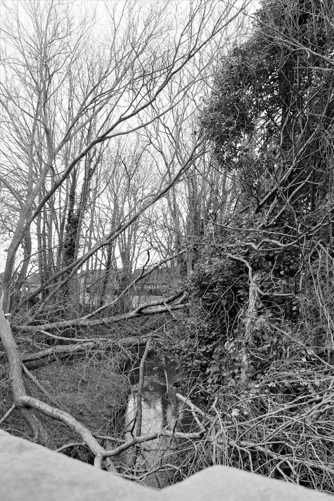
Walk it today heading towards Barlow Moor Lane, and you get glimpses of the bank of Chorlton Brook, with its dense vegetation and it is easy to think it was always such.

But not so, because back in the 1840s, the land from the path, on either side of the brook and stretching across what we now know as Chorlton Park was fields.

Rent Meadow, [1] and Lime Bank, [3], 1847
The biggest of the two was Rent Meadow which covered 4 acres and was farmed as meadow land.

Its neighbour was Lime Bank, consisting of just 1 acre and was given over to arable farming.

Had you stood on the footpath looking south towards the brook, there would have been a clear view, down to what is now Mauldeth Road West.

But bits of that scene would have been obscures by a belt of trees and bushes which followed the line of the water course.

Beech House, 1853
Both fields belonged to James Holt, who lived in Beech House.

His grounds covered all of the land from Beech Road to High Lane, and down from Barlow Moor Road, almost to Cross Road.

Added to this he owned 17 acres of prime agricultural land in the township.

But his money and that of his family had been made in town in a factory at the bottom of Deansgate, where he made the wooden engraving blocks for calico printing.

Such was his wealth that he also owned a considerable portfolio of properties around St John Street, including the only double fronted house on that street.

As befits a man who had “made it”, he retired early, moved to Chorlton-cum-Hardy, and settled in Beech Cottage which he  redeveloped into a grand property which he renamed Beech House.

The Holt's town house, 2010
His son continued to live in the city centre in St Johns Street, managing the business, and in the fullness of time followed his father and moved into Beech House.

Now, none of this is romantic conjecture, but based on maps of the 19th century, the Rate Books, Tithe schedule and a series of legal documents belonging to the Holt’s.

Together they offer up a detailed picture of the Hot’s business along with the lie of the land by our footpath.

I would love to know who worked Rent Meadow and Lime Bank, but alas that is lost to us.

But there are the odd little glimpses of who might have laboured there.

One such clue, comes in the form of of clay pipes found on the allotments.  It is just possible that they were refuse from night soil spread over the fields which had been bought in from Manchester.

A clay pipe, 2020
But I like to think they may have been discarded by an agricultural labourer on the edge of Rent Meadow sometime in the 19th century.

And as unhistorical as it might seem I would think that the resident of the house known as Lime Bank might have taken a stroll along the footpath on a summer’s evening.  He was a Charles Morton, but more of him another day.

Location; Chorlton-cum-Hardy

Pictures; Rent Meadow, 2020, the Holt's town house, 2010, and clay pipe, 2016, from the collection of Andrew Simpson, and in 1847, from the Tithe map, Beech Cottage in 1841, detail from the OS map of Lancashire, courtesy of Digital Archives, http://www.digitalarchives.co.uk/

Tuesday, 16 June 2026

The lost woods of Chorlton …… and a mystery concerning Mrs Lydia Brown and John Holland

We are looking out on John Holland’s Wood which stretched west along Chorlton Brook towards the Bowling Green Inn.

John Holland's Wood, circa 1900, looking towards Brook Farm

Today the footpath to our left is Brookburn Road which once ran east to Barlow Moor Road and west into the village and then out again to eventually cross Turn Moss to Stretford.

John Holland's Wood, formerly the Cliffs, circa 1900
I can’t be sure exactly when it became known as John Holland’s Wood, but John Holland had taken over the family farm in 1865 on the death of his father. 

The Holland family were farming 54 acres around Chorlton from at least 1841 and their holdings were dotted about the township.

These included a strip of land on Row Acre which was the large field running along Beech Road, a stretch on the northern border beyond the Longford Brook and the delightfully named Back of the World which was located where Chorlton Brook joins the Mersey to the south of the stone bridge.

The Cliffs and Brookburn Farm, 1854
Back then, according to the 1854 OS map the stretch we can see in the picture was more heavily wooded, and was known as the Cliffs, which was rented by Lydia Brown who lived at Brook Farm, and farmed across the township, on land which she owned and land she rented from the Lloyd Estate.  

Added to which she owned the smithy on what is now Beech Road, the property used by the wheelwright, Mr. Brownhill on Sandy Lane and a portfolio of cottages.

We even have a snatch of a conversation she had with the journalist Alexander Somerville who came  to Chorlton-cum-Hardy in the summer of 1847 looking for potato blight, the disease which had ravaged Ireland, and was that summer causing concern in Derbyshire.

He stopped at Brook Farm, and reported his conversation with Mrs. Brown who complained about the ash trees which grew around the fields  “which are not only objectionable as all other kinds are in and around cultivated fields but positively poisonous to other vegetation, and ran through the ground causing much waste of land, waste of fertility, and doing no good whatever.  Squire Lloyd is the landlord.  

Brookburn Farm, circa 1900

Mrs. Brown a widow, is the tenant.  She keeps the farm in excellent order so far as the landlord’s restrictions will allow.  But neither herself nor her workmen must ‘crop or lop top’ a single branch from the deleterious ash trees."

And what is exciting is that we know just which fields she was referring to.  These were Rye Field and New Hey which were plots 317 and 318, and ran beside the woods and today form part of Chorltonville.

Despite not yet finding her on the census record I can track her and her husband across the Rate Books from the 1840s through to the mid 1870s.

The woods and Rye Field, 1845

And here is the mystery, because while Lydia Brown lived at Brook Farm which was roughly on the site of Brookburn School, the Holland family are also recorded at a Brook Farm which was according to the tithe record on the bit of Manchester Road which  for a century and a bit was the Conservative Club.

All of which is compounded by the census records which in 1861 place the Holland farm house  on Brookburn Road.

I will leave it to Eric, and who else cares to attempt an explanation, suggesting only that perhaps Lydia had given up farming by 1861, and was happy to live off the rents from her properties, leaving the Holland family to move closer to the woods which took their name.

Sadly, it is no longer possible to recreate the scene and reproduce an image from roughly the same spot.

The trees have vanished under what is part of Chorltonville and a new residential development which was built on the old dairy.

Location; Chorlton

Pictures; John Holland’s Wood, and Brook farm from the Lloyd collection and the Cliffs in 1854 from the 1854 OS map of Lancashire showing a section of Chorlton-cum-Hardy, courtesy of Digital Archives Association, http://www.digitalarchives.co.uk/ and theTithe map of Chorlton-cum-Hardy, 1845

Saturday, 22 February 2025

Chorlton Brook and the Cliffs at Holland Wood in 1847 ... part two


Holland Wood, by the Cliffs along Chorlton Brook, circa 1907
We are in Holland Wood, sometime at the beginning of the 20th century and according to the caption on the photograph, “on Chorlton Brook between Claude Road and Brook Road, looking from what is now Claude Road Bridge.”

This stretch of the brook was known as the Cliffs and had been well wooded, although by the time of our picture this seems to be less so.

Over the left is Brook Road and in the distance is Brook Farm.


Brookburn Road with Brookburn Farm in the distance, circa 1907
Back in 1847 the radical journalist Alexander Somerville* stopped at Brook Farm and reported his conversation with Lydia Brown the tenant farmer who complained about the ash trees which grew around the fields  “which are not only objectionable as all other kinds are in and around cultivated fields but positively poisonous to other vegetation, and ran through the ground causing much waste of land, waste of fertility, and doing no good whatever.  Squire Lloyd is the landlord.  

Mrs Brown a widow, is the tenant.  She keeps the farm in excellent order so far as the landlord’s restrictions will allow.  But neither herself nor her workmen must ‘crop or lop top’ a single branch from the deleterious ash trees."

He may even have wandered a little further along our stretch of the brook before up to the bridge over the Mersey and a conversation with Samuel Nixon also a farmer as well as the landlord of the Greyhound who was fairly disparaging about news papers and the news that came out of them.

The Brook, looking west
All of which has taken us away from Chorlton Brook which is the most southerly of our water courses It flows from the east into the township by Hough End.

By the time it arrives at this point it is already the product of many smaller streams of which the Gore and Red Lion Brooks are the last joining by Hough End.

For those prepared to leave the township the best glimpse of any of these streams is at Hough End Playing Fields where the Red Lion Brook comes out into the light and crosses the open before flowing underneath Hough End Crescent where it becomes Chorlton Brook.

Like so many of our journeys around the township back in 1847 we would have been surrounded by open fields.

But at the point where the Red Lion and Gore Brooks joined to become Chorlton Brook the landscape changed and the water course ran through an area bordered by trees known as Hough End Clough.

Sadly for the modern traveller the brook is lost again as it runs under Mauldeth Road West before reappearing and flowing past the high school and under Nell Lane.

The Brook with Hough End Hall, circa 1900
And just a little to the west of this point is one of those mystery watercourses, which might be another little stream flowing in an old brick tunnel or it may just have dried up.

But back in the 1840s it was clearly visible, coming in from the south across land farmed by Henry Jackson with field names like Old Marled Field and Great Thick Wood.

It fed into Chorlton Brook just below where the Brook now crosses Mauldeth Road West, through a wooded and wet area with the delightful name of Pitts and Bogs.  In its journey from the south it fed a number of ponds and as it flowed into the Brook it broadened out contributing to the swampy character of Pitts and Boggs.

Tracking it today is difficult and the Environment Agency has no record, but it may have followed a route which took it from the junction of Burton Road and Lapwing Lane, north towards the Brook, passing just east of Weller Avenue.  If so it may well be that the old disused railway line marks its course.

And yet another crossed Chorlton Park from two ponds just a little south and west of Brookfield House which is now owned by the Corporation and is divided between the warden’s office and an upstairs tenant.

The Brook as it flows through Chorlton Park, 2010
From now with just a small break we can walk alongside the Brook as it wanders through Chorlton Park and under Barlow Moor Road.  Back in 1847 the Nell Lane Bridge was a lower structure but still gave good views.
Looking east there was Hough End Hall standing in its own grounds which by then was the home of Henry Jackson and later Samuel Lomas who farmed 220 acres.  Directly south was Brookfield House, commanding fine views across what is now the park.

From here on the brook remains open to the air till it meets the Mersey.  Unfortunately as its route flows through private property there is no access to it till it crosses Brookburn Road.

There is a footpath which ran from Barlow Moor Road skirting Oak House Farm by the modern Oak House Drive and running down behind the gardens on the north side of South Drive and Claude and Brookburn Roads but this fell out of use and is now blocked off and it is very doubtful that it will be reinstated.

This is a great pity because it would allow our modern traveller to walk beside Brook along a steep wooded corridor known as the Cliffs which ran roughly along the route of the footpath.  Here the Brook skirts the edge of the village.  On the south side were Brook Cottage and Brook Farm.

Here to was the village pond which today was where the cark park of the Bowling Green Hotel stands. It stretched back from the lane to include all of the modern bowling green to the edge of Finney Drive and from the Brook to the hotel it contained fish and was rented out to gentlemen.

Once across Brookburn Road the course of the Brook twists and turns before flowing into the Mersey.

The land on either side would have mainly been meadows and running off from the water course would have been the ditches which allowed the farmers regularly water the land.  This as we know was a skilled task.

The Cliffs in 1841
Today while the area retains the popular name of the meadows the land does not resemble the former meadowland.

The scars from the tipping of rubbish are still visible and much of the land had been landscaped with trees artificial ponds and raised banks.

So today where young trees and bushes crowd in on the passer by back in 1847 it would have been more open with trees forming natural boundaries between fields. And not far from the bridge across the brook the land north was covered by an orchard which ran up to and over the old Road to the big pond on Turn Moss.

It was an one of the orchards that fascinated Alexander Somerville, but that is a story for another time.

Extract from THE STORY OF CHORLTON-CUM-HARDY, http://chorltonhistory.blogspot.co.uk/search/label/A%20new%20book%20for%20Chorlton

Pictures; of Chorlton Brook passing through the Cliffs and by Hough End hall from the Lloyd Collection, as it passed through Chorlton Park from the collection of Andrew Simpson, detail of the Brook and the Cliffs from the OS map of Lancahire, 1841-53, courtesy of Digital Archives http://www.digitalarchives.co.uk/

* http://chorltonhistory.blogspot.co.uk/search/label/Alexander%20Somerville

Tuesday, 5 January 2021

Chorlton Brook


It winds its way across Chorlton from the border with Withington, having traversed the city, taking on different names in that journey, and runs out into the Mersey.*


In its time it was an important source of water to the people of the township, and by the late 19th century was notorious as a polluted waterway.

This is one of those views most people seldom see, and requires the curious and members of The Friends of Chorlton Brook, to peer over the Brook Bridge on Barlow Moor Road without falling in.

Location; Chorlton

Pictures; Chorlton Brook, 2020, from the collection of Andrew Simpson

Thursday, 2 April 2020

Following the smelly Gorton Brook into Chorlton ………… and solving a puzzle

The year is 1926 and I thought we were standing just a little north east of Hough End Playing Fields, somewhere close to what is now Hough End Centre during construction work which will take the Red Lion Brook underground.

The Gore Brook looking north, 1926
In the distance is Hough End Hall, and this is about where the Red Lion Brook vanishes from sight before joining our own Chorlton Brook.

But the title of the picture confused me, because according to the Local History Image Collection this is the Gore Brook, which flows from Gorton through Fallowfield changing its name to the Platt Brook.

And as you do I questioned the title and suggested to Peter Topping that somewhere, somebody had got the name of the water course wrong, which was one of those little bouts of arrogance that I should watch.

Because on checking the notes on the Local History Image Collection there are two connected images which carry the full title of Rivers, Gore Brook, near Wilbraham Road, Station looking north, Culverting, Manchester and Gore Brook, near Wilbraham Road, Station looking south west, Culverting, Manchester.

The Gore Brook , looking south west, 1926
Added to which the stretch of the Red Lion Brook crossing close to what is now Hough End Centre had already been culverted by 1894, leaving me to fall back on the line of the Gore Brook/Platt Brook.

So, following later OS maps along with google maps , and looking at the size of the culverts we are at that pint where the Gore Book/Platt Brook and Red Lion Brook meet, which is pretty much where I thought we were.

Leaving me to apologies for getting to the point of the story in around a bit way, but does just allow me to conclude that during the 19th century the Gorton Brook did Chorlton no favours.

As earlier as the 1880s residents had been complaining at the state of Chorlton Brook, moving Thomas Turner in 1885 to write that “It is a great misfortune for the inhabitants of Chorlton-cum-Hardy that this foul brook continues such a nuisance to the neighbourhood.  Last week during the evenings it was more than ordinarily offensive.  

The Gore Brook/ Platt Brook, & Red Lion Brook become Chorlton Brook, 1894
All along Beech Road and Barlow Moor Road to the station, the atmosphere was charged with a nauseous odour [which] is really an outrage upon suburban life that a remedy must be insisted upon”.  Adding “we have taken up our abode at a distance from our great city to have our homes spoiled and our health impaired by these ‘Noxious vapours’”, concluding “turn the brook into a common sewer by covering it.”*

All of which was quite understandable given that five years earlier, the Withington Local Government Board had reported that one third of the sewage of the district flowed into “The Chorlton Brook near Chorlton village”.**

Added to which our brook also carried the muck from the Gorton Brook which throughout the last quarter of the 19th century and into the next was notorious for being little more than an open sewer.

And that is that.

Location; Chorlton

Pictures; Gore Brook, near Wilbraham Road, Station looking north, 1926, m60575, Gore Brook, near Wilbraham Road, Station looking south west, 1926, m60574, A C Tomlinson, courtesy of Manchester Libraries, Information and Archives, Manchester City Council, http://images.manchester.gov.uk/index.php?session=pass and the point where the Red Lion Brook and the Platt Brook join Chorlton Brook, 1894, from the OS map of South Lancashire, 1894, courtesy of Digital Archives Association, http://digitalarchives.co.uk/


*Thomas Turner The Chorlton Brook, letter to the Manchester Guardian, July 2nd, 1885

**The Drainage of Withington, The Manchester Guardian, July 13th, 1880

Tuesday, 21 January 2020

The Kickety Brook, Stretford, once a vital part of our flood defences


I first walked the Kickety Brook with my old botanist friend, David Bishop.

It doesn’t look much but it was vital in its day for protecting the Duke’s Canal at Stretford.

The Canal dates from the 1760s and was cut to bring coal into the heart of the city and also was used by our farmers and market gardeners to ship their produce into the Manchester markets.

But the canal was close to the Mersey which could flood with little warning. In July 1828 flood water transported hay ricks from the farm behind Barlow Hall down to Stretford only later to take them back, while later floods proved to be even more destructive with one destroying the bridge across Chorlton Brook.

It was, wrote Thomas Ellwood the local historian
“no uncommon thing to see the great level of green fields completely covered with water presenting the appearance of a large lake , several miles in circuit,” and he recorded six major floods between  December 1880 and October  1881

By then the stone weir had been in place for nearly a century.  It had been built after a heavy flood in August 1799 had broken the banks where Chorlton Brook joined the Mersey.  This had led to fears that the Bridgewater Aqueduct across the flood plain could be damaged in a subsequent flood.

The weir was designed to divert flood water from the Mersey down channels harmlessly out to Stretford and the Kicketty Brook.  Not that it always worked.  Soon after it had been built flood water swept it away and during the nineteenth century neither the weir nor the river banks prevented the Mersey bursting out across the plain.

This happened in 1840 and in the following year it was rebuilt by the engineer William Cubitt. After litigation the cost of repair was borne by the Bridgewater Trust who paid out £1,500, the Turnpike Commissioners £500, Thomas de Trafford £1,000 and Wilbraham Egerton £1,000.

Today, standing beside the weir you get little sense of the force of the river in full flood. In the winter there can be a pool of water at its base stretching out across the plain but on many occasion in the past on warm summer’s days even this bit of land can be bone dry.

And likewise the Kickety Brook seems just an overgrown and quite forgotten bit of water. The last time the weir took an overflow of flood water was 1915 when these two pictures were taken.

Pictures; Higgibotham's field in flood, 1946, from a painting by J Montgomery, 1963, m80092, courtesy of Manchester Libraries, Information and Archives, Manchester City Council, and 1915 pictures from the Lloyd collection

Wednesday, 16 September 2015

Waking up to the day Chorlton was flooded .............. the Brook on an August morning

Now I know I shouldn’t have been surprised at seeing pictures of the Brook overflowing its banks earlier last month.

They were posted on social network by Michael J Thompson who wrote , “we had a substantial amount of rain overnight just before the flooding which led to the Chorlton Brook overflowing its banks into the northern part of Chorlton Park. 

Even the area in the park where the pond used to be filled up with water, having been bone dry the day before. 

The trams to the airport where stopped for a while due to the overnight flooding, and there was further flooding near Firswood which led to suspension of all services for a while between the Airport, Didsbury and Trafford Bar. 

I believe the Airport trams continued to run between Sale Water Park and the Airport. Most of the water had subsided by the afternoon.”

Looking at them under an Italian sun was to be reminded that we should never take our rivers and water courses for granted.

Certainly those who lived here in the 19th century maintained a healthy respect for them, for they not only offered water for drinking, cooking and irrigating the land but could flood with little warning.

In the case of the Mersey such floods could create a lake 3 miles wide across what we now call the meadows and one particularly fierce inundation swept away the weir in the bend of the river which had been built to protect the Duke’s Canal.

Even now there are plenty of winters when the Mersey comes close to topping those high banks which have been constructed over the centuries.

And there are plenty of pictures in the collection of the Brook coming close to overflowing its banks which is not surprising given that by the time it reaches Chorlton it is the sum of a number of smaller water courses of which the Gore Brook and the Red Lion are only two.

All of which brings me back to Michael’s photographs of a day when the brook offered up that reminder of how we should never take it or the other water courses for granted.

Pictures’ Chorlton Brook, August, 2015, courtesy of Michael J Thompson, Hardy Productions UK, http://hardyproductionsuk.com/

*Chorlton rivers, http://chorltonhistory.blogspot.co.uk/search/label/Chorlton%20rivers