Wednesday 31 March 2021

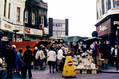
Remnants from another time ……. on Oldham Road

Now the remorseless onward march of the developers seem to have Radium Street in their sights.


For those who don’t know it runs back from Oldham Road down to the Rochdale Canal, cutting across a series of historic streets dating back to when the area was being developed for the first time.

So here are Silk Street, George Leigh Street and Jersey Street, along with others which have long since been renamed.

Which of course brings me back to Radium, which was originally German Street and its neighbour Prussia Street both of which underwent a name change, and now makes the pattern of streets a little out of kilter given than all the surrounding ones also carry place names, like Poland and Bengal Street.

Not that I suspect the new inhabitants of the renovated old industrial buildings and the modern counterparts which are springing up across the area will be over bothered.


Indeed by the time lockdown is over even more of those open spaces which were once factories, warehouses and terraced properties will have gone.

On a recent visit I noticed the Cheshire Cheese on the corner of Radium Street which closed ages ago has become just a space.

All of which means that the properties Andy recorded are all the more remarkable because they are still there running north from Radium Street along Oldham Road.

Location; New Cross

Pictures; Oldham Road, 2021, from the collection of Andy Robertson


The thoughtful skip …………. Chorlton this week

The caption on the cardboard reads, “Please do not put dog poo in this skip! A human has to sort through it once its full! Thanks”


To which I think there is no answer.

Sadly, someone chose to ignore the polite request.

Location; Chorlton

Picture; the thoughtful Chorlton skip, 2021, from the collection of Andrew Simpson


Tuesday 30 March 2021

April 1941 …….. the show of all the varieties ……….. RAF Cottesmore

I doubt we will ever get to know the identities of these young men and women who performed in a show at RAF Cottesmore in the April of 1941.


Those intervening eighty years will mean that few of them will still be alive, and I suspect any records of the event will be lost.

That said I will trawl the newspaper files for Rutland where the base was located, and just maybe there will be a route through to looking at any of the records of those years.

But for any one with parents or grandparents who served in the armed forces during the last world war, pictures like these will strike a chord, and maybe coax out memories of stories of such shows performed by willing and perhaps less willing members of military bases across Britain and beyond.


Both mother and my uncle served in the RAF, and mum certainly would have taken part, either “front stage” or more likely writing the script, assisting with the costumes, and back clothes.

Not that she ever talked about her war time service, but I know she was based on an RAF station in Lincolnshire, where she began writing and was always “up for a laugh”.

Oddly there is another connection with  RAF Cottesmore, and it is that both bases at one point flew the Handley Page Hampdens, and for as long as I can remember we had a brass replica of a Hampden which mother was given.


And that is pretty much is all we have of her time with Royal Air Force, other than a few photographs, and some of what she wrote in the long dull times, far from home.

Which brings me back to the pictures, which come from a unique wartime collection which belonged to Mary Emily Stevens, who served in the RAF from 1940 till 1944.

Most of the collection consists of a series of photographs taken I guess by Mary, and from these I have selected those from that April show.

I would like to know more, but there isn’t any more as yet to know.


But it is just possible that as the collection is shown on Facebook by David Harrop who now owns the collection someone may have something to add.

David has set up a special page dedicated to the young woman, and over the next few months he will be adding items in honour of this young women.

Location; RAF Cottesmore, April 1941

Pictures; the April show, 1941, courtesy of David Harrop.

* Mary Emily Stevens ....... and a unique collection of wartime pictures, https://chorltonhistory.blogspot.com/2021/03/mary-emily-stevens-and-unique.html

** *Mary Emily Stevens, https://www.facebook.com/105299108322389/posts/105321781653455/?sfnsn=scwspmo


Ghost pubs, car parks …... and the Hat & Feathers .... gone but not quite forgotten

It’s not much to look at I grant you, but Andy’s picture of the car park on the corner of Mason Street and Marshall Street offers up a ghost pub.

The ghost pub, 2021

Or to be more accurate the outline of the Hat and Feathers with the remnants of a bit of tiled wall which I take to be the lavatory. 

And because developers abhor city centre spaces, I am guessing it won’t be long till something new, big, and shiny fills the carpark and our ghost outline will be gone forever.

I passed the pub many times but never went in, which is a shame, because the write up in that wonderful site Pubs of Manchester Past & Present, reveals a lost gem.*

It closed in 2005 and was demolished four years later, finally finishing off a pub which was serving pints by 1825, when it was run by Mr. Hunt.  

He was the tenant paying his annual rent of £35 to a Thomas Welsh who appears to have sold the pub on to a George Eastwood who decided to take over the business of selling beer and cheer himself.  He was there by 1828 and may well have sold the place on to a William Rogers  who in turn rented it to a Thomas Doyle.

The pub, 1971

So far Thomas Doyle has proved elusive, for despite turning up on the Rate Books from the 1840s into the next decade, I have yet to find him on the census returns.

So, instead I shall look at the pub itself, which in 1851 occupied a large plot, stretching back from Mason Street and included a set of out houses separated from the pub by a small yard.

It now commanded an estimated annual rent of £40 which made it a cut above its neighbours whose rents varied from £25 down to £3, which  was as it should be, given that many of the surrounding properties were back to backs and looked out on to closed courts.

Sometime between 1851 and 1894 the pub was extended into the properties facing Marshall Street, and according to the 1911 census the Hat and Feathers  consisted of ten rooms .

There are few photographs of the pub and so far the one above from 1971 is the earliest.

Hatter's Court, and the pub, 1851

Leaving me just to ponder on the name of the place, which is recorded in the directories as early as 1825, and tantalizingly echoes Hatter’s Court which led off from Hatter’s Lane.

I suspect Hatter was the name of a building speculator, who chose to challenge posterity by giving his name twice, first to the lane, and then to a dismal court occupied by ten houses which faced each other and backed on to the pub.

I may be wrong, but there are enough people with that name listed in the rate books to open up the possibility that one of them may have built the houses.

We shall see.

Location; Marshall Street

Pictures; the car park, Marshall Street, 2021, from the collection of Andy Robertson, The Hat & Feathers, 1971, A. Dawson, m49747, courtesy of Manchester Libraries, Information and Archives, Manchester City Council, http://images.manchester.gov.uk/index.php?session=pass  the same area, 1851, from Adshead’s map of Manchester, 1851, courtesy of Digital Archives Association, http://www.digitalarchives.co.uk/ 

* Hat and Feathers, Pubs of Manchester, https://pubs-of-manchester.blogspot.com/2010/01/hat-feathers-mason-street.html


A ghost sign ….. a bit of Didsbury’s history …… and a question about what we should preserve

I am a great fan of ghost signs.

Burton Road, 2014

These were the adverts for products, companies and businesses which have long since vanished, but their hand painted signs linger on, usually on gable ends or hidden under modern signage.

Most are now a fading and peeling reminder of things we bought and shops we visited a long time ago, and some from the time of our grandparents.

School Lane, Wilmslow Road, 2020

There will be those who dismiss them, arguing that as they slowly disappear in front of our eyes, they constitute an eyesore, and given that what they advertise no longer exist, these ghost signs should be obliterated.

In their place might come a bright fresh mural, perhaps giving a local artist a chance to share their work or a commission for a new business which would be in keeping with the spirit of the original sign.

But I rather think that ghost signs are worth preserving, because they are part of our history, more so when in the case of a business we can track the firm or the individual back into the story of Didsbury.

One of my favourites is the one on the corner of Wilmslow Road and School Lane which advertised the cabinet making business of Thomas Spann who operated from numbers 35 and 37 Wilmslow Road, which are now a coffee shop and bookmakers.

Originally the sign read TEL, 234 DIDSBURY, SPANNS, BLINDS, REMOVING, CARPET LINOLEUM & BEDDING WAREHOUSE.

Warburton Street, 2018

But there are others, including the one on Warburton Street and two on Burton Road.

Of course, admiring them is one thing, but how do you preserve what is already fading, and does the very act of restoring or at least “fixing” to arrest further deterioration, change what we see?

Added to which who should pay for any such restoration?

I don’t have the answer to any of the questions, but I do think they should be carefully considered, lest we lose for ever something which we later regret.

The M&S sign ..... memories of the Co-op, 2020

And while we ponder on that, it might be fun to record all the Didsbury ghost signs.

Leaving me just to appeal for details which can be left as a comment on the blog or as a picture posted on the Didsbury social media sites, which I can use.

All of which will add to the collection and go a little way to preserve them if well meaning artists, or time do their bit to eradicate our past.

And that is it....... Record it or lose it.

Location; Didsbury

Pictures; the ghost signs of Didsbury, 2014-2020, from the collection of Andrew Simpson


The lost Eltham & Woolwich pictures ...... no.14 in the market

A short series on the pictures of Eltham and Woolwich in 1976.

For four decades the pictures I took of Eltham and Woolwich in the mid ‘70’s sat undisturbed in our cellar.

But all good things eventually come to light.

They were colour slides which have been transferred electronically.

The quality of the original lighting and the sharpness is sometimes iffy, but they are a record of a lost Eltham and Woolwich.

Location; Woolwich

Picture; Woolwich circa 1976, from the collection of Andrew Simpson


Down a side street …………….. the murial in Didsbury …… no. 3

I happen to think there should be more murials in Didsbury.


And yes, I know it should be mural …….. but then I was a great fan of Hilda Ogden, and her flying duck wallpaper which she always referred to as her murial.

This one can be found down Whitechapel Street.

Location; Wilmlsow Road

Picture; the mural, Caramello, Whitechapel Street, 2020, from the collection of Andrew Simpson

Sunday 28 March 2021

On the cusp of change ……… Oldham Road

We are on Oldham Road, standing midway between Addington Street and Marshall Street as the area continues to undergo a period of regeneration.

Oldham Road, and Marshall Street, 2021

Most of the buildings are pretty new, but there are still a handful left  from the last century and just maybe the odd one which was built during the reign of Victoria.

I don’t suppose many of these period buildings will see the decade out.


But that is pretty much what you would expect for an area which was transformed by industrialists and speculative builders who in the space of thirty years filled the fields with factories, foundries, and terraced houses during the Industrial Revolution.

Oldham Road, and Marshall Street, 1851

So that when Mr. Adshead made his map of Manchester in 1851, our spot was densely packed with textile mills, and timber yards, the odd  sawmill and heaps of houses, some of which were back to back and locked away in a series of open and closed courts.

Nor would you have wanted for pubs, because on the corner of Addison Street was the Robin Hood, with the St Vincent Tavern on the next corner, and away  back from Oldham Street there were another six including the Hat and Feather which was yet to expand from Mason Street on to Marshall Street where it remained until 2005.

Added to these there were countless beer shops, which opened and closed depending on the fluctuating economic climate.

Oldham Road, and Marshall Street, 1951

Fast forward one hundred years from Adshead’s map and the area shows the devastation wrought by enemy bombing during the last world war, with large open plots of land along both Marshall Street and Addington Street, including the corner to the right of the building with the mural.

All of which now appears to be changing, and leaves me to think that within the next fifteen years the remaining historic bits of Marshall Street and Addington Street will be lost.

Location; Oldham Road

Pictures; Oldham Road, 2021, from the collection of Andy Robertson, the same area, 1851, from Addison’s map of Manchester, 1851, courtesy of Digital Archives Association, http://www.digitalarchives.co.uk/ and in 1951, from OS of Manchester and Salford, 1951


The Eltham & Woolwich pictures ...... no.13 behind our house

A short series on the pictures of Eltham and Woolwich in 1976.

For four decades the pictures I took of Eltham and Woolwich in the mid ‘70’s sat undisturbed in our cellar.

But all good things eventually come to light.

They were colour slides which have been transferred electronically.

The quality of the original lighting and the sharpness is sometimes iffy, but they are a record of a lost Eltham and Woolwich.

Location; Woolwich


Picture; Woolwich circa 1976, from the collection of Andrew Simpson


A bit of Didsbury you will have to go looking for ……….. and a sideways look at what we did with our rubbish

I am quite prepared to accept that a picture of a pile of rubbish behind a block of shops, may not fire everyone’s imagination or advance our knowledge of Didsbury’s past.

Behind a shop in Didsbury, in 2020

But in its way it has as much a part to play in the story as any old period photograph, dusty history book, or fading memory.

And these rubbish trollies are not new. I came across a similar one back in 1967 on King Lynns Close, but then I suppose as a way of shifting a lot of boxes and assorted paper, a wooden platform with wheels and wire sides is a pretty neat idea.

Leaving me just to reflect on refuse collection as it used to be.

Taking the refuse away in 1969
Long before the big noisy vehicles, and multi coloured wheelie bins, there was the metal dustbin, into which went everything.

Of course, back, then there was a lot less packaging, and what there was tended to be recycled at home.

So baked bean tins and the larger dried milk ones, ended up as containers for assorted screws, nuts and bolts, and those waxed Sunblest and Hovis wrappers, went back out into the world wrapped around sandwiches.

And in the 1930s the Corporation actively encouraged householders to burn as much rubbish as they could on their open fires and make good use of compost heaps.

But what was left in those metal dustbins, could still offer up unpleasant surprises during the summer months, which involved excessive use of that powdered disinfectant which went under the name of Flit, and came in a small white and red tin, complete with a picture of a 19th century soldier armed with a spray.

Cleaning the bins, 1969
Which was all to the good, given that in our house in south east London, the bin had to be carried through the house on collection day, from the back garden, and left by the front doorstep.

 A task which when I was old enough fell to me, not that I was ever expected to clean it out afterwards, but only to check for signs of rust along the bottom, which might weaken the bin, and run the risk of the contents spilling out over the hall way.

A disaster which happily has never happened with our range of coloured wheelie bins and I doubt will ever happen to that paper and cardboard laden trolley.

Location; Didsbury

Pictures; that rubbish trolley in Didsbury, 2020, from the collection of Andrew Simpson, and refuse collection in 1969, Courtesy of Manchester Archives+ Town Hall Photographers' Collection,
https://www.flickr.com/photos/manchesterarchiveplus/albums/72157684413651581?fbclid=IwAR35NR9v6lzJfkiSsHgHdQyL2CCuQUHuCuVr8xnd403q534MNgY5g1nAZfY

Saturday 27 March 2021

Down on Nell Lane with a smelly story ................... the Destructor Plant

Now I remember the Corporation depot on Nell Lane and think we may even have used it once, but its closure and demolition passed me by.

The Destructor Plant in 1925
There will be someone who knows and I hope they get in touch to offer up a date and perhaps a reason.

Like so many bits of our most recent past the closure of the depot pretty much went unreported and the information has yet to arrive in an archive.

In the case of the Nell Lane site that is a shame given that its story goes back to 1892 when the Withington Board of Health decided it needed its own “destructor plant” to deal with the increasing amount of refuse.

As far as the Board was concerned the need was obvious and set out the case at a local government inquiry in 1892.  “The population of the district was 25,000 in 1891, and was now estimated at 27,000. ............. The number of houses was 5,200.  There were the same number of ashpits, and of these 2,284 were dry ashpits.  

The Local Board had to deal with about 15,000 tons of refuse and other matter in the course of the year. 

Part was disposed of to farmers and it had hiterto been the custom to tip the rest.  Objection had been taken to the custom to tipping and the Board had been obliged to give up all the tips but two.”**

Salford Corporation had a decade earlier been forced to do the same. Mr J Swarbrick the consulting engineer of the scavenging department of Salford explained at the inquiry that similiar objections to land tipping had been made and the Council had recourse to building a destructor in 1881, which was all to the good as early evidence had suggested that tipped land when disturbed gave off awful smells and was unsuitable for building on.***

The original plans for the site included placing the destructor’s furnaces ten feet below the surface of the ground and surrounding the area with an eight foot high wall.

The destructor had been opposed by the Chorlton Union who expressed their concerns for the health of the inmates of the nearby Withington Workhouse.

But the plant was built and in 1912 Manchester Corporation who had taken over the destructor reported that it accounted for 12,320 tons of refuse, some which was sold on to farmers, and 365 tons burned in the destructor.

And that is it the first smelly story on the blog.

Location; Nell Lane, Chorlton-cum-Hardy, Manchester

Picture; Aerial Views, Chorlton-cum-Hardy, Manchester Corporation Destruction Works, Nell Lane, 1925, Imperial Aerial Photo Com72045, courtesy of Manchester Libraries, Information and Archives, Manchester City Council, http://images.manchester.gov.uk/index.php?session=pass


*The Withington Board of Health and later the Withington Urban District Council was the local government body responsible for Burnage, Chorlton-cum-Hardy, Withington and Disbury.  The latter ceased to exist when the rate payers of the four areas voted to join Manchester in 1904

**Proposed Refuse Destructor at Withington, Manchester Guardian, November 23 1893

*** Proposed Refuse Destructor at Withington, Manchester Guardian, February 16 1892


Revisiting favourite places with a twist of history ............... nu 2 Paris

An occasional series which just aims to reflect old places and places with a story.


We were staying at the hotel opposite the Opera House

Picture; Paris, 1980, from the collection of Andrew Simpson

Roby Street – Manchester’s Other Infirmary …. a story from Anthony Hewitt

Recently as part of my genealogy research, I had received a copy of the Death Certificate* from the GRO# for a family member who had died at Roby Street Infirmary, Manchester. 

My immediate reaction was to question the location as Roby Street Infirmary was a place that I had never known. My quest to discover more had started.

William Hughes, 68, had been crossing City Road, Hulme, near his home, on the evening of Monday, 8th March 1943 when he was run down by a motor vehicle. 

He had been taken to Roby Street Infirmary, where he had died from his injuries.

Extract from Death Certificate for William Hughes, Columns 1, 6 & 7
Roby Street runs parallel to and between Piccadilly and Aytoun Street and the Infirmary had occupied an entire block between those two roads.

The photograph shows the rear elevation of Roby Street Infirmary in 1940, which faced onto Aytoun Street, which at the time of construction was not the major artery that it is today and had ended at the Rochdale Canal.

1922 OS 25” Map of Piccadilly Area of Manchester [NLS]

Roby Street Infirmary, Rear Entrances, Aytoun Street, 1940

The site of the infirmary had previously been occupied by the Grosvenor Street Chapel on Roby Street, and from 1901 by Roby Sunday School on Aytoun Street, named after William Roby, a former minister. The Sunday School only needed and had occupied only two upper floors of the building. 

Not only was the ground floor unnecessary but behind those intriguing, trellised window openings lay a dark secret.

An extract from Godfrey’s 1849 Map, clearly shows Roby Sunday School located on Aytoun Street and Grosvenor Street Chapel on Roby Street, separated by Chapel Yard, occupied the site that became Roby Street Infirmary. 

Roby Sunday School, Aytoun Street, 1901

Chapel Yard was a burial ground that reached as far as Aytoun Street**. 

It is reasonable to assume that the presence of those graves had prevented a ground floor in Roby Sunday School, except for that part needed by the stairs.

This raises the question of when those buildings had been demolished and the infirmary was built, and by whom. 

The question of what had happened to the remains of the unfortunates who had been laid to rest therein is not known to the author. 


Extract from Godfrey’s 1849 Map of Piccadilly, Manchester


A temporary workhouse for 200 inmates had been located on Minshull Street, 1847-8*** with a fever hospital on Millgate but a clue or red herring, only time and research will tell.

For several weeks after writing this story I kept asking myself how it was possible that, as a schoolboy I had ridden top deck on a No. 94 bus along London Road and Piccadilly, but I could not remember Roby Street Infirmary. 

A fleeting glimpse of memory recalled a heart on a building at the far end of Gore Street and brought the National Blood Transfusion Service out from the mists of time.

It is not possible for me to be certain but in all probability Roby Street Infirmary had closed as a hospital and been repurposed as the Central Blood Bank for Manchester many years earlier than my memories had 

Today, the site is occupied by apartments in what looks like a repurposed building.

National Blood Transfusion Centre, Roby Street, 1963

…And quite possibly by a few restless souls too.

Photographs: courtesy of Manchester Libraries, Information and Archives, Manchester City Council, 

Roby Street Infirmary, Rear Entrances, Aytoun Street, 1940, Manchester Libraries, m75488 https://images.manchester.gov.uk/web/objects/common/webmedia.php?irn=82579&reftable=ecatalogue&refirn=2149

Roby Sunday School, Aytoun Street, 1901, Manchester Libraries, m69114 https://images.manchester.gov.uk/web/objects/common/webmedia.php?irn=54277&reftable=ecatalogue&refirn=23890

National Blood Transfusion Centre, Roby Street from Gore Street, 1963, W. Higham, Manchester Libraries, m01891 https://images.manchester.gov.uk/web/objects/common/webmedia.php?irn=10004&reftable=ecatalogue&refirn=66785 

Maps:

1922 OS 25” Map of Aytoun Street Area of Manchester; National Library of Scotland

1849 Map of Piccadilly, Manchester, Sheet 29; Alan Godfrey; John Anthony Hewitt Collection.

References:

# GRO: HM Passport Office, General Register Office

* Death Certificate for William Hughes, GRO Ref. 1943-Q1, Manchester, Vol. 8d, Page 10; John Anthony Hewitt Collection.

** https://manchestervictorianarchitects.org.uk/buildings/roby-day-and-sunday-schools-aytoun-street-manchester 

*** http://www.workhouses.org.uk/Manchester/


The lost Eltham & Woolwich pictures ...... no. 12 waiting for the Ferry

A short series on the pictures of Eltham and Woolwich in 1976.

For four decades the pictures I took of Eltham and Woolwich in the mid ‘70’s sat undisturbed in our cellar.
But all good things eventually come to light.

They were colour slides which have been transferred electronically.

The quality of the original lighting and the sharpness is sometimes iffy, but they are a record of a lost Eltham and Woolwich.

Location; Woolwich

Picture; Woolwich circa 1976, from the collection of Andrew Simpson


Friday 26 March 2021

Marshall Street ….. that place of derelict buildings …. open spaces ….. and car parks

Now, you know something is going to happen to Marshall Street.


It is after all in the middle of the new developments which are seeing this part of Ancoats buzz in a way it hasn’t since the industrialists and speculative builders of the late 18th and early 19th century started transforming the fields on the edge of the city into that complex of factories, ironworks, terraced houses, and canals.

The signs are all there from the derelict buildings, the already open spaces, and the carpark which was the Hat and Feathers.  It closed sometime around 2005 and was swept away four years later.

I was a regular visitor to the street from the 1970s when I was aimlessly wandering the city, and more recently when the County Records Office was situated in the Marsden Marcombe building with its stunning green tiled entrance.


And this week Andy on an essential trip out was also drawn to walk the street.

As his pictures show there is every sign that something is a foot.  

That said the last planning application for this building was in 2005, when the developers wanted to erect a mixed residential and commercial complex with 182 apartments, office space and space to accommodate 225 cars.

But the planning application only extended for 5 years, and as far as I can see there have been no fresh plans put forward.


So for now at least Marshall Street remains a bit of a ghost place, despite the presence of one block of flats, it sits and waits, and mirrors the ghost site for the Hat and Feathers which is still there on the internet which registers its presence, but does at least record that it is closed.

Location; Marshall Street

Pictures; Marshall Street, 2021, from the collection of Andy Robertson


In Didsbury ……. with the fingerless finger post

I have to confess that until recently I never knew that those old fashioned road signs with their outstretched arms, bearing destinations and distances, were called Finger posts.

2020


2020
It makes perfect sense, but then I lived a sheltered life.

Not so Andy Robertson who in a quite moment from recoding our industrial history, ventured along Barlow Moor Road to its junction with Palatine Road and photogtaphed the pole with the circle inscribed City of Manchester.

I have passed it countless times, and never noticed the remains of the bots which supported the  three boards carrying the names Cheadle 2½ miles, underneath were the words The South, and on the second The Docks, Bolton, Warrington Liverpool and on the third, Chorlton-cum-Hardy and Manchester.

At some point each of the three fingers were given an added bit which recorded the names of the roads. 

So, the white destination sign for Cheadle and The South were joined with B5217, as were The Docks, Bolton, Warrington Liverpool.

1959
I can be forgiven for missing the fingers, as they were taken down sometime in 1960.

And that is about it, other than to thank Andy for the pictures and the reference back to the older pictures, which are in the Local History Collection.

Location; Didsbury

Pictures; the fingerless finger post, Didsbury, 2020, from the collection of Andy Robertson, and with fingers, 1959, D. Oakes, m21393, courtesy of Manchester Libraries, Information and Archives, Manchester City Council, http://images.manchester.gov.uk/index.php?session=pass

“We will always have Paris” ....... Part 4 .... from the Eiffel Tower

When you visit Paris, there will be a moment when you end up at the Eiffel Tower.

And so did we, and much against my better judgement we went up.

I did tale the usual tourist pictures, which everyone takes, but I also took this one of a group of young visitors.

Location; Paris

Picture; the Eiffel Tower, 1980 from the collection of Andrew Simpson

Thursday 25 March 2021

One hundred years of one house in Chorlton …. part 119 ....... “If it wasn’t for the houses in between”

 The continuing story of the house Joe and Mary Ann Scott lived in for over 50 years and the families that have lived here since. *

It is not the first time I have visited the story, but I have been drawn back by the relentless rise of an extension to a neighbour’s house, which isn’t very intrusive but will obscure views of the side of Ivy Court.

The view south, 2020

More intrusive is the “brick slab” directly behind us which replaced Joe Scott’s old office and workshop.

It had been a low rise building, which after the sale of the Scott’s house was variously used as a TV repair place and by Fairbarts the builder’s.

To be fair it only advanced the building line of the houses on Beaumont Road a littler closer to our back garden, but it is enough.

Which brings me back to the view from 1915.  

Looking out from their back bedroom they would have had an uninterrupted view down to the brook and on to the Mersey.

But it was already diminished by the terraced houses to their right which ran along Provis Road, and to their left by those on Reeves Road, and in the distance the eastern part of Chorltonville.

The view south from Beech Road, 1907

Sadly, I have no pictures of that view, but one day something will turn up.

From the front much of what we see would have been familiar to them.  

The Rec had been a public space for about twenty years, and the properties along Cross Road were all 40 or more years old. 

But on a summer’s day, beyond the Rec Joe and Mary Ann would have been able to see bowls being played on what is now the car park of the former Irish Club, while to their right behind a line of hedges there was still the Bowling Green farm house.

And they may have bought their milk from Ivy Farm which was just passed our house, and speculated what films would be on at the the Palais De Luxe on Barlow Moor Road.

The Rec, 1910

It was our first purpose built cinema and would have beaten the socks off the former Chorlton Pavilion and Winter Gardens on Wilbraham Road or the Longford Picturedrome, both of which had been converted from a variety hall and skating rink.

Now to be accurate Mr. and Mrs. Scott would not have been able to see the Palais De Luxe, but it was there, and had opened in 1914 in what had been the extensive garden of the house owned by the Holt family since the 1830s.

That garden extended along Barlow Moor Road, from the corner of Beech Road, as far as High Lane, and then down High Lane almost to Cross Road.

Looking up Beech Road, circa 1900

But by the time the Scott's moved in the Holt family home had been demolished and a section of the eastern side of garden had been bought by the Corporation for its new tram terminus while the rest was destined to become shops.

All of which is just a bit beyond the view from Joe and Mary Ann’s upstairs windows, so I shall leave it there.

And, close with that musical hall song by Gus Elen, "If it wasn't for the 'ouses in between", which might have struck a chord with Joe and Mary Ann.***

"If it wasn't for the 'ouses in between"

Location; Chorlton

Looking out from Beech Road, 2018

Pictures; Looking out on the brick slab, 2020, and view from the front, 2018, Looking south feom Beech Road, 1907, from the OS map of Manchester & Salford, 1907, The Rec, circa 1910, and Beech Road, circa 1900, from the Lloyd Collectionfrom the collection of Andrew Simpson, and poster,  circa 1890-1910, PlayPeople UK (V&A theatre museum)

*The story of a house, https://chorltonhistory.blogspot.co.uk/search/label/The%20story%20of%20a%20house

**Chorltonton-cum-Hardy, History of the Suburbs of Manchester, Manchester Evening News, September 20th, 1901

***Gus Elen and his music hall song, "If it wasn't for the 'ouses in between"

Oh it really is a wery pretty garden

And Chingford to the eastward could be seen;

Wiv a ladder and some glasses,

You could see to 'Ackney Marshes,

If it wasn't for the 'ouses in between.

https://www.youtube.com/watch?v=_XchS7hdddU


Paris ................ a long time ago

It was one of those short breaks to Paris which coincided with my first proper camera, a Pentax K1000, SLR.

So good was the camera that I bought a second a few months later.

I continue to have a strong affection for them, and they travelled all over Europe, sitting in the back of boiling hot taxi in Athens and dropped beside a babbling brook on a cold winter’s day outside Buxton

And with the camera I began to master the joys of a dark room along with developing and printing the pictures.

As much as I felt grown up it was all rather hit and miss and after a long break between taking pictures when, I started again it was with a digital camera.

I suppose I should also comment on the trip to Paris, but it was so long ago and anyway after Paris there was Rome, and that as they say is a love affair that I have never lost.

Location; Paris

Picture; Paris 1981 from the collection of Andrew Simpson

The story behind the picture

Now I have always been fascinated by the stories which sit beside old photographs.

Rarely do you get the full story and more often than not much is left in the shadows.

But not so this picture which is one of the many that are now being revealed for the first time in four decades.

They belong to a huge collection of images that I took in 1978 through into the mid 80s using old fashioned film, smelly chemicals and a dark room.

Most never became prints and for those forty years sat in the cellar as negatives and after the enlarger and chemicals were thrown out remained just negatives.

But now I have one of those clever scanners and the software which do the trick in seconds, and so as you do, I have been playing; selecting strips at random and discovering all sorts.

Many are of London, with a lot more of demonstrations, when a man with a camera was not regarded with suspicion.

And that brings me to the picture.

It will date from 1979 or 1980/81 when some of us seemed constantly to be on a demonstration, be it against cuts in public spending, the rising unemployment figures, or the march of the Far Right peddling their message of racism and intolerance and later the installation of Cruise Missiles in Britain.

This one was Manchester, and it will have been an anti cuts demonstration.

The negative was chosen by chance, but what I was not expecting was that it included a picture of Malcolm selling newspaper.

I first met Malcolm when we were both on the same degree course.

By his own admission he had travelled far, from being a Moral Rearmer in the 1960s to embracing Socialism in the earlier ‘70s.

The journey took him via the Communist Party to the International Socialist Party and by degree into the Labour Party.

We lost touch with each other in the 1980s and only recently did I learn he had died.

Now given that I was born in the first half of the last century losing touch and later learning of the death of friends is becoming commonplace, so I am rather pleased that this image of Malcolm has come to light, leading me to reflect on that friendship which was never dull and more than once filled with a bizarre outcome.

Location; Manchester


Picture; a demonstration; circa 1980, from the collection of Andrew Simpson

That Thames Barrier …… still looking good ..... nearly 40 years on

Now, it is 39 years since the Thames Barrier went into service.

The Thames Barrier, 2020

Work began in 1974 and it was finished in 1982, and watching it being built I marveled at the engineering that went into its construction.

Under construction, circa 1979

Although someone I suspect will tell me that it was quite easy to build.

But I remain impressed.

Sometime around the late 1970s, or early 1980s  I wandered down and took a series of pictures, which lay forgotten in our cellar for four decades.

They aren’t the best I have taken but in my defence they were converted from old colour slides and negatives, and were at a time when I was just starting out on a long love affair with the camera.

In all it's glory, 2020

And having found them I started posting them, which prompted Garry to contribute to of his own pictures taken a full 38 years later.

Together I think they make a nice comment on the passing of nearly four decades of the Thames barrier.

Location; the River Thames, 


Pictures; the Thames Barrier, circa late 1970s from the collection of Andrew Simpson, and gain in 2020 courtesy of Garry Luttman