Forty-seven years is a pretty big chunk of any one’s life and in my case falls short of the six decades I have lived here in the city.
 It is also the space between the pictures taken by a young art student and roughly the time I revisited the place with some of my own.
The canal was finished in 1804 and ran for 32 miles across the Pennines from the Duke’s Canal at Castlefield Basin to join the Calder and Hebble Navigation at Sowerby Bridge in West Yorkshire. In his description of the canal network published in 1830 Priestley was in no doubt of the canal’s importance.
"The canal is one of the main links in the chain of inland navigation between the east and west seas, being made for vessels of such size as enables them to navigate the tide way, and to pass between Liverpool and Hull without the expense of reshipping their cargoes, thus affording great advantages to the populous towns of Manchester, Rochdale, Halifax, Wakefield and other son the banks of the intermediate rivers. The Baltic produce can thus be readily conveyed into Lancashire and the manufacturers of Lancashire in return exported through the ports of Goole and Hull to Hamburg, Petersburg, Lubeck and other continental markets. The stone from Cromwell Bottom and its neighbourhood is hereby also conveyed to Rochdale and Manchester. These connections are likely to make it ultimately an undertaking of considerable profit to the proprietors.”*
 So our own international highway and one that carried everything from “corn, timber, woollen cloth, coals and raw materials.”
But like all our canals find it difficult to compete with the railways and finally closed in 1952, although the section through the heart of the city from Castlefield to Piccadilly proved profitable and stayed open.
So our own international highway and one that carried everything from “corn, timber, woollen cloth, coals and raw materials.”
But like all our canals find it difficult to compete with the railways and finally closed in 1952, although the section through the heart of the city from Castlefield to Piccadilly proved profitable and stayed open.
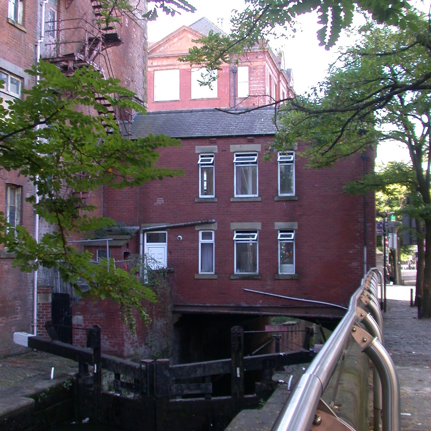
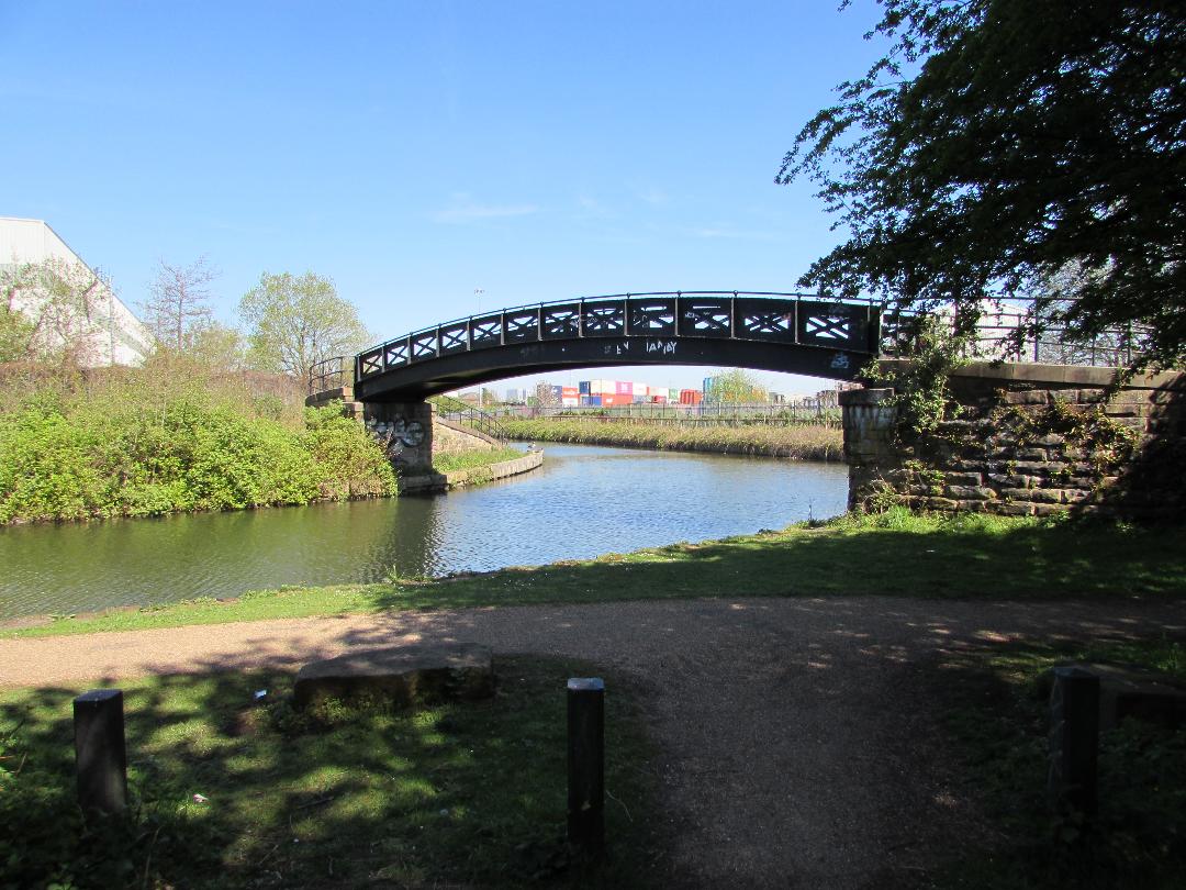
 Location; the Rochdale Canal
Pictures; from the collections of Eileen Blake and Andrew Simpson , map of the canal network around Manchester from Bradshaw’s map of 1830, The Inland Navigation of England and Wales, and the extract from Joseph Priestley’s Historical Account of the Navigable Rivers, Canals, and Railways, 1830 courtesy of Digital Archives http://www.digitalarchives.co.uk/
* Priestley, Joseph, Historical Account of the Navigable Rivers, Canals, and Railways, 1830, Page 579

The canal was finished in 1804 and ran for 32 miles across the Pennines from the Duke’s Canal at Castlefield Basin to join the Calder and Hebble Navigation at Sowerby Bridge in West Yorkshire. In his description of the canal network published in 1830 Priestley was in no doubt of the canal’s importance.
"The canal is one of the main links in the chain of inland navigation between the east and west seas, being made for vessels of such size as enables them to navigate the tide way, and to pass between Liverpool and Hull without the expense of reshipping their cargoes, thus affording great advantages to the populous towns of Manchester, Rochdale, Halifax, Wakefield and other son the banks of the intermediate rivers. The Baltic produce can thus be readily conveyed into Lancashire and the manufacturers of Lancashire in return exported through the ports of Goole and Hull to Hamburg, Petersburg, Lubeck and other continental markets. The stone from Cromwell Bottom and its neighbourhood is hereby also conveyed to Rochdale and Manchester. These connections are likely to make it ultimately an undertaking of considerable profit to the proprietors.”*


Pictures; from the collections of Eileen Blake and Andrew Simpson , map of the canal network around Manchester from Bradshaw’s map of 1830, The Inland Navigation of England and Wales, and the extract from Joseph Priestley’s Historical Account of the Navigable Rivers, Canals, and Railways, 1830 courtesy of Digital Archives http://www.digitalarchives.co.uk/
* Priestley, Joseph, Historical Account of the Navigable Rivers, Canals, and Railways, 1830, Page 579