Showing posts with label Chorlton in the 1880s. Show all posts

Sunday, 25 January 2026

A pub ... a farm.... and that walk through Chorlton-cum-Hardy in 1881

Now I grant you this isn’t the zippiest of titles, but it does the business.

We are standing at the junction of Barlow Moor Road and Wilbraham Road, looking up towards Martledge and the year is 1881.

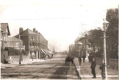
Wilbraham Road was still relatively new having only been cut a decade and a bit before, but had already begun to attract some wealthy residents who settled along the stretch from Edge Lane towards Barlow Moor Road.

And that fulfilled the expectations of the Egerton estate who in the 1850s had considered a route which would run from Stretford through to Fallowfield, creating a new highway which could better connect Chorlton-cum-Hardy to Wilmslow Road and in turn open up the township to new developments as well as the possibility of more trade.


There had been a series of alternatives , all of which favoured a route to the north of the one built, but all seemed to have been abandoned possibly because the land was dotted with small water courses and ponds which had given the area the name of the Isles.

As it was the route chosen sliced through Manchester Road which ran away from the village and up to West Point and which by degree passed through Martledge which was one of the three hamlets which made up Chorlton-cum-Hardy.

Today, on a wet grey day when the rain clouds touch the tops of the houses, the best way to get a sense of the area is street google, which offers up a map, a satellite view and of course pictures of the properties along the way.


But I have the 1881 map, commissioned by the Withington Board of Health which is both very detailed and very attractive.

And because I can I have chosen to look at the bit which today is a mix of residential and commercial properties, including that car park.

I won't insult any one by commentating on the details that map reveals or a then and now commentary, anyone interested can do that for themselves.

What does fascinate me are the houses along that bit of Manchester Road which vanished under the car park and the long greenhouse behind the old Royal Oak which stood to the north of the present pub and had been dispensing beer and cheer from the early decades of the last century.

The present pub stands on the site of Renshaws Buildings which were a collection of ten back to back cottages which were constructed sometime before 1832.

Leaving me just to wander up Barlow Moor Road to where it joined Manchester Road and stand by the guidepost.  


And here the map throws up one of those tiny bits of history I like.  Back then the post faced a tree lined field, which today is the Co-op Undertakes, and was from 1920 a cinema, which in turn replaced a grand house called Sedge Lynn.  

This was the home of Aron Booth who in the summer and winter of 1882 took a series of photographs of Martledge of which only four have survived.

The Booth’s were one of those new families with money behind them and business interests in the city who had made their home here just as the housing boom of the 1880s was about to take off.


A housing boom which in a few short decades would not only engulf Martledge in rows of houses and shops but ensure that the name of the hamlet was forgotten, so that when people talked about the area they preferred to call it the new town or new Chorlton to distinguish it from the older community which lived around the village.


But what the map shows is that Sedge Lynn was built sometime between the beginning of 1881 and the April of that year, because the house is not there on the mapbut the family show up on the census return which was completed in April.

Leaving me just to trawl the Rate Books to confirm that date.

Location; Chorlton-cum-Hardy

Picture; Martledge, 1881,  from the map of Chorlton-cum-Hardy, 1881, Withington Board of Health, courtesy of Trafford Local Studies Centre Sedge Lynn and the view across the Isles towards Longford Hall  in 1882 courtesy of Miss Booth, from the Lloyd Collection


Monday, 1 December 2025

Settling a few old mysteries and uncovering a few new ones ……. Chorlton-cum-Hardy in 1881

Now, it is a simple observation that what you once thought you knew about a place or a past event can be turned on its head.


And that is pretty much what has happened today with the acquisition of a map from 1881.

My friend Richard came across it in the archives of Trafford Local Studies Centre, and it looks to be unique, in that there isn’t a copy at Central Ref.

Added to which it is a beautifully produced map in colour, and is more detailed than the OS map made a decade later.

Richard thinks it was made for the Withington Board of Health which had become responsible for Chorlton-cum-Hardy, Burnage, Didsbury and Withington, and replaced a system of governance which stretched back to the Middle Ages.

The detail in the map allows me to confirm what I had thought about some of the buildings in the township and offers new clues about some others.

So, in the case of the Renshaws Buildings which stood on the site of the Royal Oak I had long thought that they were back to back cottages which had been built before 1830.


The census returns and other maps suggested this was so, but the 1881 map offers up the evidence that there were indeed ten back to back cottages which also fits with the few photographs that we have.

And the map also clarified what I thought about a set of cottages on the corner of what is now Beech Road and Wilton Road, and back in 1881 bordered a small orchard which was part of Row Acre. 

One of these was Sutton’s Cottage, for which we have a photograph dating from 1892.

The earlier maps suggest that there was more than one cottage, and again the 1881 map confirms this, which for me is quite exciting, because we know that the Sutton family had lived in the end cottage from at least 1851.*  

We know he was an agricultural labourer, and we know how much rent the Sutton’s paid along with the size of the family.


And using even older maps it is possible to date the cottages back into the late and possibly even the mid 18th century. 

They were wattle and daub constructions and by 1881, there were only 50  left in the township, which was not a bad thing.

Most were wattle and daub cottages made by filling in the space between a wooden frame with walls made of woven branches covered with a mix of mud, and straw.

Such houses were easy to build and equally easy to maintain, but there could be disadvantages to living in them.  The porous nature of walls meant they were damp and crumbling clay meant endless repairs.

According to a later Parliamentary report, “Many of them have not been lined with lath and plaster inside and so are fearfully cold in winter.  

The walls may not be an inch in thickness and where the lathes are decayed the fingers may be easily pushed through.  

The roof is of thatch, which if kept in good repair forms a good covering, warm in winter and cool in summer, though doubtless in many instances served as harbour for vermin, for dirt, for the condensed exhalations from the bodies of the occupants of the bedrooms....”  *


Floors made of brick or stone were laid directly on the ground and were almost invariably damp, and in the worst cases reeked with moisture.  Once the brick was broken, the floor became uneven and the bare earth exposed.  

This might be compounded where the cottage floor was below the ground outside or the floor level was uneven which caused problems of drainage.  

Even the proudest wife and mother must have been reconciled to damp and dirt which were the result of such floors.


The only heating would come from the open fire or stove which might have been combined with a cooking range.

On damp days when the coal or wood was wet the smell would permeate every room in the house.

During the winter months the unheated bedrooms were particularly unpleasant places.  On the coldest nights ice would form on the inside of windows.

And that is it for now, but I will be returning to our 1881 map

Pictures; 1881 map of Chorlton-cum-Hardy, Withington Board of Health, courtesy of Trafford Local Studies Centre, Sutton’s Cottage circa 1892, photograph from the Wesleyan Souvenir Handbook of 1895, and interior of a Chorlton farm cottage, 1930s, from the collection of Philip Lloyd

* Sarah Sutton, a life lived out on the Row, https://chorltonhistory.blogspot.com/2019/04/sarah-sutton-life-lived-out-on-row.html

**British Parliamentary Papers 1893-4 XXXV V,1, page 103 quoted from Gauldie Enid Country Homes p532  The Victorian Countryside edited by Mingay C. E Vol 1 Routedge & Kegan Paul 1981 ISBN 0-7100 1009734 5


Monday, 29 September 2025

Sad stories of the deaths at Sally's Pond..... out on Turn Moss …….

This is the newspaper report on the death of Samuel Wood, for which Chris Geliher sent over to me about an hour ago.

Manchester Evening News, 1887

Chris added that “I came across this and thought it might be of interest to you Andrew if you haven't already seen it. It comes from the Manchester Evening News and is dated July 14th 1887”. 

Now I hadn’t and the story drew me.

Sally's Hole, Sally's Pond, 1958
Sally’s Hole was a pond on Turn Moss, whose name is lost centuries ago but the popular understanding was that a young woman named Sally downed in the water and that the death was suicide.

It is a place I often write about.”*

Today despite being filled in sometime in the 1960s the location can still be found just off the old carter’s track that leads out across the meadows to Stretford.

It surrounded by trees and overgrown vegetation and get there just as the light is fading and it sems a foreboding place which even in summer is dank and dark, and standing there offers up an unsettling feeling where anything is possible.

Alas the trees and vegetation are relatively new and instead through the 19th century and beyond the pond was in an open space with views in all directions, but even so it had a reputation as a place not to linger.

Travis Street, 1916
But linger I did  and began looking for the three named individuals who played a part in the story.  Woods, turned out to be Samuel Woods who was living on Travis Street in 1884 and paying a weekly rent of six shillings which was a cut above most of the rents paid.  

The street is still there running from Fairfield Street to London Road, but all the houses have gone, and today it is bordered at one end by part of the Mayfield Railway station and with the rest being grass verges hiding a series of nondescript car parks.

And so far that is about it for Mr. Wood, sadly the genealogical platforms show that he shares no one who has claimed his as a relative.

And another account, 1887
As for Henry Mellor he was 21 when he came across the body and described himself as a “gardener domestic” living with his parents on Chorlton Green.

PC Hobden has yet to come out of the shadows, but his records may be in the archives of the Greater Manchester Police Museum, and there is more on Henrry Mellor.

And I bet the two of them will have talked about the incident and in doing so rekindled the scary mystery of Sally’s Hole.

Leaving me just to thank Chris, who turned up another press cutting which allows a little more detail and the chance of more researc,

Picture; Sally’s Field, J Montgomery, 1958, copied from a 1945 photograph, m80104, Travis Street, 1916, m10665, courtesy of Manchester Libraries, Information and Archives, Manchester City Council, http://images.manchester.gov.uk/index.php?session=pass

*Sally's Hole,  https://chorltonhistory.blogspot.com/search?q=sally%27s+hole


Thursday, 7 August 2025

Round Field Holt ….. Albany Road …… and a man called Enoch Royle

This is the story of a road.

Albany Road, circa 1920s
Not that there is much to distinguish it from all the other roads which from the 1880s into the next century transformed a place of fields and cottages into rows of shops and houses.

Along the way this place had lost its ancient name of Martledge and gained a new one.

The new one was less romantic and was just a statement.

 So, when people called the surrounding area New Chorlton, or the New Village it was only to distinguish it from the old centre of the township located around the former village green and the long twisty lane we now call Beech Road which was always known as Chorlton Row.

But New Chorlton had the railway station, which had opened to a flurry of interest in 1880 and was accompanied by a goods yard for the unloading and temporary storage of “things”.

Coal reciept, 1963
And because we were still a coal age part of the yard was given over to coal merchants, some of whom have yet to pass out of living memory, along with the Bailey family who regularly “walked” their newly arrived animals from the goods yard through Chorlton to their farm on St Werburgh’s Road.

As for Albany Road it was not cut until 1885, and then only extended to number 57, with the remaining seven houses coming along about nine years later.

To which will now be added a “4 storey building to form 40 residential apartments, together with cycle and car parking, bin store, landscaping, and boundary treatments” at 4B Albany Road.

Its a development which will replace a low-rise industrial building dating back to 1983.*

This plot has had a chequered past having once been railway land sitting at the end of the goods yard and briefly for a period in the 1920s into the 1930s was home to a tennis court.

Go back another century and it was farmed as arable land by William Knight and owned by the Egerton Estate.  Mr Knight counted 72 acres of arable, pasture and meadow land in his holding of which our spot had the delightful name of Round Field Holt.

Enoch Royle and assistant, undated
To date I have found no pictures of the field although there are a few of the goods yeard and the railway station.

But Albany Road was recorded, and amongst the images there iare two of Mr. Enoch Royle and his wagon.  

He was a carter, and the two images show him on the stretch of Albany Road just past the junction with Brantingham Road.

What makes the two pictures of special interest are the buildings behind the wagon, one of which is the semidetached houses which are still there today and the other is the garage.

The church and hall, J Montgomery, 1968 from a lost picture postcard
And it is the garage that has always intrigued me, because I think this is on the site of what was once a church and church hall. 

There is a reference to the St Andrew’s Protestant Episcopal Evangelical Church and the Davenport Mores Hall on the corner of Albany and Brantingham.

It was run by the Rev William R. Graham D.D. and it was built sometime between 1907 and 1909, and two years later had become St Luke’s Protestant Episcopal Evangelical Church.

By then in 1911 the hall was unlisted but beside it on Albany Road sandwiched between the church and the home of Mrs Annie Kennedy was Metcalf & Higginbotham Ltd, paper merchants, which later is recorded as a “Furniture depository” and by 1950 as a garage.

All decked out, undated
All of which takes me back to the second picture of Enoch Royle which shows his wagon decked with decorations

The caption says “Decorated float in Albany Road, for Chorlton Carnival in the 1930s? Enoch Royle at the horses head, permission William Jackson.”

And I suppose that decorated float is where we will start.

According to the local historian John Lloyd, Chorlton staged a number of these carnivals during the mid-1930s which seemed usually to be centred on the Oswald Road part of new Chorlton and were part of the Rose Queen festivals which raised money for the Manchester and Salford Hospitals.

Before Albany Road, 1881
The Manchester Guardian in 1937 reported that carnival season had opened with “the gala held in St Margaret’s playing fields, Chorlton-cum-Hardy, on Saturday may be said to mark the opening of the charity carnival season. 

It has a history of five or six years only, but already it has become perhaps the most considerable effort of its kind undertaken in the city on behalf of the Manchester and Salford Medical Charities Fund”. 

And beyond a field, a railway and a Rose Queen Festival, there will be more on just how Albany Road fitted in to the story of Chorlton-cum Hardy but that is it for now.

Location; Albany Road

Pictures; Albany Road, circa 1920s, Enoch Royle and his wagons, undated but circa 1930s, from the Lloyd Collection, Coal reciept, 1963, courtesy of Marjory Holmes, and the church and hall, J Montgomery, 1968, from a lost picture postcard, m80123, courtesy of Manchester Libraries, Information and Archives, Manchester City Council, http://images.manchester.gov.uk/index.php?session=pass and Before Alabany Road, 1881, Withington Board of Health, courtesy of Trafford Local Studies Centre

*Application for the Erection of a 4 storey building to form 40  residential apartments, together with cycle and car parking, bin store, landscaping, and boundary treatments following demolition of existing buildings. 136878/FO/2023, Manchester City Council Planning Portal. 2023, https://pa.manchester.gov.uk/online-applications/applicationDetails.do?keyVal=RU36JOBCJDG00&activeTab=summary


Friday, 13 June 2025

When you have the chance to explore 200 years of Chorlton’s history ……

 Today … and stretching out over the next few months I will be wandering across two centuries of Chorlton’s past.

Public Tea Meeting in connection to laying the Foundation Stone, 1885
It comes in the form of a private archive and focuses on the Wesleyan Sunday School on Manchester Road.

Today it is home to the Edge Theatre, which opened “in 2011, ….. [and] has entertained, captivated and enthralled audiences with some of the best small scale touring theatre in the country, alongside our own productions made by our wonderful in-house creatives”.*

The company is justifiably proud “of our beautiful venue” which dates back to 1885 and was a Sunday School for most of its existence, although during the Great War it was used by the Red Cross as an Auxiliary Hospital caring for servicemen recovering from wounds and illnesses.

I was aware of some of its long history, but the archive offers up a detailed record of how the Sunday school worked, original plans along with lists of furniture and fittings which were purchased in 1885 and heaps of memories and other memorabilia.

The Chapel and school, undated
All of which makes the archive an invaluable record of a portion of our community and takes us back beyond 1885 to the original Wesleyan School founded sixty years earlier.

For most of that earlier period the scholars met in the chapel on Beech Road and briefly in a purpose-built school on the site of the present Beech Inn. That school had been built with money raised by the congregation but for reasons which are now unclear they had not secured a claim to it, and it was lost to them.

I don’t think the archive will shed any light on that disaster but looking through the documents there is much about the new Sunday School.

It is early days, and at present the task is just scanning the many and varied records and setting up a database which will allow others to access the material.

And progress is slow, there are four full ring binders, and each item has to be copied and entered on to the data base.

At the Edge, 2024

But it’s fun and will provide heaps of detail to what is now that "beautiful venue".

Location; Chorlton

Pictures; invitation to a “Public Tea Meeting in connection to laying the Foundation Stone", 1885, Chorlton-cum-Hardy, Wesleyan Chapel +New Schools And Minister Residence, John West +Architect + Surveyor Manchester, undated, and The Edge 2024, from the collection of Andrew Simpson

*The Edge Theatre, https://www.edgetheatre.co.uk/


Tuesday, 8 April 2025

Ours was a young community.... stories of Public Health

I think it must be the oldest picture of Chorlton children in the collection and I guess it was taken at the old school on the green. 

Even so when it was taken child mortality had improved and these youngsters could expect to survive into adulthood. 

But fifty or so years earlier it would have been a different story.  Despite the fact that ours was a young community with children out numbering all other age groups they were vulnerable to many different illnesses.  Amongst the very young in the warm weather they were prey to diarrhoeal infections and in late winter and early spring from respiratory ailments while school children could die from diphtheria and scarlet fever.  Added this all of them might be prone to mumps, skin diseases, sore throats chicken pox, coughs, colds, bronchitis and influenza.  So during the first half of the 19th century of the 27 children under the age of two who died during this period 18 succumbed in the warm or hot months.

You first get a sense of this by trawling the census returns and looking for the missing children who didn’t make from the 1841 to the next ten years later and then there are the parish burial records which detail young lives caught short.

But it is the parish gravestones which more than any document brings you face to face with the awful sadness of child mortality.  William Chessyre was a month old when he was buried in 1831, Mary Bell Whitelegg and John Gresty just 3 months and William Cardrew Birley son of the Reverend William Birley and his wife Maria only five months.  Some families were unluckier than others.  The Holland’s lost three of their children between 1840 and 1841 and James Gresty buried his two young sons and his wife in just a year. *


Such events were common enough in both rural and urban settings and were partly at least due to the quality of drinking water which in our case was getting worse as the 19th century wore on, so that by the 1880s most of our wells had according to one observer either dried up or were contaminated. 

Opposite; % of child burials in the parish church by age from 1800-1850

But in 1864 the first pipe bringing in mains water from Manchester was laid and a decade later the sewage works had been opened south of the village on the Mersey.  Not that this was all progress.

There were complaints about the state of both Chorlton and Longford Brooks which according to one newspaper were akin to open sewers and well into the 1880s there were hot spots of measles in the township.

All of which I suppose goes a little way to burst that rural rosy picture that some historians fall back on as the way things were in the country.

Location; Chorlton

Pictures; school children from the Lloyd collection, undated, gravestone, from the Parish church yard, 2011, from the collection of Andrew Simpson

Monday, 7 April 2025

Walking the Isles ........ lazy little streams running into ponds full of mystery

 Now the Isles have passed out of living memory.


They were a stretch of land running west from Manchester Road to Longford Hall, and were a mix of lazy little streams running into small ponds and were evidence of our earlier industrial revolution when residents dug out the marl to put on the land and clay to turn into bricks.

The business was well advanced by the 16th century and led to one legal dispute over who had the right to dig for “marle cloddes and turves on Chorlton More”.*

Later still of course the area became the site of the brick works, which was opened at the beginning of the last century and was supposed to have a short life but lingered on into the middle decades, before closing and eventually becoming the site for St John’s school and its playing fields.

During the interwar years, the newspapers carried stories of children drowning in the clay pits and there are still people who remember childhood adventures amongst the ruins of the old brickworks, and fearing the appearance of “Duffy” whose job was to guard the place.


All of which is an introduction to that 1881 map which has featured in the blog over the last few days.

It is very detailed and has the added advantage of being in colour making the presence of the ponds along with the Black and Longford Brooks much easier to pick out.

And not for the first time I have pondered on those open stretches of water and the potential danger they presented to young children, especially those who in the twenty-seven cottages which were located close to the edge of the Isles.

These cottages were there by 1854, and there is strong evidence from earlier maps that they date back to the beginning of the 19th century and possibly into the previous century.

They were the subject of an exchange of letters in the 1880 from residents who feared their proximately to the Black Brook put their residents in danger of infection, from what had become a polluted water course.


But the Isles, like so much of this part of Chorlton succumbed to the housing boom which began in the 1880s, and by the first decades of the last century the long roads of Oswald, Nicolas, Newport and Longford has made great inroads into what had been open land.

Added to which the very clay dug by the brickworks may have hastened the loss of the Isles, as those bricks were used in the construction of the houses which now cover the area.

Leaving me just to reprise a photograph from yesterday taken around 1882 by Mr. Aaron Booth from the back garden of his house, looking out across the Isles to Longford Hall.

And not long after the story went live John Anthony Hewitt added more to the story, 

“Please allow me a minor correction to your story, Andrew. If you are referring to the 2 rows of houses marked as Fielden Terrace, not all of those were cottages. 

The nearest row of 14 on what is now Oswald Road, were indeed cottages, as my parents, neighbours and their inhabitants called them in the 1950s. The neighbouring terrace, named "Sunnyside" on what is now Fielden Avenue, were 3-bedroom houses with cellars.


Not sure Sunnyside was old as the cottages. 

Those houses did not wear well having been demolished, 1980s I think (there had been a farewell street party), to make way for bungalows, whereas the cottages are still inhabited. 

I have attached a photo, circa 1955, of my childhood home, No. 22 (and numbers 24 & 26). The large blackened stone high up on the wall was engraved "Sunnyside." If it is any help, the landlord of No. 22 in the 1950s was a firm called S. Chesters Thompson, who were based somewhere in town - Deansgate area maybe”.

Pictures; The Isles, 1881,  from the map of Chorlton-cum-Hardy, 1881, Withington Board of Health, courtesy of Trafford Local Studies Centre Sedge Lynn and the view across the Isles towards Longford Hall  in 1882 courtesy of Miss Booth, from the Lloyd Collection, and Sunnyside, 1955 from the collection of John Anthony Hewitt

*A History of the Ancient Chapels of  Didsbury and Chorlton, The Rev, John Booker, 1857

Sunday, 6 April 2025

The one about a murder ….. a property developer ….. and a map … Stanley Grove

Now there is always a story, and I am never surprised at how twisty turny they can be.


So, yesterday I posted a story about the 1881 map of Chorlton-cum-Hardy, and how it had settled a few mysteries as well as offering up a few new ones.*

But I wasn’t  quite prepared for the speed with which that map handed me yet another story

This one centred on Stanley Grove which is off Crosland Road, behind the green.

And it started when Jeremy replied to the story with a question about the date of the map and the houses on Stanley Grove, which he thought had been built in around 1887, but appear on the 1881 map.


It is the sort of participation I welcome, not least because I have been known to get things wrong.

But in this case, the map and Stanley Grove fit together, because I found the houses on the 1881 census, and with a bit of digging pushed the date of the properties back to 1878.

They appear in the Rate Books which list both the tenants and owners of all the buildings in Chorlton-cum-Hardy, the value of each property and whether it was for commercial or domestic use.

The first entry for Stanley Grove is 1878, so I think we can be confident that is the date they were built.

And here the story goes off in a different direction, because they were owned by a Frances Deaken, who turns up in other sources as a property developer, and whose father had been murdered in 1847 .**

The family had been market gardeners way back into the 19th century and in the middle decades they lived in Martledge which was one of the three hamlets of Chorlton –cum-Hardy.

In the 1840s they farmed 3½ acres when Mr Deakin’s father was murdered in a beer shop in Chorlton in 1847.


The family received much sympathy and financial help not least because Mrs Habron was left with a large family of young children.

The family appear to have survived the tragedy and prospered. By 1881 Francis Deakin was farming 36 acres and employing 16 men and 3 boys and lived at Brookfield which still survives and is the house in Chorlton Park opposite Hough End Hall. 

In that same year Mr Deakin farmed land near Hough End hall and so I suspect it might well be that the land was around Brookfield House in what is now the park.****

So, that is it, the story that started in Stanley Grove and ran out across Chorlton, taking in a murder, a property developer and a map.

Pictures;  Stanley Grove in 1881, from the map of Chorlton-cum-Hardy, 1881, Withington Board of Health, courtesy of Trafford Local Studies Centre, Stanley Grove, H Milligan, m18209, courtesy of Manchester Libraries, Information and Archives, Manchester City Council, http://images.manchester.gov.uk/index.php?session=pass, and Brookfield, 2014, from the collection of Andrew Simpson

*Settling a few old mysteries and uncovering a few new ones ……. Chorlton-cum-Hardy in 1881, https://chorltonhistory.blogspot.com/2020/11/settling-few-old-mysteries-and.html

**When the story of a murder reveals an earlier tragedy and a family that made good, https://chorltonhistory.blogspot.com/search?q=deakin

****Looking for the story of Brookfield House on the edge of Chorlton Park, https://chorltonhistory.blogspot.co.uk/2016/12/looking-for-story-of-brookfield-house.html


Saturday, 5 April 2025

How long before the last Chorlton farmer has gone? ……….. when things change

“Every year we witness the loss of another field to the onward march of brick and glass, and I truly wonder when all that will be left of the old Chorlton-cum-Hardy will be the memories of those ancient men and women who laboured in the open, brought in the yearly harvest and sent the produce of the land they tilled to market”.

Mr. Higginbotham brings in the harvest, undated
It is a lament for the passing of a rural way of life which might well have been uttered by many here in Chorlton during the last two decades of the 19th century.

From the 1880s through into the 1920s, there was a huge housing boom, extending along Barlow Moor Road, Wilbraham Road and out in all directions.

It had started after the arrival of the railway at Stretford in 1849, gathered pace with the creation of Wilbraham Road in the late 1860s and became a boom in the succeeding decades.

The first new houses were grand mansions set in ample grounds and home to wealthy businessmen, later came the rows of semi-detached and terraced properties occupied by professionals, managers and clerks many of whom worked in town and wanted to retreat to a semi-rural Chorlton.

Ploughing Row Acre, circa 1894
In 1851 there had been just 750 people in the three small hamlets that made up Chorlton-cum-Hardy, and most were engaged in growing crops or the related trades of blacksmith, wheelwright and thatcher.  
Added to which earlier in the century there is evidence of handloom weaving.

And three decades later perhaps 50% of the cottages were still constructed of wattle and daub that mainstay of rural properties.

Mains water only arrived in the early 1860s, followed by gas a decade later along with the first sanitation works, and the railway and later corporation tram network from 1880 onwards.

It was the combination of all these which made possible the housing boom.

Wilbraham Road, circa 1911
Plus, a clever plan by the main landowners to make it easier for speculative builders to engage in building and of course that simple fact that rents from agricultural land were no where near what could be accrued from properties.

All of which brings me back to the opening quotation abhorring that swift spread of urbanization.

And here I have to be honest ….. I made it up, because the opinions of those who worked on the land have not survived.

Thomas Ellwood our own historian did collect the memories of some “old residents” in the course of writing his history of Chorlton-cum- Hardy during the winter of 1885 and the spring of 1886, and they described many of the old rural practices but remained silent on the changes.*

Looking down Wilbraham Road, undated

That said we do know that the area around the former four banks stretching up to the library and out to Longford Hall became known as New Chorlton or the New Village/New Town to distinguish it from Old Chorlton which was the area around the village green and up Beech Road.

And to reinforce that divide New Chorlton had the banks and most of the shops while in the village we had just a post office and the Penny Savings Bank which opened for just a few hours once a week in the school on the green.

But it was a divide which lasted a full century with people still referring to Old and New Chorlton at the turn of this century.

Looking out on Manchester Road from the Sedge Lynn, circa 1880s
Such are the ways we react to change, and it was one of those comments on social media about how much Chorlton had changed and changed for the worse which occasioned this story.

I have been here since 1976 and there has been plenty of change, and some not in my opinion for the best, but it is as well to remember that very few communities stay the same.

And most places are constantly renewing themselves with buildings and with people.

Leading me to smile at those who publish comments about true “Chorltonians” as if there has even been a time.

So going back to 1851, the roads, lanes and fields of our township would have been alive with the accents of people from all over the UK, many of whom were domestic or farm servants. 

The smithy, Beech Road circa 1880
The arrival of the Duke’s Canal in nearby Stretford followed by the railway in 1849 would have opened up Chorlton, as indeed did the itinerant traders who plied their businesses around the villages south of Manchester, and of course the “weekend visitors” from town looking for peaceful country walks or on the “lash” looking for opportunities to drink themselves happily into oblivion in our small pubs and beer shops.

Now “No one expects the Spanish Inquisition” and few in the 1840s and ‘50s would have seen that housing boom coming and just how within a few decades it would transform our small rural community.**

Funny how things change.

Location; Chorlton-cum-Hardy

Pictures; Bringing in the harvest, date unknown,  Ploughing Row Acre before it became the Recreation Ground, 1894 , courtesy of William Higginbotham, Wilbraham Road, circa 1900,  from the Lloyd Collection, Manchester Road from the Sedge Lynn, courtesy of Miss Booth, 1880s, , and the Smithy on Beech Road, circa 1880s, from the Lloyd Collection

*The History of Chorlton-cum-Hardy, Thomas Ellwood, 1885-86, in 26 articles, published in the South Manchester Gazette

**Monty Python's Flying Circus, series 2 episode 2 September 22nd 1970

Friday, 4 April 2025

The story of one road in Chorlton ……. a picture

An occasional series exploring the road which was once called Chorlton Row.

This is a familiar enough picture of what is now Beech Road, and it crops up every so often.

John Lloyd offers the date of 1880 which maybe correct.

The wall to the right belongs to what had been Daniel Sharpe’s house, and beside it is the smithy, which from 1860 had been worked by the Clarke family.

Like now, the road snakes off towards Barlow Moor Road, and while there had been some new build along its course, there were still two farm houses and plenty of open land which was still being farmed.

There had been a smithy on the Row from at least 1834, and the magic of “heating and hammering” on this spot would continue well into the 20th century.

The blacksmith was at the heart of the rural community and in 1834 this task was performed by William Davis who  supplied the needs of the village, repairing broken tools, forging new ones and shoeing horses. 

He lived with his family at Black’s cottage on land he rented from Lydia Black and John Brundrett. 

The smithy was well sited.  To the east along the Row were the Bailey and Gratrix farms and around the corner on the green three more.

Little more is known about William Davis, but we know that John Clarke paid £55 for the goodwill and fixtures , including the forge, pigsty and shed, in 1859.
If this picture dates from 1880, it is more than likely that the man in shirt sleeves standing in the doorway is John Smith who would be 50 years of age.

Location; Chorlton

Picture; Beech Road, circa 1880 from the Lloyd Collection

Monday, 31 March 2025

So ……… who pinched the tennis courts by the Lloyd’s Hotel?

Now, everyone knows that the Lloyds has a bowling green, which will date from soon after the hotel was built in the late 1860s.

The Lloyds, 1970

Thomas Ellwood, our own historian writing in 1886 said that along with the bowling green there “is a bowling club which meets every Wednesday during the season”.

Adding “recently a lawn tennis club has also been started”.

This I suspect had something to do with Mrs. Crabtree who ran the pub in the 1880s and by all accounts “improved the place considerably in various particulars” and it may have been her who encouraged the bowling green members to build their own club house and as an enterprising woman with an eye for business also laid out a lawn tennis court on the open land along side Whitelow Road.

The growing population brought in by the housing boom centred along the Edge Lane/Wilbraham Road corridor and around what until recently was the “Four Banks” stimulated a growth in both cultural and sporting groups, and Mrs. Crabtree’s tennis courts may have played to that interest.

The Lloyds in 1894

But none of the maps dating from the 1880s onwards show the presence of those tennis courts, and while the same maps do not indicate other courts which were in place by the late 19th century and survived into the1900s, it suggests that ours did not last long.

Certainly, by the mid 20th century the site had become a car park, and so the mystery remains.

And a mystery not helped by the lack of any reference to the tennis courts in the rate books.

Mrs. Ada Crabtree is there as the tenant of the pub from 1884to1887, followed by Richard Crawshaw, but no tennis green which as an asset should have turned up in the Rate Books.

Location; Chorlton

Pictures; The Lloyd Hotel with that public lavatory, 1970, A Dawson, courtesy of Manchester Libraries, Information and Archives, Manchester City Council, http://images.manchester.gov.uk/index.php?session=pass the Lloyds in 1894 from the OS map of South Lancashire, courtesy of Digital Archives Association, https://digitalarchives.co.uk/

*Ellwood, Thomas, Inns, Chapter 23, History of Chorlton-cum-Hardy, South Manchester Gazette, April 17 1886


Wednesday, 14 September 2022

Walking Chorlton’s past ……. another in Andrew Simpson’s History Walks

Well next week sees the start of another Chorlton Book Festival.

Wilbraham Road, 1900, once Kemp's Corner and later the Four Banks
And yet again that will include the 13th annual history walk, where there will tales of dark deeds, silly stories and a place called Martledge. 

Together we will revisit a lost hamlet, encounter historic Chorlton individuals and uncover an awful murder.

All of which will help explain how Chorlton-cum-Hardy changed from being a small rural community on the edge of Manchester into a suburb of the city in just three decades.

Meeting at the former Four Banks at the junction of Barlow Moor and Wilbraham Roads we will take a gentle walk past some farms, the old Royal Oak pub, and a very interesting block of houses dating from 1832. 

The Sedge Lynn, once the Temperance Billiard Hall, 2017
Then by degree out across the Isles to gaze at the sight of the old Chorlton Ice Rink, catch a glimpse of the Lloyds and the story of the Great Chorlton Burial Scandal, to finish at the Edge Theatre on Manchester Road

Along the way there will be  murder of young Francis Deakin in 1847, the Hulme potato thieves and the amazing Mr Booth who lived at Sedge Lynn and took some of the first photographs of Chorlton.

All of which will help explain how Chorlton-cum-Hardy changed from being a small rural community on the edge of Manchester into a suburb of the city in just three decades.

The Isles, looking out to Longford Hall, circa 1880
In those thirty years the fields, farms and market gardens gave way to rows of tall houses, banks, posh shops and a railway. 

So complete was that transformation that the old name of Martledge was lost and people referred to it as simply New Chorlton.

We will meet outside the MR Floors Tile shop on Sunday September 18th at 2 pm.

The cost is just £7.50 which includes heaps of history, some interesting people and refreshments at the Dressing Room Café on Manchester Road after the walk.

Tickets are available from https://www.ticketsource.co.uk/chorltonbookfestival

Location; Chorlton

Pictures; Wilbraham Road, circa 1900 and the Isles, circa 1880, from the Lloyd Collection

Painting; Sedge Lynn, 2017, by Peter Topping, Paintings from Pictures, www.paintingsfrompictures.co.uk

Thursday, 21 October 2021

The Great Burial Scandal

The Great Burial Scandal is a story and I have to thank Ida Bradshaw for picking up on the old references and unearthing the awful truth.


And it is a pretty gruesome one which is difficult to comprehend as you walk through the old parish graveyard on a warm spring day.

 But back in 1881 it was according to some so full that “it is now difficult to tell where there is any land left for new graves, [and because] so many internments have taken place there is not 2ft of earth between the coffin and the surface.”*

There were also lurid tales of existing gravestones being broken up and thrown into the midden of the Bowling Green Hotel to allow new ones to be erected and worse still of bones and skulls appearing and being transported away in wheelbarrows.

Much more was revealed at the official Government inquiry opened by the Home Office in the November of 1881. One witness spoke of “human bones .... knocking about the highway. Only that morning a jawbone with teeth in had been picked up.” 

There were also past sextons who reported the difficulty in finding space to place a coffin and the ever present danger of unearthing past burials. William Caldwell described how he regularly “disturbed human remains in digging” and once before he “could get down to any depth I smashed into another grave, and I was flooded by liquor and human remains.”


Now given that the first parish church had been opened in 1512 it should perhaps not be surprising that the place teemed with the dead. As the Reverend Booth admitted, while the burial records only dated back to 1753 he had come across a headstone from 1660, and confirmed “that the burial ground had been enlarged three times.” Moreover “the interior of the church was filled with graves and the worshippers, Sunday by Sunday, knelt in the dust of their fathers.”


Some of just how crowded the place had become can be got from comparing the picture taken in 2008 and that of 1860, both of which are looking south to where the church was sited.

Medical opinion increasingly turned on the heath issue which was compounded by the rapid growth in the population of the township.

But the real scandal seemed to be that the local church authorities had continued to bury the dead in the church with the present sexton denying that there was a problem and the Reverend Booth being critical of the evidence of previous sextons. Despite plenty of evidence that for a decade or more finding new spaces was difficult.

Of course we should temper our shock and disgust a little and remember the practice of removing old burials to accommodate new was a traditional practice.

 Also I do have some sympathy with the argument made out by Reverend Booth and some correspondents to the Manchester Guardian that for those with family plots there was a real link with wanting also to be buried in the parish church.

But the Home Office Inspector was “satisfied that the churchyard is exceedingly full and that you want an order for the closing of the churchyard and the only thing to talk about is the exceptions.”

The following year this was carried out with the proviso that where families had an existing grave an internment could go ahead providing that the graves could be opened to a depth of five feet without exposing coffins or disturbing human remains.

Finally in 1930 the remains were exhumed and reburied in Southern Cemetery, which I suppose should have closed the story were it not for the discovery of some body parts during the archaeological dig in the late 1970s and early 80s but that is another story.

Pictures from the collection of Andrew Simpson 2008, and the Lloyd collection circa 1860


*from the Chorlton Ratepayer Association to the Withington Local Board of Health January 12th 1881

References from the Manchester Guardian 1881-86, Manchester City Council Town Clerks’ Papers Re Closed Burial Grounds 1930, reports in the dig by Angus Batemean

Tuesday, 29 September 2020

Early Chorlton Map Discovered by Richard Bond

It is generally accepted that the earliest Ordnance Survey 25 inch maps of Chorlton were surveyed in 1892 and published, as 'First Edition' maps, in 1894. 


Remarkably, an 1881 25 inch OS map of part of Chorlton has been discovered at Sale Library. 

The map first came to light last year when fellow Stretford resident David Brady was researching the New Longford Bowling Club, which was on Edge Lane near the border with Stretford. One of the staff at Trafford Local Studies pointed him to sheet CX1.1, dated 1881. 

When David shared his notes with me earlier this year, I went to Sale Library and found that the map did indeed show part of Chorlton in great detail. However, roughly half of the sheet was blank, all of the map to the west of the boundary with Stretford. 

Another member of staff then found another 1881 OS map, C1V.14. She apologised that it was largely blank - perhaps 90% - but showing a small part of Alexandra Road in Withington. 

This suggested the maps must have been specially produced for Withington Local Board, whose area in 1881 included Chorlton as well as Withington. I then found a report confirming this in the Manchester Guardian of 6th January 1881, which said the survey would cost the ratepayers £1500 or £2000. 


Next, I posted details on an OS map forum and within 24 hours, had a number of replies. 

I was astonished to find that the Withington survey comprised no less than 15 sheets, C1V.14-15 and CX1.1-11, 14-15. Of these, I have only found the two at Trafford Local Studies. I have checked with Manchester Central Library and Manchester University Library, and they have no copies of the 1881 survey. 

According to the OS map forum, the one place where copies would certainly be held is at the British Library, which would require a personal visit to see and be very expensive to copy. The Bodleian Library is also likely to have a set and their OS maps were digitised some years ago – but are not available online.

The Chorlton map which survives makes an interesting study compared to the version which was surveyed some 11 years later. Indeed, I have now hit on a new mystery, as the 1881 map shows a statue in gardens near the Lane End junction - the gardens were still there in 1892 but the statue was no longer there. The question is - who was the statue of?

Richard Bond © 2020

Location; Chorlton

Picture; the OS map of Chorlton-cum-Hardy, 1881, courtesy of Trafford Local Studies