Showing posts with label Longford Road. Show all posts

Thursday, 24 October 2024

A map .....some ponds .... and a bit of the Longford Brook ……..

I am looking at one of my favourite maps of Chorlton-cum-Hardy.


It was produced for the Withington Local Board of Health in 1881, and I have Ricard Bond to thank for copying this section.

The Withington Local Board of Health was established following the Public Health Act of 1876, and covered the four townships of Burnage, Chorlton, Didsbury and Withington, and along with building the sewage works commissioned the map.

It is a beautifully detailed map and I have chosen the section which covers the area to the west of what is now the library stretching almost as far as the Longford Estate.

There is much to take in including the 27 properties that made up Fielden Terrace which was a community in itself, along with the Longford Brook, the Canal Feeder and the set of ponds some of which will have been the result of excavating marl and clay, a practice which went back to the 17th century.

These I have written about over the years and came back to recently.*


What I had never noticed before was the footbridge across the Longford Brook, which I guess vanished when this stretch went underground, leaving just a small section through Longford Park open to the sky. There are those who can remember when it was still there to see.  Equally another short bit in front of Copley Road was still exposed as late as 1934.

Just when most of it went underground is as yet unclear.  It was there in 1907 but had vanished by 1933.

And that is it.


"Although I copied the map, I also did not notice the footbridge until much later. As you say, this is a bridge over Longford Brook, not the canal feeder - the canal feeder is the watercourse running parallel to the Longford Brook, a little to the south, so OS have mis-labelled it. The section with the footbridge was culverted by the time OS surveyed a new map in 1892, see https://maps.nls.uk/view/126523724#zoom=5&lat=7759&lon=9124&layers=BT 

Note that the trees shown at top left are roughly where the present tree line of the eastern boundary of the disc golf course is located. The trees marked the then eastern boundary of the Longford estate but between 1876 and 1881, John Rylands and the Lloyd family exchanged lands, the result being the artificially straight boundary line running roughly N-S, to the east of the foot bridge. By 1892, Enriqueta Rylands had planted the present line of poplars, next to the boundary with Ryebank Fields, to mark the new boundary of her estate".

Location; Longford Road

Pictures; west of Martledge close to the Longford Estate, 1881 from the Withington Local Board of Health map, 1881,courtesy of Trafford Local Studies, and copied by Richard Bond

*Of clay pits ...... meandering streams …….. and plenty of ponds …… walking west of Martledge in 1854, https://chorltonhistory.blogspot.com/2021/11/of-clay-pits-meandering-streams-and.html


Tuesday, 5 March 2024

To ice skate or watch a movie? …….Chorlton in 1914

Now this is a picture of our own ice rink, here in Chorlton.

The Chorlton Ice Skating Rink, 1907
It was located on the corner of Longford Road and Oswald Road and is a place I have long been fascinated by and have written about. *

During the early decades of the last century ice skating was a popular past time and newspapers like the Manchester Guardian regularly reported on just when it would be possible to glide and slide on the ice and where across the city there were sites available.

In the December of 1908 the Manchester Guardian announced “There was skating in Manchester yesterday at Broughton Park” and went on to list alternatives at "Drinkwater Park, Bell Vue, Withington and Chorlton, along with Lindow Common near Wilmslow and Buxton where “there was good ice [as well as] several exposed waters on the Derbyshire side. **

Skating on the Meadows, 1914
Two years later the same newspaper reported that “The skaters were out betimes yesterday.  

The 14 degrees Fahrenheit of the night put the finishing touch on the Manchester waters and made the ice come almost up to the advertisement that recommended it ‘perfect ice’ and ‘safety guaranteed’…… with no sheet of water of any size missing from the list.  Chorlton Meadows, Sale, Belle Vue, Broughton and Drinkwater Water parks, all frozen.  

In prices one may choose between the humble ‘tuppence of Chorlton to exalted two shillings of Broughton Park, but it is only fair to Broughton to add that, in the event of the ice holding, the 2s ticket lasts the week out”.***

And the prices tell us all we need to know about skating on the Meadows, which was the preserve of the tenant farmers who rented land close to the Mersey.

But of course, outside skating is determined by the vagaries of the weather, and even in a time which was perhaps seasonally colder than today the window was short.

Manchester Ice Palace, 1986
Which led to the construction of indoor stadiums, of which the first in the City was the Manchester Ice Palace on Derby Street in Cheetham.  

It opened in the October of 1910 and was the largest indoor rink in Britain with a capacity of 2000, seated and standing.****

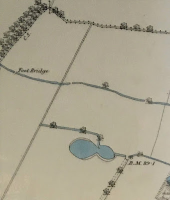
All of which is fine but runs into the buffers when matched against our own Chorlton Skating Rink which seems to have dated from sometime after 1905.  

The building does not appear on the OS map of 1907 which was a surveyed two years earlier but is referred to by a “H” who sent a picture postcard of the rink on January 17th 1907 to Albert, adding that  “This is a photo of Chorlton’s Skating Rink.  I had a dust on it on New Year’s Day and it is OK”.

The Chorlton Ice Skating Rink, 1907, painted in 1946
Which seems to be confirmed by a local artist who painted the building in 1946 from another picture postcard dated 1906.

That it was well established by 1909 is further confirmed  by listings in the newspapers advertising skating shows and hockey matches between Chorlton and rival teams.

So, on October 20th of that year, for the price of 6d you could have seen “Professor Hurst the Great Trick Skater” and the following night cheered on Chorlton as it played Ashton. 

At present the early business history of the place is fragmentary.

I know that in 1910 it is referred to as the Chorlton Rinkeries when it was the venue for the Chorlton-cum-Hardy Amateur Gardeners’ Society which held it annual show there on August 13th, but regularly was also described as the Chorlton Ice Rink.

On the Meadows, 1914
The Chorlton-cum-Hardy Ice-Skating Company only came into existence sometime between 1910 and 1911, but in 1912 A George Alfred Barker “applied for the transfer to himself of the music and dancing license of the Skating Rink, Oswald Road”.

All of which suggests that our building was branching out into new areas of entertainment, a journey which was to end in it showing films.  

In 1914 it was listed as the Longford Picturedrome in the Kinematograph Year Book Program Diary and Directory.  

It could seat 600 and its proprietor was a James Morland. Sadly that is all we have and the listing did manage to substitute Street for road in the address. 

And in the same way George Alfred Barker is little more than a name.  I know he was born in 1864, lived with his wife on Hampton Road from at least 1901 and described himself as a “Bank Clerk”.

I have yet to find out if he was a director of the company or if he was involved when the company was wound up in 1916.

What we do know is that the building went up for sale by auction in the February of the previous year.  It was described as “Timber built SKATING Rink.  The building is substantially built, lofty, and well lighted, stands on a sound brick foundation, and is built entirely of well-seasoned timber, the beams being the best Belfast trusses.  It is fitted throughout heating apparatus, electric light fittings, excellent maple floor, ante rooms, cloakrooms, lavatories, cafĂ©, exit doors, and passages each side 10ft wide.  Frontage of 115 ft to Longford Road, and 320ft. to Hartley and Oswald Roads.  The site contains 5,951 square yards or thereabouts, and is held on a yearly tenancy expiring June 1915, at a rental of £130, which can either be terminated or renewed”.*****

The Ice Rink, 1907
There was an expectation that it might appeal to “Cinema and Circus Proprietors, Entertainers, and others”.

But it seems its days as a centre of entertainment were over, and by 1935  the site was filling up with houses, which are still there today.

Just why it failed is unclear.  Perhaps the Great War had a part to play or maybe its rival the Chorlton Pavilion on Wilbraham Road proved a popular venue.  

It had started as a Variety Hall and Gardens, but also became a cinema and in 1912 underwent alterations. 

Chorlton Pavilion and Winter Gardens, circa 1906
Or our cinema audiences might have preferred the purpose built Palais de Luxe Picture House which opened in 1914 and was conveniently sited close to the new Chorlton Tram Terminus.

And the years just before and after the Great War were a time of cinema mania.

The Manchester Guardian in 1919 wrote that "No form of indoor amusement or recreation can show such a phenomenal growth as the kinema, [adding] that some twenty million people in the United Kingdom visit the moving picture show once a month .... and in Manchester despite building difficulties cinemas new picture houses are being opened".*****

The jury is out, but I am sure I will return to our skating Rink and Picturedrome.

The Palais De Luxe cinema, circa 1928
Leaving me just to thank Richard Bond and Chris Griffith who provided some additional research.

Location; Chorlton

Pictures; The Chorlton Ice Rink, 1907 from the collection of Chris Griffiths,  The Manchester Ice Palace, 1986, from the collection of Andrew Simpson, Skating on Chorlton Meadows from the Manchester Courier, 1914, “Chorlton Skating Rink (later the Picturedrome” J Montgomery, 1946 m80132, courtesy of Manchester Libraries, Information and Archives, Manchester City Council, http://images.manchester.gov.uk/index.php?session=pass Chorlton Pavilion and Winter Gardens, circa 1906, from the Lloyd Collection, and the Palais De Luxe cinema, circa 1928, Charles Ireland, GD10-07-04-6-13-01 courtesy of East Dunbartonshire Archives 

*Chorlton and Ice Skating, https://chorltonhistory.blogspot.com/search/label/Chorlton%20and%20ice%20skating

** Skating in Manchester, Manchester Guardian December 29, 1908

***Manchester Waters Busy with Skaters, Manchester Guardian, January 28, 1910

****Ice Palace Derby Street Cheetham Manchester, Architects of Greater Manchester 1800-1940, https://manchestervictorianarchitects.org.uk/index.php/buildings/ice-palace-derby-street-cheetham-manchester

*****Sales by Auction, Manchester Guardian, February 6, 1915

******Local Amusements, Manchester Guardian, December 8th, 1919

Saturday, 6 January 2024

Chorlton’s own brick works Part Two ......... a lost road and several tragedies

The development of a brick works in Chorlton by The Chorlton Land and Building Company is an interesting insight in to the way the township developed.

 It made sense to develop the clay pits for the growing building boom in the area and I guess many of the internal walls of our houses are made from their brick. The Egerton and Lloyd estates who owned most of the land in Chorlton were keen to prevent industrial development. Chorlton was too valuable as a residential area to be having the smoke stacks of factories dominate the landscape.

The brick works had a short life but there is still some evidence of its presence. I am told that it is still possible to dig up the odd brick on the site and the tall chimney of the works was still standing in 1959.

On a more tragic note, throughout the 1920s and 30’s newspapers reported the deaths of young children who had fallen into to the water filled pits and drowned.

The works attracted labour from outside the township. Ernest Stubbs was born in 1879 in Kendal. Sometime around 1901 aged just 22 he had made his way here to Chorlton and was living with the Hartington family. 
 There was also Joseph Hartley who had been born in Wakefield across the Pennines in 1844 and his wife in Rochdale.

Ernest later moved in to a tiny row of terraced houses off Longford Road in Cardiff Road. In 1909 there were eleven houses on the road and four of the householders were connected with bricks. Two were brick makers and two brick layers. Cardiff Road had a short life. It was built sometime after 1903 and may have been demolished by the 1940s. There is however a tantalising clue to its exact location. At the top of Longford Road there is the entrance to St John’s playing fields. The slight curve of the road matches that from the OS Map of 1907. More research will need to be done to date the demolition of Cardiff Road and there may still be people who either remember it or may even have lived there.

And Tony Heslop has added, "I remember the clay pits being filled in around 1961.at that time we lived on Newport Road, my brother and I went to watch the bulldozers in operation, and both lost our whit week shoes in the deep mud. The factory chimney was still standing then".

Location; Chorlton, London

Map; Longford Road, the brickworks, and the lost Cardiff Road, from the 1907 OS map of Chorlton

Friday, 5 January 2024

Chorlton's own brick works Part One

Not a lot of people know about the Chorlton brick works.

 After all it had a short life less than 40 years.

It was concentrated around the Oswald Road and Longford Road axis and was a continuation of the practice of extracting marl for farming and clay for brick making which went back to at least the early 17th century.

At the turn of the 19th century The Chorlton Land & Building Company Ltd was given permission to use the land. No doubt a reflection of the need to bricks for the new housing boom here in Chorlton which had been in full swing since the 1880s.

The Chorlton Land & Building Company reserved the rights to “Mines & Minerals” which was an important consideration because the clay pits for brick making were on Oswald Road. There were marl pits just behind where the library is now in 1841 and Brick Kiln Pits roughly where Longford runs into Oswald Road. In 1907 this had developed into a largest brick works behind the houses on Longford and Chepstow. St John’s School sits on what looks like the works buildings, while the clay pits seem to be where the playing fields are now.

It remains the only industrial development in the township and was given only a limited period to exploit the land. Neither of the two large landowners who had controlled the area since the late 18th century wanted to see industrial development preferring to maintain the old township as a place for residential settlement.

Location; Chorlton, Manchester

Picture; Brick works, corner of Longford Road and Manchester Road, A H Downes, 1958, m18034 Courtesy of Manchester Libraries, Information and Archives, Manchester City Council. http://images.manchester.gov.uk/index.php?session=pass

Tuesday, 15 August 2023

Just below your feet …….. a bit of the 19th century

If I am honest it is a daft title ….. allowing Eric of Needham Road to explode with the comment “of course there is history below the ground, I’ve got plenty in our back garden from the remains of a dead cat to heaps of broken pottery”.

Wilbraham Road, 2023

But it is the lead into a series of pictures taken by Peter Topping recently of Wilbraham Road during the resurfacing work.

Wilbraham Road, 2023
And this time it is those stone setts which formed the road surface during the late 19th and early 20th centuries, before the widespread application of tar macadam.

And yes at one time there was a debate about whether to use wooden blocks or stone ones.

If you are lucky and it is a main road, you may well also come across fragments of tram rails, which were just covered over when trams were replaced by buses.

Beech Road, 2014
And that is about it.


Location. Wilbraham Road

Wilbraham Road, 2023


Longford Road, circa 1900

Pictures, what grandma would have walked past on Wilbraham Road, 2023, from the collection of Peter Topping, a stone sett, 2014, from Beech Road, from the collection of Andrew Simpson, and Longford Road circa 1900 from the Lloyd Collection

Thursday, 19 December 2019

Going to the “flicks" on Longford Road in Chorlton in 1913

Now as a story it is less a detailed and comprehensive piece of history and more just another tantalising clue to how we enjoyed ourselves in 1913.

The Skating Rink and Pucturedrome, 1946 from 1906
Back then the cinema was still in its infancy but that said already from Didsbury down to Withington and across to Whalley Range there were picture houses.

Some like the one on Elm Grove in Didsbury were pretty small fry.

It was called the Bijou Electric Theatre and could accommodate 350 but still bigger than the Manley Park Palace on Clarendon Road which could seat just 200 customers.

Advert, 1914
For those wanting a bigger cinema locally there was only the Chorlton Pavilion on Wilbraham Road which could hold an audience of 800.  It had been operating as a Variety Hall from the early 20th century and was the best you could get in Chorlton-cum-Hardy in 1913.

Or so I thought, because just a few minute’s walk away was the Longford Picturedrome, on the corner of Longford and Oswald Road.

It was a place that has slowly crept into my knowledge.

It  first came to my attention when I came across a painting by J Montgomery who painted the place in 1946 from a photograph dated 1906

He referred to it as “Chorlton Skating Rink (later the Picturedrome”.

There is a reference to as the Chorlton Skating Rink when it was wound up as a company in 1916, but I have always been fascinated by the Montgomery’s use of Picturedrome.

And now I am a little closer to adding a bit more to the story.

In 1914 it is listed as the Longford Picturedrome seating 600 and its proprietor was a James Morland.

Sadly that is all we have and the listing did manage to substitute Street for road in the address.

There was a Mr Moreland living in Old Trafford just a few years earlier but that is it.

As to why it closed I have yet to find out.

It may be the competition with its close rival proved too much, or the Great War finished it off.

That said I am confident that we will find the answer in time.

Location Chorlton

Picture; “Chorlton Skating Rink (later the Picturedrome” J Montgomery, 1946 m80132, courtesy of Manchester Libraries, Information and Archives, Manchester City Council, http://images.manchester.gov.uk/index.php?session=pass and advert from The Kinematograph Year Book, 1914 page 43

*The Kinematograph Year Book Program Diary and Directory 1914

Monday, 18 February 2019

The lost photograph ..... the mystery of Chorlton’s Ice Rink ... and the walk through our past on Sunday

Now here is a story which has been a long time in the making.

It concerns our own Chorlton Ice Rink which stood on the corner of Longford and Oswald roads.

On Jan 17 1907, “H” wrote to Albert, that “This is a photo of Chorlton’s Skating Rink.  I had a dust on it on New Year’s Day and it is OK”.

I first came discovered, it when I came across a painting by J Montgomery who painted the place in 1946 from a photograph dated 1906

He referred to it as “Chorlton Skating Rink (later the “Picturedrome”).

But until this week the original photograph was lost, but I rather think this may be the one Mr Montgomery used.

The building belonged to the Chorlton Skating Rink which was wound up as a company in 1916, but its time as a cinema was limited to just Montgomery’s reference to the Picturedrome.

In 1914 it is listed as the Longford Picturedrome seating 600 and its proprietor was a James Morland.

Sadly that is all we have and the listing did manage to substitute Street for road in the address.

There was a Mr Moreland living in Old Trafford just a few years earlier but that is it.

It may be the competition with its close rivals proved too much.
The Chorlton Theatre and Winter Garden had opened in the early years of the 20th century as a variety hall and doubled up as a cinema, while in 1915 a purpose built picture house had opened on Barlow Moor Road.

The combined competition may just have proved too much or it might have been the  war that finished it off.

Either way you can find out lots more on Sunday when we walk our past and call in at the site of the Chorlton’s Ice Rink.

The walk which is part of Chorlton Book Festival, will start from the the Library on Sunday November 18 at 2 pm and take about an hour, after which we will relax in The Edge Theatre, Manchester Road.

Beverley from the library service informs me that “tickets are £7.50 including soup and a roll at the Dressing Room cafĂ©, The Edge Theatre, Manchester Road, M21 9JG after the walk. 

Booking is essential for this popular event. 

Please visit Chorlton Library or call 0161 227 3700.

Walking Chorlton's Past, Sunday 18 November 2 - 4pm"

Location; Chorlton

Picture: The Chorlton Ice Rink, 1907 from the collection of Chris Griffiths and cover from The Kinematograph Year Book Program Diary and Directory 1914

*Chorlton Book Festival, November 16-24, https://www.chorltonbookfestival.co.uk/


Wednesday, 24 January 2018

To tarmac or not ......... that is the question in Chorlton this evening

Now there has been a flurry of comments across the social media platforms about the resurfacing work that is going on a pace across Chorlton.

And as ever to adapt President Abraham Lincoln, you can please all the people some of the time and some of the people all the time but you cannot please all the people all the time.

So in the space of a few days we had those pinning for the lost of the stone setts and calling for the council to “leave our streets alone” to those who couldn’t abide the prospect of riding a bike or driving their car over the wibbly wobbly surface.

Added to which some people called them cobbles which they are not and no one picked up on the debate in the 19th century as to whether stone of wooden blocks would be better.

I do remember Dad coming home with wheelbarrows of the wooden variety lifted from the street round the corner and using them as fuel for our kitchen stove.

And this just left Andy Robertson to go out and photograph Oswald Road yesterday, and then remembering that there is a picture of Longford Road from the Lloyd Collection which regularly appears on the blog dating back to the early 20th century.

Enough said.  Compare and contrast, answers on an old fashioned postcard, please.

And to start you off ...... anyone spot the litter?

Location; Chorlton

Pictures; Oswald Road, 2018, from the collection of Andy Robertson and Longford Road circa 1900 from the Lloyd Collection 

Monday, 1 May 2017

The mystery of Cardiff Road in Chorlton

I wonder if there is any one left who lived in Cardiff Road in Chorlton.

In 1907
It was a small road of just eleven houses and I guess it owed its existence to our brick works which stretched along Longford Road.

The brick works opened at the beginning of the 20th century and Cardiff Road with its 11 houses  dates from just sometime between 1903 and 1907.

Four of the householders were connected with bricks. Two were brick makers and two brick layers.

In 2015
Today all that is left marking the road and its houses are these gates which Andy Robertson photographed this week.

Now I have never bothered to find out when they were demolished.

They were still there in the 1930s and probably went when the brick works were demolished which was sometime in the 1970s.

Already a decade earlier the works had been closed and attracted local lads drawn by the  opportunities to explore the derelict buildings and of course because they were a place of secrets.

In time I will track down the directories and work my through the pages from 1933 year by year until I discover when they were demolished.

Although the directories only go up to 1969 and I have a feeling the houses might have gone in the 70s, so we shall have to wait for someone to come forward.

And today a day after I reposted the story it has taken a turn with Stephen writing in to say that, "talking to a neighbour who lives opposite there and she says the photograph isn't where the road was. There's another curb a little further along where Cardiff Road actually started."

Location; Chorlton-cum-Hardy

Picture, entrance to Cardiff Road, 2015, from the collection of Andy Robertson, and detail of Cardiff and Longford Roads from the 1907 OS for Manchester

Wednesday, 11 January 2017

Looking for lost pictures of Chorlton and memories of Cardiff Road

Longford Road,, and that lost Cardiff Road, 2015
Now as pictures go it is not the most promising of images, but it offers a story.

That said if you want to know about the lost road which once stood beyond the gates you will have to follow the link.*

Instead I want  to ask for photographs of Longford Road including the field currently owned by the MMU.

And before any resident worries that this is part of a development bid rest assured it is just the start I hope of a series of stories about this end of Chorlton, and in particular the brick works which has featured on the blog and which still stirs the memory of those now in their 60s. who once played amongst the old kiln and ran at the first sight of  "Duffy."

Picture, entrance to Cardiff Road, 2015, from the collection of Andy Robertson

*Chorlton's industrial history, http://chorltonhistory.blogspot.co.uk/search/label/Chorlton%27s%20industrial%20history


Friday, 14 October 2016

The case of the missing things ........... down on Longford Road

Now I have to admit I was rubbish at those spot the ball competitions which seemed to be in all the popular Sunday newspapers when I was growing up.

And that might explain why I was stumped when Andy Robertson sent over this picture of Longford Road and asked what was missing.

I thought it might be the absence of a familiar building which Derek the Developer deemed a blot on the landscape and even wondered if they had once had yellow lines which have vanished.

But I confessed defeat only to be told that there were no cars.

Which I grant you is unusual and takes you back to a time before the beginning of the last century.

The explanation is of course that the road was being resurfaced which in that great scoreboard kept by me and Andy means its one up to him.

But then he is the proud possessor of both a badge for Observation awarded first by the Cubs and another by the Scouts.

Which makes me shout that this was unfair playing field and also makes me wonder when the picture will reappear in Martin’s Moments of Chorlton’s history or Susan’s pub quiz, neither of whom I suspect will credit Andy.

I await round two Andy .......

Location; Chorlton

Picture; Longford Road, 2016 from the collection of Andy Robertson

Saturday, 27 June 2015

Down at Rybeank Fields off Longford Road, with a belt of mature woodland some patches of native bluebells and a bit of our history

Ryebank Fields is one of those places I have rather just taken for granted.

It’s that bit of open land at the bottom of Longford Road which for a big chunk of the 20th century was the site of our old brick works, and before that an area of pasture and meadowland.

And since the brickworks went it has slowly been developing into a fascinating site for biodiversity covering 4.6 hectares.

Its story has been covered in Stuart Marsden’s recent article  The history and natural history of MMU’s Ryebank Fields* which mixes the history of the site with a recent survey of the plant and animal life.

Written by Stuart it includes contributions from me and Lynsey Crellin an environmental consultant from The Environment Partnership (TEP), and together they “talk about the site, its history, and its current biodiversity value.”

Now this is one to read.

Picture; Ryebank Fields, 2015Stuart Marsden

*The history and natural history of MMU’s Ryebank Fields, Stuart Marsden's Conservation Research Group, http://stuartmarsden.blogspot.co.uk/2015/06/the-history-and-natural-history-of-mmus.html

Monday, 2 March 2015

On Longford Road recording another bit of our industrial past disappear

It was just a year ago that this building caught Andy Robertson’s interest.

It had for as long as I can remember been a lock up workshop and was typical of those small plots of land that never got a house and instead were turned over to light industrial use.

During the late 19th and early 20 centuries the Egerton and Lloyd Estates who owned most of the land in Chorlton began selling off small parcels to speculative builders, but never allowed the development of any heavy industry in the area.

And even the brick works on Longford Road was granted for only a short period which left just the bakery on Needham Avenue and the laundry on Crossland Road as the only thing we had close to a local factory.

But enterprising small traders did take charge of the odd stables and convert them into other use.

As for this plot I am not sure.  The 1907 OS map shows it as open land which seems to have acquired the workshop by 1933.

Interestingly it did receive a direct hit from a fire bomb on October 10 1940 during a raid where lots of other incendiaries were dropped and a high explosive bomb in Newport Road almost directly behind our lock up.

And in the year since Andy wandered down Longford Road the builders have been busy and soon a little bit of our old past will have vanished forever.

Picture; Longford Road, March 2014 and 2015, from the collection of Andy Robertson

*The way things go ...... looking for that last plot of land in Chorlton, http://chorltonhistory.blogspot.co.uk/2014/03/the-way-things-go-looking-for-that-last.html

Monday, 17 March 2014

The way things go ...... looking for that last plot of land in Chorlton

Andy Robertson sent me these pictures of a lock up workshop on Longford Road with the comment “a bit boring, I know.”

Now he is a welcome contributor to the blog and his pictures are never boring catching as they do those moments when the place is about to change.

In the last few months he has been there with his camera just as work recommenced on the old Masonic Hall on Edge Lane, revealed for most of us the extent of the new build to Oswald Road School and recorded the demolition of New Broadcasting House, the remnant of a Salford textile mill and the iconic Raby Street alms houses.

So I was not surprised that he clocked the old workshop on Longford Road and the sign announcing “FOR SALE” Building plot with full planning permission for two three bedroom semi-detached properties.”

Most of us will be able to identify that odd bit of land that somehow never got a house during the building room of the late 19th and early 20th centuries.
Some remained just plots of land, while others became workshops, garages and lock ups.

Well into the 1980s the strip of land beside the brook behind Belwood Road lay empty as did a smaller plot at the southern end of Claude Road.

My old friend Jack who had a lived good chunk of his adult life here he claimed the land by the brook and been a timber yard or nail factory, but there is no evidence for either.

That said the plot at the end of Claude Road which now Rainbow Crescent did have buildings on it as late as the 1940s and well with the living memory of many of us there was a disused petrol pump at the corner.

In the same way before the Finney Drive was built in the mid 1960s there had been a a set of workshops in the old farmyard.

And that bit of land on Longford Road had belonged to the brick company at the beginning the last century.

But the onward march of property development in Chorlton will mean that fairly soon it will become the “two three bedroom semi-detached properties” of the sign above the workshop.

All of which fits with the history of the township since Egerton and Lloyd began selling off their farmland in small chunks to speculative builders.

Pictures; courtesy of Andy Robertson