Showing posts with label Chorlton's water. Show all posts

Thursday, 18 June 2026

Of floods and weirs and peaceful places, on the edge of Turn Moss


The weir in 1915
I really don’t do enough pictures on the blog and rarely do those then and now sort of stories.  So here with the help of Nigel Anderson and Michael J Thompson of Hardy Productions UK* are some shots of the weir on the edge of Turn Moss just where the river takes one of its dramatic twists.

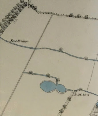
Now the Mersey is prone to flooding and after a particularly bad flood in 1799 the weir was built to channel storm water across the plain and into the Kickety Brook and so lessening the danger to the aqueduct which carried the Duke’s Canal.

And floods and the story of floods regularly pop up on the blog including the tale of the weir and Kickety Brook,.

Almost the same spot today © Nigel Anderson
So when Michael told me that he and Nigel had been down at the weir I just had to ask permission to use their photographs, along with two from 1915 which was the last time it served the purpose it was built for.


Their pictures show a benign spot, but it was not always so.

The river could flood with little warning and on one occasion a farmer just had time to release his horses from the cart as the water swept across the open land.

The weir from the flood plain, 1915
Another time in the July of 1828 flood water transported hay ricks from the farm behind Barlow Hall down to Stretford only later to take them back, while later floods proved to be even more destructive with one destroying the bridge across Chorlton Brook.

It was, wrote Thomas Ellwood the local historian
“no uncommon thing to see the great level of green fields completely covered with water presenting the appearance of a large lake , several miles in circuit,” and he recorded six major floods between  December 1880 and October  1881.

Looking towards Kickety Brook from the weir © Michael J Thompson


Not that it always worked.  Soon after it had been built flood water swept it away and during the nineteenth century neither the weir nor the river banks prevented the Mersey bursting out across the plain.

This happened in 1840 and in the following year it was rebuilt by the engineer William Cubitt.

After litigation the cost of repair was borne by the Bridgewater Trust who paid out £1,500, the Turnpike Commissioners £500, Thomas de Trafford £1,000 and Wilbraham Egerton £1,000.

*Hardy Productions UK https://sites.google.com/site/hardyprodsuk/

Pictures; of the weir in 1915 from the Lloyd collection and the weir today courtesy of Nigel Anderson and Michael J Thompson


Saturday, 23 August 2025

When the Brook emited "noxious odours and offensive gases which polluted the air"


I would have liked to have listened into the discussions between the seventeen Chorlton households who sometime in the summer or autumn of 1863 decided to ask the city of Manchester to build a water main.  

Up till then we had relied on wells, pumps and ponds for our drinking water.  Not that they were going to be enough, for while they might have served our needs in the past there was soon to be a pressing need for alternative sources of supply.

So while George Whitelegg had built his two fines houses on Edge Lane with a joint well in 1863 in the following January the Water Works Committee of Manchester Corporation  resolved “to  authorise the laying of a service Main in Edge Lane ........... for the supply of the houses situate in Chorlton cum Hardy”

The request had come from 17 of the principle residents and the 3 inch main extended down Edge Lane, along St Clements Road to the Horse & Jockey.

All of which was rather timely given that many of the existing sources of water were either drying up or becoming polluted. The small water course which had fed Blomeley’s fish pond on the Row had become so full of rubbish that it was flagged over and the stones then covered with ash and earth.

And a little over ten years later there were serious concerns about the quality of water in the Chorlton and Longford Brooks, which flowed through the township.  In 1875 a special conference had been convened in Manchester between the city council “and a large number of members of sanitary authorities and local boards” to discuss “what steps should be taken on the subject of the outfall of sewage and filthy matter” in the water courses across south Manchester.*

A decade later the Withington Urban District Council reported that Chorlton Brook “is  being constantly polluted with the sewage and other liquid refuse of several large manufacturing towns” and “emits most noxious odours and offensive gases which pollute the air.”  So much so that the Bridgewater Navigation Company had “discontinued using the water for some time past owing to its polluted state.”**  A state of affairs which was no better in 1907 when one newspaper reported “faecal matter” clearly visible in the water.

The very real threat to the health of the township became a a serious cause for debate in the May of 1886 but that is for tomorrow.

*Pollution of Streams about Manchester, the Manchester Guardian November 6th 1875.

**Pollution of Streams in the Withington District, the Manchester Guardian September 12 1885


Picture; Brook Road Bridge and the brook, 1909, City Engineers, Courtesy of Manchester Libraries, Information and Archives, Manchester City Council, m78027

Wednesday, 20 August 2025

Defending Chorlton and Didsbury from the fury of the Mersey

Now there is a caption competition here but I leave that to the swift of mind who can call up a witty aside on the turn of a sixpence.

All I will say is that we are back in 1966 at that point on the Mersey where the new bridge crosses the river by the pub.

And not for the first time over the last few centuries work is underway on the river banks,

These have been raised and raised to protect us from the river which in the past could flood with little warning and cover the meadows in a lake which stretched for miles.

The last time this happened on our side of the Mersey was in 1912 and there are pictures of the flood water poring over the weir which had been built to protect the Duke’s Canal.

There are plenty of stories of those flash floods which during the 19th century were common enough to enter local folk lore and have been reproduced in the book on Chorlton-cum-Hardy.*

And that is about all I am going to say other than that the story of Jackson’s Boat and its many different names is covered in that book and in the latest on Chorlton’s pubs and bars.**

But I shall just finish with one last comment on the image which and has recently come to light through a new project.

Neil Simpson tells me that "the Town Hall Photographer's Collection Digitisation Project, which is Volunteer led and Volunteer staffed, is in the process of systematically scanning the 200,000+ negatives in the collection dating from 1956 to 2007.

The plan is to gradually make the scanned images available online - initially on Manchester Archives+ Flickr and later on other Archives+ digital platforms.***"

*Manchester City Council Archives+ Town Hall Photographer's Collection Flickr Album...

And that is all I have to say other than a thank you to Neil and the team.

Location; Chorlton

Picture; Down by the Mersey, 1966, courtesy of Manchester Libraries, Information and Archives, Manchester City Council, http://images.manchester.gov.uk/index.php?session=pass

*The Story of Chorlton-cum-Hardy, Andrew Simpson, 2012, https://chorltonhistory.blogspot.co.uk/2014/12/the-story-of-chorlton-cum-hardy.html 

**A new book on the pubs and bars of Chorlton, https://chorltonhistory.blogspot.co.uk/2017/05/chorlton-pubs-and-bars-book-has-arrived.html

***Manchester City Council Archives+ Town Hall Photographer's Collection Flickr Album...

Monday, 7 July 2025

“that plague has entered almost every house in the village which contains children.”


The April and May of 1886 were anxious times for any in the township with children for we were in the grip of a measles epidemic.

This according to one resident “has been ranging for many weeks now” with the result that “between two hundred and three hundred of our children have been attacked and five or six have died.”*

And the issue was bound up with bigger concerns of the general lack of sanitation and the tardiness of the public health authorities to act in the face of the epidemic

There had been growing disquiet about the high level of pollution in Chorlton Brook since at least 1875 with the local board a decade later commenting that it “is being constantly polluted with the sewage and other liquid refuse of several large manufacturing towns” and “emits most noxious odours and offensive gases which pollute the air.”**

And in 1881 a government inquiry called for the closing of the parish churchyard because the place was not only full but in an effort to accommodate more bodies, the authorities had resorted to removing some and burying others within 22 inches of the surface.  Added to this there was the assertion that there “were a great number of houses here which are jerry built... and one or two spots where hollow places have been filled up with stuff which is nothing more than night soil.”

Here then was a real threat to public health made worse by the unwillingness of the authorities to close the schools during the epidemic with the result “that the plague has entered almost every house in the village which contains children.”

Of course the authorities and medical opinion sought to argue an alternative picture.  It was said by Dr Rains that the epidemic was “now passing away” and “the death rate has been very small.”

And at the heart of the rebuttal was the plain fact that “The death rate varies, as we all know, in the different townships, but the rate per 1,000 in different townships of children under five years of age in 1885 was as follows, Withington 3.3, Didsbury, 4.3, Chorlton-cum-Hardy 3.2 Burnage 5.5 showing very much in favour of Chorlton.”

But then there are statistics and dammed statistics, and when the figures are viewed over a longer period there may well have been less room for complacency.  Taking the years from 1881-4 together and comparing the death rate across the townships Chorlton recorded the highest deaths of under fives per thousand of the population.

But measles is not caused by poor sanitation.  And in the absence of hard evidence about the state of housing conditons it is difficult to draw a conclusion about the general threat to public health.

By the 1880s there were only six houses left which were wattle and daub which one Parliamentary Committee had argued were often no better than hovels.  True there were plenty of brick built cottages which were just one up one down and many that predated 1840 and there was still overcrowding in some of them.  But Dr Rains maintained that “the main drainage of the place being very good, that all dwellings are connected therewith, under the superintendence if the surveyor to the Local Board.”

Nor if he can be believed was there any evidence of Typhoid during the period which along with Cholera is a bed fellow of unsanitary conditions.

So despite the concerns over the smelly brook and the odd set of bones on the highway perhaps he was right when he asserted that people wanting to settle here could be confident that Chorlton was “more healthy than most others round Manchester whatever their elevation may be.”  And he had come “here for the good of my health in June 1868.”

Of course I might yet be proved wrong.  But then that is the fun of history. You do the research, draw the conclusions, write what you think and then something new pops up.  Well we shall see.

Location; Chorlton, Manchester

Pictures; extracts from the Manchester Guardian, 1885

*Samuel Norbury Williams, letter to the Manchester Guardian May 17th 1886.

**Pollution of streams in the Withington District, Manchester Guardian September 12 1885


Thursday, 24 October 2024

A map .....some ponds .... and a bit of the Longford Brook ……..

I am looking at one of my favourite maps of Chorlton-cum-Hardy.


It was produced for the Withington Local Board of Health in 1881, and I have Ricard Bond to thank for copying this section.

The Withington Local Board of Health was established following the Public Health Act of 1876, and covered the four townships of Burnage, Chorlton, Didsbury and Withington, and along with building the sewage works commissioned the map.

It is a beautifully detailed map and I have chosen the section which covers the area to the west of what is now the library stretching almost as far as the Longford Estate.

There is much to take in including the 27 properties that made up Fielden Terrace which was a community in itself, along with the Longford Brook, the Canal Feeder and the set of ponds some of which will have been the result of excavating marl and clay, a practice which went back to the 17th century.

These I have written about over the years and came back to recently.*


What I had never noticed before was the footbridge across the Longford Brook, which I guess vanished when this stretch went underground, leaving just a small section through Longford Park open to the sky. There are those who can remember when it was still there to see.  Equally another short bit in front of Copley Road was still exposed as late as 1934.

Just when most of it went underground is as yet unclear.  It was there in 1907 but had vanished by 1933.

And that is it.


"Although I copied the map, I also did not notice the footbridge until much later. As you say, this is a bridge over Longford Brook, not the canal feeder - the canal feeder is the watercourse running parallel to the Longford Brook, a little to the south, so OS have mis-labelled it. The section with the footbridge was culverted by the time OS surveyed a new map in 1892, see https://maps.nls.uk/view/126523724#zoom=5&lat=7759&lon=9124&layers=BT 

Note that the trees shown at top left are roughly where the present tree line of the eastern boundary of the disc golf course is located. The trees marked the then eastern boundary of the Longford estate but between 1876 and 1881, John Rylands and the Lloyd family exchanged lands, the result being the artificially straight boundary line running roughly N-S, to the east of the foot bridge. By 1892, Enriqueta Rylands had planted the present line of poplars, next to the boundary with Ryebank Fields, to mark the new boundary of her estate".

Location; Longford Road

Pictures; west of Martledge close to the Longford Estate, 1881 from the Withington Local Board of Health map, 1881,courtesy of Trafford Local Studies, and copied by Richard Bond

*Of clay pits ...... meandering streams …….. and plenty of ponds …… walking west of Martledge in 1854, https://chorltonhistory.blogspot.com/2021/11/of-clay-pits-meandering-streams-and.html


Saturday, 20 April 2024

When “buckets of water were the only supply of any but rain and spring water.”


Revisiting an old story.

Now I do not think there is anything romantic about having to collect a bucket of water from the local well.  

I know it is still what millions of people have to do across the world and it just makes the daily round of maintaining a household just that bit more difficult.

And that is what went on here well into the middle of the 19th century.

The first piped water arrived from Manchester in 1864 along Edge Lane and went to just 17 households.

The year before when Stockton Range opposite the new parish church was built it included two wells inside the house.

So wells, pumps and ponds were pretty much how we got our water.  And there was plenty of the stuff, along with the Brook to the south of the village  and Longford Brook running through Martledge* there was Rough Leech Gutter which followed the route of Corkland Road before meandering down what is now Wilbraham Road and then out to Turn Moss.

There was the village pond by the Bowling Green Hotel and an impressive stretch of water known as Blomely’s Fish Pond which stretched along Beech Road from Acres up to Chequers Road and dotted all over the township were smaller ponds many of which were old clay and marl pits which had been left to fill with water around what was once called the Isles and is now the Oswald Road, Langford Road area.

Our farm houses and the bigger houses had their own wells as did some of the cottages while other families had to share.  The Higginbotham family who lived on the green only filled there’s in sometime during the 1960s, while the pump at Bailey’s old farm on the Row** was still standing in the 1970s. 

But however close the source it still had to be collected and a family might need several buckets of water a day which had to be drawn and carried home.

Even in those grand homes it was someone’s job to pull or pump it up from the deep and take it to where it was needed.  And in humbler homes the walk to the nearest supply could in itself be a real chore. 

Mrs Williamson writing in 1883 described how the villagers of Lady Barn regularly had to visit a pond in a nearby hay field to collect  “buckets of water where with to clean their houses, this being the only supply of any but rain and spring water.” ***

Henry Stephen’s who write the manual on farming in the mid 19th century estimated
 “the cost of digging a well in clay, eight feet in diameter and sixteen deep and building a ring three feet in diameter with dry rubble masonry is only L5 [£5] exclusive of carriage and the cost of pumps.”

The earliest pumps in the township would have been made of wood, with the central part coming from a hollowed tree trunk and different woods used for the different parts of the pump.  Later lead and cast iron pumps were made replacing the old wooden ones.

Both pumps and wells which were shared were focal points where people met and exchanged gossip. And on long hot summer days  the pump provided our children with a source of entertainment.

Still, as idyllic as this may seem by the 1880s the supply was no longer enough and was already becoming polluted, but that is for another day.


Picture; from the collection of Lois Elsden taken from one of the posts on her blog,  http://loiselsden.wordpress.com/


 *Martledge is the area from the four banks down to the Library and across to Longford Nichola and Newport Roads

**The Row was the old name for Beech Road

*** Williamson, W. C., Sketches of Fallowfield and Surrounding Manors Past and Present, John Heywood Manchester, 1888, page 38


Sunday, 23 February 2020

Ghost ponds on the wireless …….with a nod to our history


I am fascinated by the lost ponds, water courses and wells which lie hidden and forgotten across south Manchester.

Chorlton Clough, circa 1900
And ever since I wrote the book on ruralChorlton-cum-Hardy, I look for evidence for these bits of our ancient past.*

Like the vanished village green in Withington and its much shrunken “friends” in Didsbury and Chorlton, water courses are a clue to how we lived.

These ponds wells and water course courses were all there was before the provision of mains water in the 19th century.

Look at any old map of south Manchester, and the evidence is there in abundance.  The land which was to become Southern Century was a studied with small streams, so much so that when they began work on the cemetery, they struck water just a few feet down across the area.

The Isles; 1854
Much the same is true of Chorlton, where water courses like the Rough Leech Gutter, and Blomely’s Fishpond were once important features.  

The Rough Leech Gutter ran from Sandy Lane across the Township before heading out to Turn Moss, while Blomely’s Fishpond supplied water and building materials for the inhabitants of Chorlton Row which is now Beech Road.

Quiet ponds fed by lazy streams, the Meadows, 2018
And even more striking were the mix of small ponds and meandering  little lazy streams which crisscrossed the land from Oswald Road out towards Longford Park and which were known as the Isles.

All of which leads me to a fascinating programme on Radio 4 today, from On Your Farm, which explores the often neglected farm ponds which “are a vital wildlife habitat in the working countryside but tens of thousands have been lost in the drive for greater efficiency. Anna Hill joins farmer Nick Anema and the team from the Norfolk Ponds Project as they help bring 'ghost ponds' back to life”.**

And it really has the lost, from ghost ponds, to restored ones, with a sideways look at the importance of ponds to wildlife and to our own rural history.

So …. one to listen to, and ponder on what it might tell us about where we live.

Location, everywhere

Pictures; Chorlton Clough, circa 1900, from the Lloyd Collection, and detail from the 1854 OS map of Lancashire courtesy of Digital Archives, http://www.digitalarchives.co.uk/

*The Story of Chorlton-cum-Hardy, https://chorltonhistory.blogspot.com/2011/11/the-story-of-chorlton-cum-hardy.html


Tuesday, 21 January 2020

The Kickety Brook, Stretford, once a vital part of our flood defences


I first walked the Kickety Brook with my old botanist friend, David Bishop.

It doesn’t look much but it was vital in its day for protecting the Duke’s Canal at Stretford.

The Canal dates from the 1760s and was cut to bring coal into the heart of the city and also was used by our farmers and market gardeners to ship their produce into the Manchester markets.

But the canal was close to the Mersey which could flood with little warning. In July 1828 flood water transported hay ricks from the farm behind Barlow Hall down to Stretford only later to take them back, while later floods proved to be even more destructive with one destroying the bridge across Chorlton Brook.

It was, wrote Thomas Ellwood the local historian
“no uncommon thing to see the great level of green fields completely covered with water presenting the appearance of a large lake , several miles in circuit,” and he recorded six major floods between  December 1880 and October  1881

By then the stone weir had been in place for nearly a century.  It had been built after a heavy flood in August 1799 had broken the banks where Chorlton Brook joined the Mersey.  This had led to fears that the Bridgewater Aqueduct across the flood plain could be damaged in a subsequent flood.

The weir was designed to divert flood water from the Mersey down channels harmlessly out to Stretford and the Kicketty Brook.  Not that it always worked.  Soon after it had been built flood water swept it away and during the nineteenth century neither the weir nor the river banks prevented the Mersey bursting out across the plain.

This happened in 1840 and in the following year it was rebuilt by the engineer William Cubitt. After litigation the cost of repair was borne by the Bridgewater Trust who paid out £1,500, the Turnpike Commissioners £500, Thomas de Trafford £1,000 and Wilbraham Egerton £1,000.

Today, standing beside the weir you get little sense of the force of the river in full flood. In the winter there can be a pool of water at its base stretching out across the plain but on many occasion in the past on warm summer’s days even this bit of land can be bone dry.

And likewise the Kickety Brook seems just an overgrown and quite forgotten bit of water. The last time the weir took an overflow of flood water was 1915 when these two pictures were taken.

Pictures; Higgibotham's field in flood, 1946, from a painting by J Montgomery, 1963, m80092, courtesy of Manchester Libraries, Information and Archives, Manchester City Council, and 1915 pictures from the Lloyd collection

Monday, 2 October 2017

Chorlton Brook, meadowland and a winters day

Chorlton Brook can seem a pleasant and benign bit of water.

Come across it on a warm summer’s day as it flows under the Brookburn Bridge and it looks pretty peaceful.

And when the children were young it was a favourite walk of ours, following its course past “secret pathways” and on to where it joins the Mersey.

Of course all the land on either side has changed dramatically and what you see now is a product of tipping and landscaping.

My friend David often rails against the policy of tree planting that has been undertaken over the years.

After all, everything you can see from the Brook to the river was until recently farmed as meadow land.*

Meadowland is grassland that is kept damp by the use of ditches called carriers worked by sluice gates fed from a river.

The skill is to keep the land fed with water up to an inch in depth through from October to January, for about fifteen to twenty days at a time before allowing the water to run off into the drainage ditches.

The land must then be left to dry out for 5-6 days so that the air can get to the grass.  The early watering took advantage of the autumnal floods which brought with them a mix of nutrients and silt which enriched the land.

In 1845 there were 680 acres of meadow and pasture compared to 490 arable acres and 10 of woodland.

But all of that has gone, and now pretty much the only reminder of what went on is the Brook and even that has changed.

So here are two of Andy Robertson’s picture taken sometime in the 1990s when the brook was in full flow.

Pictures; from the collection of Andy Robertson

*Remembering the meadows in the 1940s ..... the power of oral testimony, http://chorltonhistory.blogspot.co.uk/2013/05/remembering-meadows-in-1940s-power-of.html

Sunday, 18 June 2017

Watching the waters of the Brook rise in 1996

The Brook in 1996
I am back by Chorlton Brook with two of Andy Robertson’s pictures.

Now I have always had a fascination for the Brook which rises out beyond Manchester in the east, flows through the south of the city and meets the Mersey here on Chorlton.

More of this water course is open to the skies than most people realize and for me the best is the stretch from Hough End to the river.

That said some of it is still difficult to access and it really only becomes possible to walk beside it from
Brookburn Road as it meanders across the meadows.

Long ago it was where we went with the lads when they were young and more than once they were tempted by that long branch which hung over the water.

As a responsible father they never got the chance to test its strength, although I can’t say what happened when they were there alone.

In all those years I don’t remember it as high as in these pictures and is a reminder that once both the brook and the Mersey were prone to flooding.

Now those events are well documented so I shall just leave you with these two photographs and the promise of more to come.*


Pictures; courtesy of Andy Robertson

*Chorlton rivers, http://chorltonhistory.blogspot.co.uk/search/label/Chorlton%20rivers

Wednesday, 16 September 2015

Waking up to the day Chorlton was flooded .............. the Brook on an August morning

Now I know I shouldn’t have been surprised at seeing pictures of the Brook overflowing its banks earlier last month.

They were posted on social network by Michael J Thompson who wrote , “we had a substantial amount of rain overnight just before the flooding which led to the Chorlton Brook overflowing its banks into the northern part of Chorlton Park. 

Even the area in the park where the pond used to be filled up with water, having been bone dry the day before. 

The trams to the airport where stopped for a while due to the overnight flooding, and there was further flooding near Firswood which led to suspension of all services for a while between the Airport, Didsbury and Trafford Bar. 

I believe the Airport trams continued to run between Sale Water Park and the Airport. Most of the water had subsided by the afternoon.”

Looking at them under an Italian sun was to be reminded that we should never take our rivers and water courses for granted.

Certainly those who lived here in the 19th century maintained a healthy respect for them, for they not only offered water for drinking, cooking and irrigating the land but could flood with little warning.

In the case of the Mersey such floods could create a lake 3 miles wide across what we now call the meadows and one particularly fierce inundation swept away the weir in the bend of the river which had been built to protect the Duke’s Canal.

Even now there are plenty of winters when the Mersey comes close to topping those high banks which have been constructed over the centuries.

And there are plenty of pictures in the collection of the Brook coming close to overflowing its banks which is not surprising given that by the time it reaches Chorlton it is the sum of a number of smaller water courses of which the Gore Brook and the Red Lion are only two.

All of which brings me back to Michael’s photographs of a day when the brook offered up that reminder of how we should never take it or the other water courses for granted.

Pictures’ Chorlton Brook, August, 2015, courtesy of Michael J Thompson, Hardy Productions UK, http://hardyproductionsuk.com/

*Chorlton rivers, http://chorltonhistory.blogspot.co.uk/search/label/Chorlton%20rivers

Saturday, 15 November 2014

Of lost water courses and hidden places, Chorlton Brook and the River Wogebourne

Now when you write about rural communities in the past you quickly become aware just how important water courses, ponds and wells were to the well being of the place and the success of agriculture.

As few of us are directly involved in farming and only visit the countryside the connection with open water is less vital.

It comes in pipes from reservoirs high up in Derbyshire and the Lakes and is there at the turn of a tap.

And many of the brooks and rivers which openly flowed across south Manchester have long since been buried underground or have just dried up, and with them have gone the ponds and wells which have  been drained or filled in.

It remains one of my abiding fascinations and long after the book on Chorlton’s rural past* was finished I continue to hunt out the old water courses and areas of surface water.

Stream in Shooters Hill Golf Course
And of course what applied to Chorlton also applies to Eltham which is that other place I often write about.

It too was a rural community on the edge of a big city and many of its residents made a living from farming and market gardening.

So I was drawn to two articles in Shooters Hill** which is a wonderful blog about an area of Eltham I know well.

Both stories feature water courses and the search for ones that have been lost.

Now I have never thought it proper to lift other people’s research and work.  It is that simple observation that if it has been done well the first times I am not going to try and do better.

Instead I shall point you to the two links below on Shooters Hill Springs and The Lost River Wogebourne.

Both are excellent stories starting with a bit of detection and taking you by degree across both time and place in the search for these water courses.

They are  set in south east London but have an instant application to Chorlton and south Manchester because the process of identifying the streams and brooks, matching up the historical sources and oral testimony with old maps and modern ones is equally applicable to Chorlton.

Stream through Woodlands Farm
So while the the Chorlton Brook, is still visible  the Longford Brook, and the Black Brook have long gone underground, while the Rough Leech Gutter which is  my own favourite, was lost  and pretty much forgotten about.

And all of this goes a long way to explaining why  Eltham regularly appears on a blog about Chorlton.

Both were and are similar so reading about one gives a context to the history of the other.

After all what happened in Chorlton is replicated in Whaley Range, Fallowfield, Burnage and beyond so it makes sense.

And I like Eltham.

Pictures; Holland Wood from the Lloyd Collection, and reamining pictures courtesy of Shooters Hill, http://e-shootershill.co.uk/


*The Story of Chorlton-cum-Hardy, http://chorltonhistory.blogspot.co.uk/2011/11/the-story-of-chorlton-cum-hardy.html
**Shooters Hill Springs, http://e-shootershill.co.uk/springs/ & The Lost River Wogebourne, http://e-shootershill.co.uk/wogebourne/