Showing posts sorted by relevance for query omega place. Sort by date Show all posts

Thursday, 23 March 2023

Down behind Deansgate Station with the memory of a dark and forbidding period in our history

I think it must be a full decade since I wandered around the small network of streets behind Deansgate railway station.
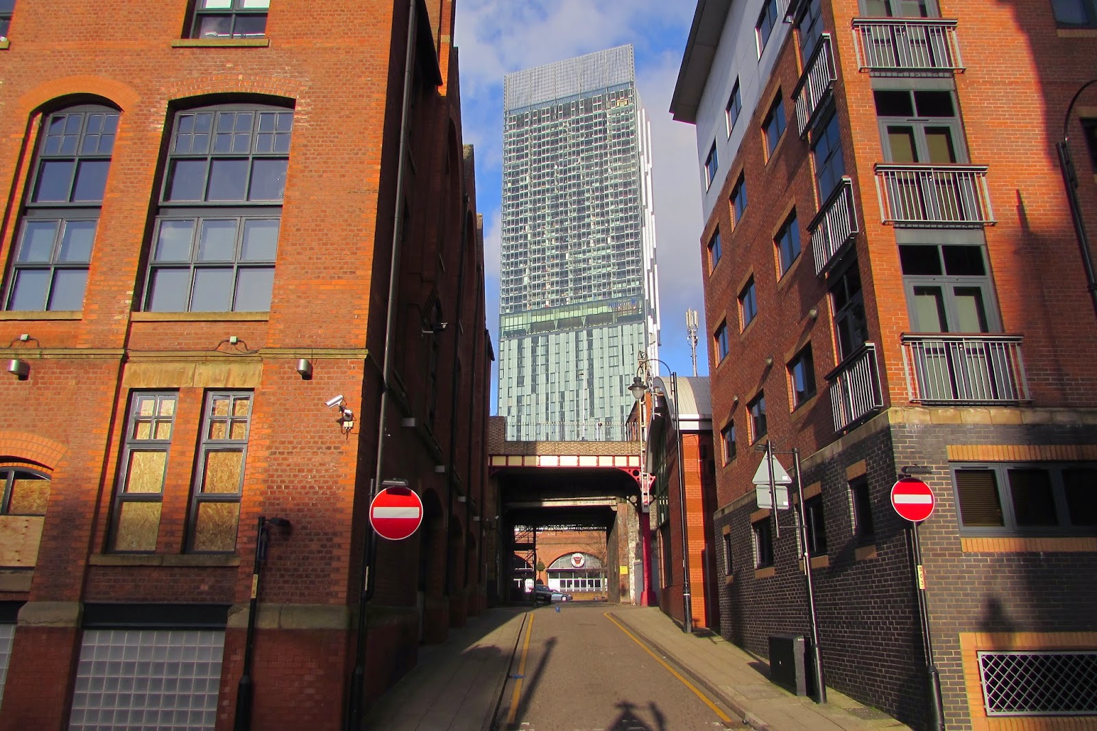
During the 1980s and into the turn of the last century the area bounded by Commercial Street, Jackson Street and Omega Place was part of a series of guided walks and talks  I did around this part of the city.*

They had started as a study of Liverpool Road Railway station grew to include the pubs, surviving houses in Castlefield along with the canal basin and spread out across Deansgate.

Back in the 1980s much of the area was still a place waiting for something to happen, and now thirty years later this has happened.  The empty and derelect buildings have either been converted into smart office and residential properties or been replaced by tall 21st century glass and steel structures.

But Andy Robertson has managed to capture a little of what I remember and looking at his pictures it is easy to conjure up those walks I made and something of what the area was like back in the mid 19th century.

Over two decades ago I wrote that

“in a small area which still keeps the original place names of Commercial Street, Jordan Street and Omgea Place, the 1853 Sanitary report records two hundred people living there in what is now a small car park.  It was still possible in the mid 1980s to see the levelled walls of the buildings at ground level.

Chorlton-upon-Medlock which also neighbours Castlefield and includes Little Ireland, had a population in 1851 of 35,546 squeezed into 6,951 houses.


The high numbers of people who were buried in the St Johns graveyard can further attest this density of living in the area. 

Between 1848-51 the burial records show 457 deaths, which is matched by an inscription, which reports that 22,000 lie in the park. 

Similar data comes from Angel Meadow where 44,000 people were buried between 1789-1816."  

The 1853 report commented that the houses on Omega Place were by no the worst properties that could be found in the area but still rereading the report is to be transported into a world of overcrowding, poor sanitation and grim prospects.

Which just leaves me to add that this was once Knott Mill Railway Station.

Pictures; Little Peter Street & Commercial Street, 2014, from the collection of Andy Roberston

*Castlefield, http://chorltonhistory.blogspot.co.uk/search/label/Castlefield

**Report on the Sanitary Condition of Certain Parts of Manchester, M126/5/1/13, Manchester Libraries, Information and Archives, Manchester City Council, quoted in Castlefield, Andrew Simpson, 2003


Tuesday, 24 March 2026

A blue plaque for Mary Clarke ……….. resident of 8 Alpha Place

Now, I don’t think I will ever find Mary Clarke.

Alpha Street, 2003
In 1853 she was living in the cellar of number 8 Alpha Place, which with Omega Place and Fogg’s Place formed a complex of back to back housing consisting of 32 cottages and fifteen cellars inhabited by 208 people.*

The three streets were bounded by Commercial street to the south and Jordan Street to the east and are just off Deansgate in Knott Mill.

I am not even sure how long she was there. Two years earlier she doesn’t feature on the census return and in 1854 she has gone.

And so far, while there are plenty of Mary Clarke’s living across the city in the 1850s, it is unclear which might be her.

Alpha Street, 1849
Nor am I surprised, because Alpha Place was another of those small streets where “poverty busied itself”.*

In 1853 it attracted the attention of the Manchester and Salford Sanitary Association which drew attention to the poor housing and lack of sanitation.**

I can’t be sure when they were built, but the first entry in the Rate Books for Commercial Street is 1836 and for Jordan Street the following year. 

All 32 properties were back to back and consisted of two rooms with the addition of a cellar.

Mary Clarke paid just 1/6d for her cellar room while the going rate for the houses ranged from 2/5d to 2/8d, which was a substantial chunk of a weekly wage.

For as along as I can remember the area has been a car park and back in the 1980s it was still possible the exposed lines of the brick walls.  On my last visit the car park had been given a make over and the evidence for those walls had vanished under tarmac.***

Alpha Street, 2022
Which is pretty much how I left it.

By the start of the new century the area had been fenced off, gained an odd-looking single-story hut in 2008, which subsequently vanished behind another fence, and since then the fences have slowly deteriorated.

Andy Robertson was down there a few days ago and pondered as he took pictures, that there was “Plenty of room for at least two 95 storey tower blocks”.

But a search of the planning portal has revealed no development plans.

So, for now the site which was home to Mary Clarke, John Fletcher, Ellen Hoole, James Brooks and another 204 people remains and empty space.

Alpha Street, 2022
Of course, I know that there will never be a blue plaque to remember Mary Clarke, but perhaps there should be, if only as a reminder of the thousands of unknown residents across the city, who lived, and worked in the menial jobs, and many of whom lived on the margins of poverty.

They are less the people who history has forgotten and more those who were never even recognized.

Location; Manchester

Pictures; Commercial Street, Omega Street, 2003 from the collection of Andrew Simpson and area in 1849 from the OS for Manchester & Salford, 1842-49, courtesy of Digital Archives Association, http://www.digitalarchives.co.uk/ and in 2022, from the collection of Andy Robertson


*Robert Roberts, The Classic Slum, Salford Life in the First Quarter of the Century, 1971, Pelican edition 1973

** Report of the Manchester and Salford Sanitary Association 1853

***Commercial Street, https://chorltonhistory.blogspot.com/search?q=commercial+street


Saturday, 15 May 2021

Following the Medlock ……….. from Gaythorn into Knott Mill

This will be the last of the short series exploring the changing landscape on either side of the Medlock as it flows from Gaythorn,  through to Knott Mill and beyond.

Old and new along the Medlock, 2021

It is one of those places rich in industrial history with more than its share of iffy housing, which consisted of numerous back to back properties and closed courts.

As late as 1794 it still flowed through open fields, but already there were was the evidence of what was to come, in the shape of a printing press, several dye works and an iron foundry.

Half a century later and these had been joined by a heap more.  

So, as the river ran through Gaythorn, it encountered the Gaythorn Chemical Works, the gasworks, a cotton mill and the Medlock Street Dye Works, before navigating the Medlock Street Iron Works, the Hulme Brewery, the Knot Mill Iron Works and finally as it passed under the Knott Mill Bridge washing up against the Brazil Cotton Workes owned by Lea Birch & Co.

Knott Mill, 1794

Some  of this industrial history was still there to see until relatively recently, although the few bits still standing had almost all been converted into other uses.

Knott Mill, 1849

And back in the 1980s the evidence of those back to backs was still visible in one cark park on Jordan Street Street.* 

The houses bordering Fogg’s Place, Alpha Street and Omega Street have long gone, but the outline of the lower bricks were still there in thirty years ago. 

Since then the cark park has been properly surfaced, the surrounding 19th century buildings transformed, and joined by bright shiny new build, some of which house offices, others housing people and some doing both.

There will be a few who moan at the new developments, but will rarely acknowledge that some of these 19th century conversions, were themselves responsible for sweeping away earlier properties or worse still building over those open fields.

Along the Medlock, 2021

And while some of the new build might not win an architectural prize, at least it might be argued they have  filled what were empty derelict spaces which in turn were bordered by decaying and sad mills and warehouses which no one wanted or could think had a useful life.

In time I will return to some of those back to backs off Jordan Street and research who lived there in the middle decades of the 19th century, but for now I will just follow Andy’s series of pictures which followed the Medlock as it flowed through Knott Mill and under Chester Road.

Location; Knott Mill

Old and new, 2021


Pictures; following the Medlock at Knott Mill, 2021 from the collection of Andy Robertson, and the area in 1794 from Green’s map of Manchester,  and in 1849 from the OS map of Manchester and Salford, 1849, courtesy of Digital Archives Association, https://digitalarchives.co.uk/

*Knott Mill, https://chorltonhistory.blogspot.com/search?q=omega+place

Friday, 24 July 2026

Looking for the lost 32 cottages and 15 cellars, home to 208 people

Looking down Commercial Street, 2015
Now I first wandered down Commercial Street sometime in the 1980s looking for Omega Street, and its neighbours Alpha Street and Fogg’s Place.

And I must have missed them by just a few years.

That said I don’t think they would have featured in any glossy guide to comfortable inner city living.

In 1853 they had formed a complex of back to back housing consisting of 32 cottages and fifteen cellars inhabited by 208 people.*

Commercial  Omega Street, 1849
Directly opposite was the Egerton Mill, while behind them there were two more and the surrounding area was dominated by more textile mills, a handful of iron works and the Hulme Brewery.

And I doubt even the most optimistic estate agent could gloss over the noise from the nearby railway or the smell from the river Medlock which flowed in a curve close by.

Back in the 1980s you could still see the outline of the house walls in what at the time was a temporary car park but when I returned some 20 years later these had vanished under new tarmac and there was nothing left to show what had once been there.

Looking across to Omega Street from Commercial Street, 2002
Now another eighteen years on and the surrounding buildings had either been demolished or made genteel and the worst I suspect in the form of pollution comes from the noise of loud music in the flats opposite or the conversation of the office workers making their way home.

And even that car park is now boarded up which may soon mean even space inhabited by those three streets and 32 cottages will be lost for ever.

Location, Manchester

Pictures; Commercial Street, 2014 courtesy of Andy Robertson, Omega Street, 2003 from the collection of Andrew Simpson and area in 1849 from the OS for Manchester & Salford, 1842-49, courtesy of Digital Archives Association, http://www.digitalarchives.co.uk/

* Report of the Manchester and Salford Sanitary Association 1853

Wednesday, 15 June 2022

Castlefield the story .............. Part Four surviving there

Housing and sanitary conditions in all our large cities were bad during the early part of the 19th century. In 1842 Chadwick had recorded the average age of death for working people in Manchester at 17 years and in Leeds at 19 compared to 38 in rural Rutland.

For many, Manchester was the shock city of the Industrial Revolution and was visited by those who wanted to see a new type of city. And many recorded how dire were the living conditions of working people.

Most of the houses in the area were occupied by more than one family, with some showing as many as three families living in one house. It is possible then that conditions were bad in Castlefield. In 1853 The Manchester & Salford Sanitary Association reported that so much rubbish had been dumped near Tonman Street, that St Matthews Church yard was in danger of being swamped by the stuff.

Dr Gautier who wrote a book on the Cholera epidemic of 1832 records that some of the first 200 cases of Cholera occurred in Castlefield, and while it is difficult to be precise because the map is unclear they could be on either Southern Street or Barton Street. In 1849 three people caught Cholera in Southern Street, 1 on Liverpool Road and three on Camp Street.

Living conditions in the Deansgate district, which bordered Castlefield, were awful in 1849 according to a history of the 1849 cholera epidemic. Earlier in the 1831 epidemic cholera deaths had been high in this area and resulted a hospital for cholera victims had been opened in Worthington’s factory on Commercial Street, Knott Mill, which is just behind Deans gate Station. It is possible then that being so close the conditions in Castlefield were similar.


Again is possible to read of equally bad conditions in parts of Chorlton-upon-Medlock in 1849 where it comes close to Castlefield and Deansgate. Here the courts at Gaythorn were particularly bad. A similar more detailed picture comes from a lecture given to the Sanitary Association by John Hatton in 1854. A survey of 17 streets in Chorlton-upon-Medlock showed that 61% of children died before their fifth birthday and 39% died at birth.

The national figure for children dying under the age of 1 year was 15%. Child mortality was equally high in neighbouring townships. Ashton-under-Lyne was a mill town about eight miles from Manchester and underwent similar changes to Manchester. One grave stone in the parish churchyard records that Charles Sharp buried his two wives and eigh children between 1836 and 1855. All but one of the children died before their second birthday.

Despite these grim facts, children did survive. In 1851 35% of the people in Southern Street are children under the age of 16, and the figure for those under the age of 6 is 13%. Figures, which bear comparison to John Street where 30%, are under the age of 16 and 12% under the age of 6. The age profile of Southern Street shows that over three quarters of the residents were under the age of 31.

Picture; Omega Place, on this carpark the 1853 Sanitary report recorded two hundred people living on this spot from the collection of Andrew Simpson

Monday, 3 October 2016

Lost and forgotten streets of Manchester .....nu 55 the vanished 32 cottages and 15 cellars, home to 208 people

Looking at the streets, 2014
Now I first wandered down Commercial Street sometime in the 1980s looking for Omega Street, and its neighbours Alpha Street and Fogg’s Place.

And I must have missed them by just a few years.

That said I don’t think they would have featured in any glossy guide to comfortable inner city living.

In 1853 they had formed a complex of back to back housing consisting of 32 cottages and fifteen cellars inhabited by 208 people.*

The streets in 1849
Directly opposite was the Egerton Mill, while behind them there were two more and the surrounding area was dominated by more textile mills, a handful of iron works and the Hulme Brewery.

And I doubt even the most optimistic estate agent could gloss over the noise from the nearby railway or the smell from the river Medlock which flowed in a curve close by.

Back in the 1980s you could still see the outline of the house walls in what at the time was a temporary car park but when I returned some 20 years later these had vanished under new tarmac and there was nothing left to show what had once been there.

The car park in 2002
Another thirteen years on and the surrounding buildings had either been demolished or made genteel and the worst I suspect in the form of pollution comes from the noise of loud music in the flats opposite or the conversation of the office workers making their way home.

And even that car park is now boarded up which may soon mean even space inhabited by those three streets and 32 cottages will be lost for ever.

Location, Manchester

Pictures; Commercial Street, 2014 courtesy of Andy Robertson, Omega Street, 2003 from the collection of Andrew Simpson and area in 1849 from the OS for Manchester & Salford, 1842-49, courtesy of Digital Archives Association, http://www.digitalarchives.co.uk/

* Report of the Manchester and Salford Sanitary Association 1853