I think it must be a full decade since I wandered around the small network of streets behind Deansgate railway station.
 During the 1980s and into the turn of the last century the area bounded by Commercial Street, Jackson Street and Omega Place was part of a series of guided walks and talks I did around this part of the city.*
They had started as a study of Liverpool Road Railway station grew to include the pubs, surviving houses in Castlefield along with the canal basin and spread out across Deansgate.
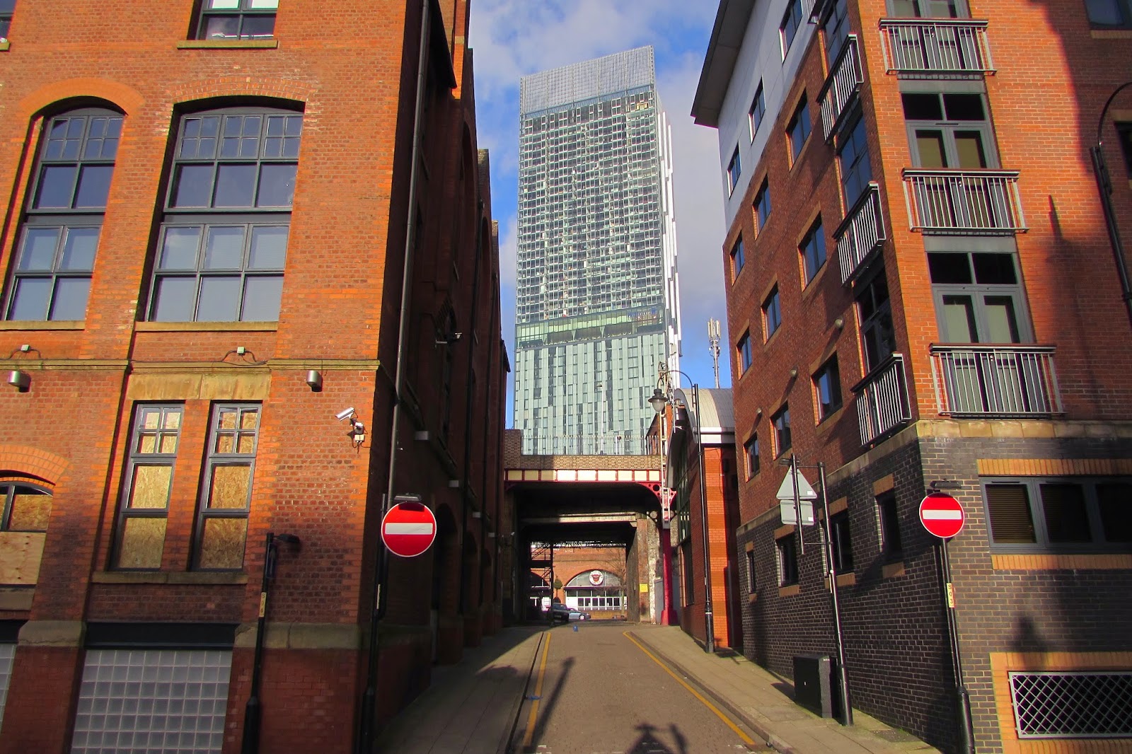
Back in the 1980s much of the area was still a place waiting for something to happen, and now thirty years later this has happened. The empty and derelect buildings have either been converted into smart office and residential properties or been replaced by tall 21st century glass and steel structures.
 But Andy Robertson has managed to capture a little of what I remember and looking at his pictures it is easy to conjure up those walks I made and something of what the area was like back in the mid 19th century.
Over two decades ago I wrote that
“in a small area which still keeps the original place names of Commercial Street, Jordan Street and Omgea Place, the 1853 Sanitary report records two hundred people living there in what is now a small car park. It was still possible in the mid 1980s to see the levelled walls of the buildings at ground level.
Chorlton-upon-Medlock which also neighbours Castlefield and includes Little Ireland, had a population in 1851 of 35,546 squeezed into 6,951 houses.
 The high numbers of people who were buried in the St Johns graveyard can further attest this density of living in the area.
Between 1848-51 the burial records show 457 deaths, which is matched by an inscription, which reports that 22,000 lie in the park.
Similar data comes from Angel Meadow where 44,000 people were buried between 1789-1816."
The 1853 report commented that the houses on Omega Place were by no the worst properties that could be found in the area but still rereading the report is to be transported into a world of overcrowding, poor sanitation and grim prospects.
Which just leaves me to add that this was once Knott Mill Railway Station.
Pictures; Little Peter Street & Commercial Street, 2014, from the collection of Andy Roberston
*Castlefield, http://chorltonhistory.blogspot.co.uk/search/label/Castlefield
**Report on the Sanitary Condition of Certain Parts of Manchester, M126/5/1/13, Manchester Libraries, Information and Archives, Manchester City Council, quoted in Castlefield, Andrew Simpson, 2003
They had started as a study of Liverpool Road Railway station grew to include the pubs, surviving houses in Castlefield along with the canal basin and spread out across Deansgate.
Back in the 1980s much of the area was still a place waiting for something to happen, and now thirty years later this has happened. The empty and derelect buildings have either been converted into smart office and residential properties or been replaced by tall 21st century glass and steel structures.
Over two decades ago I wrote that
“in a small area which still keeps the original place names of Commercial Street, Jordan Street and Omgea Place, the 1853 Sanitary report records two hundred people living there in what is now a small car park. It was still possible in the mid 1980s to see the levelled walls of the buildings at ground level.
Chorlton-upon-Medlock which also neighbours Castlefield and includes Little Ireland, had a population in 1851 of 35,546 squeezed into 6,951 houses.
Between 1848-51 the burial records show 457 deaths, which is matched by an inscription, which reports that 22,000 lie in the park.
Similar data comes from Angel Meadow where 44,000 people were buried between 1789-1816."
The 1853 report commented that the houses on Omega Place were by no the worst properties that could be found in the area but still rereading the report is to be transported into a world of overcrowding, poor sanitation and grim prospects.
Which just leaves me to add that this was once Knott Mill Railway Station.
Pictures; Little Peter Street & Commercial Street, 2014, from the collection of Andy Roberston
*Castlefield, http://chorltonhistory.blogspot.co.uk/search/label/Castlefield
**Report on the Sanitary Condition of Certain Parts of Manchester, M126/5/1/13, Manchester Libraries, Information and Archives, Manchester City Council, quoted in Castlefield, Andrew Simpson, 2003
About half way up Little Peter Street was once the converted loft apartment of 'catalyst and broadcaster' Tony Wilson.
ReplyDeleteTony Wilson Place would be the first place for people to find out the history of Knott
ReplyDeleteThere's no such thing as 'Deansgate Station'. It's real name is carved in stone.
ReplyDeleteOh dear there is that inscription to Knott Mill Railway Station high above the entrance at the front of the railway station, but "The station became Knott Mill and Deansgate (for railway purposes: to the local press it remained Knott Mill station) around 1900 and Deansgate on 3 May 1971. It is sometimes known as Manchester Deansgate, and on many station information boards it is Deansgate G-Mex" .See Butt, R.V.J. (1995). The Directory of Railway Stations. Yeovil: Patrick Stephens Ltd. p. 137. and Butt 1995, pp. 137, 77 ISBN 1-85260-508-1. R508. Leaving me just to say next time you are at Piccadilly Railway Station or London Road as it was once known try finding a train to Knott Mill
DeleteThe river dene runs beneath the area
ReplyDelete