Thursday 17 October 2024

Travels from Cornbrook and on into the city ……

 This is the book which every tram traveller should have.

Stories at the Stops, Book 2, Cornbrook to Exchange Square, 2024
It’s the second in the series telling the history of Greater Manchester By Tram.*

Book one covered the journey from East Didsbury to Trafford Bar and over the next brace of years Andrew Simpson and Peter Topping will cover all 99 tram stops on all of the eight routes across the 64 miles of the network.

And they confidently expect that heaps of the 42 million passengers who annually let the tram do the biz will read about “The Stories at the Stops”.

Cornbrook, the stairs and the passenger, 2024
So, at Cornbrook there is the tale of Pomona Gardens and its 1850 model of Vesuvius.

 At Deansgate, dark doings along the canal.

In St Peter’s Square the history of the church, the war memorial and that massacre.

Leaving a collection of historic stuff around Exchange Square including that “bile yellow” “thing” which passed for “the biggest toilet block in the world” and which replaced a wealth of secret alley ways with names like Back Sugar Lane, Seven Stars Court and Little Tipping Street.

And the odd idea of jacking up a much-loved historic building and later taking it apart and reassembling it closer to Manchester Cathedral.

Arriving at Deansgate Castlefield, 2023

Book two "Cornbrook to Exchange" along with all the Simpson/Topping collection is available from Chorlton Bookshop, and from us at www.pubbooks.co.uk, price £4.99

Crowds gather to greet a big yellow tram, St Peter's Square, 2024


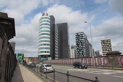
The changing scene, Exchange Square, 2014
Location; From Cornbrook to Exchange Square


Pictures; traveling from Cornbrook via Deansgate Castlefield, and St Peter's Field to Exchange Square, 2013-2024

The Rec in 1933


Long before it was Beech Road Park it was the “Rec” and depending on which name you use marks you out as a newcomer or a local.

 Now we have always called it the Rec and so do all my children which I guess says something about us.

Of all the pictures of the Rec in the collection this is my favourite and I have to own up it’s because it features our house.

The date on the postcard is 1933 and the path running along the inside parallel to Beech Road has long gone.
Otherwise apart from the size of the trees it is a scene not so different from today.

Picture; from the Lloyd collection

Working a Salford Corporation Tram in 1917 ............ Salford women in uniform

I like the way that stories have a habit of reappearing and so it is with Miss Rebecca Chapman of Hodson Street who in 1918 began work with Salford Corporation as a “clippie” on the trams.

My old friend David Harrop acquired her contract, license and handbook and they featured on the blog back in May.*

And because it was such a good story she made her way into my new book on Manchester and the Great War due out in February 2017.**

Now yes I know the title is Manchester and the Great War, but by the very nature of things people didn’t adhere to strict geographical boundaries.  

They moved from area to area, lived in Manchester but worked in Salford and Trafford and swapped homes and work places.

So a little bit of Salford has got into the book, and quite right too.

All of which is an introduction to a new short series featuring photographs of Salford women in uniform and given Miss Chapman’s contribution I have started with a picture of a clippie from 1917.

And I rather think she is holding her handbook which gave detailed instructions on how to work the tram, what to do in emergencies and the pay scales awarded to clippies.

There was even a few pages dedicated to making notes.

Miss Chapman had written soon after joining the Corporation that "she had fallen off the tram"

it was the only entry so I guess she never fell off again.

Location; Salford

Picture; Instructions to Female Conductors from the collection of David Harrop, and "uniformed woman worker with Salford Tramways," 1917, m08109,, courtesy of Manchester Libraries, Information and Archives, Manchester City Council, http://images.manchester.gov.uk/index.php?session=pass

* Miss Rebecca Chapman gets a job on a Salford Tram in 1918 .......... stories behind the book nu 23, https://chorltonhistory.blogspot.co.uk/2016/05/miss-rebecca-chapman-gets-job-on.html

**Manchester and the Great War, Andrew Simpson, the History Press, was published in February 2017, ISBN -33: 9780750 978965


Charlton in 1922

The caption on the postcard just says Old Charlton, and the date is given as 1922.

Now that’s not much to go on but it is enough to anchor the scene and allow reflection on how this bit of south east London has changed.

And no sooner had O posted the story John King offered up this view from 2017.

John has a fine collection of pictures from across London and beyond, and thank him for this one.

Location; Charlton


Picture; Charlton in 2017, from the collection of John King, and in 1922 courtesy of Mark Flynn, http://www.markfynn.com/london-postcards.htm

Looking for autumn on Beech Road …..

Nothing more historic or deep … just a few indifferent pictures of where I live.


Location; Beech Road


Pictures; Looking for autumn on Beech Road, 2024, from the collection of Andrew Simpson


Wednesday 16 October 2024

Lost stories in a forgotten street ……. the one behind Deansgate

Now it is easy to shudder and feel outrage at the accounts of housing conditions in the poor parts of Manchester in the first half of the 19th century.

New Gates, Manchester,  1908
Overcrowding, back-to-back houses, closed courts where the sun fought to penetrate, and of course a lack of sanitation matched only by parts of the developing world are the stuff of social history.

But the history books and rarely the social observers of the time burrowed deep to offer up the personal stories of those who lived in the cellar dwellings and the one up one down properties, often built in the shadow of textile mills, and iron foundries and bounded by the polluted rivers that ran through the city.  

Dr Kay, Frederick Engels and a few foreign visitors did paint a grim picture.

And more revealing is the case notes of Dr Henry Gaulter who experienced the first outbreak of Cholera during the May to December of 1832. 

He kept a detailed record of the first three hundred patients he attended describing their physical condition, the onset of the disease and their living conditions but was forced to abandon the exercise as the numbers increased.*

Royton Street, 1851
So, with that in mind I have plunged back into one street off Deansgate in 1851.  In that year it was home to 408 people who lived in 46 houses, nine of which were one roomed back-to-back properties, and the remainder, consisted of four rooms with weekly rents ranging from 1 shilling [5p] to 5s [25p].

The street was Royton Street, and history has not been kind to it.  It never featured in any of the street directories for the 19th century, and progressively lost its houses and half its length to industrial development and finally vanished under the Spinnyfields project at the start of this century.

There are only two photographs of it in the City’s digital collection, and one of those I think has either been misplaced from somewhere else or is much older than the published date.**

I came across the place by chance a few days ago, wrote about it and planned to move on but the detail is as they say in the detail and so I trawled the 20 pages of the 1851 census and then went back for some of the surrounding closed courts.***

One bit of detail was the presence of a Catholic day and Sunday school in the middle of the street, which made perfect sense given that 36% of the street’s residents were born in Ireland and a cursory look at the surrounding area suggest that this was typical.

Royton Street, circa 1880-1900
Nor would the Irish accent be the only one you could hear, for while 50% were from Manchester, there were significant numbers of residents from Scotland, Wales, Yorkshire, as well other parts of Lancashire, seven from London, nine from Cheshire, and even one from Prussia.

Their occupations were as varied as their origins, with a mix of textile workers, four policemen, an architect’s apprentice, and two teachers.

And there were the usual range of skilled trades from carpenters, painters, and glaziers to those engaged in the book and shoe trades, as well as tailors, dress makers, a blacksmith, oastler, and “brick setters.” 

But we are in one of the poorer areas of the city, and so here were labourers, house servants, and those on pensions, and poor relief.

To which we can add children, for over a third of the street were young people under the age of 15, and while plenty of these were attending school others by the age of 11, were employed as errand boys, apprentices, and servants.

Birth places of Royton Street residents, 1851
The census also records the degree of overcrowding, so our 408 inhabitants lived in just 46 houses made up of 89 households.  

Nor does this deliver the true degree of overcrowding.  So picking just three houses, which were numbers one, three, and four, together they were home to 38 people.  

At number one there were 18, divided into three households, at number three, eight divided into two households, and at number four there were 12 living in three households.

It is a picture replicated across the entire street, and while there were some big families, there were also many lodgers.  In total the figure was 72, most of whom were unmarried, were not related, and were occupied in a variety of skilled and non-skilled occupations.  

Of the 72, only 11% were from Manchester, with the rest drawn from all parts of the country, with 43% from Ireland.

Age Profile of Royton Street residents, 1851

Almost every household included some lodgers, and while there were a few “lodging houses” most families shared their home with people they were unrelated to.

All of which raises the question of how big the houses were.  

There were 14 back to back properties which might have had three rooms but equally might have had just two, and the census return is silent on the total number of rooms for these or the remaining houses.  

The surviving properties listed in 1901 indicate that they consisted of four rooms, but by then there were only 14 left which leaves the other 32 a mystery.

Royton Street, 1849
Nor it appears were there any cellars, recorded on the 1851 census.  Now cellar dwellings do show up for other parts of the city, and people are recorded as living in them, so it seems Royton Street was cellar free, or at least, from cellar occupants.

For the curious Royton Street was located between Hardman and Cumberland Streets and its course roughly follows the route of the Avenue in Spinneyfields

In the vicinity of Royton Street, Spinningfields, 2020

Occupations of Royton Street residents, 1851
Next, I have a fancy to explore some of the families and try to delve into what their lives were like.

Location; Off Deansgate, Manchester

Pictures; New Gates, 1908, m8316,  courtesy of Manchester Libraries, Information and Archives, Manchester City Council, http://images.manchester.gov.uk/index.php?session=pass, Spinneyfields, 2020, from  the collection of Andrew Simpson and Royton Street in 1849, from the OS map of Manchester and Salford, 1844-49, and Royton Street circa 1880-1900 from Goad's Fire Insurance maps, courtesy of Digital Archives, http://digitalarchives.co.uk/and Royton Street 1951, from the OS map of Manchester and Salford

All that was left, 1951

*Gaultier Henry, The Origin and Progress of the Malignant Cholera, 1833, London, & Appendix A, To the Report of the General Board of Health on the Epidemic Cholera of 1848 & 1849, 1850, London

**Royton Street, Manchester Libraries, Information and Archives, Manchester City, http://images.manchester.gov.uk/index.php?session=pass

***Lost and forgotten streets of Manchester .......... nu 95 Royton Street, 1951 https://chorltonhistory.blogspot.com/2022/02/lost-and-forgotten-streets-of.html 

Hough End Hall still a working farm in the 1950s

This will be the last of the descriptions of the Hall from Oliver Bailey whose family rented and then owned Hough End and the surrounding land.

The Hall from Nell Lane, in 1952
It is a fascinating account not least because it is the only detailed description of the place during the 20th century.

There are a few anecdotes about the place from people who remember it as children and there is the 1938 survey commissioned by the Egerton Estate.

But most of these anecdotal accounts are vague and lack detail while the Egerton survey cannot be copied or photographed.

Back in the 19th century there is a short description of the Hall by the historian  John Booker which includes an engraving * and an inventory of the contents of the farm in 1849 published in the Manchester Guardian but this  sheds little light on the Hall itself.

So Oliver has cornered the market on descriptions of the Hall in the 20th century and at anytime come to that.

And in the process of sharing these memories he provided a plan of the buildings which to my knowledge apart from the Egerton survey is the only idea we have of what was there.

The Hall and surround buildings 1950s
It confirms that part of the hall was a smithy and right up to the end the place was a working farm with Mr Bailey’s pigs, horses and cattle and Jimmy Ryan’s rabbits.

“At one time my father had Highland cattle in the field where the school once was and there may be pictures in the Manchester Evening News archive. 

"My memory might be playing tricks there, he definitely had Highland cattle but they may have been in the field near Chorlton Station or perhaps even in both locations.

He also had a peacock with a couple of peahens and for a period Hough End was nicknamed Peacock farm because of the noise they made and because the peacock used to fly across Nell Lane into the park so lots of people saw it. 

There was a deep depression in the field near the rear left hand corner of the plot of the Hall itself and it was made a by a bomb which dropped there during the second world war, certainly it was known as bomb crater corner. 

According to family history the blast knocked my father over – he was an ARP Warden during the war so could have been out at night on fire watch.

During the war there was a riding school at Hough End, a Mc somebody – a search through a trade directory might find him - and my sisters learnt to ride horses at that time. The horses were kept in the loose boxes in the long building parallel to Mauldeth Road."

All that is left is for me to thank Oliver and his family for taking the trouble to recall the old hall and just hope it provokes more memories.

© Oliver Bailey, 2014

Picture; Hough End Hall from Nell Lane, T Baddeley, 1952, m47852, courtesy of Manchester Libraries, Information and Archives, Manchester City Council, http://images.manchester.gov.uk/index.php?session=pass

Plan; © Oliver Bailey, 2014

*John Booker, A History of the Chapels of Didsbury & Chorlton, 1857, Cheetham Chetham Society Manchester