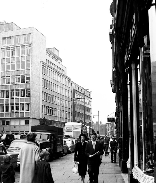
It’s just one of those age things that if you can remember cars in St Ann’s Square, you will have had plenty of birthdays.
Today, you can take your pick from a pleasant amble across the square, take in the market stalls which are a frequent feature, or just sit and watch everyone else going about their business.
Just over 40 years ago much of the square was given over to cars, lorries and coaches, and while the pavements were wide this was still a place where you had to be mindful of parked and passing traffic.
There had been moves to pedestrianize the square, and introduce open air cafes in 1962.
But the plans were shelved because of
concerns that “congestion would be caused on Market Street and St Mary’s Gate
if the square was closed to traffic”.*
This proposed “new pedestrian area in four main squares in Manchester, [suggesting] extra traffic restrictions, so that a new pedestrian route could wind through part of the central shopping area”.
The scheme would have involved changes in St Peter’s Square, Albert Square, St James Square and St Ann’s Square.
In St Peter’s Square, the Cenotaph and cross could be moved and re positioned directly in front of Central Ref, while in Albert Square, the Albert Memorial would “remain in its present place, but other statues would be moved slightly and the lavatories in the square would be removed”.
King Street was pedestrianized in1976, and St Ann’s Square in the early 1980s, leaving St Peter’s Square to be transformed in part by the coming of the Metro in the 1990s and fully transformed by the Second City Crossing, which resulted in an enlarged square, the loss of the Peace Garden and the removal of the Cenotaph to a spot outside the entrance to the Town Hall.
And for those wondering where St James Square can be found, it is the narrow street which connects John Dalton Street with South King Street.
With the passage of time it is difficult now to remember that there was a time when you had to dodge cars.
Picture; St Ann’s Square,2016, from the collection of Andrew Simpson, and in 1960, 1960 – 3107.3, 3107.4, 3107.1, courtesy of Manchester Libraries, Information and Archives, Manchester City Council, http://images.manchester.gov.uk/index.php?session=pass


No comments:
Post a Comment