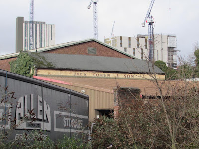
Now it seems everywhere you look there are those cranes which relentlessly march across the city, leaving in their wake a mix of tall residential and commercial towers.
 |
| The onward march of the cranes, Travis Street, 2022 |
And it is of that area around Fairfield Street, north towards Travis Street and the site of St Andrew’s Church, and south beyond the great railway viaducts that I want to write about.
But before anyone leaps to their keyboard to call down wrath on the cranes and the developers, historically this is but a new round of urbanization which had already covered the area with narrow streets, mean houses and a variety of industrial units from mills to foundries, and dyeworks, interspersed with timber yards.
My copy of Adshead’s map of Manchester from 1851 clearly shows the degree to which 19th century speculative builders had created a densely packed network of streets and courts, which nestled beside those factories and hemmed in by railway lines, canals and the river.
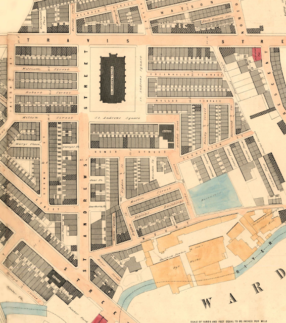 |
| From the river to the Square, 1851 |
For over four decades I have been fascinated by their history and keep coming back to the stories of the houses and the people who lived there. *
Of course, they have all gone, swept away by a mixture of municipal house clearances over two centuries, further helped by Mr. Hitler’s bombs, along with the grand plans of the railway companies which cut a swathe through those streets with their giant railway viaducts.
To which we can add the deindustrialization of the centre of Manchester which saw the mills, dyeworks and foundries close to be replaced by small businesses, car parks and open spaces.
But with a bit of imagination and armed with old maps of the area it is possible to gain a sense of just how many houses existed because much of the street plan still exists.
 |
| When the old jostles with the new, 2022 |
They may have lost their buildings but the sheer number of them brings home the density of the area.
So there is the challenge, all you have to do is wander past Piccadilly Railway Station and plunge eastwards, but do so soon, because within a few years the cranes will have done their job.
Location; east of Piccadilly Railway Station
Pictures; between Travis Street and Fairfield Street, 2022, from the collection of Andy Robertson, and in 1851, 1851 from Adshead map of Manchester, 1851, courtesy of Digital Archives Association, http://digitalarchives.co.uk/
*Fairfield Street, https://chorltonhistory.blogspot.com/search/label/Fairfield%20Street
Homer Street, https://chorltonhistory.blogspot.com/search/label/Homer%20Street
St Andrew’s Square, https://chorltonhistory.blogspot.com/search/label/St%20Andrew%27s%20Square
No comments:
Post a Comment