
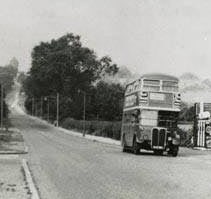
Just 87 years ago 250,000 of these were issued to Manchester school children to commemorate the opening of Central Ref in 1934.
Location; Manchester
Picture; from the collection of Linda Rigby
Picture; from the collection of Linda Rigby


One day in the Ref.

Location; Central Reference Library, St Peter's Square, Manchester
Picture; It's all in the windows, 2023, from the collection of Andrew Simpson
My association with Central Ref stretches back 54 years and across that half century and more I have always pondered on those steps through that archway and just where they led to.

But when the hours hung heavy and the promised break through from an old document was not forth coming I would ponder on what Narnia like scene would be revealed behind that wooden door.


Of course, I could just ask those I know who worked there.
But wouldn’t that be too easy?*
Location; Central Ref
Pictures; that staircase, 2023, from the collection of Andrew Simpson
*But I can not stay silent for Helen was moved to offer up "Yes they were both just offices. The one at the end of the Local Studies dept. I knew well. I think they are now just storage rooms, as there's not much wiring into them, for computers, and phones".
So no Narnia surprises then.


So, I can think of no where better to launch a book on a pub than in a pub.


We were joined by the Manchester poet Lindy Newns who read one of her stories and the event finished with a series of questions about the book, Chorlton’s past and that out rageous Sam Wilton who stole the village green.
Leaving me just to thank Iain, his staff, the brewery and all those who turned up.
The book is available at www.pubbooks.co.uk or the old-fashioned way on 07521 557888 or from Chorlton Bookshop, and costs £4.99.


Pictures; the launch in the pub, 2024, from the collection of Andrew Simpson


When you have a pub that first opened its doors in 1793 in a building which was still new when Henry VIII walked up the aisle with Anne Boleyn there are going to be heaps of stories.
 |
| The forgotten pub sign, 2024 |
 |
| The Horse and Jockey circa 1900 |
The interior has been repainted and repapered along with bits you don't see, like rewiring, and new pumps which you can see.
For me one of the crowning features is the collection of framed photographs and Peter's paintings which are taken from our book.
 |
| The rediscovered chimney breast, 2024 |
It has quite correctly been reinstalled as a talking point and the manager Iain hopes it will spark a memory of when it stood outside.
 |
| Dining in the restaurant, 2024 |
To these forgotten bits of the Jockey’s past can be added a varied collection of stories from Samuel Wilton who stole the village green from the community in the early 19th century to the inquest held in the pub to investigate the murder of Francis Deaken in 1847.
 |
| Outside the Horse and Jockey, 1936 |
I could go on but for the details of these and other stories you will have to buy the book which will be on sale on the night.
The launch will follow our earlier ones and along with a brief few words from the authors we are hoping for performances from two Manchester poets, along with the usual mix of good conversation.
The event is free, is always fun and of course allows you to explore the newly redecorated pub and relax with a drink.
Leaving me just to thank Iain and his assistant Anna for being our hosts on the night.
You can order the book at www.pubbooks.co.uk or the old-fashioned way on 07521 557888 or from Chorlton Bookshop
 |
| In the dinning room, 2024 |
.png)
Pictures; cover of Chorlton Pubs The Stories Behind the Doors The Horse & Jockey, designed by Peter Topping, pictures of the newly refurbished Horse & Jockey, 2024, from the collection of Andrew Simpson, and the pub in 1900 courtesy of Carolyn Willitts, and A 'gang' of 'teenagers' outside the Horse and Jockey circa 1936 courtesy of Yvonne Richardson
* Chorlton Pubs The Stories Behind the Doors, Andrew Simpson, and Peter Topping, 2024
**Every Chorlton pub should have its own book, https://chorltonhistory.blogspot.com/2024/02/every-chorlton-pub-should-have-its-own.html
 |
| Looking down Shooters Hill in 1909 |
Now yesterday I posted a story of Greenwich Park and the view from the hill across the River.

Not quite a 360 degree due to trees behind taller than the tower, but a zoom lens will bring the city, Docklands, the west end into view, and far to the west (out of picture) Windsor Castle looms as a shadow on the horizon”.
I still remember looking out from both locations at the city over the river.
Back in the 1960s, I had no camera to record the scene, and now I live in the far north and do not regularly get home.
But there will be someone who does have those pictures of the very different skyline and may choose to share them.
I can still remember the first time I saw the view from Shooters Hill at night.
I was visiting Mr. Vaughan who was my science teacher at Samuel Pepys, who I hoped would help me with a few textbooks to assist my retake of O level Science.
By then I had left the school in New Cross for the much grander Crown Woods and the promise of A levels, but my failure at getting Maths or Science GCE, doomed me to a resit.
Until the visit to Mr. Vaughan I had never seen the city lit up at night from Shooters Hill.
And 55 years later it is still as vivid.
So I thank Douglas and John for reuniting me with that memory.
And for all those who also remember the scene 55 years ago I shall just say “compare and contrast”
Location; Eltham
Picture; looking out from Shooters Hill, 2020 from the collection of Douglas White
Deansgate Castlefield metro stop is the place where history tumbles out in all directions
 |
| Heaps of towers, 2023 |
It begins with that network of waterways which make up the Castlefield Canal Basin, interspersed with the tall lattice structures that imitate medieval castle walls and takes in some fine 18th century warehouses, along with the spire of the old Congregational Chapel and that growing number of tower blocks which seemingly reach up to scrape the sky.
 |
| On arriving, 2022 |
But for those whose interests are elsewhere beside the entrance to Deansgate/Knot Mill is the Atlas Bar which has its own claim to a bit of history, having opened in 1999 boasts that it serves 570 different gins from around the world.
Nor is it alone for just across the road there is Deansgate Locks, while nestling in the canal basin can be found Dukes 92, and the even longer established Barca Bar all of which are part of the renaissance of the area which has gone from a busy but grubby work a day corner of the city to an elegant residential and leisure centre.
.png) |
| Atlas, 2023 |
 |
| Fort in the sun, 2022 |
The network of military establishments connected the big legionary bases of Chester and York, and like many of these forts it attracted a settlement which grew up outside its walls.
Here could be found metal workers, bar owners, merchants and anyone attracted to the Roman army which offered a degree of safety and a ready market for pretty much everything your average Roman soldier might want.
Alas only a fragment of the original fort still exists, but a series of archaeological digs in the 1970s uncovered finds from the civilian settlement.
In turn the presence of that fort led to a City Council project to recreate two sections of wall and a gateway. The construction was undertaken by apprentices from the Direct Works Department and included laying out a series of ditches which were the first line of defence.
 |
| Water, unlight and bridges, 2003 |
 |
| A rally at the Castlefield Bowl, 2024 |
.jpg) |
| Canal Basin, 2003 |
The idea of telling the story of Greater Manchester by using the tram network has a lot going for it.
You can catch a tram from the city centre and go south, east, north, and west and along the way each of the 99 stops will have a story to tell, and being the tram, you can just jump off, explore this little pocket of history and move on.
Or skip to the end destinations and discover interesting historical things about Didsbury, Ashton-Under-Lyne, Rochdale, Oldham, Salford and bits of Trafford, Altrincham and Bury.

They are available from Chorlton Bookshop, and from us at www.pubbooks.co.uk, price £4.99
Location Deansgate Castlefield
Pictures; Castlefield and Knott Mill, 2003-2024, from the collection of Andrew Simpson
*A History of Greater Manchester by Tram, https://chorltonhistory.blogspot.com/search/label/A%20new%20book%20on%20the%20History%20of%20Greater%20Manchester%20by%20Tram
Now I have been a great fan of Roger Shelley’s photographs for over a decade, ever since he shared a collection of pictures he took of a group of young lads playing in the near ruin of Hough End Hall nearly 60 years ago.

And so, I was very pleased when he posted another group of images he took during the house clearances in Hulme and Moss Side.
The pictures are a mix of street scenes, and the people he encountered, including kids at play, men and women at work and the ever present piles of rubble as the grand plan advanced and centuries old houses disappeared under the impact of the wrecking ball.

They just record what he saw.
I don't have exact locations for the images, but some can be traced through the odd street name or feature.
And with his permission I will be working my way through the portfolio, fastening on images which tell their own stories.

Pictures; from the collection of Roger Shelley, https://www.flickr.com/photos/photoroger/
*Baker, Shirley, Without a Trace, Manchester and Salford in the 1960s, 2018
 |
| South of Woolwich from Bradshaw's Inland Navigation, 1830 |
 |
| Sevendroog Castle, 1909 |
I say letters but I really mean those property sheets which are still the go to when wanting to buy a house.

But back in the day it was a matter of collecting the property sheets and sifting through them
And if you saved the details of the ones you bought you have in time a history book, offering up the cost of a house, its size, and number of bedrooms, long with things like central heating, the provision of a garage and how big the garden was.
I last bought a house in the 1980s, but of the three, only one already had central heating and all of them were woefully supplied with power points when I moved in, although they did have a telephone connection.


Their first house in Chorlton was in 1968 on Devonshire Road, and then a littler on St Webrughs’s.
And the rest I leave you to pour over and make of what you will.
Location; Chorlton
Pictures; property details of Devonshire Road, 1968 and St Werburghs’s Road, 1970s, from the collection of Ann and Howard Love
I am looking at the mosaic of “Our Lady of Good Counsel” on Stockton Road.
 |
| Our Lady, 2024 |
The main school was in Carlton House on High Lane.
The house dates back to the 1860s and has an interesting story all of which I have written about.*
In the early 20th century it was taken over by the Sisters of the Christian Retreat , and there will be many who remember attending the school before it in turn became the Islamic High School for Girls.
But with the removal of the Islamic High School to Fielden Park the site is up for development. There is a planning application in from Cube Homes who propose to build “22 high quality, energy efficient and sustainable new homes comprising 14 four bedroom townhouses, 6 two-bedroom apartments, and the retention and refurbishment of Carlton House, which will be converted into 2 homes”.**
 |
| Convent of the Sisters of the Christian Retreat, 1959 |
So I wonder the fate of Our Lady. I couldn’t see any reference to it in the planning proposals, but maybe I missed them.
The Sisters of the Christian Retreat still exist, and St John’s is just round the corner.
In the face of its possible destruction some will mutter so what, but it is a little bit of our history. Just how much of our past is unclear. The extension post dates 1956 and looks to be 60s/70s build, that said there will be someone who remembers it being constructed and might have press cuttings of the unveiling of the mosaic.
 |
| A tree, some fruit and Our Lady, 2024 |
Location; Stockton Road
Pictures; Our Lady, 2024 from the collection of Andrew Simpson and Convent of the Sisters of the Christian Retreat, 1959, A.E. Landers, m17917, courtesy of Manchester Libraries, Information and Archives, Manchester City Council, http://images.manchester.gov
*Carlton House, https://chorltonhistory.blogspot.com/search?q=Carlton+House
**Cube Homes High Lane Consultation, https://www.cubehomeshighlaneconsultation.co.uk/?fbclid=IwAR0RpY4WJSNMpEm-cSD6fIFNrQfHjnh9M1Dhccez1k9WCISxdPBYZTNpfyA
***Manchester Planning Portal, 37994/FO/2023. Erection of 12 no. 2.5 storey dwellinghouses; a pair of three storey semi-detached dwellinghouses; a three storey building comprising 6 no. apartments; the retention and change of use of the existing mansion house together with the erection of a two storey side extension to form 2 no. dwellinghouses; creation of vehicular access points, associated landscaping, car parking and boundary treatment following the demolition of the other existing buildings and structures. https://pa.manchester.gov.uk/online-applications/applicationDetails.do?activeTab=documents&keyVal=S0IQG9BCMGC00


Your starter is to suggest a date when this pub sign hung outside the Horse and Jockey.
 |
| Who can date the sign? |
 |
| The restaurant, 2024 |
The sign was discovered upstairs in a corner of one of the store rooms.
Nor is that the only forgotten secret to reappear because back in 2010 a chimney breast and an internal wattle and daub wall were uncovered which will have not seen the light of day for at least two centuries.
 |
| The rediscovered chimney, 2024 |
 |
| Outside the Jockey circa 1900 |
I could go on but for the details of these and other stories you will have to buy the book which will be on sale on the night.
The launch will follow our earlier ones and along with a brief few words from the authors we are hoping for performances from two Manchester poets, along with the usual mix of good conversation.

Leaving me just to thank Iain and his assistant Anna for being our hosts on the night.
You can order the book at www.pubbooks.co.uk email or the old-fashioned way on 07521 557888 or from Chorlton Bookshop
Location; The Horse and Jockey
Pictures; The Horse and Jockey, 2024 from the collection of Andrew Simpson and in 1900, courtesy of Caroline Willetts