Showing posts sorted by relevance for query river mersey. Sort by date Show all posts

Saturday, 23 January 2021

Walking by the Mersey in 1958 ………

Now, on this I will need help.

I am looking at two pictures of the Mersey sent to me by Dave Kennedy, yesterday evening, who added, “Hi Andrew, with the current situation on the Mersey.  I came across a couple of photos in my dad’s archive, in the background is the old sluice building at Jackson’s Boat. The cut is a lot narrower,  dates from around 1958”.


I have known Dave for years and I remain impressed with his photographs  and those of his Dad’s, many of which are of Chorlton and Stretford.*

The two pictures are a wonderful collection of period detail, from the clothes worn by Dave and his sister, to the scenes of the river and the surrounding land.

Like Dave I wore a balaclava and was made to keep my shoes equally shinny. But of course, it is the river that draws you in, along with the high earth banks, which do seem to have risen in height since 1958.

The banks stretch back into the centuries and were added to by successive generations of farmers because the river has always been unpredictable and prone to flash floods, many of which arrived with little warning.

Our own local historian, Thomas Ellwood writing in the 1880s and drawing on the memories of locals stretching back through the 19th century and beyond described the devastation caused by the rising waters, including the destruction of the first stone weir in the 1840.

These and subsequent stories and pictures have appeared on the blog over the years,  and Dave’s two photographs are a welcome addition.**

I think the first is looking north with the stone aqueduct and Chorltonville in the distance. Today the scene has been altered with the planting of large numbers of trees and bushes, but the aqueduct is still there, although back in 1958 the pumping station has yet to be built.

So, while the 1958 OS shows that aqueduct, the modern building is missing.


And that brings me to the second picture which Dave places “at the old sluice building at Jackson’s Boat”.

Try as I can, I can’t visualize the scene today.  I think we are looking north again, and the chimney stack belongs to the laundry on Crossland Road, with Chorlton falling away into the background, but I am wondering whether we are further west where the river takes a bend.

Back in 1958 the maps shows a sluice gate and a building on the Chorlton side, directly in front of the filter beds.

For those less interested in the semantics of the flood prevention architecture, there are those fascinating scenes of what the meadows on either side of the river liked like 63 years ago …. along with what the well dressed kids wore.

Location; the Mersey, 1958

Picture; the Mersey, 1958, from the collection of Dave Kennedy

*The Photographs of Jack Kennendy, https://chorltonhistory.blogspot.com/search/label/Photographs%20of%20Jack%20Kennedy

**The River Mersey, https://chorltonhistory.blogspot.com/search?q=river+mersey


Sunday, 29 September 2024

Today I walked the old road ........ part two

The road twists and turns following the old field divisions and natural obstacles before running up beside the river bank.

Junction of the Gore [Chorlton] Brook, 1963
This was our first warning of the power of the Mersey. For here there is no gentle river bank sloping down to the water’s edge.

 Instead the road hugs a towering bank built and added to over the centuries as the main defence against a powerful threat to the lives and livelihoods of all those who lived beside it. Generations of farmers have laboured to construct this natural wall to repel the flood waters of the Mersey.

The village and the isolated farms were all built beyond the flood plain. Even so this was not always sufficient protection. The Mersey has on countless occasions risen and breached these towering banks sometimes even sweeping away the defences themselves.

It was for this reason that the weir was built. Just beyond the point where the Brook joins the Mersey and at a bend in the river the weir was built to divert flood water from the Mersey down channels harmlessly out to Stretford and the Kicketty Brook.

Not that it always worked. Soon after it had been built flood water swept it away and during the nineteenth century neither the weir nor the heightened river banks prevented the Mersey bursting out across the plain.

 In July 1828 the Mersey flood water transported hay ricks from the farm behind Barlow Hall down to Stretford only later to bring them back, while later floods proved to be even more destructive. It was, wrote Thomas Ellwood the local historian
“no uncommon thing to see the great level of green fields completely covered with water presenting the appearance of a large lake , several miles in circuit.”


Painting; Junction of Gore Brook and River Mersey, 1963, M80140, courtesy of Manchester Libraries, Information and Archives, Manchester City Council, http://images.manchester.gov.uk/index.php?session=pass

Montogomery is incorrect, at the point where it joins the Mersey it has become Chorlton Brook

Sunday, 6 July 2025

Of floods, tall embankments and dramatic happenings across Chorlton

Now anyone who walks the Meadows will have wondered at some stage about the tall embankments that run the length of the Mersey.

The Mersey, 1966
The river, which in the summer seems a gentle and benign strip of water, can in winter become a torrent, which some years threatens to over top even these tall flood walls.

And over the centuries they have done just that. 

In 1799 a particularly powerful flood, broke through the embankments along the Chorlton and Sale sides of the Mersey, while fifty years later another destroyed the weir which had been built to protect the viaduct of the Duke’s Canal.

And there are plenty of photographs from the early 20th century showing the extent of these floods including some from 1915 when the weir was last over topped and others showing vast stretches of land reduced to a great lake.

Our own historian, Thomas Elwood described a number of severe floods in the early 1880s and described in detail the dramatic events on June 14th, 1828, when the Mersey broke its banks near Barlow Hall, above Jackson’s Boat, during hay harvest time.*

The Mersey, 1828
The event occurred at about six on the Sunday evening while farmers were busy leading the hay.

The water rose so quickly that the horses had to be taken out of the carts and made to “stampede” to the nearest high ground.

The hay was carried down river lodging against the banks, where men, women and children assembled to rescue it but to no success.**

The Mersey, 1991
A George Lewis of Streford who had gone with his horse and cart to collect hay from the Ouzel meadow was caught by the flood and was trapped there till the morning while another Stretford man took refuge in a birch tree and was rescued the following day.

All which points to the importance of those embankments.  That said, it is unclear when they were built, but it is most likely they are very old and have been worked on over the centuries.

The Stretford Manor Court Records dating back to 1700 frequently mention the raising, thickening and mending the banks, while the name Wall roods for a field adjoining the river in Stretford, close to the weir is traceable as far back as 1588. ***

The Mersey, 2009
And according the historian T H Croften, in the adjoining township of Urmston, “at the Halmot, on October 5, 1614, amongst the officers appointed were both ‘Overseers of Watercourses’ and Banklookers’, whose duty was to make presentments to the Court" respecting any offences in their separate departments, respecting neglect of the water courses and ditches and the banks.

While Mr. Fletcher Moss in his book on Didsbury noted records kept by one of the parish clerks referred to the strengthening of the land between Northdenden and Gatley at nine shillings an acre in 1771 and the strengthening and repair of other parts of the banks.

Chorlton Brook, 1960
Leaving Crofton to add that “in 1840, when times were bad and work scarce, the local landowners joined together and made an assessment on their lands to raise funds, which enabled them to employ the poor all winter in raising the banks.  Probably the banks had been injured by the flood of August 1840, which had swept away the old overflow weir near the confluence of Chorlton Brook”. ****

More recently the banks along the Chorlton ees were also worked on, but sadly I can’t remember when.

Location; Chorlton

Picture; Down by the Mersey, 1966, courtesy of Manchester Libraries, Information and Archives, Manchester City Council, http://images.manchester.gov.uk/index.php?session=pass, the Mersey in 1991, courtesy of David Bishop, and in 2009, from the collecion of Andrw Simpson, 
the Junction of Gore [Chorlton] Brook and River Mersey, 1963, M80140, courtesy of Manchester Libraries, Information and Archives, Manchester City Council, http://images.manchester.gov.uk/index.php?session=pass

*T L Ellwood, Chapter 1, History of Chorlton-cum-Hardy, November 5, 1885, South Manchester Gazette,

**Dreadful Effects of the Late Storms, Manchester Guardian, July 27 1828

***Crofton, T L, A History of the Ancient Chapel at Stretford, 1899, page 31

****ibid Crofton, page 34

Saturday, 25 February 2012

The power of the Mersey


I posted this very tranquil scene of the Mersey at Red Bank Farm a few days ago and you would be forgiven for thinking that the river was a quiet and benign bit of water.
http://chorltonhistory.blogspot.com/2012/02/unfamiliar-picture-red-bank-circa-1910.html

But anyone who has walked the banks of the river after a few days of heavy rain will no differently.

Our village and the isolated farms near the Mersey were all built beyond the flood plain. Even so this was not always sufficient protection. The Mersey has on countless occasions risen and breached these towering banks sometimes even sweeping away the defences themselves.

It was for this reason that the weir was built. Just beyond the point where the Brook joins the Mersey and at a bend in the river the weir was built to divert flood water from the Mersey down channels harmlessly out to Stretford and the Kicketty Brook.

Not that it always worked. Soon after it had been built flood water swept it away and during the nineteenth century neither the weir nor the heighted river banks prevented the Mersey bursting out across the plain. In July 1828 the Mersey flood water transported hay ricks from the farm behind Barlow Hall down to Stretford only later to bring them back, while later floods proved to be even more destructive.

It was, wrote Thomas Ellwood the local historian
“no uncommon thing to see the great level of green fields completely covered with water presenting the appearance of a large lake , several miles in circuit.”


On a cold bleak and rain swept morning it was possible to sense the importance of the weir. Stretching out from the wall was a deep and placid pool of water home to ducks and broken by bunches of water plants. But with just a little imagination how different it might have been on a stormy night when the river swollen with rain water burst over the weir.


A friend has talked about his own scary moment earlier in the year when after what seemed to be weeks of rain the river rose and topped the protective banks, leaving him scrabbling for safety.

And indeed these historic floods were quite sudden. One such event left a farmer just enough time to release his horses from the cart and stamped them to higher ground, while on another occasion one man was forced to take refuge in a birch tree till the following morning.

Pictures; The Mersey at Red Bank & the wier 1915 from the Lloyd collection, Higginbotham’s flooded field 1946 from a painting by J Montgomery 1963, m80092, Courtesy of Manchester Libraries, Information and Archives, Manchester City Council

Saturday, 30 March 2013

The pub beyond the river, a ferry and a bridge


Hardy Lane circa 1912
On a warm summer’s evening a walk across the meadows to the Mersey and the pub beyond the river is one of those pleasant things to do.

Although walking back in the dark can be an adventure and one which more than once has left at least one of us down the ditch at the side of the lane.

And I guess it was ever such because the pub has been serving beer from the beginning of the 19th century and most probably before that.

The small community which lived in Hardy and those from the village who fancied a walk out with a drink at the end of it will no doubt have known it well.

But any one drinking there before 1816 would have had to rely on the ferry across the river until Samuel Wilton built his bridge.  Now Sam Wilton was canny and maintained the toll once charged by the ferry man and to ensure he got his money he added a stout door on the southern end hard by the pub.

The old bridge in 1865,  built in 1816
Nor was this charge dropped when the new bridge was erected in 1881 so while the door became an iron gate the toll remained and did so until well in to the late 1940s.

But I suspect the sale of beer was always secondary, and the prime money spinner for the tenant landlord was the land along with the crossing charge.

So Samuel Nixon who was there in the 1840s and 50 described himself as a farmer and according to the tithe schedule of 1845 tended nine acres of orchard and meadow land.

Now nine acres put him amongst the 60% of market gardeners in the township who farmed between one and nine acres of land growing the crops the city wanted to eat.


The old bridge and toll door, 1865
Of course like a handful of others he had diversified into other occupations as well as farming.  In his case this was  the crossing toll and the sale of beer.


I don’t know when Samuel Nixon took over the pub but it may have been when the place was sold in 1832.

He may even have seen the advert which led to Edmund Howarth buying the land, the buildings and of course the right to charge that toll.

It is a fascinating piece of history and well worth reproducing.

“By Mr. Nathaniel Pass, by order of the trustees named by the will of James Marsland, deceased at the house of Mr. George Brownhill, known by the name of Jackson’s Boat in Chorlton-with-Hardy, in the county of Lancaster, on Monday the 5th day of March, 1832, at five o’clock in the evening subject to conditions to be then produced.

The land around Jackson's Bridge 1841-53

The Inheritance in Fee-Simple or and in all that long established  and well accustomed Public-House, known by the name of Jackson’s Boat, aforesaid, with the outbuildings, garden, orchard, and several closes of Land thereto belongings, called the Bank, the Nearer Ford Mouth, Further Ford Mouth, and the Further Field, situto in Chorlton-with-Hardy aforesaid, but lying on the southerly or Cheshire side of the River Mersey, and containing together with the site of the said buildings, by recent admeasurement, 5a.2q. 16p of land, of the Lancashire measurement, or thereabouts.  

Together with the Ferry thereto belonging, and the right and priviledge of carrying passengers over the river Mersey, in the occupation of the said George Brownhill, as tenant.

And also all that Field or Parcel of LAND, called the Boat Field, situate in Sale in the county of Cheshire, containing 3a 0q. 14p. Of land, of the measure aforesaid, or thereabouts, in the occupation of John Marsland, and adjoining the land before mentioned.

The house and land in Chorlton-with-Hardy will be sold subject to an annuity of £26. 13s. 8d., payable during the life of a widow lady, aged 46 in April next.  The buildings are in excellent repair, and the land is of the first rate quality.
The pub circa 1881

The tenant of the public house will shew the premisises; and for further particulars apply to Mr. Marsland, or Mr. Samuel Alderley, of Sale; or to Meesrs. PASS and Shelmerdine, Althrincham.”**

Manchester Guardian February 18, 1832

At the time the pub was called Jackson’s Boat but it had during the early 19th century other names, including the Old Greyhound and the Boat House, before reverting back to the old Greyhound.  Sometime around 1832 it became Jackson’s Boat and then the Greyhound from 1834.

Just another of those wonderful ways history has of surprising you.

*The not so safe bridge over the Mersey circa 1865, http://chorltonhistory.blogspot.co.uk/2013/03/the-not-so-safe-bridge-over-mersey.html


**Manchester Guardian February 18, 1832

Pictures; from the Lloyd Collection and map of the land around Jackson's Bridge, courtesy of Digital Archives, http://www.digitalarchives.co.uk/

Tuesday, 19 August 2025

The benign and fairly gentle River Mersey


The Mersey up by the meadows and down past Jackson’s Boat can seem a benign and fairly gentle stretch of water.

And this picture taken some time in the early 20th century captures just such a moment.

It was taken on the edge of the township by Red Bank Farm which was lonely outposts hard by the river, well away from the rest of community.

Another peaceful scene, May 2009
It is a peaceful scene on a warm sunny day and you can see why our commercial photographer went to the trouble to take the scene.

As it turns out he took more than one and there are a whole series shot on the same day along this part of the water.

He must have had it easier then to get the water’s edge.

Most of the river at this point is today viewed from towering banks built and added to over the centuries as the main defence against a powerful threat to the lives and livelihoods of all those who lived beside it.

And a less peaceful scene, February, 1991
Generations of farmers have laboured to construct this natural wall to repel the flood waters of the Mersey and three are plenty of moments when our benign and fairly gentle stretch of water burst even these defences, in what were sometimes flash floods and often such an immense tide of water that it created a huge lake several miles wide across the meadows.

Here below in the February of 1991 the Mersey was just lapping the top of the uppermost bank.


Location; along the Mersey

Pictures; from the Lloyd collection, circa 1900, and the collections of David Bishop, 1991 and Andrew Simpson, 2009

Tuesday, 6 December 2011

Today I walked the old road .......... Part Three

We had been following the old road and been talking about the massive earthworks which protected us from the Mersey. In a further effort to curb the river and control the ever present danger of flooding they built a weir in the bend of the Mersey just beyond where Chorlton Brook flows into the river.

On a cold bleak and rain swept morning it was possible to sense the importance of the weir. Stretching out from the wall was a deep and placid pool of water home to ducks and broken by bunches of water plants. 

But with just a little imagination how different it might have been on a stormy night when the river swollen with rain water burst over the weir. And almost on queue my companion talked about his own scary moment earlier in the year when after what seemed to be weeks of rain the river rose and topped the protective banks, leaving him scrabbling for safety. And indeed these historic floods were quite sudden. One such event left a farmer just enough time to release his horses from the cart and stamped them to higher ground, while on another occasion one man was forced to take refuge in a birch tree till the following morning. As destructive as these floods were they did deposit silt from the river onto the land which the farmers prized. In normal times it was the practice to “open the sluices or floodgates in order to get the advantage of such sewage upon the land as the river affords, thus saving the trouble and expense of carting ‘management’ there.” Later as our walk took us along the banks of the Mersey we walked through flood silt which had been left by the river earlier in the year when it had nearly topped the bank.

Painting;Higginbotham's field in flood 1946, painted in 1963, J Montgomery m80092 Courtesy of Manchester Libraries, Informationand Archives, Manchester City Council.

Monday, 15 July 2024

Of floods and tourist attractions on the edge of Chorlton


Today I am on the Mersey at the edge of the township.  It is 1910 and judging by the trees we are somewhere in the summer or early autumn.

To the left is the barn of Red Bank Farm and in the distance the tower of Christ Church. It is a photograph I have used before because it perfectly captures the peaceful and benign side of the river l and yet those raised banks are the give way to what the Mersey can become.

Almost without warning it can be transformed into a heavy fast flowing roll of water that can almost over top the high banks along most of its course through Chorlton.  It has always been so and in the past it has broken over those high banks and left a wide lake.

Just what that could all mean for our farmers is there to read in the visit made to Chorlton in the June of 1847 by Alexander Somerville.

He was looking for evidence of potato blight which had destroyed the crops in Ireland and  was in Derbyshire.

And having taken in the township crossed the Mersey at Jackson’s Boat and headed on to Northenden which led him in turn to the Boat House and here

“in the absence of the potato marks, I examined the records upon a wooden post in the Kitchen of the Boat House of the highest Mersey floods since 1709.  In that year the water was a about a yard deep in the kitchen.  It was four feet six inches deep on the 21st of December 1837; it was three feet and some inches on the 31st of August, 1833.  1845 and 1828 were both years of record in the Boat House kitchen.”  

It remains a remarkable account not least because the voices of those he spoke to have been recorded in his newspaper account.

Now I have always made much of the attractions of Chorlton to the Sunday trade out from Manchester for a day in the countryside, and here Somerville did the same for Northenden and Didsbury,

“there were many sweet attractions in the meadows and the shady paths, and on the flowering sward, and by the Mersey’s waterfall, for those to hear that Manchester has many people who seek for and enjoy such delightful places of recreation.  

And I must confess that like many strangers visiting Manchester on business, or passing through it, I have been ignorant that, while it is the centre place of matchless enterprise and industry, it is surrounded with scenery of great beauty- not surpassed even by the beautiful fields, meadows, gardens, and the public pathways through them, lying around London.”

So just perhaps when he passed the banks of the river captured by our photograph he might have reflected on the two sides of our river.

Location; the Mersey

Picture; the Mersey,circa 1900 from the Lloyd Collection


Sunday, 14 February 2021

Stories from a Didsbury picture ….. no 5 …. always respect the River Mersey

This will be the last of the short series featuring a picture from Andrew and a story from me.

Didsbury floods, 2021

I began the short run after Andrew offered up five images, each of which linked the present with Didsbury’s past.

I had no idea where each story would take me, and over the course of the week, the stories have ranged from Withington Hospital, the first occupants of Knight Road, and the TransPennine Trail, with a sideways glance at defribialtors, the history of a much loved fishmongers, and  Didsbury’s own railway station.

And I end with “The flood basin from the gardens of the University Vice Chancellor’s house Broomhurst”, which is a salutary reminder of the power of the River Mersey and its importance to the township.  

Didsbury Floods, 1930

Over the centuries the river has been both a gift and at times a threat.  

On the upside the Mersey has provided a natural barrier in more unsettled times, driven the mills along its banks and provided supplies of water.  

But it remains a formidable and at times a dangerous force that can breach the defences and flood large parts of the neighbouring land. 

Today the flood prevention schemes allow for excess water to be released into catchment basins.

But as the recent floods have demonstrated, even with such schemes, homes can still be in danger.

Andrew is the Labour Councillor for Didsbury East on Manchester City Council please contact me at cllr.a.simcock@manchester.gov.uk

Location; Didsbury

Picture; “The flood basin from the gardens of the University Vice Chancellor’s house Broomhurst”, 2021, from the collection of Andrew Simpson, and Didsbury, 1930

Tuesday, 18 March 2025

A history of Didsbury in just 20 objects ... number 13 ……. messing about on the water ….

The story of Didsbury in just twenty objects, chosen at random and delivered in a paragraph or more.


I shouldn’t really be surprised that there was a time when the Mersey was a huge attraction for anyone wanting to mess about on the water.

The Didsbury Rowing Club was formed in 1850, and its most successful period was from 1866 to
1878 when it took part in many principal regattas.

However, after 1878, interest waned and the club was wound up in January 1885 with the sale of all its boats.

But in 1903, the club was revived and was so successful that by 1909, a new clubhouse had to be built to accommodate a membership
of over 100.

The new boathouse opened on 28 August 1909, which attracted a large number of
spectators who watched the thirty-four races that ran over six hours.

And in recognition of that I have broken the rule and featured two pictures
Location; The River Mersey

Pictures; The River Mersey, dates unknown

Thursday, 15 October 2020

On Fairfield Street …..…. with a pub, a river, and some mysteries

There is something quite magical about rivers, streams, and canals, and more so when they run through our towns and cities.


Often access to them is made difficult by the surrounding buildings and at some point many disappear into a tunnel and are lost, while a lot of those once busy canals have long ago been drained and their route only indicated by the odd bridge or modern foot path.

 But the deindustrialization of places like Manchester, now offer up the opportunity to get close to our rivers in a way not possible since the Industrial Revolution consigned them to sources of water for steam engines, handy sewers, or in a few cases navigable routes for transporting goods.


 And so, it is with the River Medlock which Andy came across while looking for old pubs on Fairfield Street.

 So, having found what was once the Bridge Inn, he took to looking over the stone parapet at the slow-moving water below.

 In the distance you can just make out the tunnel that takes the river under what is now North Western Street.

 Now, I will take some time out to track the story of the Bridge Inn.  It was serving beer and good cheer under its landlord, a Mr. William Walker in 1840, and eight years later turns up on the OS map,  complete with a brewery situated directly behind it.


The map also reveals a row of properties running along the bank of the Medlock.  In all there were 24 of them, and fourteen were back to back houses, of which seven faced onto the river and the remaining seven onto Coronation Square.

 And while Victoria Terrace consisted of 4 rooms the remaining properties were two and three roomed.

You can still walk  Coronation Square, one side of which runs along the side of the former pub and the other beside a tall brick wall beyond which is a small lorry park.

 But of Mr. William Walker I can as yet find no more.  He is there in the rate books for 1840, and is shown as the owner and occupier of the Bridge Inn which commanded a ratable value of £58, but try as I might I can’t find him on the 1841 census.


All of which will require a lot more detective work, as will locating those 12 back to back houses off Coronation Square.  

Needless to say, given their location beside the river they are too modest to appear on directories of the period, leaving me just to  contemplate the slow tedious job of working my way through the census returns for this bit of Manchester.

 The short cut is usually to pick other people from the rate books, look for them on the census and by degree wander across the pages to Coronation Square, but alas so far I gave drawn a blank with all of them.


But by a happy coincidence, a few days earlier my friend Linda Rigby gave me a slim book by the Greater Manchester Planning Department on “Giving the river valleys a breath of fresh air”.

 It is chatty little document covering five of the river valleys in Greater Manchester, describing each and looking to the future of each.*

 It is an optimistic piece but sadly there is no date, which leaves me falling back on a guess for its publication, sometime between 1974 when the Greater Manchester Council was established and 1986 when it was abolished.


 It is a planning document I shall return to, if for no other reason than to compare the descriptions and forecasts for the future with the way things have turned out.

 But it doesn’t include our bit of the River Medlock as it twists and turns through the area behind Piccadilly Railway Station, so I shall leave it on the table, along with a story of the Bridge Inn in the 20th century, for tomorrow.

 So that is it.

 Location; Manchester

Pictures; Fairfield Street and the Bridge Inn, 2020 from the collection of Andy Robertson, Fairfield Street in 1848, from the OS map of Manchester and Salford, 1848-49, courtesy of Digital Archives Association http://www.digitalarchives.co.uk/ and pages from “Giving the river valleys a breath of fresh air” GMC Planning Department, date unknown, courtesy of Linda Rigby

 *Croad/Irwell valley, Tame valley, Mersey valley, Etherow/Goyt valley, and the Medlock valley, Giving the river valleys a breath of fresh air” GMC Planning Department, date unknown

Thursday, 3 July 2025

Of floods and weirs and floating hay ricks


"It was," wrote Thomas Ellwood the local historian
“no uncommon thing to see the great level of green fields completely covered with water presenting the appearance of a large lake , several miles in circuit.”

It was for this reason that the weir was built.  Just beyond the point where the Brook joins the Mersey and at a bend in the river the weir was built to divert flood water from the Mersey down channels harmlessly out to Stretford and the Kicketty Brook.

After a heavy flood in August 1799 broke the banks where Chorlton Brook joined the Mersey, there were fears that the Bridgewater Aqueduct across the flood plain could be damaged by flooding it was decided to build an overflow channel improving the course of Kicketty Brook and build the stone weir.

Not that it always worked.  Soon after it had been built flood water swept it away and during the nineteenth century neither the weir nor the heighted river banks prevented the Mersey bursting out across the plain.

In July 1828 the Mersey flood water transported hay ricks from the farm behind Barlow Hall down to Stretford only later to bring them back, while on another occasion one man was forced to take refuge in a birch tree till the following morning.

Later floods proved to be even more destructive, destroying a bridge across Chorlton Brook and making for six major floods between  December 1880 and October  1881. The last time the weir took an overflow of flood water was 1915.

On a cold bleak and rain swept morning it is possible to sense the importance of the weir.

Stretching out from the wall is a deep and placid pool of water home to ducks and broken by bunches of water plants.

But with just a little imagination how different it might have been on a stormy night when the river swollen with rain water burst over the weir.

Pictures; Higginbotham’s field in flood, J Montgomery 1963, painted from a photograph dated 1946, m800092, Courtesy of Manchester Libraries, Information and Archives, Manchester City Council, picture of weir in 1915 from the collection of Tony Walker

Thursday, 20 February 2020

Mr. Booker’s amazing book about Didsbury

Now if you want to immerse yourself in the history of Didsbury from the earliest times, you can’t do worse than read Mr. Booker’s amazing book about Didsbury, which was published in 1852 and was part of a series of books on the chapels and townships around Manchester. *

The Chapel in 1620
And it is more than just the story of the church, pulling on documentation which describes the evolution of the township from the 11th century, through to the mid-19th century.

What I particularly like is the level of detail, which allows you to explore the numbers of baptisms, burials and marriages in the chapel from 1561 to 1855.

So, for those who want to know, in that first year there were 28 baptisms, and 18 burials, while at the close of 1855, the records record 51 baptisms, 71 burials and 65 marriages.

Baptisms in the chapel, 1838-47
And that is a fantastic amount of detail which offers up the chance to follow the changes in population during three hundred years, filling out the more meagre census returns.

Added to this there is a wealth of information about some of the people who lived in Didsbury, including wills, charities, and the names of people baptized, married and buried in the chapel.

I am the first to admit that these snapshots of people are drawn from the wealthy, but this was 1852 and the idea that history should be about “common people” was an idea yet to have its day.

Mr. Booker's amazing book, 1852
That said there is a lot to read, starting with the opening paragraph,

“The township of Didsbury is situated about five miles and a half south of Manchester and three miles west of Stockport.

It is bounded on the north by Withington; on the south by the river Mersey, which there divides the counties of Lancaster and Chester, on the east by Burnage and Heaton Mersey …and on the west by Chorlton-cum-Hardy and the Mersey.

It is the most southerly township in the parish of Manchester. Its area has been computed by Messrs. Johnson at 1616 acres; the Tithe Commissioners in the Census Returns of 1851 estimate it at 1527 acres; the Ordinance Survey of, 1552a; and Rickman in the Census Return of 1831; 1560 acres.  

It lies on the north bank of the river, at a point where the stream is sufficiently shallow to admit of passengers crossing from Didsbury to Northenden; the river and the lands adjacent to the ford receiving the anciently the name of Didisford- an appellation still to be traced after the lapse of nearly six hundred years in Ford Bank”

Location; Didsbury

Pictures, from A History of the Ancient Chapels of Did bury and Chorlton in Manchester Parish, the Rev. John Booker, 1852       

*A History of the Ancient Chapels of Did bury and Chorlton in Manchester Parish, 1852

Sunday, 10 July 2022

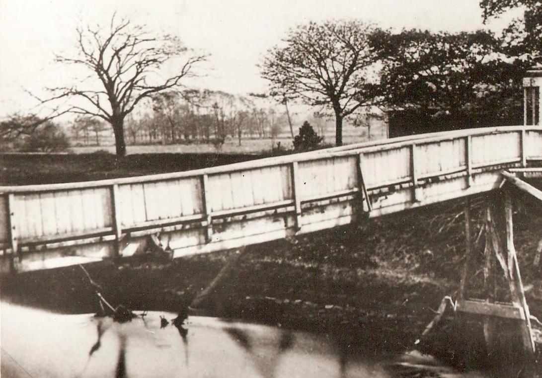
The not so safe bridge over the Mersey circa 1865


The old bridge 1865
This is one of the oldest pictures in the collection and dates from 1865.

We are on the bank of the river Mersey and just beyond the bridge is the pub.

“The pub was built in the 18th century and so might count as the oldest in the township.  It was known variously as the Old Greyhound and the Boat House, before reverting back to the old Greyhound.  Briefly it was called Jackson’s Boat and then the Greyhound from 1834.

The names may in part be explained by the origins of the site.    At some point a farmer called Jackson farmed the land and kept a boat for ferrying passengers across the river.


The pub sometime after 1881
Later still Samuel Wilton built a bridge in 1816 over the river at this point at a cost of £200.  

But the ferry and the right to transport passengers across the Mersey were still in place in 1832 when the pub and the surrounding land were put up for sale.

The advert throws some light on how the relationship between owner and tenant. The land and pub were owned by John Marsland and tenanted by a George Brownhill who seems to have benefited from the ferry charges.  The sale in 1832 went to Edmund Howarth who may well have placed Samuel in as tenant.”*

The old bridge and the missing central support 1865
And so back to the bridge which by 1865 was in a pretty poor state.

The central section had been swept away and judging by the way it slops down in the middle could not have made travellers feel particularly safe.

It did however survive until 1881, although the loss of the support on the Chorlton side a year earlier made a new bridge a necessity.

This was opened on October 14th 1881 which was all to the good given that the old one was washed away a few hours earlier.

But the new one like the old one had a secure door at the southern end which the landlord would open only after having been paid the toll.

Pictures; from the Lloyd collection

*THE STORY OF CHORLTON-CUM-HARDY 

Tuesday, 29 April 2025

The Didsbury mystery …… and “a right pong”

Now I say mystery, but I suspect there will be an avalanche of answers to the simple question, what is it?

The mystery object, 2025

The blog regularly gets requests to search out people, places, and events, as well as being offered pictures and stories, and so I welcomed the message from Dominic Parker who wrote in “Hi Andrew, big fan of your work!  Wondered if you could enlighten as to what this is?

Craigmore Avenue and the Mersey, 2025
It’s in a garden I maintain on Craigmore Avenue West Didsbury.  My own theory is its some sort of ventilation for an old tip or something like that, it kicks off a right pong every now and then”.

Craigmore Avenue is off Princess Road close to where the Mersey does one of its loops and is sited on what was Redbank Farm.

I can’t be exactly sure when the avenue was cut but it will be sometime after 1936.  The OS map for that year shows the farm still there but the 1938-46 version records the presence of the avenue with its houses.

Looking at all the maps going back to 1818 there is no indication of a water course feeding into the Mersey at this spot.

But the City Council conducted widespread controlled tipping which at the time lauded as the new and scientific way was “'controlled tipping'.  Here the rubbish is dumped on low lying land and is spread carefully out and ‘sealed’ by covering with a thick layer of soil. 

Redbank Farm and the Mersey, 1894
Then another layer of waste is put on top, ‘sealed’ and so the land is built up into what becomes in a year or two solid land.  

Just as the clinker obtained from the incineration method is put to good use in road making, the controlled tipping method is usefully applied to filling up waste land, and as you will find on the Mersey Bank at Wythenshawe that a large area of waste land previously liable to floods has been built up by this method into high solid land, grass-grown and suitable for all sorts of purposes, such as playing fields and parks...”

Now just exactly where around Craigmore Avenue the City Council may have undertaken tipping is as yet unclear but with a bit more research and perhaps some anecdotal memories, we may be able to establish if this were so.

I don't think that the Corporation would build on tipped land, and there is no evidence on the maps from the 1930s that the area by Redbank Farm was tipped on, especially given that the farm had existed on that spot from the early 19th if not the late 18th century.

The Mersey and Redbank Farm to the left, 1915
Despite the Mersey’s unpredictable flood record, generations of farmers would bot choose to build and live in a farm so close to the River.

So, it is over to the experts. …. Sorry Dominic.

And just an hour after the story went live we had the suggestion that it was a "Septic tank vent" which has form, but I think all the houses will have been connected to the sewage system, but it will be interesting to hear from local residents.

Location; Close to the Mersey in West Didsbury

Pictures; the mystery object, Dominic Parker, 2025, Craigmore Avenue, 2025, courtesy of Google Maps, Redbank Farm 1894, from the OS map of South Lancashire, courtesy of Digital Archive Association, http://digitalarchives.co.uk/ The Mersey at Red Bank 1915 from the Lloyd collection

*Our City, Manchester 1838-1938, the Manchester Municipal Officer’s Guild, 1938


Wednesday, 20 August 2025

Defending Chorlton and Didsbury from the fury of the Mersey

Now there is a caption competition here but I leave that to the swift of mind who can call up a witty aside on the turn of a sixpence.

All I will say is that we are back in 1966 at that point on the Mersey where the new bridge crosses the river by the pub.

And not for the first time over the last few centuries work is underway on the river banks,

These have been raised and raised to protect us from the river which in the past could flood with little warning and cover the meadows in a lake which stretched for miles.

The last time this happened on our side of the Mersey was in 1912 and there are pictures of the flood water poring over the weir which had been built to protect the Duke’s Canal.

There are plenty of stories of those flash floods which during the 19th century were common enough to enter local folk lore and have been reproduced in the book on Chorlton-cum-Hardy.*

And that is about all I am going to say other than that the story of Jackson’s Boat and its many different names is covered in that book and in the latest on Chorlton’s pubs and bars.**

But I shall just finish with one last comment on the image which and has recently come to light through a new project.

Neil Simpson tells me that "the Town Hall Photographer's Collection Digitisation Project, which is Volunteer led and Volunteer staffed, is in the process of systematically scanning the 200,000+ negatives in the collection dating from 1956 to 2007.

The plan is to gradually make the scanned images available online - initially on Manchester Archives+ Flickr and later on other Archives+ digital platforms.***"

*Manchester City Council Archives+ Town Hall Photographer's Collection Flickr Album...

And that is all I have to say other than a thank you to Neil and the team.

Location; Chorlton

Picture; Down by the Mersey, 1966, courtesy of Manchester Libraries, Information and Archives, Manchester City Council, http://images.manchester.gov.uk/index.php?session=pass

*The Story of Chorlton-cum-Hardy, Andrew Simpson, 2012, https://chorltonhistory.blogspot.co.uk/2014/12/the-story-of-chorlton-cum-hardy.html 

**A new book on the pubs and bars of Chorlton, https://chorltonhistory.blogspot.co.uk/2017/05/chorlton-pubs-and-bars-book-has-arrived.html

***Manchester City Council Archives+ Town Hall Photographer's Collection Flickr Album...

Saturday, 20 June 2026

A lost bridge across the Brook


Now I think it is time for a walk across the meadows in search of Mosley Bridge.

It was a small bridge over the Brook put up by Charles Walker and later washed away.  Charles Walker was the son of Thomas Walker, the radical, and lived at Longford Hall and the bridge connected his land on either side of the brook.

In the 1830s it was destroyed by a flood, and a new one was built where the brook joins the Mersey which makes it easy to find.  It’s there on the old tithe map of 1845 and looks to be roughly where the bridge is today.

But I am not sure that this is our bridge.  Over the last fifty years the banks and the land on either side of where the brook runs into the Mersey have been raised a number of times but from memory the masonry looks old.  And a bridge does show up on the right spot not only the tithe map of 1845 but on the earlier OS for 1841 and the later OS of 1888-93.

So far I have not come across any old photographs of the bridge but there is a painting made by J Montgomery in 1963 looking east along the line of the Brook.  Stand on that exact spot today and to the south there is a dense collection of bushes and small trees which were entirely missing when Montgomery recorded the scene.

But neither his or the modern view are how it was.  Back in the 1840s, to the south of the Brook on what was Charles Walker’s land were water meadows, while away to our left just beyond the field was Walker’s orchard.

Now before I take a walk down to the spot I should really ask my old botanist pal David Bishop whose knowledge of the place goes back to the 1970s and whose blog at http://friendsofchorltonmeadows.blogspot.co.uk/ is a wonderful collection of information about the land and the plant life along this stretch of the Mersey on the edge of our township.

Picture; Courtesy of Manchester Libraries, Information and Archives, Manchester City Council, Junction of Gore Brook [Chorlton Brook] and the River Mersey, J Montgomery 1963, m80140

Saturday, 10 May 2014

Of floods and boat building at Stretford

The weir in 1915
Now as I promised I am back with the Duke’s Canal at Stretford with memories of floods and boat building.

As benign as the Mersey appears on a warm summer’s day it has in the past been unpredictable and dangerous.

As a late as the beginning of the last century the river could flood with little warning and turn vast areas of our farmland into a gigantic lake.

It was for this reason that the weir in the bend of the river was constructed to protect the canal from a sudden surge of storm water and the banks continually raised to create a huge natural barrier.

There are many accounts of the extent of the flooding during the 18th and 19th centuries including plenty of oral testimony.  The Chorlton historian Thomas Ellwood published graphic descriptions of the flooding and there are of photographs from the turn of the last century along with the paintings by the artist Montgomery.

Likewise Samuel Massey in his book on Stretford** recalled the memories of his parents who were born in the middle of the 19th century and remembered that

“whenever the River Mersey was in flood, there was a boat stationed near the ‘Watch House’ the occupants of which were detailed to watch the Barfoot Bridge, and heavy baulks of timber were provided to place in grooves built in the stone embankment of the canal; these were provided on either side of the bridge.  

By these baulks being fitted into the grooves the canal water would be shut off in the event of the collapse of the bridge.”**

Now this was a real threat.  In the 1840s the weir was swept away and had to be rebuilt and as late as 1915 the rebuilt weir continued to channel storm water down towards the Kickety Brook.

Boat yards along the canal in 1893
That said for most of the year all was relatively tranquil by the canal and the high light of any year were the days that Rathbone’s the boat building company launched a boat built in their yard.

There were three boat building yards in the district, of which Rathbone’s was off Edge Lane on the south side of the road bridge, with another Rathbone yard at Longford Bridge  and for a few years around 1900 the company of Fellowes, Morton and Clayton on the north side of Edge Lane by the railway station.

So for Samuel Massey “it used to be a great treat for the scholars attending the Edge Lane Wesleyan Day School when they were allowed to stand on the towing path and watch from a short distance away the launching broadside, of a canal boat from Rathbone’s yard.  

The wave would go across the towing path and well up the school wall.”**

There will be those who remember the yards and I rather think this will be a rich source of further stories.

We shall see.

Picture of the weir in 1915 from the collection of Tony Walker, and detail of the Duke’s canal from the OS map of South Lancashire, 1888-93, courtesy of Digital Archives Association, http://www.digitalarchives.co.uk/


*Chorlton Rivers, http://chorltonhistory.blogspot.co.uk/search/label/Chorlton%20rivers

**A History of Stretford, Samuel Massey, 1976